Current Issue

2026, Volume 52,  Issue 9

Display Method:
Volume 9 Issue E-journal
Volume 52 Issue92026
iconDownload (24751) 320 iconPreview
Multi-UAV path planning for forest fire-fighting in plateau based on adaptive improved dung beetle optimization algorithm
ZHU Pei, LYU Xiaolong, CHEN Kaisen, SONG Rui, ZHANG Jiangao, SHAO Quan
2026, 52(9): 2987-3000. doi: 10.13700/j.bh.1001-5965.2025.0846
Abstract:

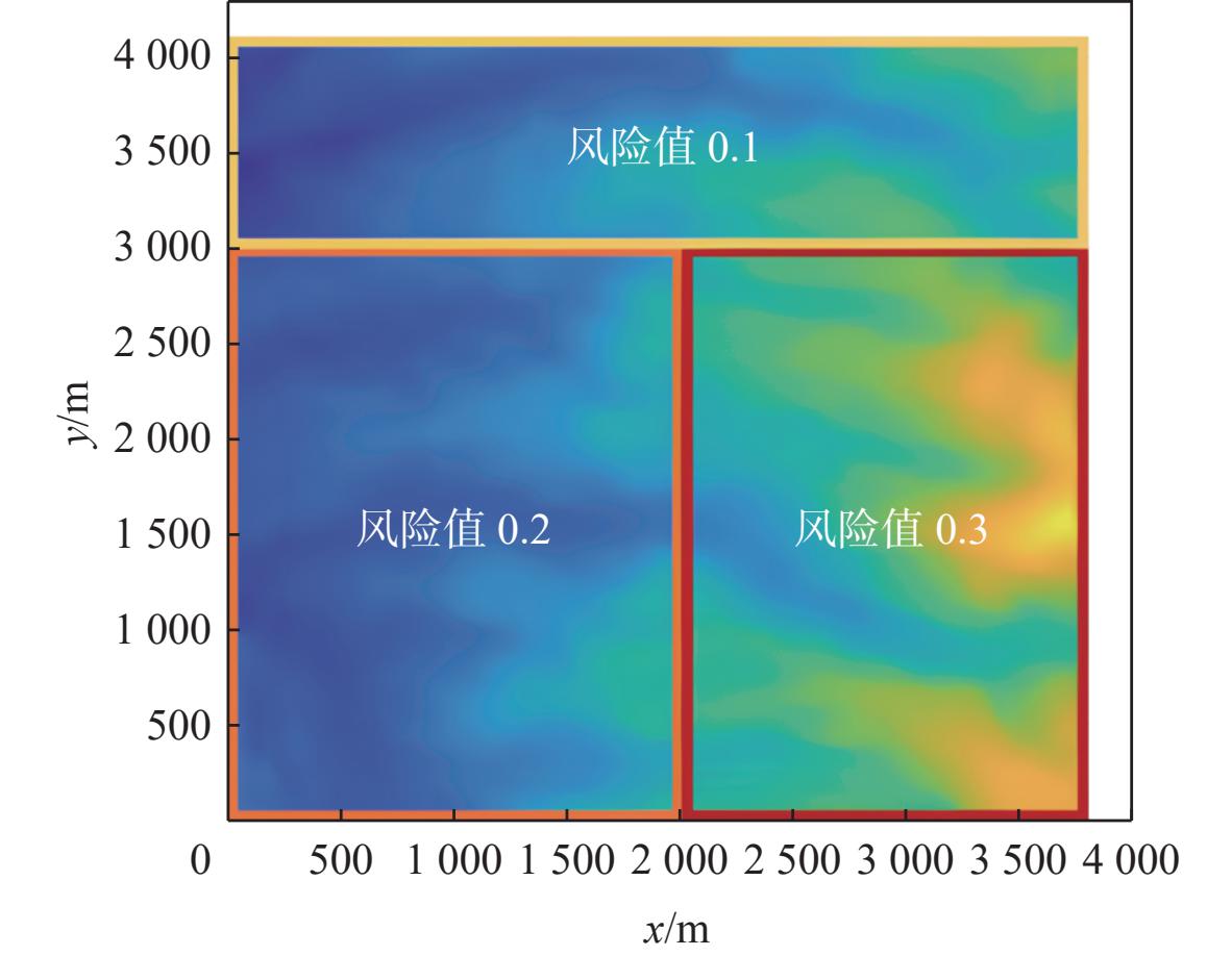
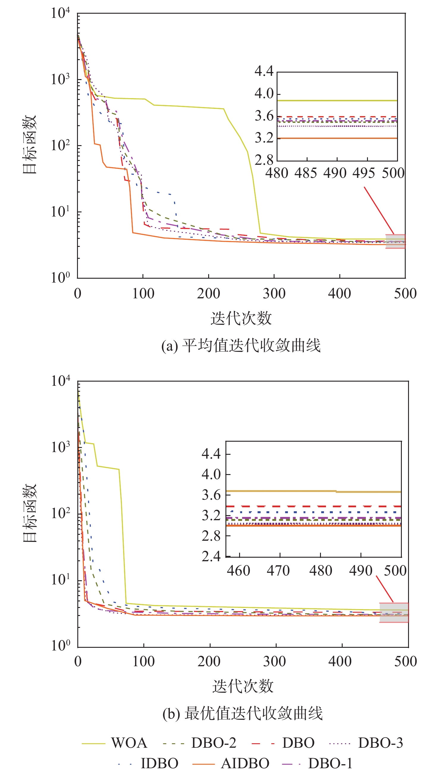
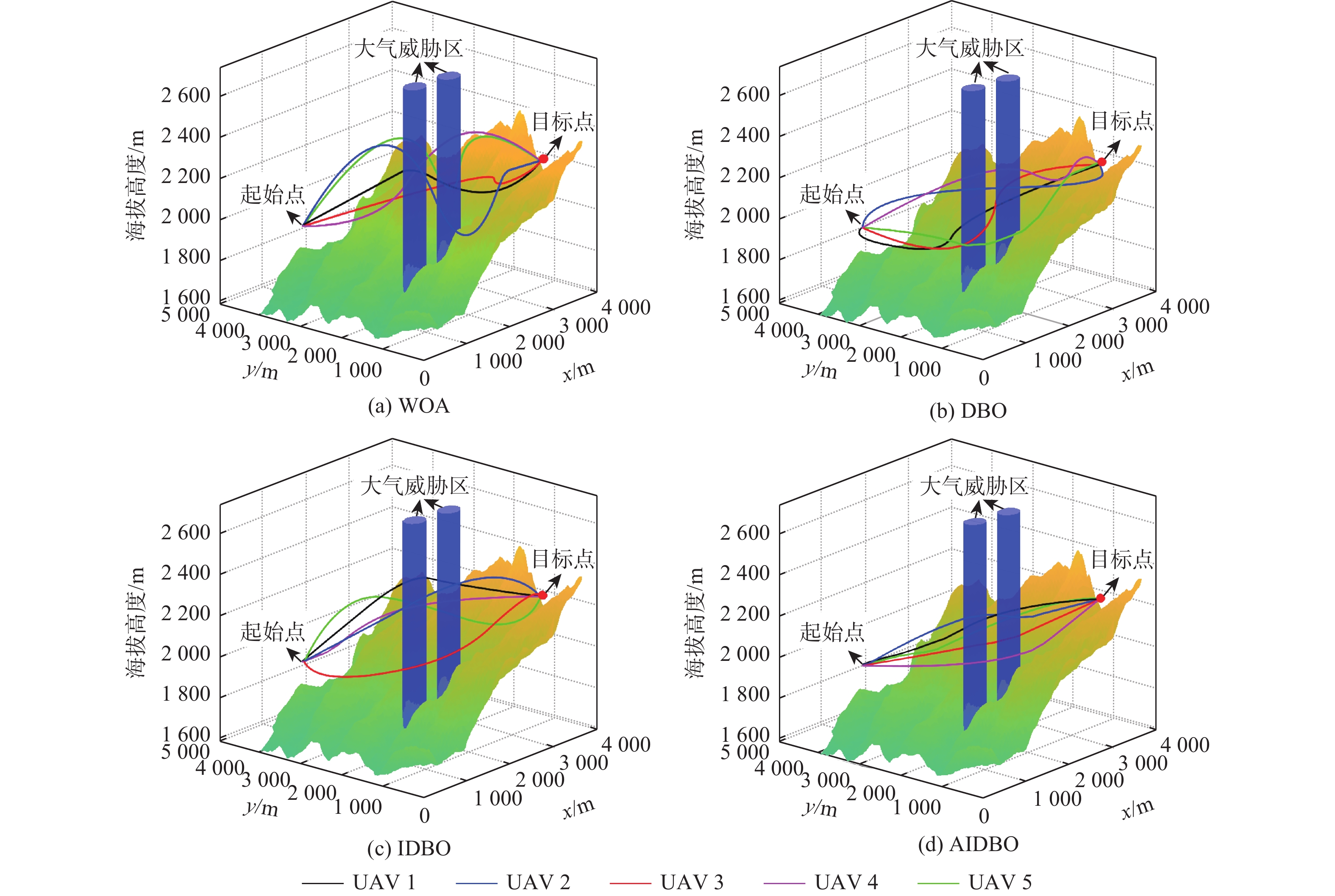
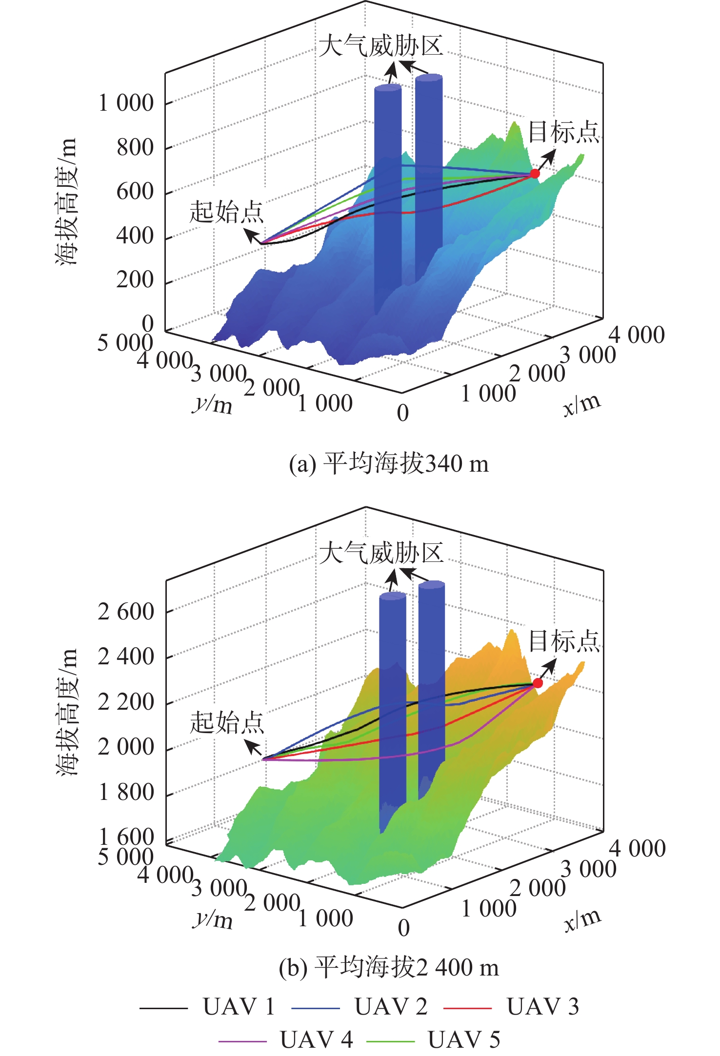
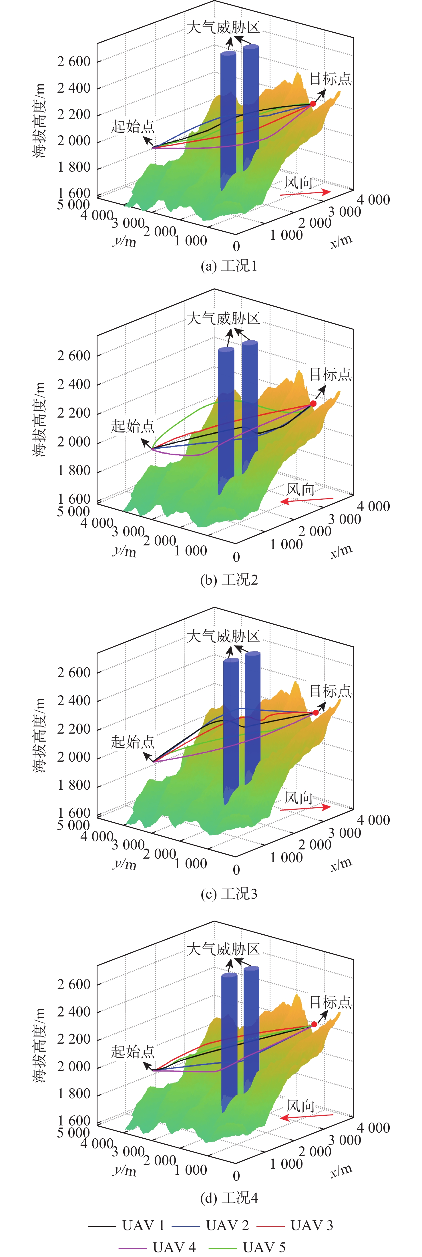
Aiming at the problem of UAV fire-fighting and rescue path planning in the complex environment of plateau forest, a multi-UAV path planning method based on an adaptive improved dung beetle optimization (AIDBO) algorithm was proposed. Based on the digital elevation model (DEM) data, a three-dimensional geospatial model of the plateau forest and mountainous area was established. Considering the influence of complex terrain, environmental wind, altitude and other factors, a multi-UAV path planning model under multiple constraints was established, taking the minimum flight time, risk cost and energy consumption as the objective function. Chaotic mapping and reverse learning optimize the population initialization, the whale optimization algorithm (WOA) introduces the spiral search strategy to enhance the position update mechanism, and adaptive Cauchy mutation improves the population’s capacity to eliminate local optima. An AIDBO algorithm is proposed to solve the problem. The results showed that the average fitness of AIDBO was 10.59% and 9.82% higher than that of the original dung beetle optimization (DBO) algorithm and the improved dung beetle optimization (IDBO) algorithm, respectively. Compared with a 340 m plain environment, the maximum flight time of the UAV in a 2400 m altitude environment is slightly increased by 0.997%, while the energy consumption is increased by 58.96%. At the same time, the wind direction and speed will also have a certain impact on the flight time and energy consumption. In addition to providing decision assistance for UAV firefighting and rescue scheduling in the plateau forests, the adaptive improved dung beetle algorithm presented in this research may greatly optimize the multi-UAV path in the plateau forests.

Object detection method for anti-UAV systems in complex backgrounds based on YOLOv11-drone
XUE Shan, YANG Wenda, LI Qigui, REN Wanfei
2026, 52(9): 3001-3010. doi: 10.13700/j.bh.1001-5965.2025.0423
Abstract:

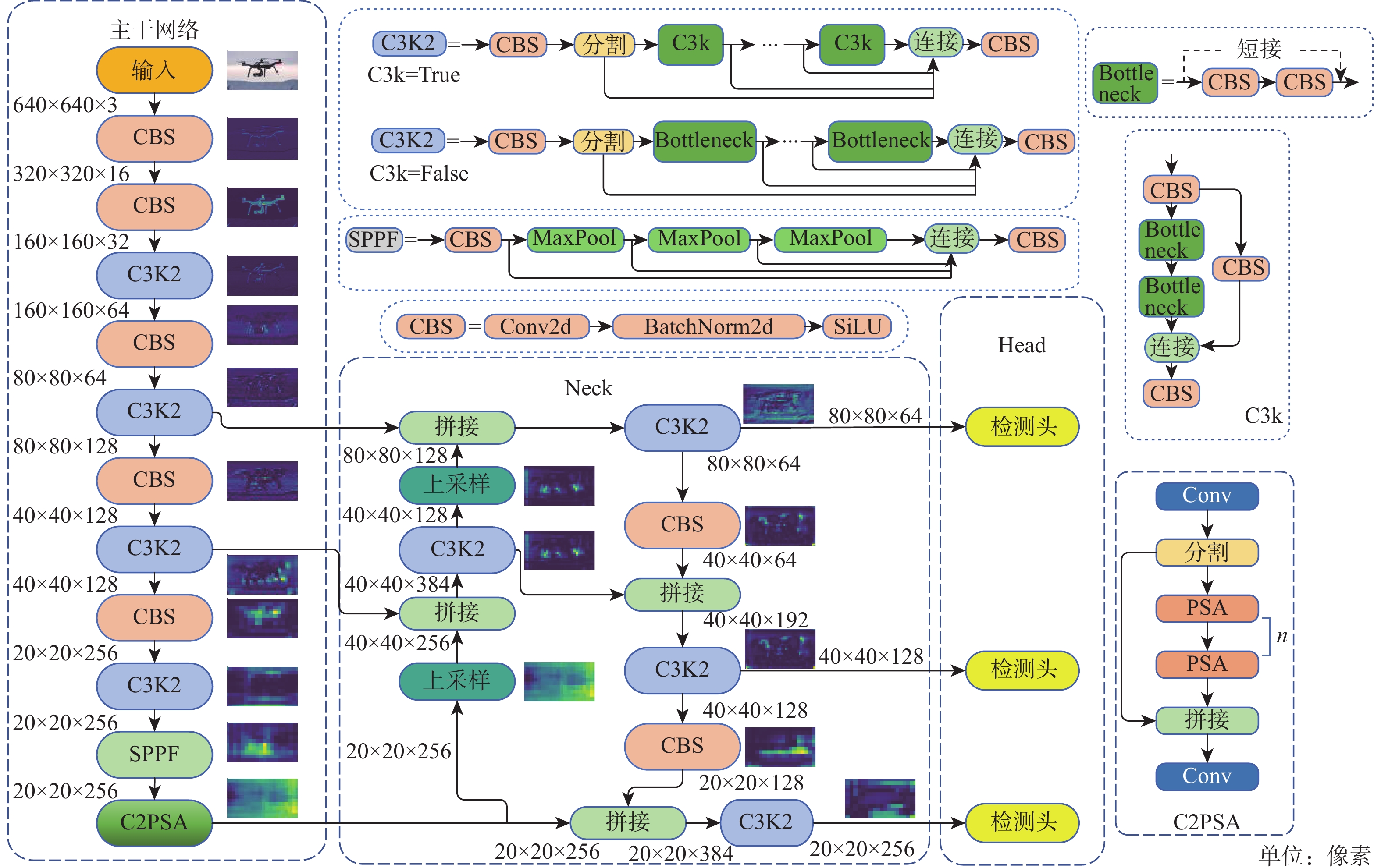
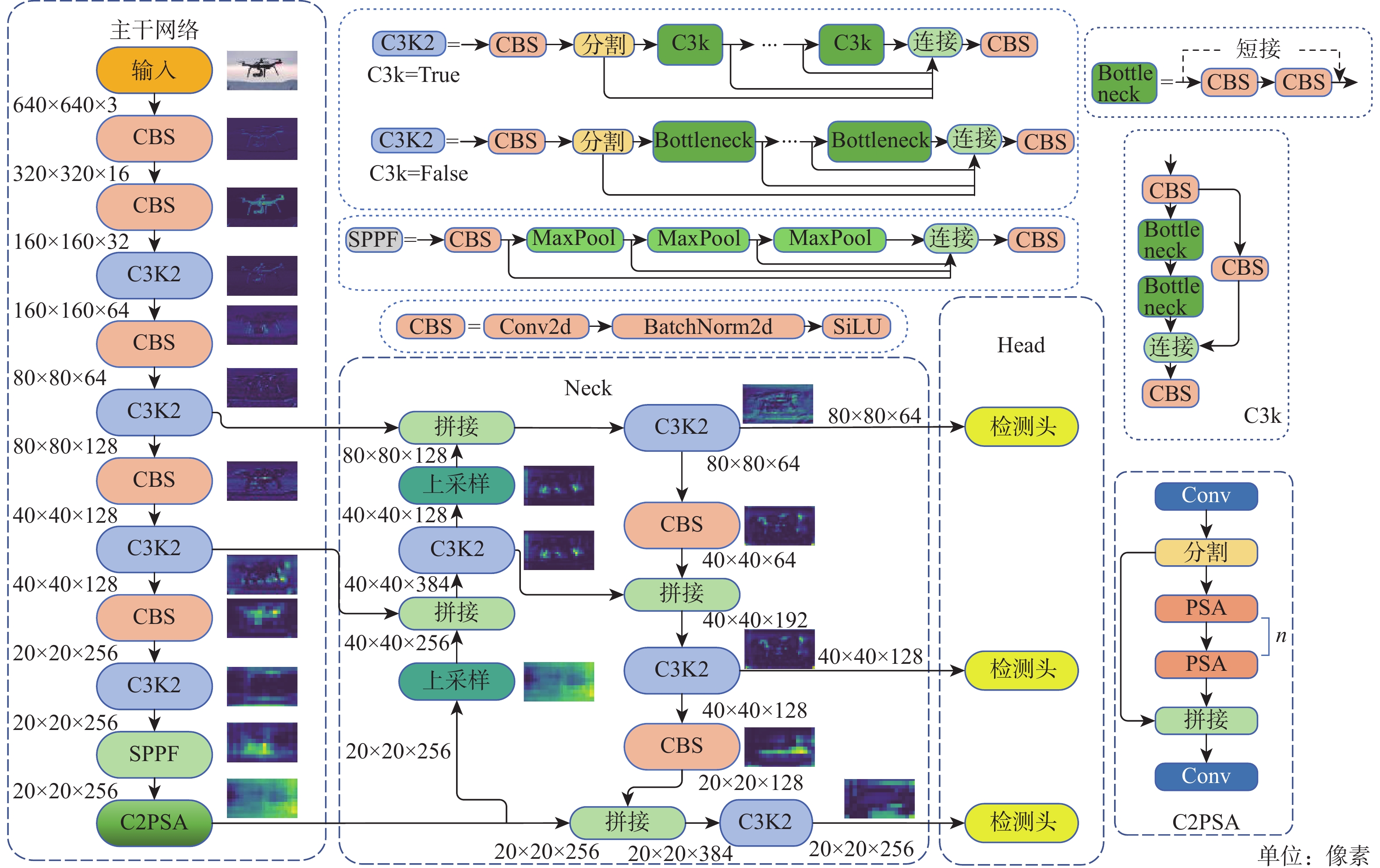
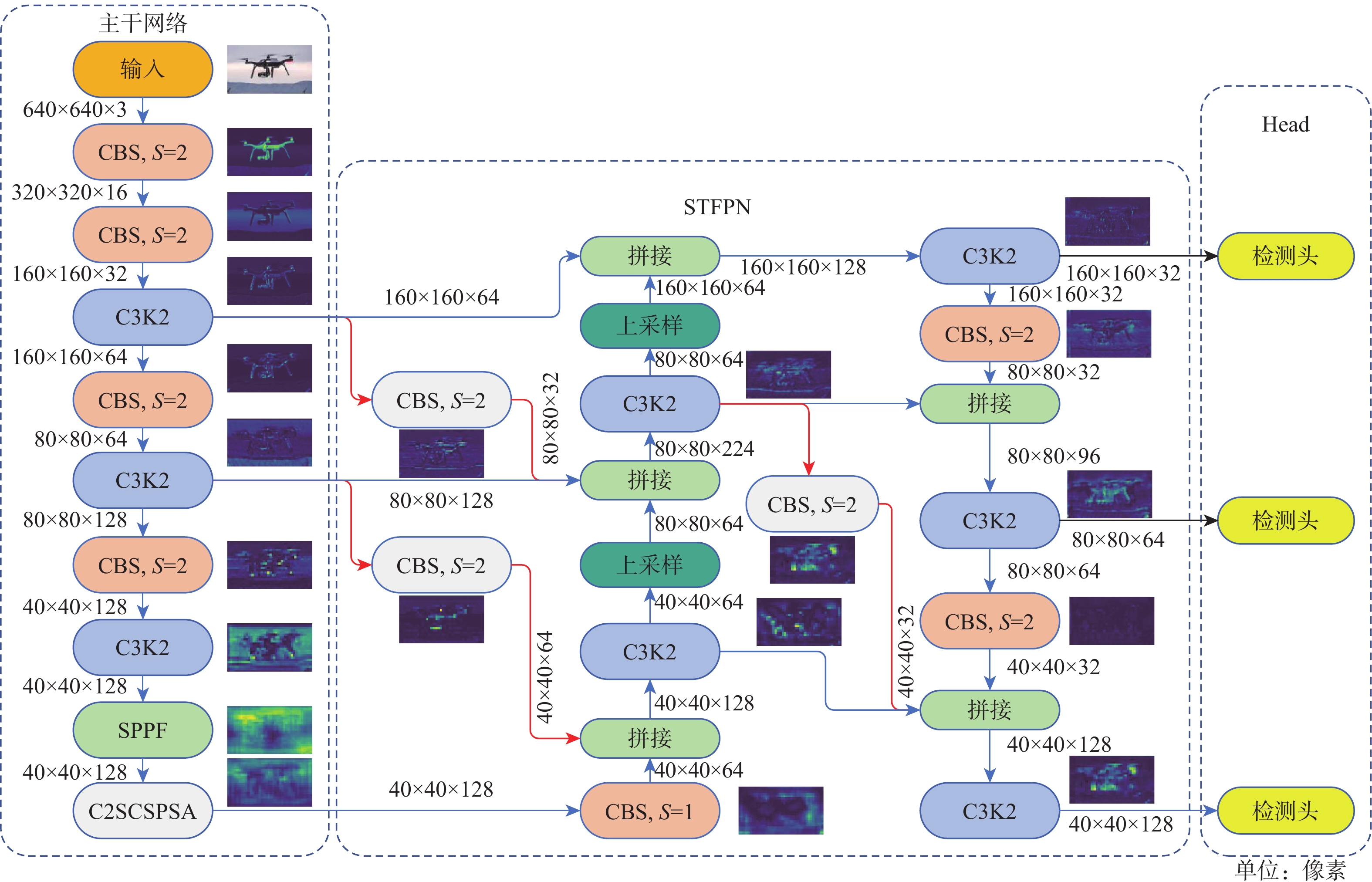
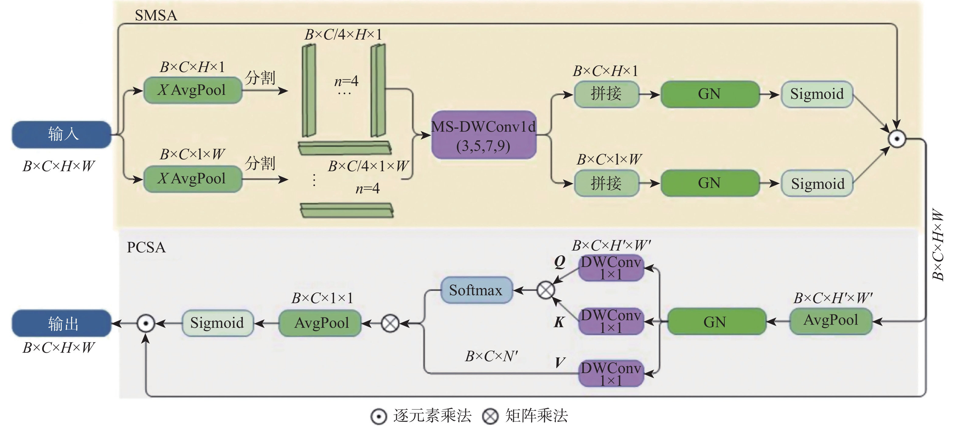
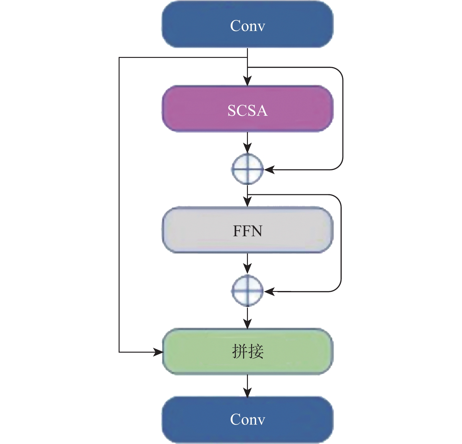
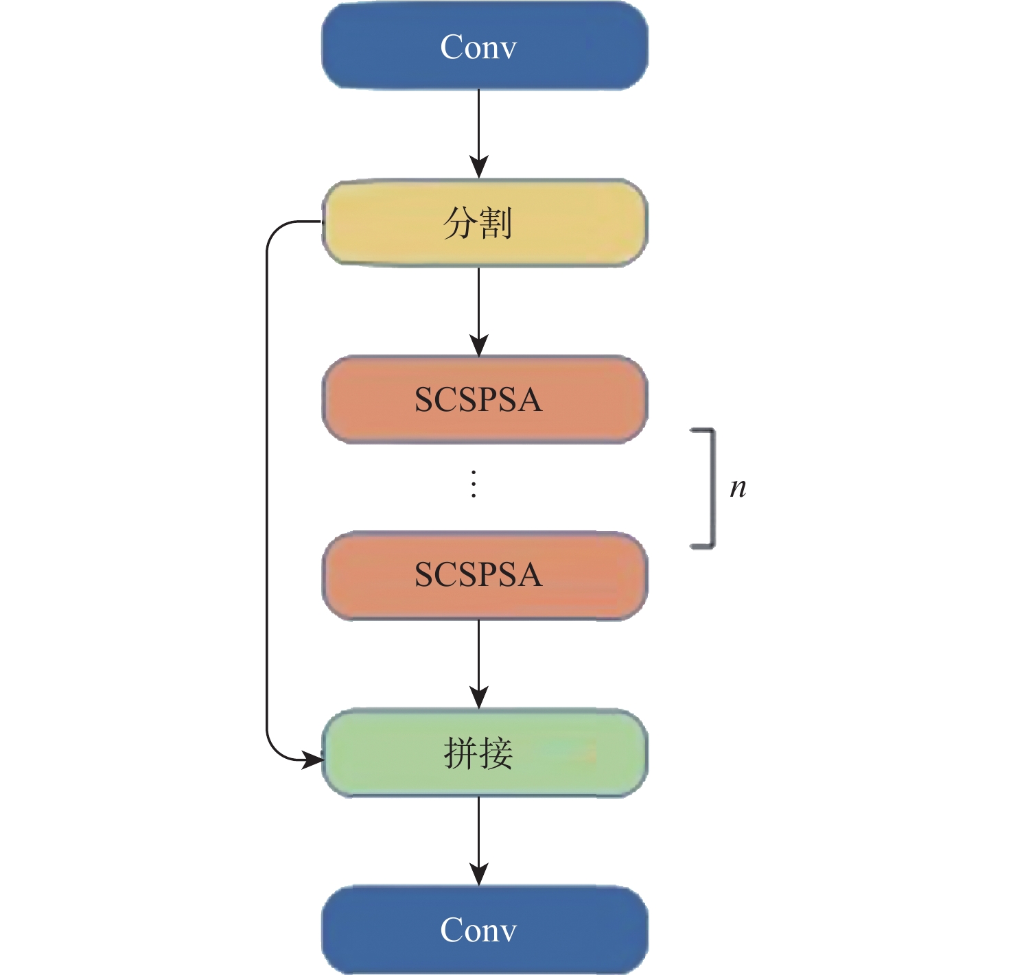
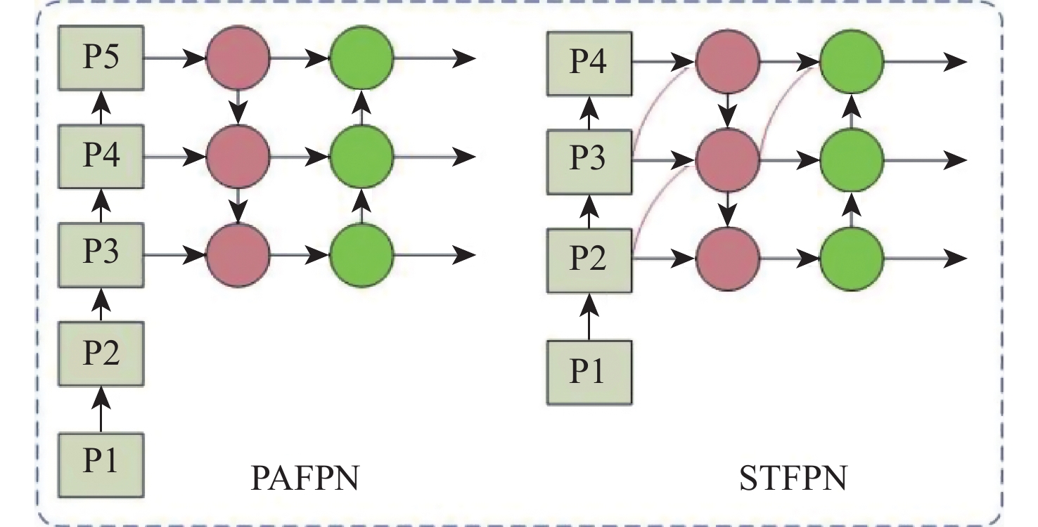
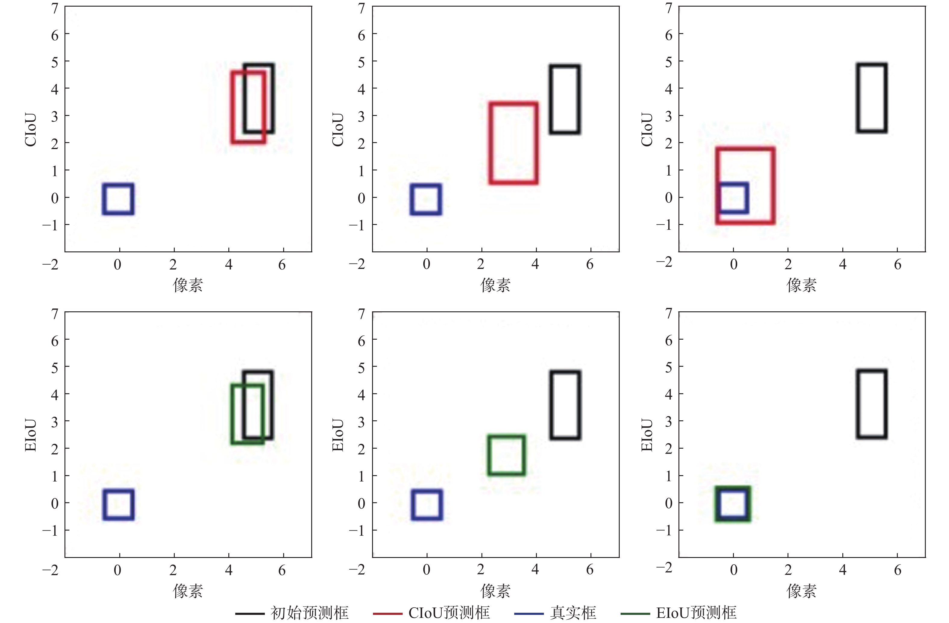
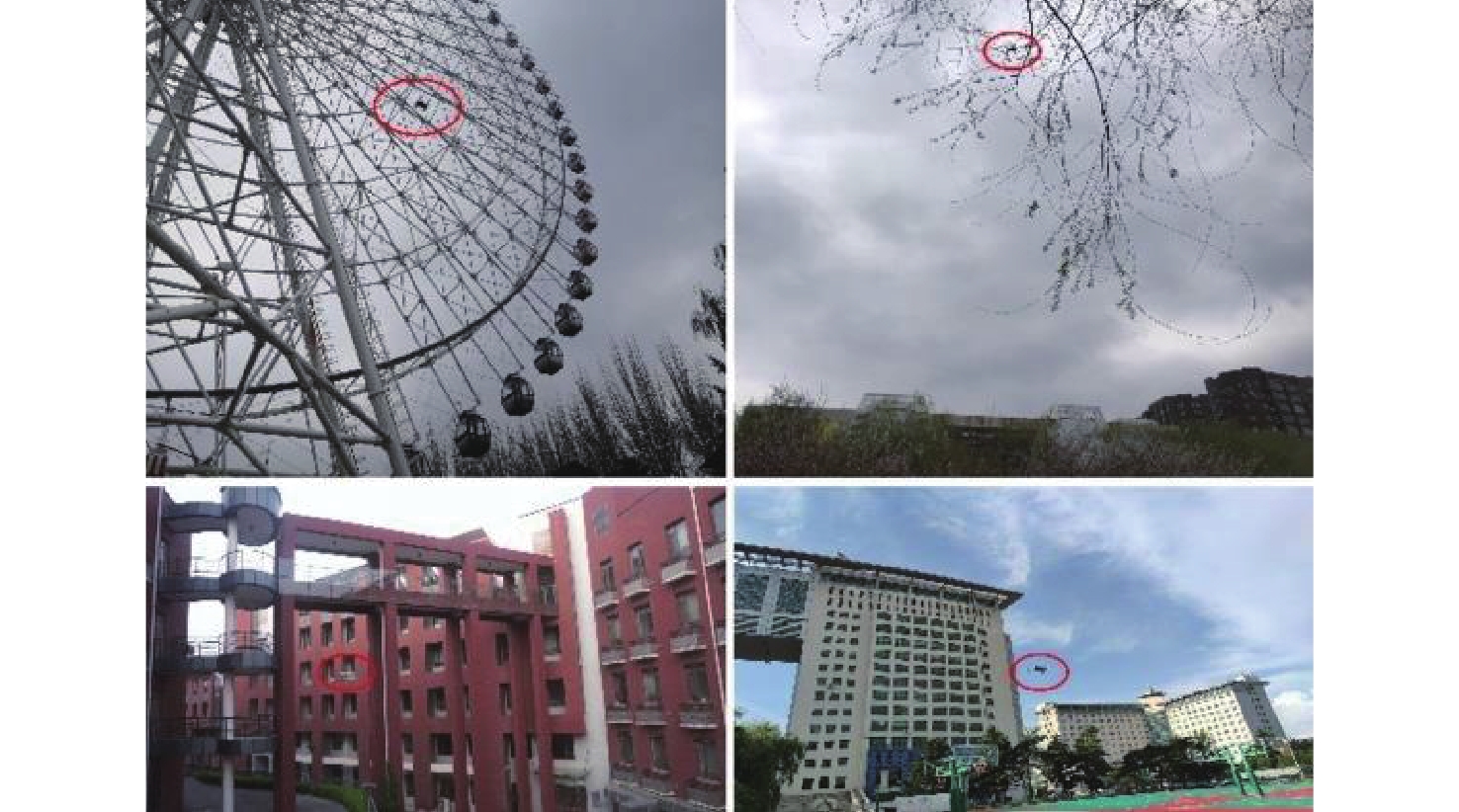
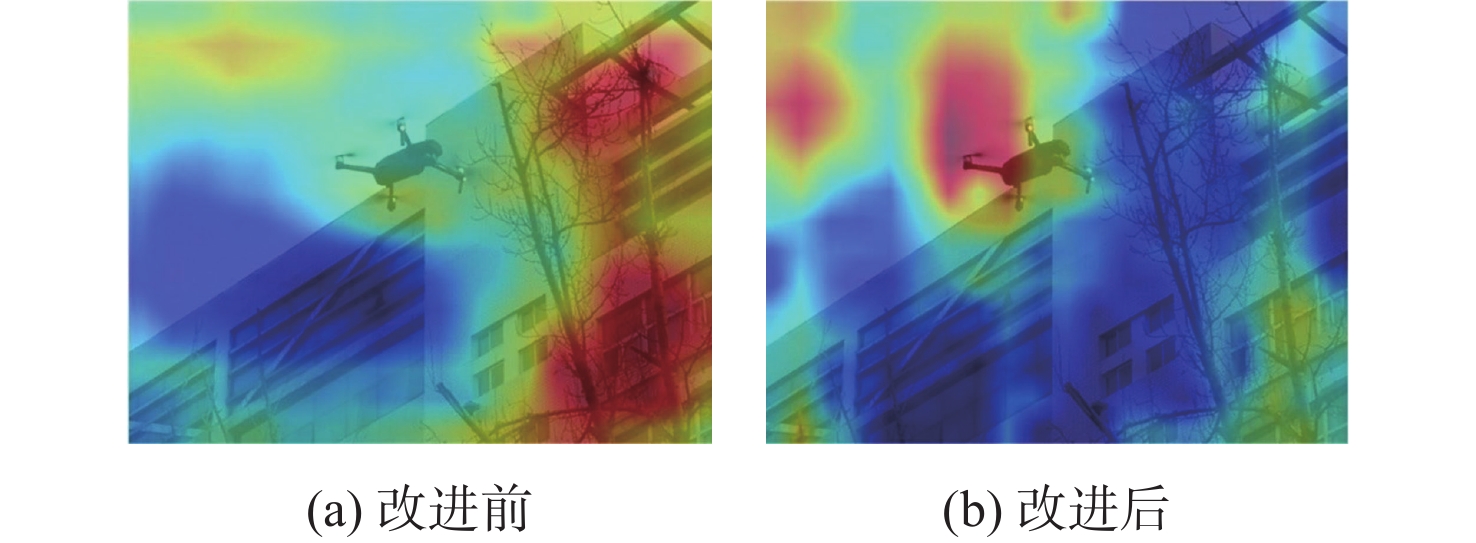
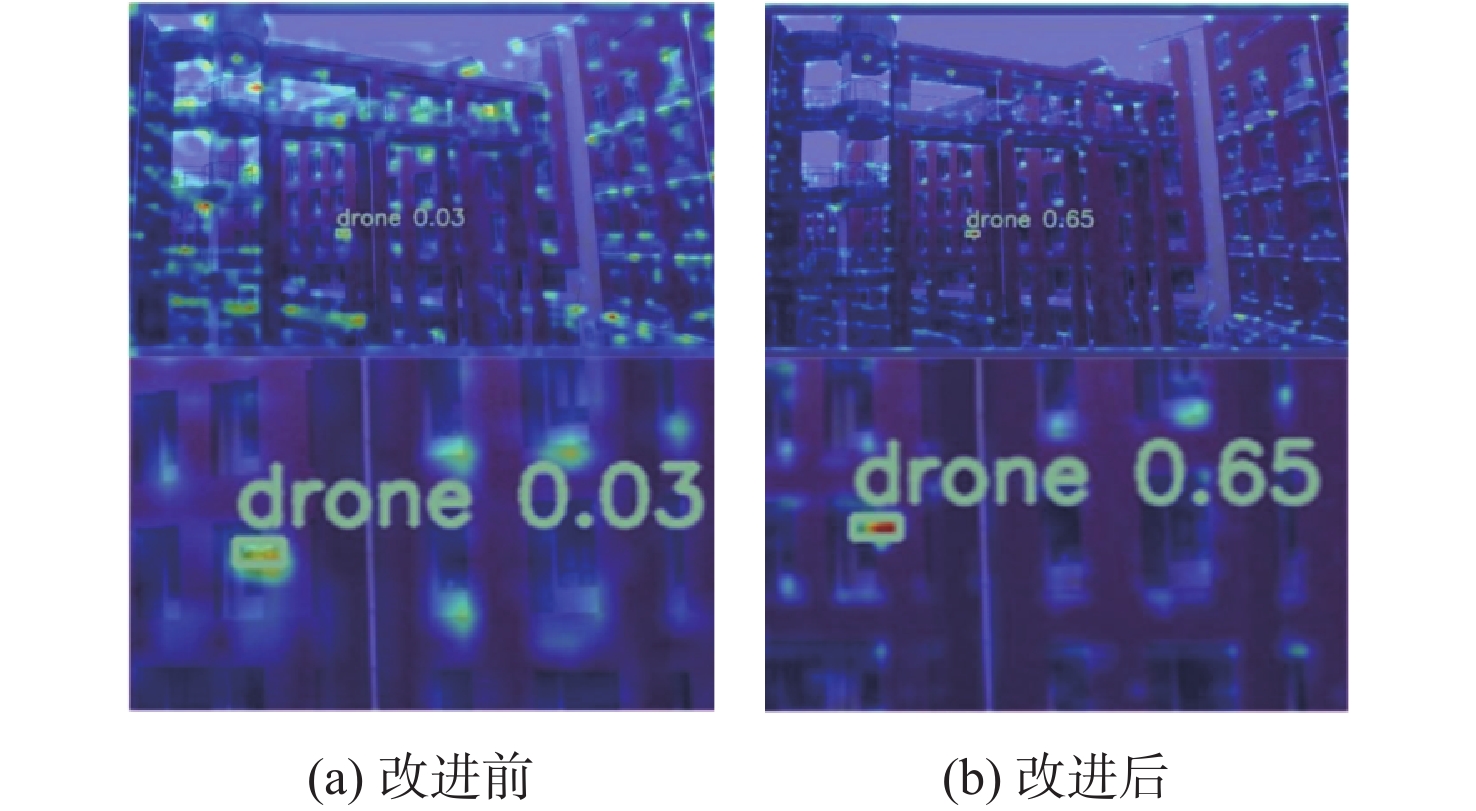
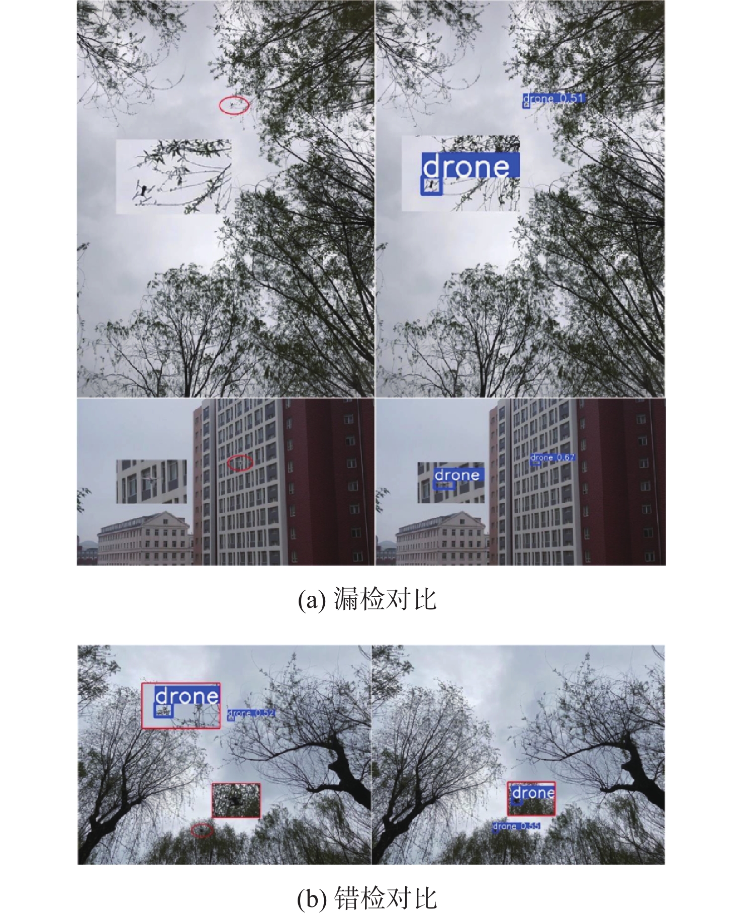
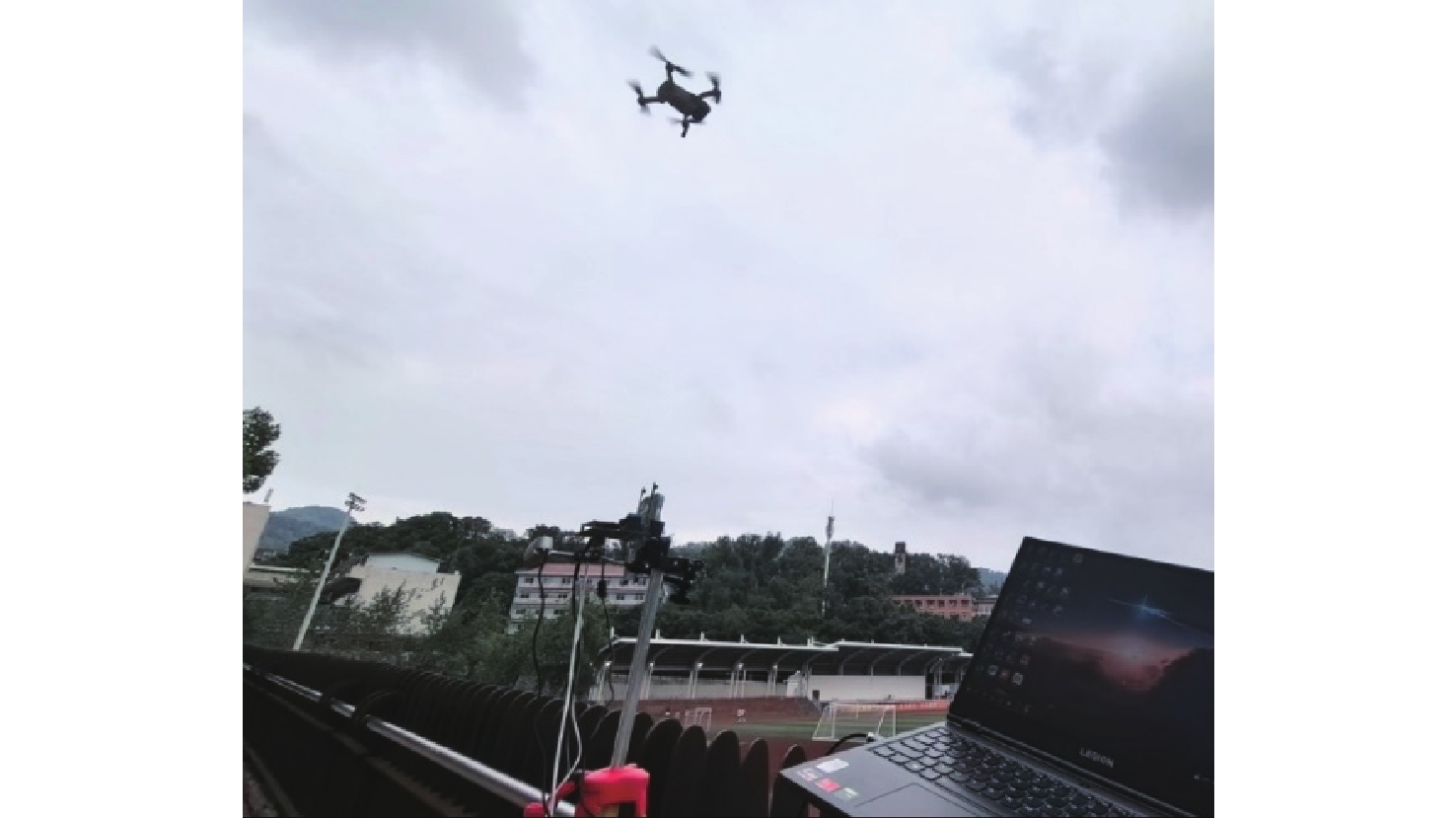
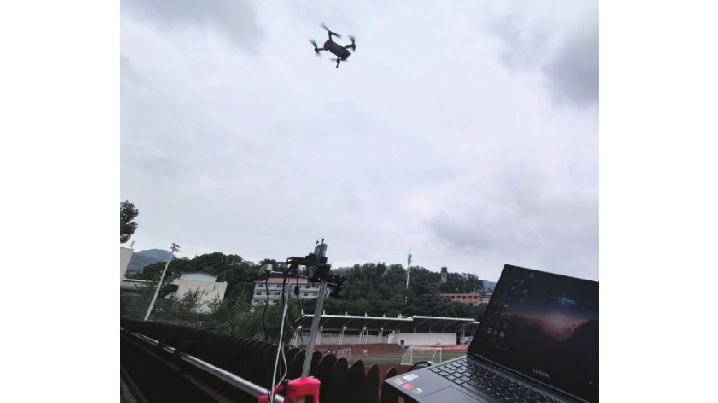
Amid the rapid expansion of the low-altitude economy, UAVs present escalating security threats to large-scale public spaces. Accurate and rapid target detection of drones has become the primary and critical component in anti-drone systems. To address the critical challenges of low detection accuracy, high miss rate, and false positives in small UAV detection within complex environments, this study proposes YOLOv11-drone, an optimized object detection framework based on an enhanced YOLOv11 architecture specifically designed for counter-UAV applications. First, an autonomous dataset of small-target drones in complex backgrounds was constructed. Second, to improve the model’s ability to extract features for drone targets, a partial spatial-channel cooperative attention module C2SCSPSA was created that combines channel attention with spatial attention processes. Furthermore, a small-target-oriented multi-level feature pyramid network (STFPN) was proposed. By fully leveraging shallow semantic information, this architecture significantly reduces the model’s parameter count while improving its focus on small targets. Finally, the model’s loss function was replaced with the EIoU metric, which simultaneously enhances regression accuracy and accelerates convergence speed. The proposed improved algorithm was evaluated on the self-constructed dataset. Experimental results demonstrate that the YOLOv11-drone model achieves a detection accuracy of 95.5%, representing a 4.1% improvement over the baseline algorithm. Additionally, the model reduces parameter count by 62% while attaining an inference speed of 83 frames per second. These advancements confirm its efficacy for small-target drone detection in complex backgrounds. To further evaluate generalization capability, experiments were conducted on the public VisDrone2019 benchmark. The suggested technique shows strong cross-domain applicability and generalization performance, achieving a 0.6% improvement in mAP@0.5 while using just 38% of the baseline model’s parameters.

Capacity model and collaborative scheduling of droneports for drone regional logistics
JIANG Bo, LI Die, ZHENG Yuan, LI Chenglong, ZHANG Zhaoxuan
2026, 52(9): 3011-3022. doi: 10.13700/j.bh.1001-5965.2025.0422
Abstract:

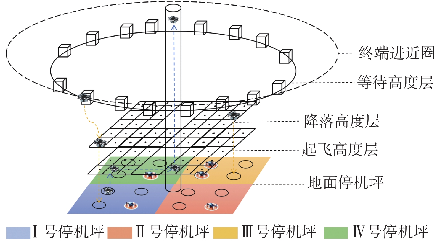
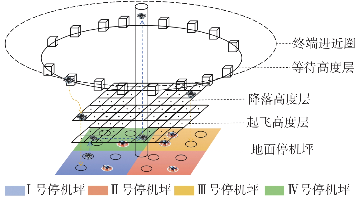
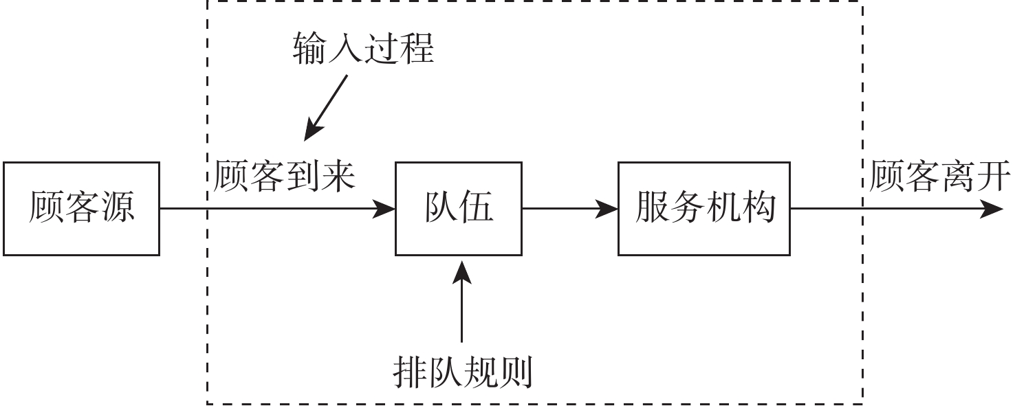
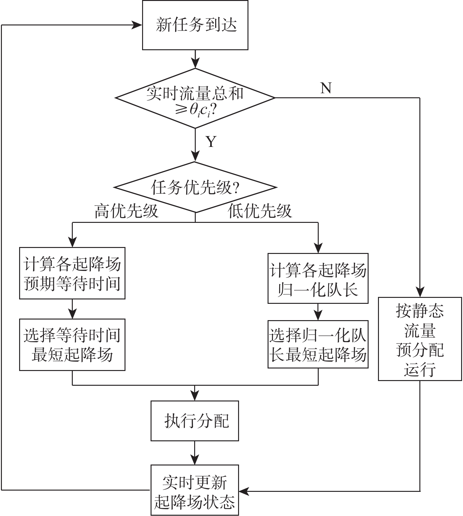
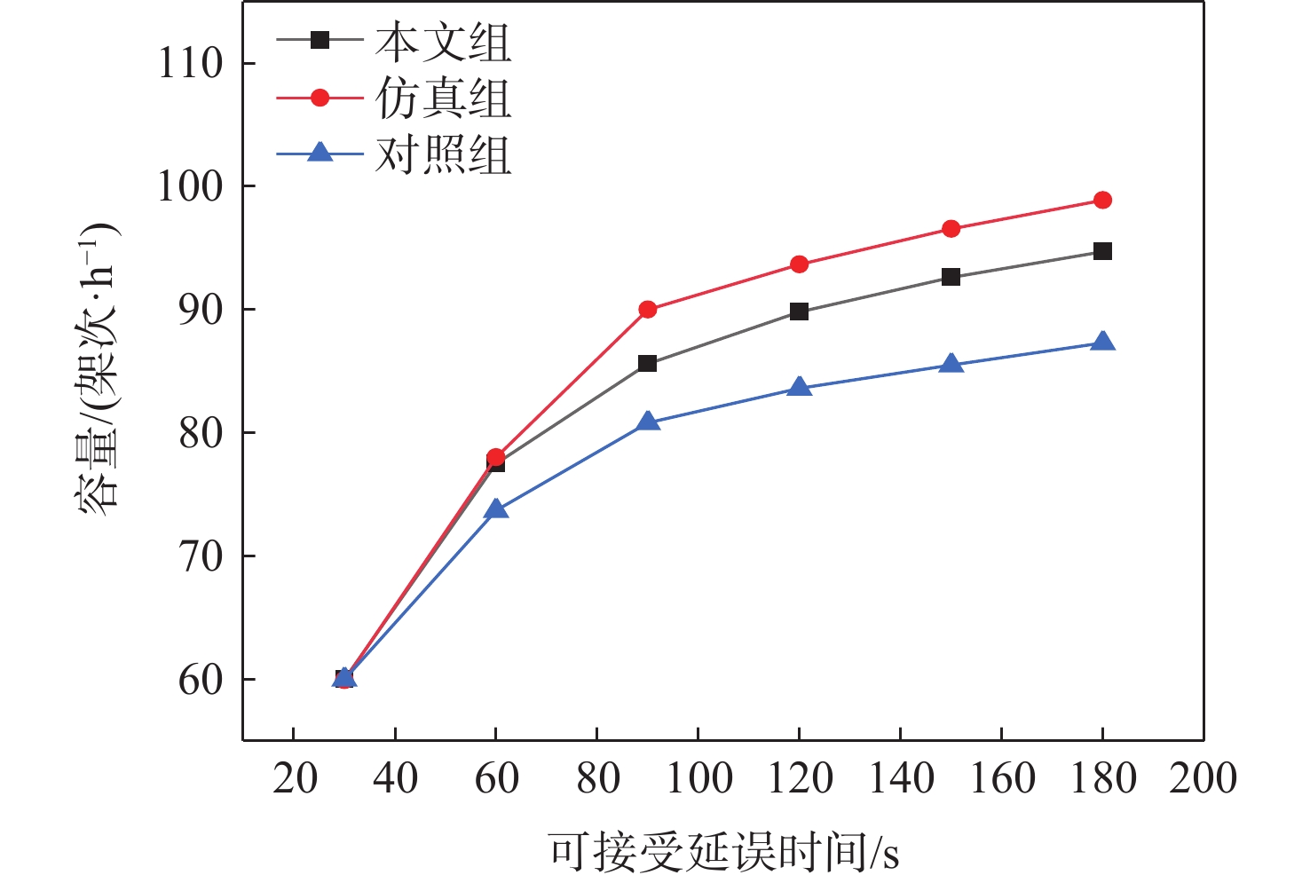
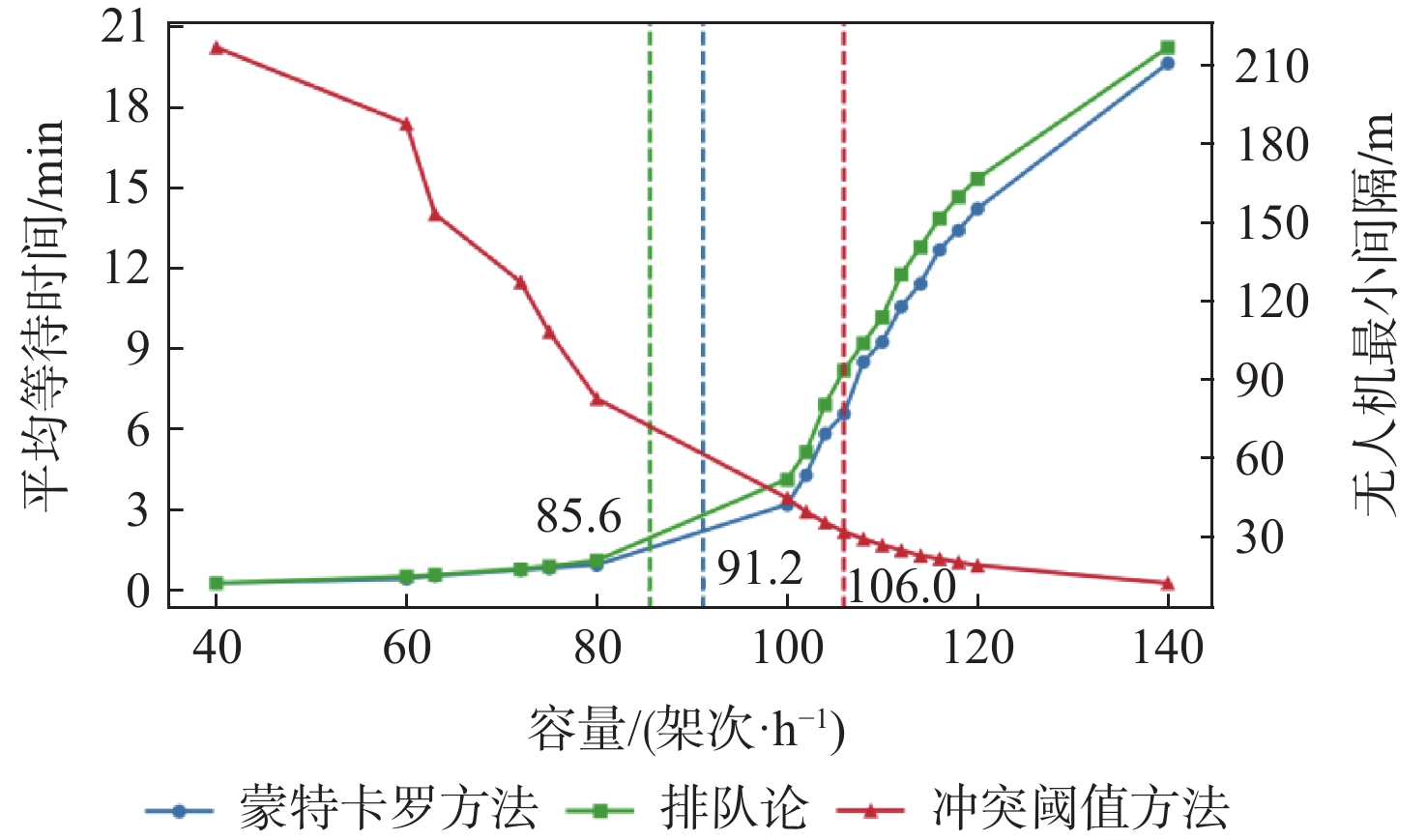
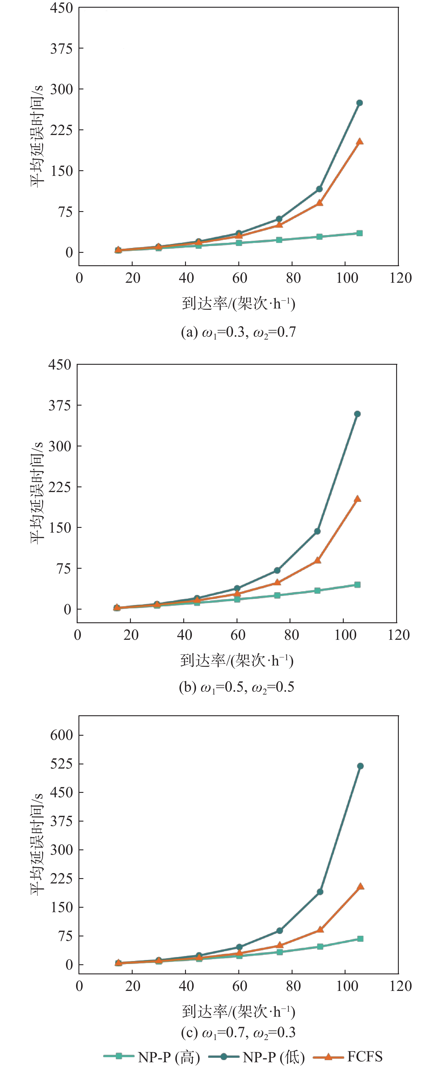
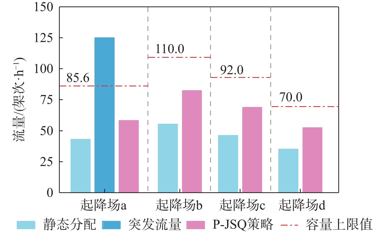
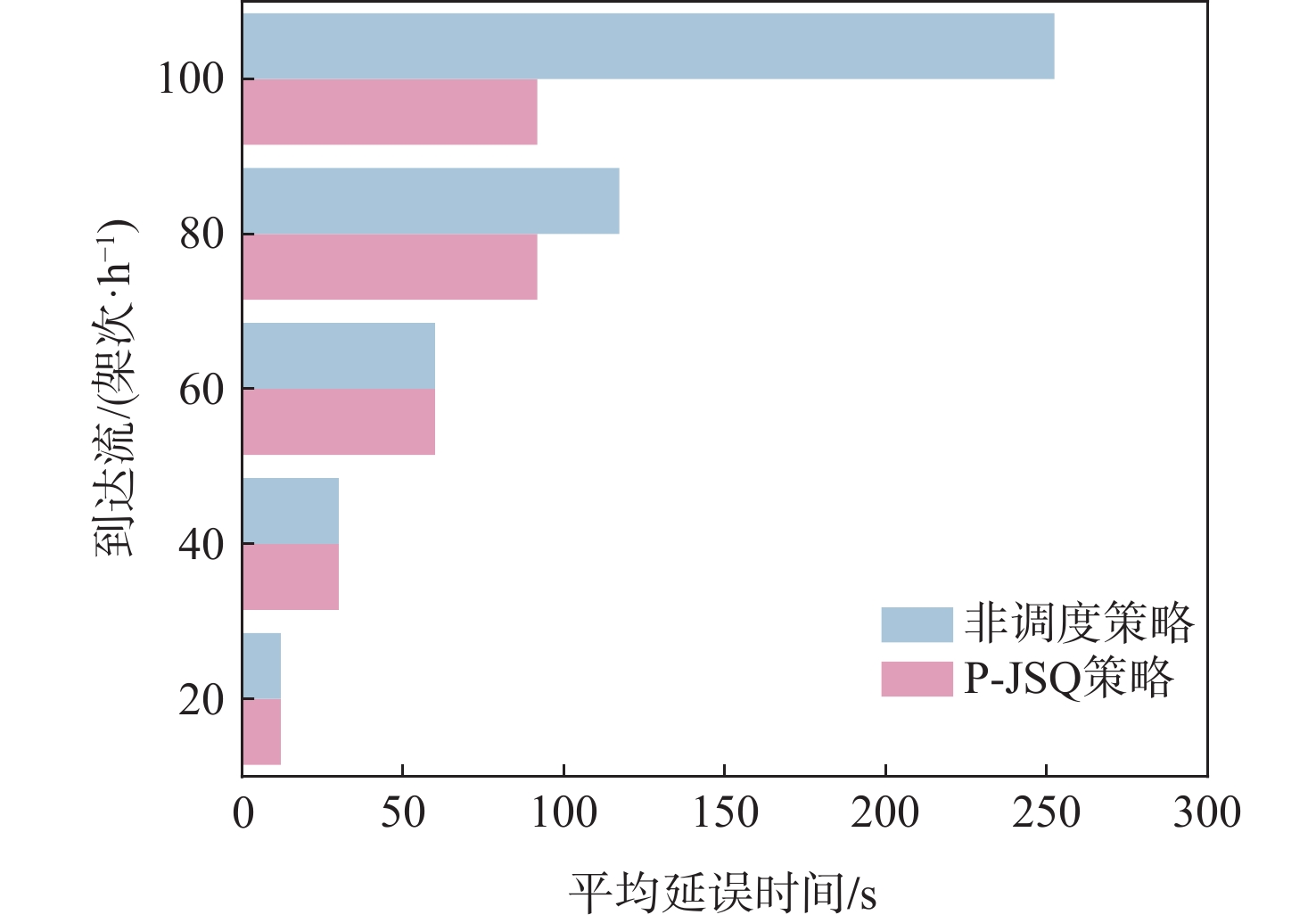
Droneport terminal airspace faces the critical issues of scarce airspace resources and insufficient operational efficiency. A series-coupled queuing model and a static-dynamic collaborative scheduling strategy are established to achieve accurate capacity assessment and effective regional collaborative scheduling, taking into account the lack of collaborative scheduling mechanisms for multiple droneports and the need for load balancing in regional logistics areas. First, a differentiated queuing model is constructed to characterize blockage effects in each operational link, breaking through the limitations of traditional independent analysis. Second, a non-preemptive priority strategy is introduced into the landing system to safeguard high-priority tasks. Finally, a "static flow pre-allocation + dynamic capacity-flow regulation" mechanism is designed to achieve multi-droneport collaboration through dual-path decision-making based on queuing theory. The static results show that the overall capacity assessment deviation of the proposed series-coupled queuing model is controlled within 6%, which is significantly superior to the traditional independent analysis model. Moreover, in the capacity assessment of the waiting layer airspace, it also significantly outperforms the conflict threshold-based model. Under the non-preemptive priority strategy, the average delay time of high-priority tasks consistently stays below 30 seconds. However, with the increase in their proportion of total tasks, the system’s average delay rises significantly. Under surge traffic conditions, the cooperative scheduling approach lowers overall drone delay by 39.49% on average and increases regional load balance to 95.9%. The research results can provide theoretical support for low-altitude logistics network planning and real-time dispatch.

Design of operational security guarantee method for DAA system based on runtime assurance
DONG Lei, WANG Qi, CHEN Xi, LIU Jiachen
2026, 52(9): 3023-3038. doi: 10.13700/j.bh.1001-5965.2025.0122
Abstract:

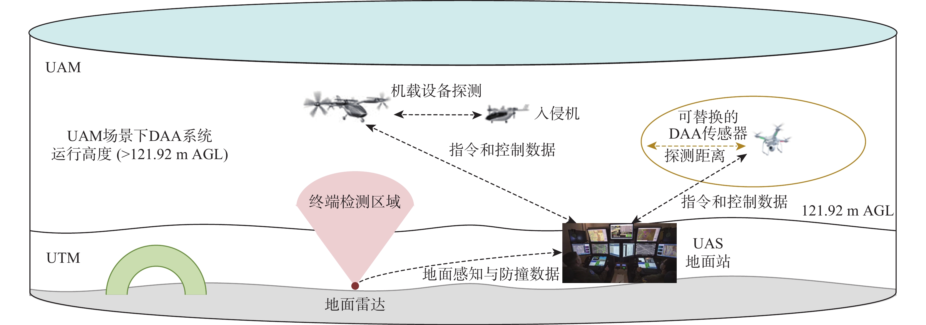
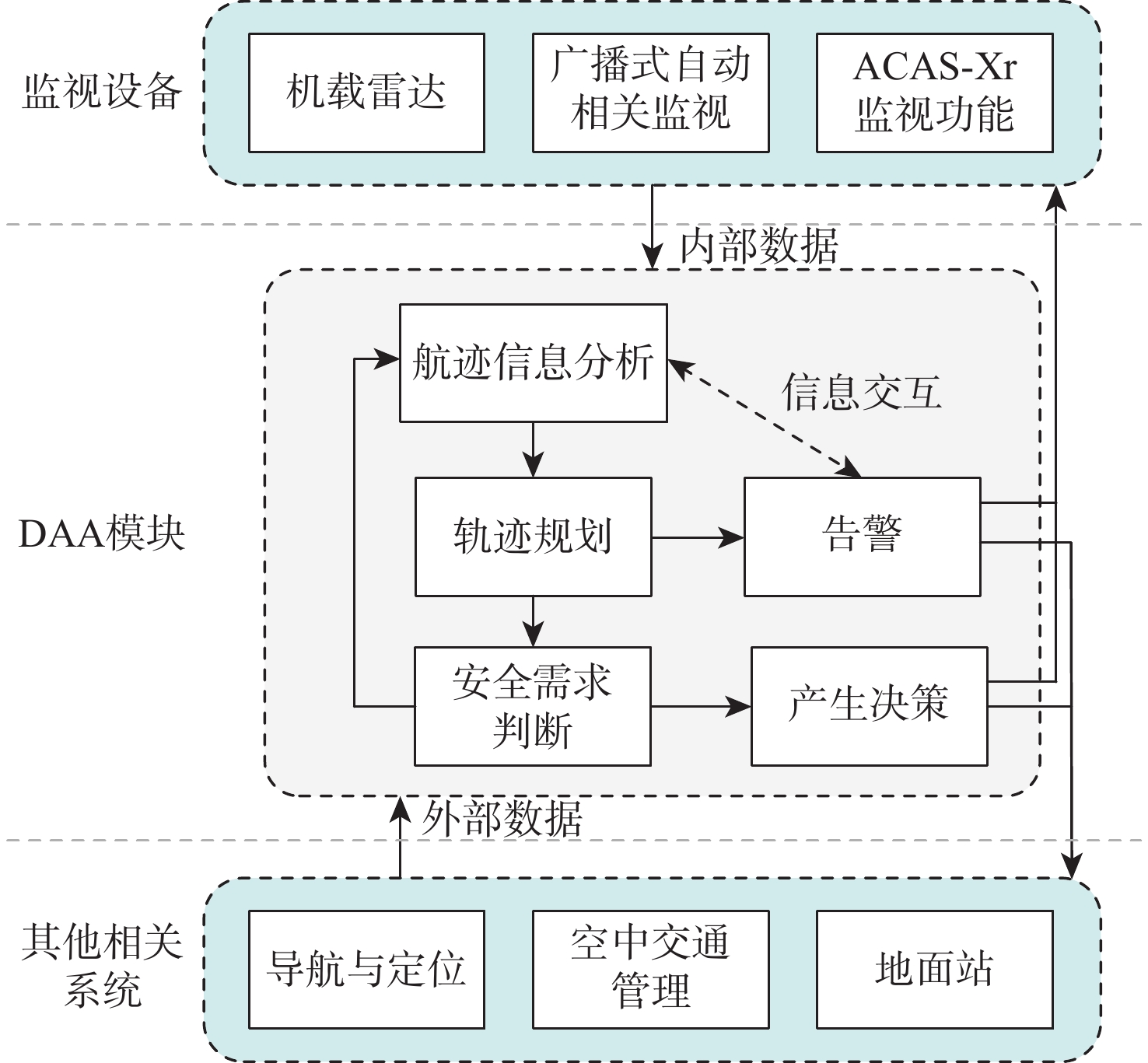
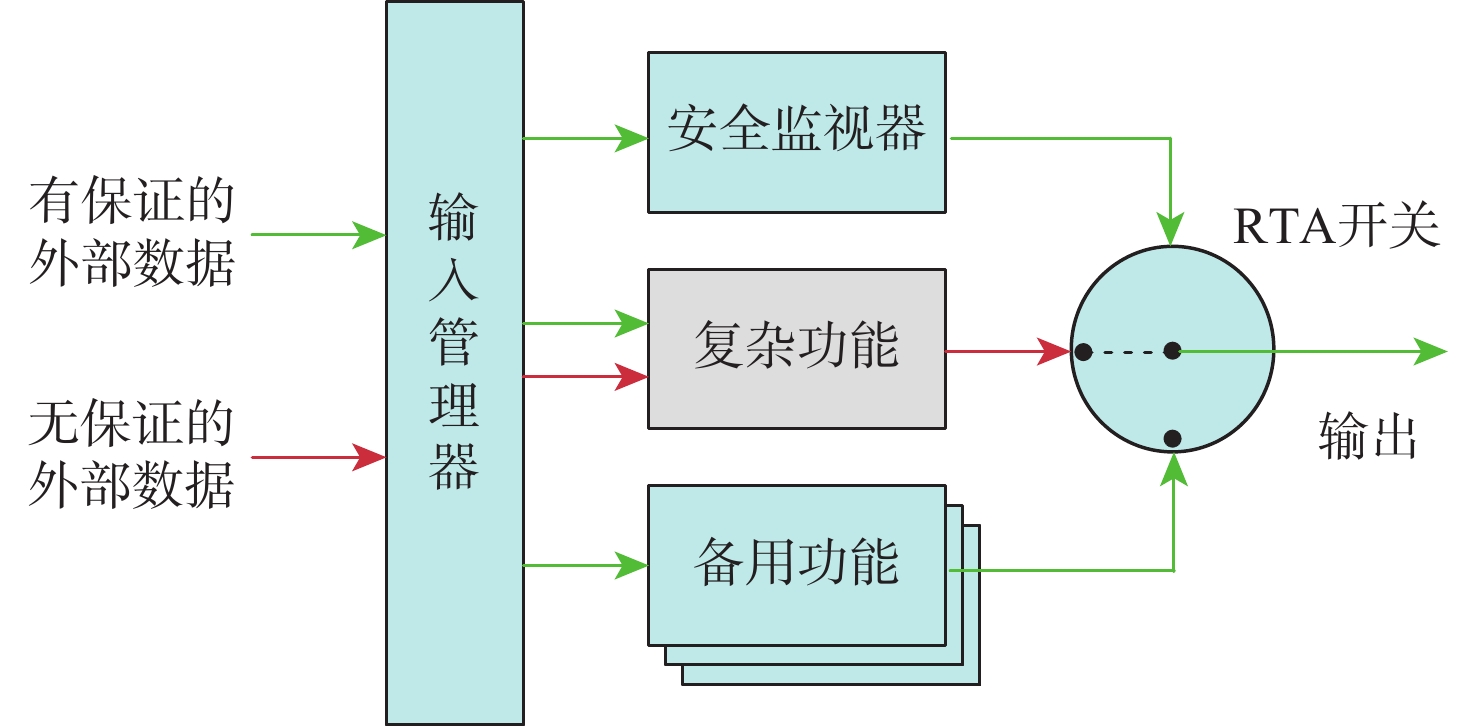
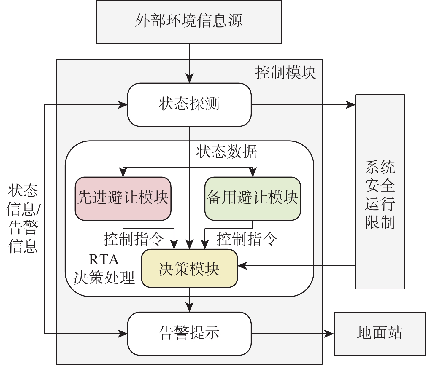
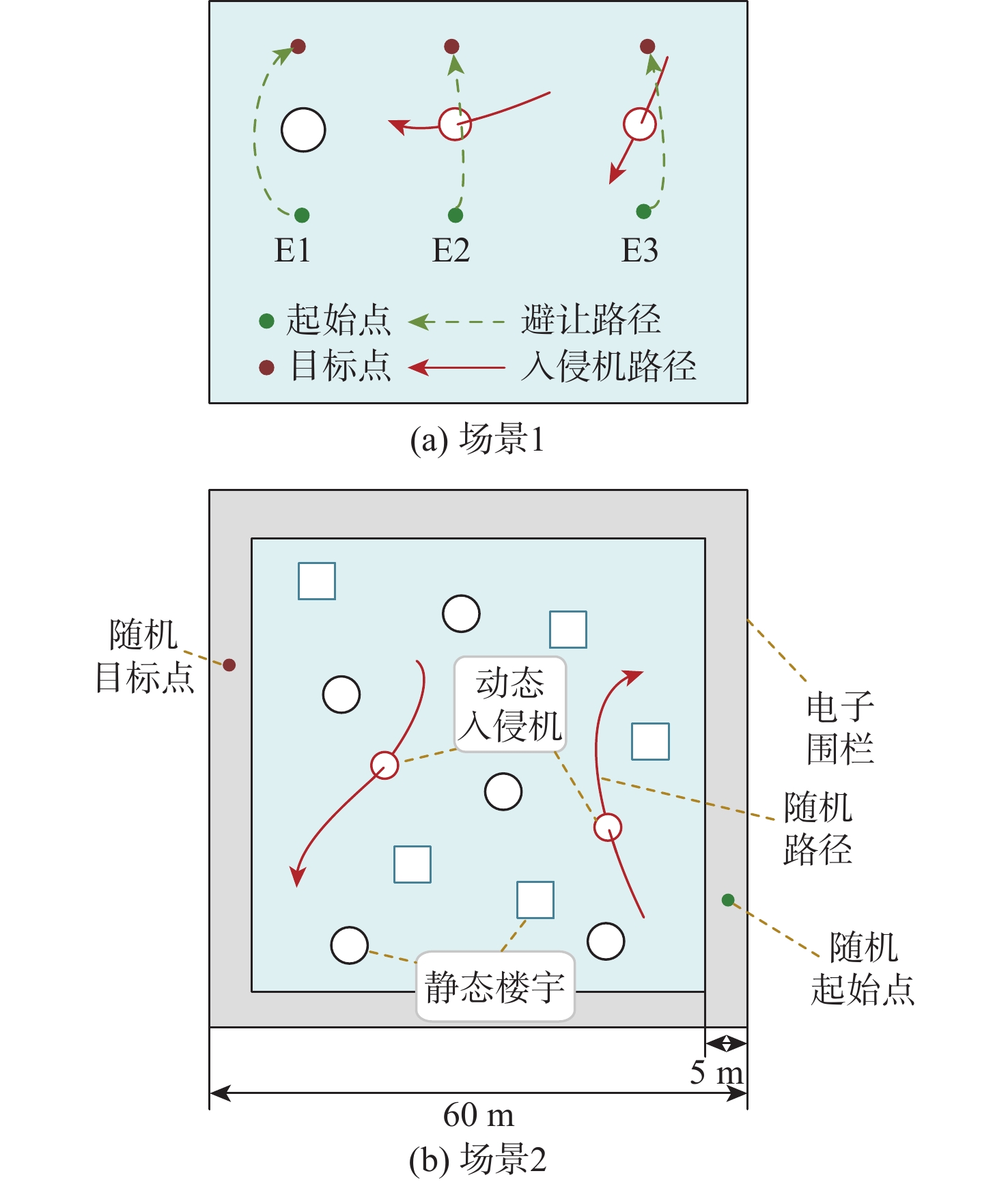
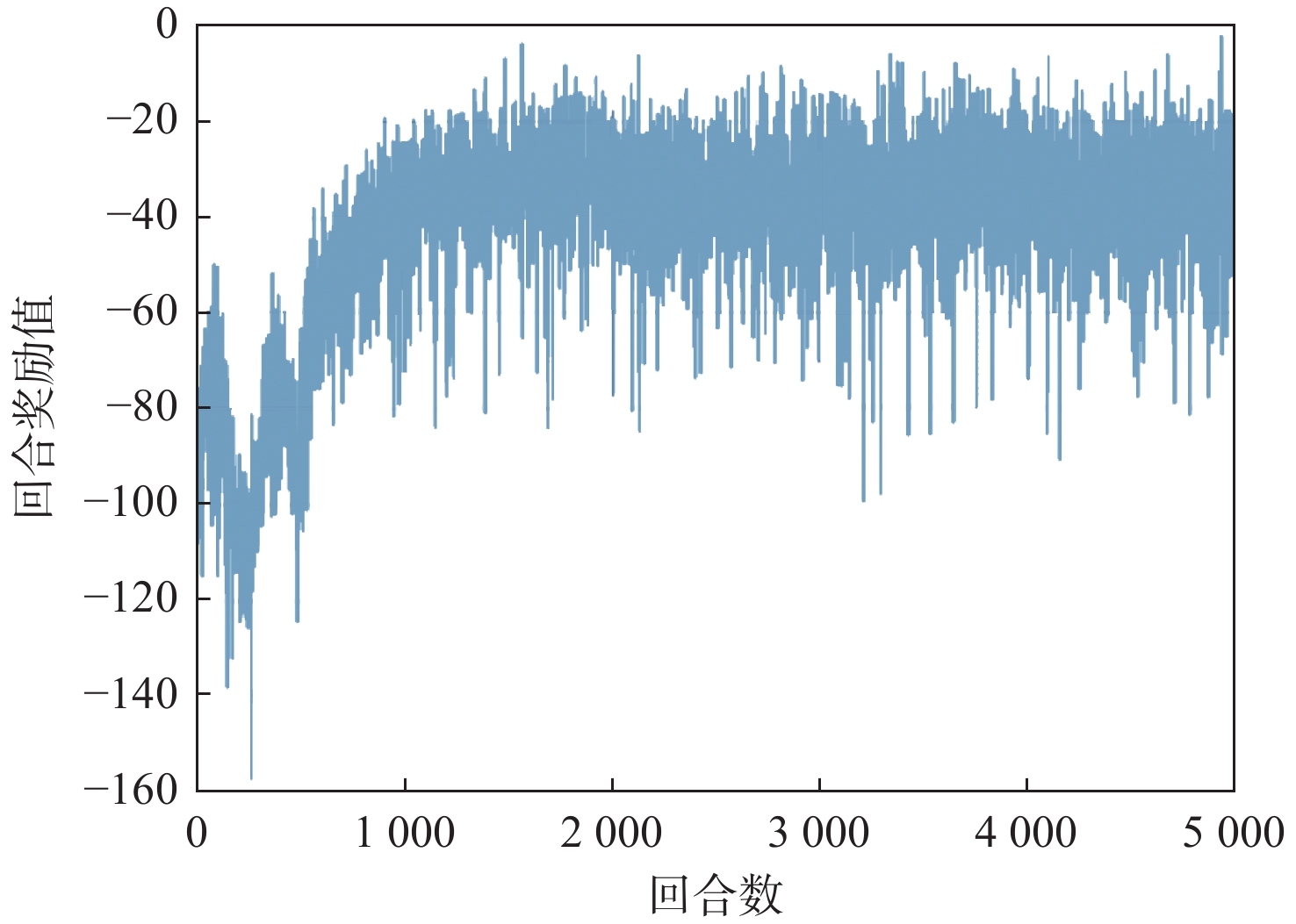
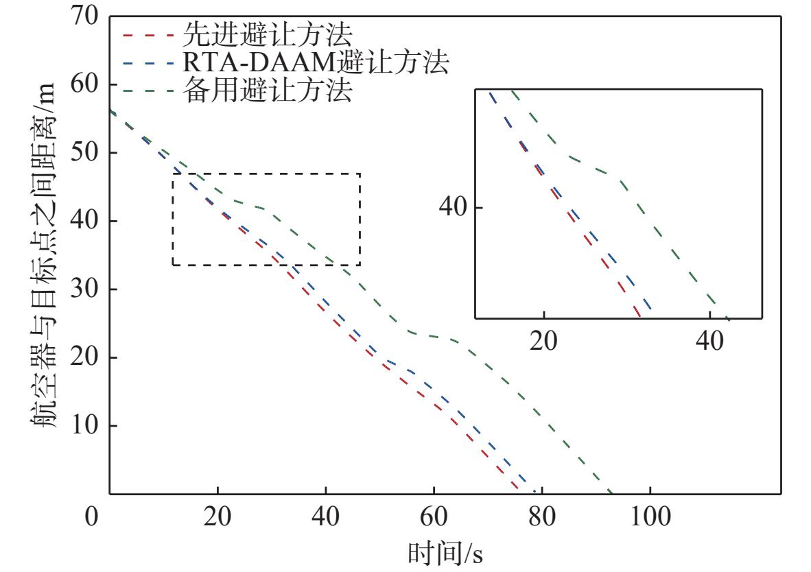
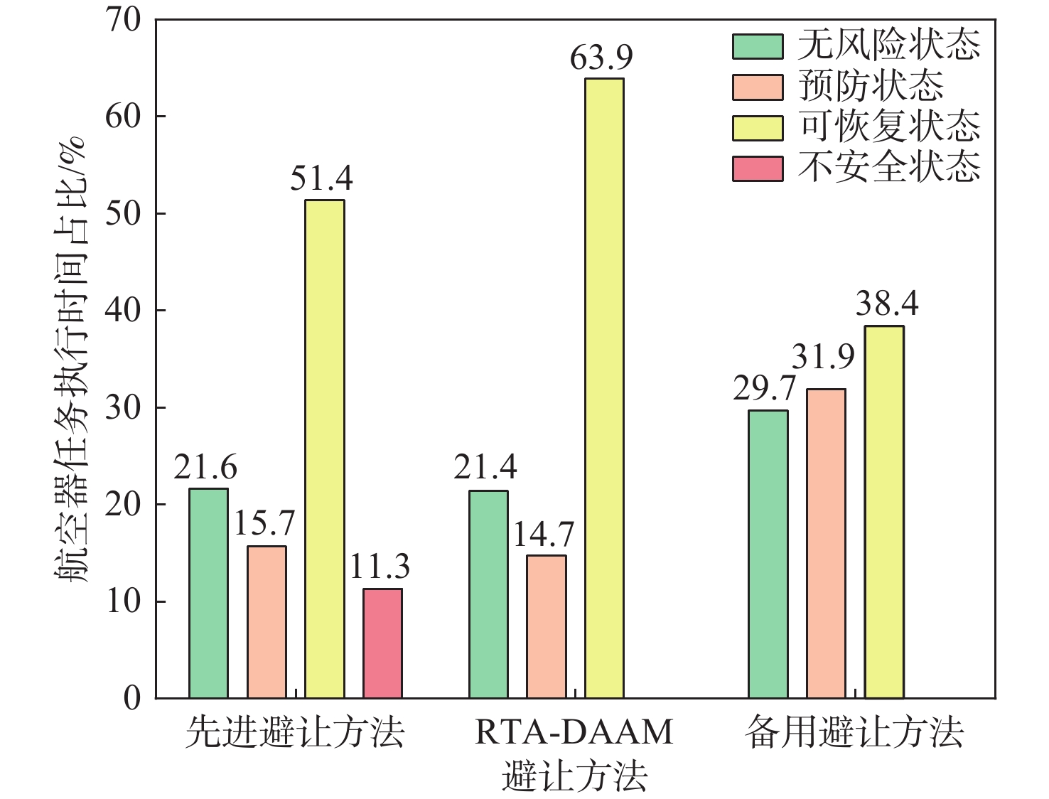
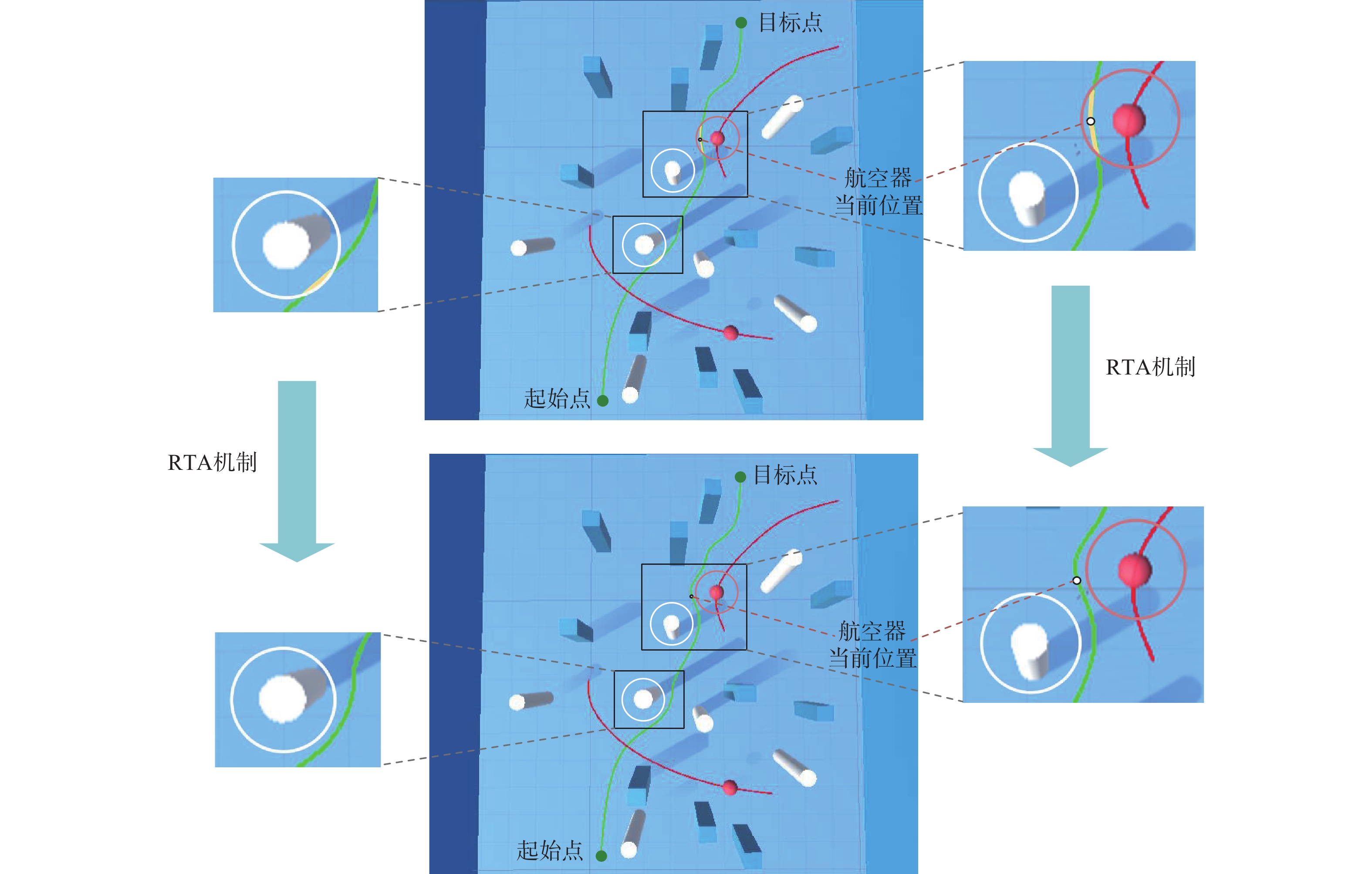
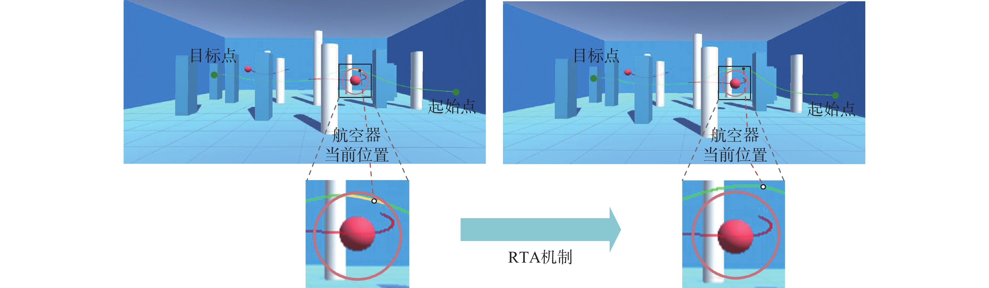
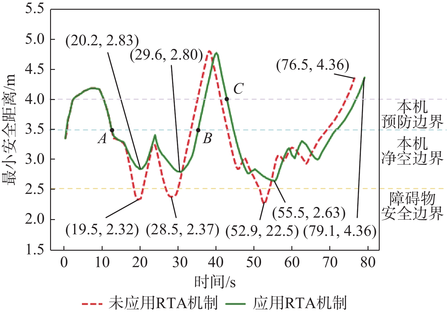
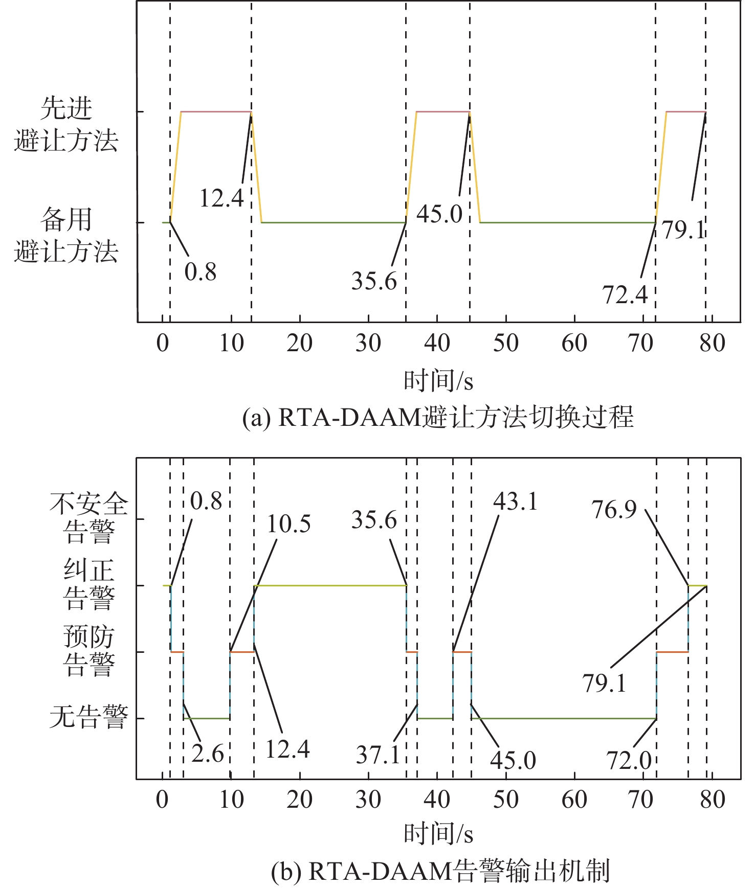
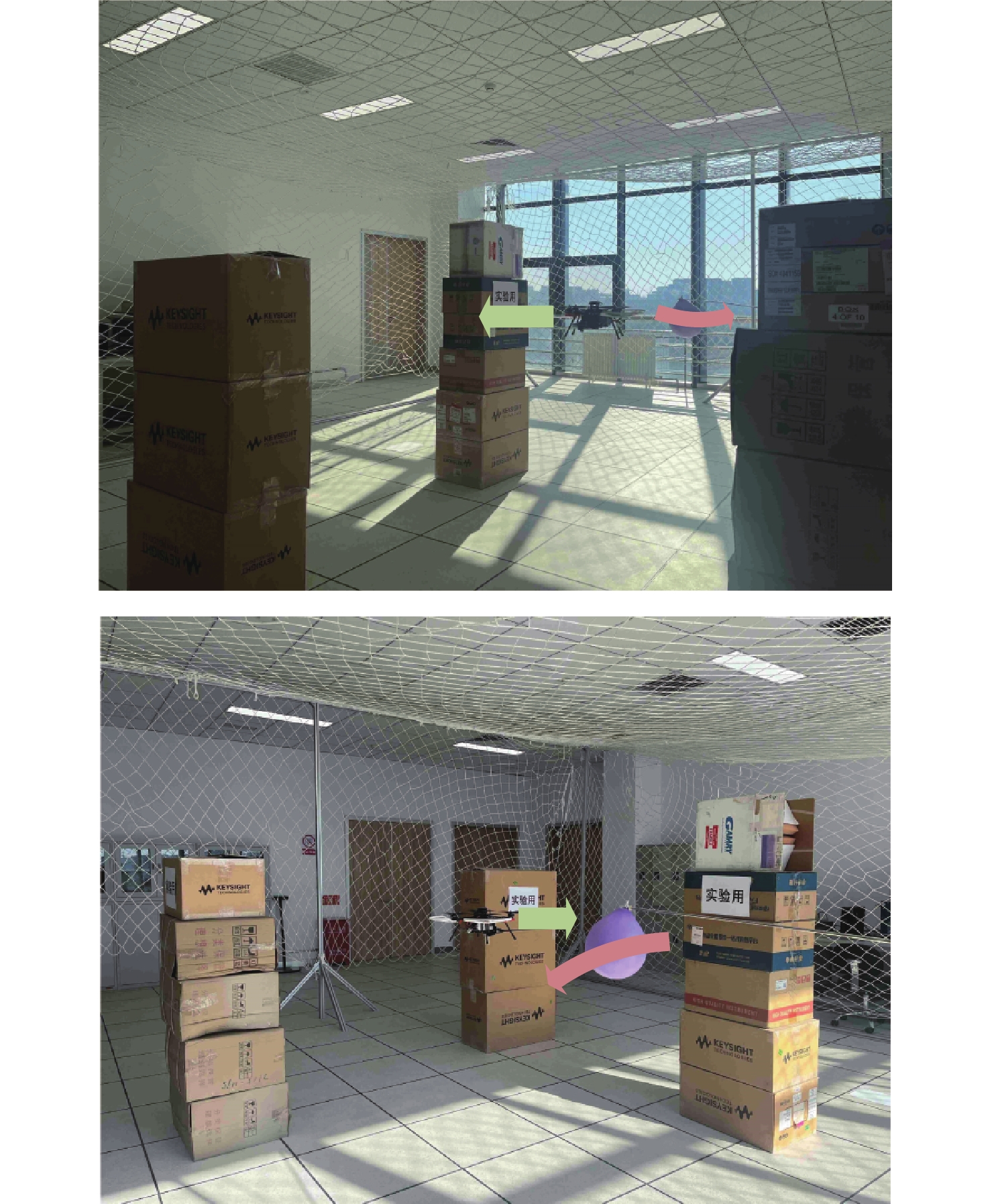
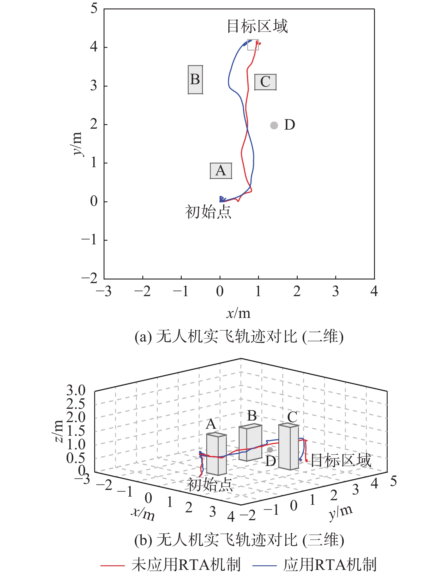
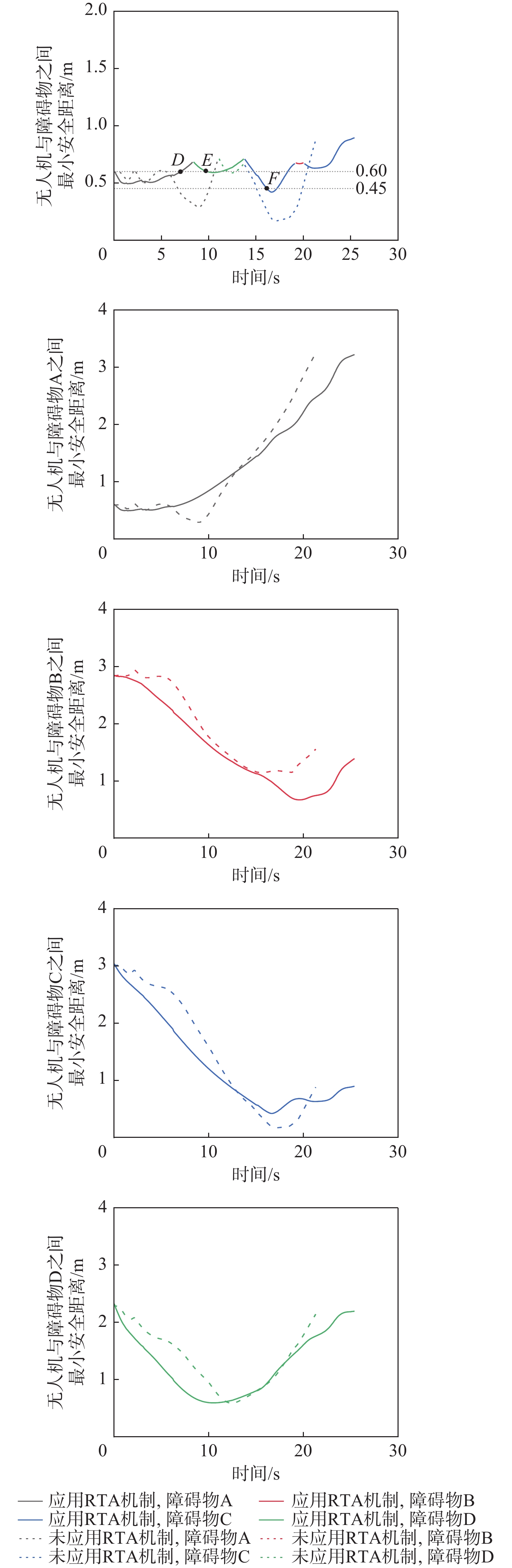
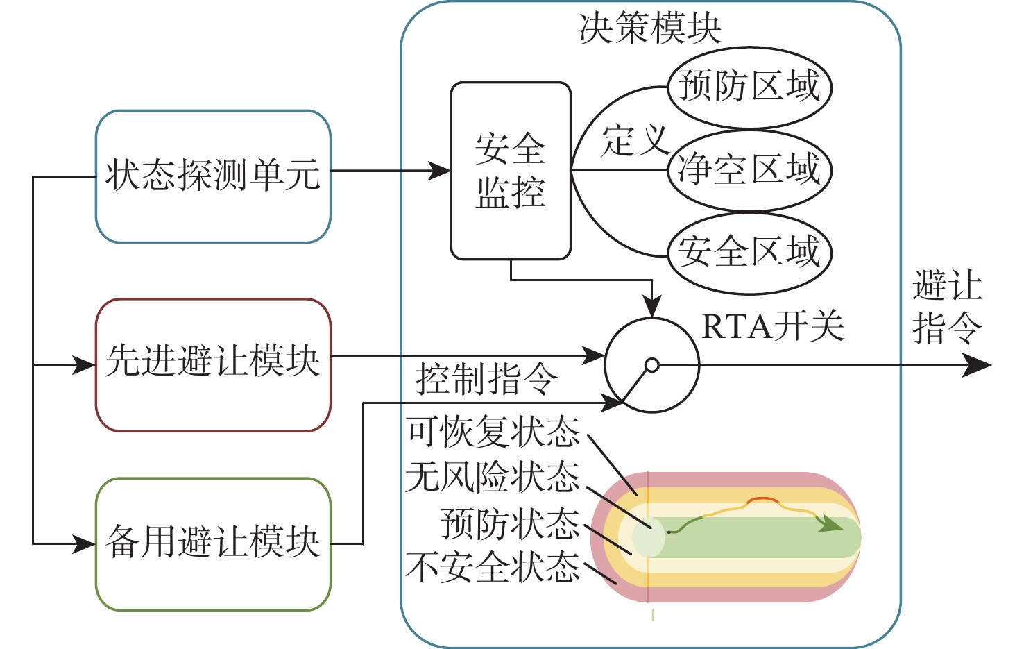
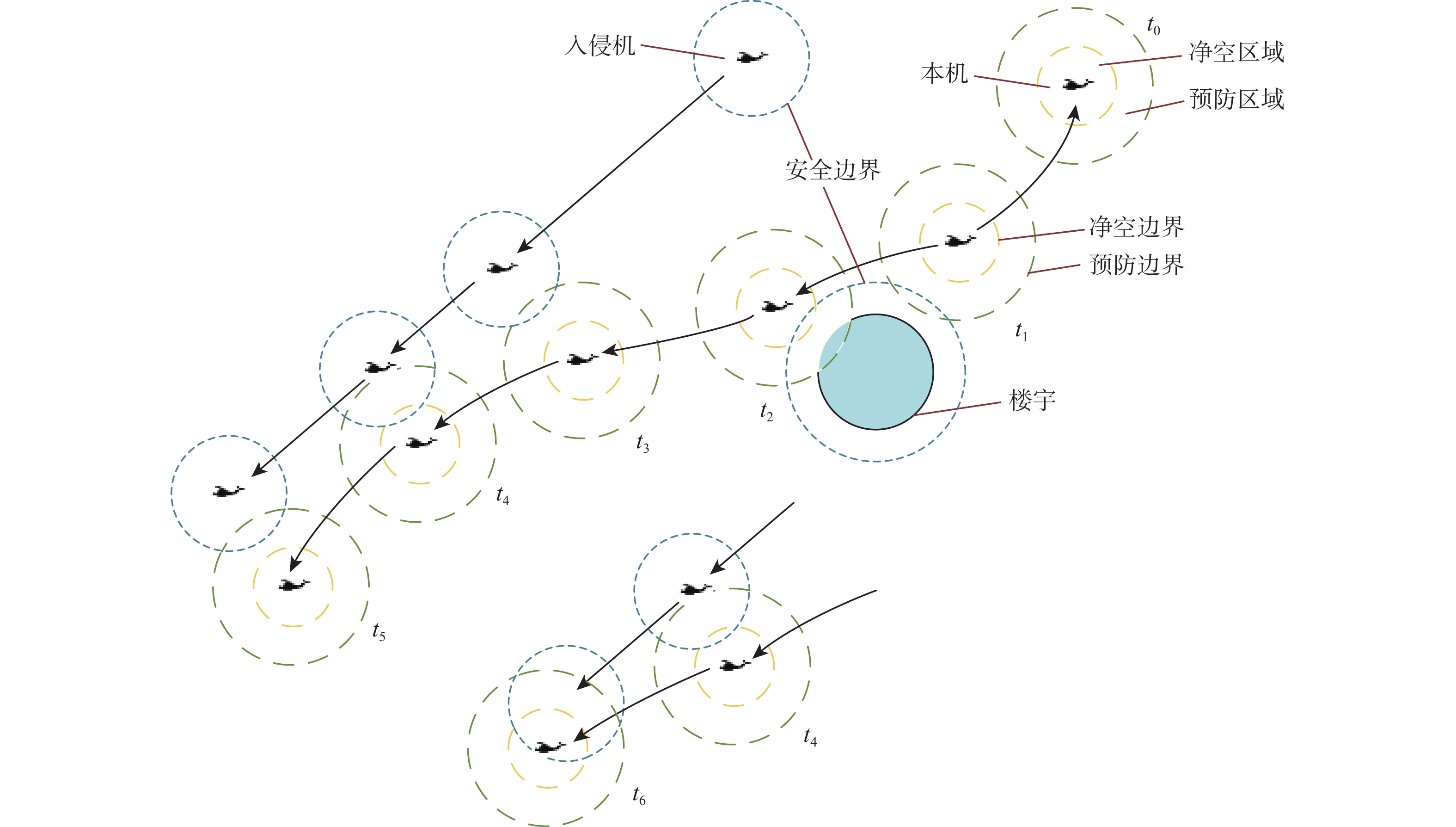
A runtime assurance-detect and avoid module (RTA-DAAM) is proposed to address the avoidance issue of unmanned aerial vehicles in the urban air mobility (UAM) scenario. It does this by identifying external environmental information sources and providing control commands and alarm information to guarantee the effectiveness and safety of aircraft in the UAM scenario. The control methods of advanced and standby collision avoidance modules in RTA-DAAM are designed. Considering the importance of coordination of detection, decision-making and warning functions, defining the aircraft’s own clearance boundaries, prevention boundaries, and obstacle safety boundaries, and dividing the different aircraft states so as to complete the design of the decision-making and warning logics. The simulation results show that RTA-DAAM can ensure the desired separation distance of the aircraft at a loss of only 3.40% of efficiency, so as to ensure the safety of the DAA system. The implementation of RTA technology can increase UAV safety time to 96.9%, providing UAV safety to the greatest extent possible, according to the real flight results of tiny UAVs.

Extended low-altitude aircraft tracking via navigation-assisted radar measurement augmentations
LI Kunkun, LI Kebo, CAO Rui, LIU Yuanhe, HU Shuang
2026, 52(9): 3039-3051. doi: 10.13700/j.bh.1001-5965.2025.0267
Abstract:

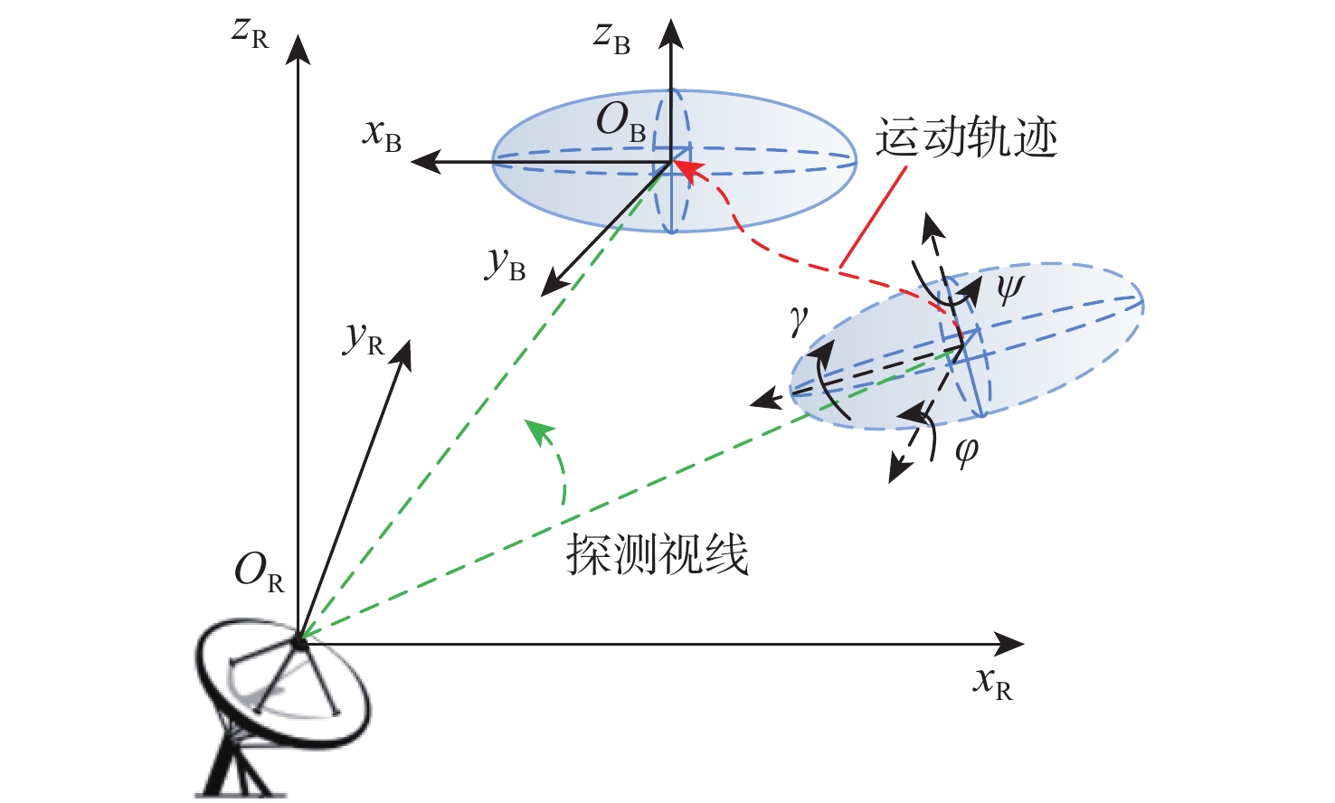
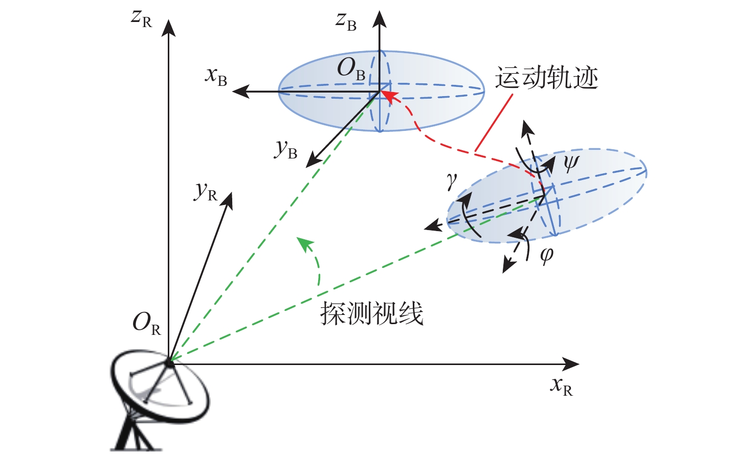
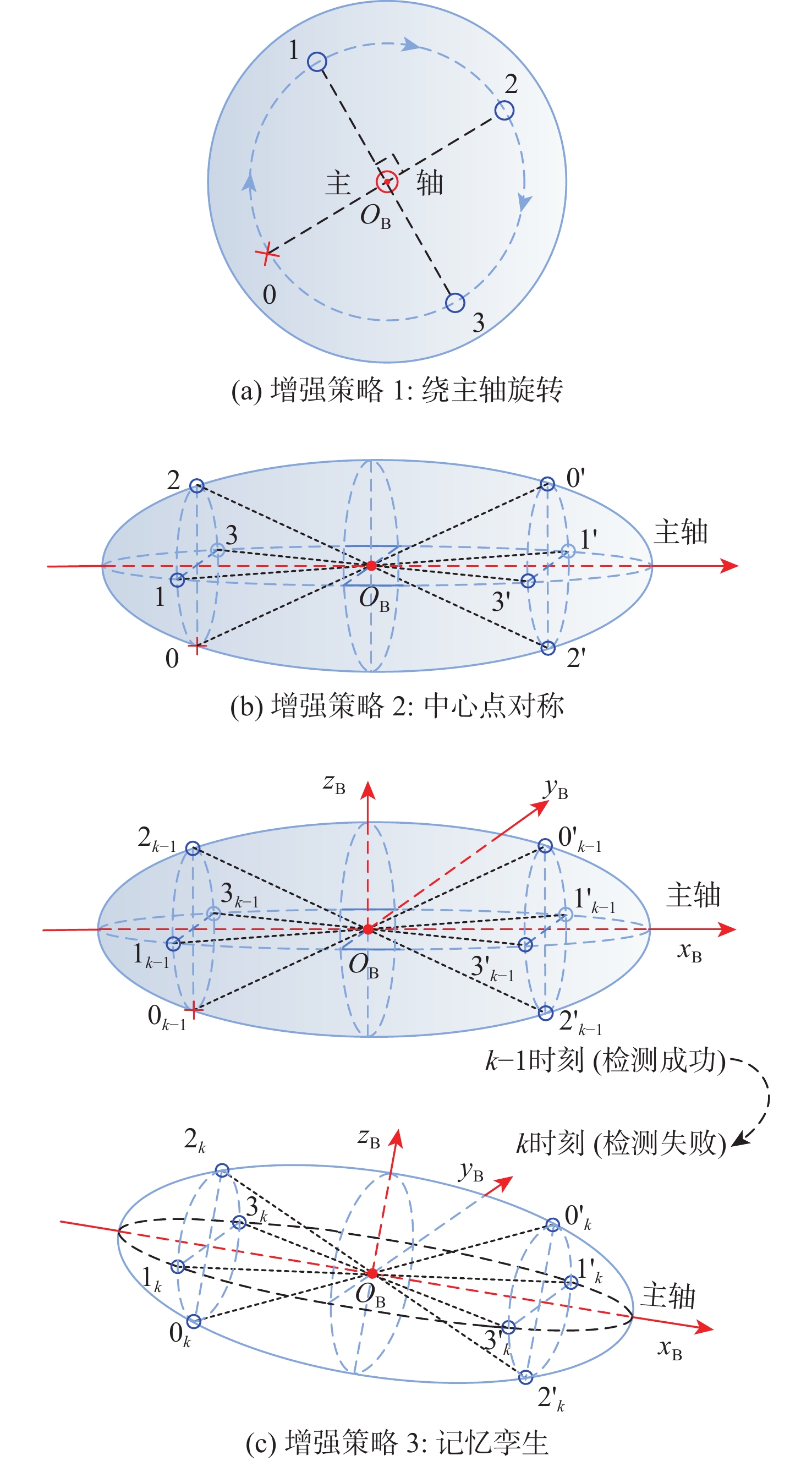
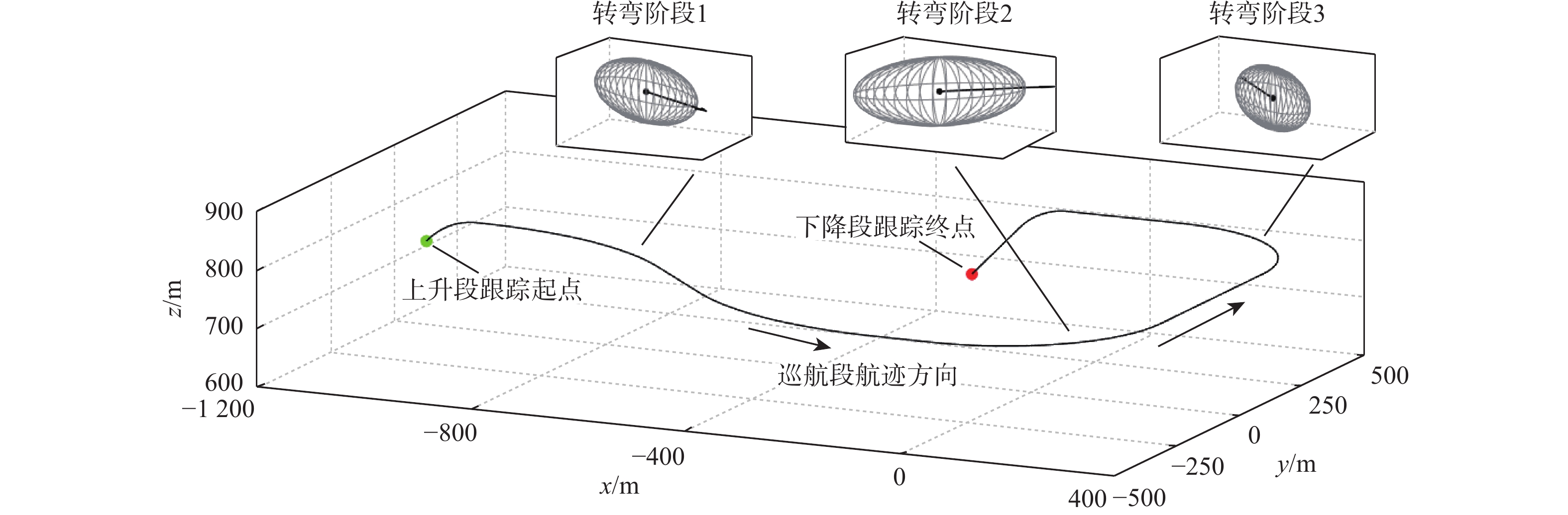
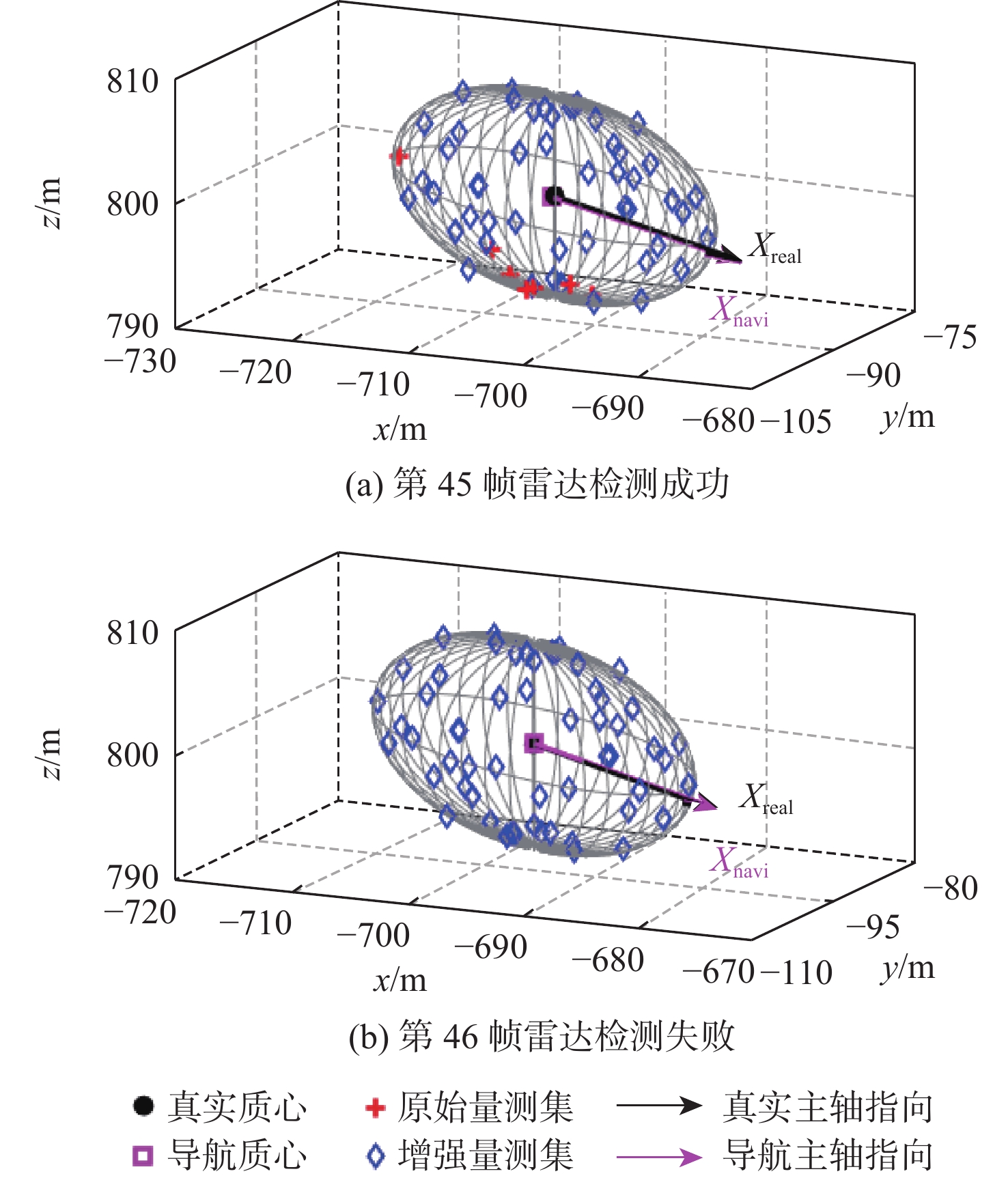
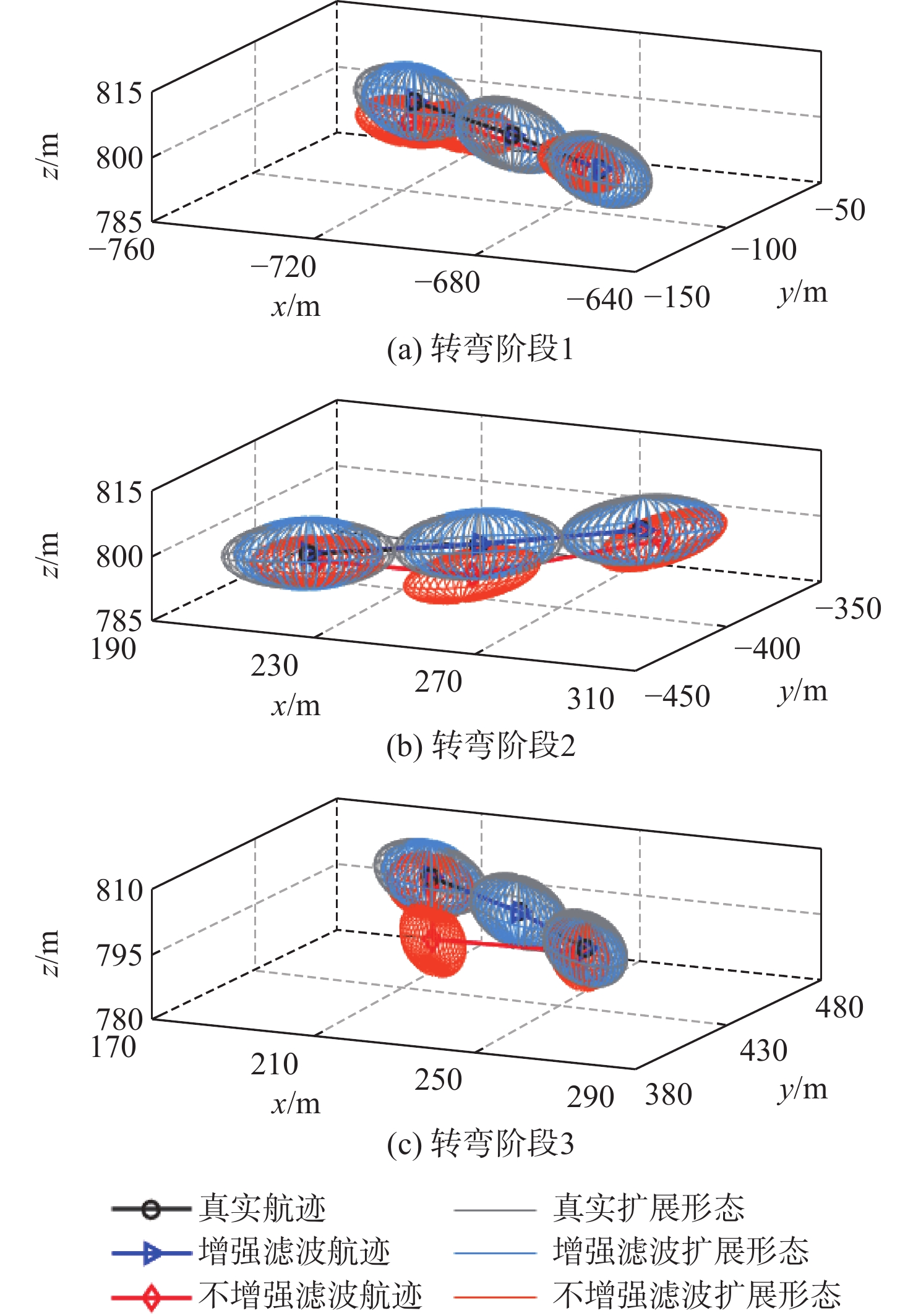
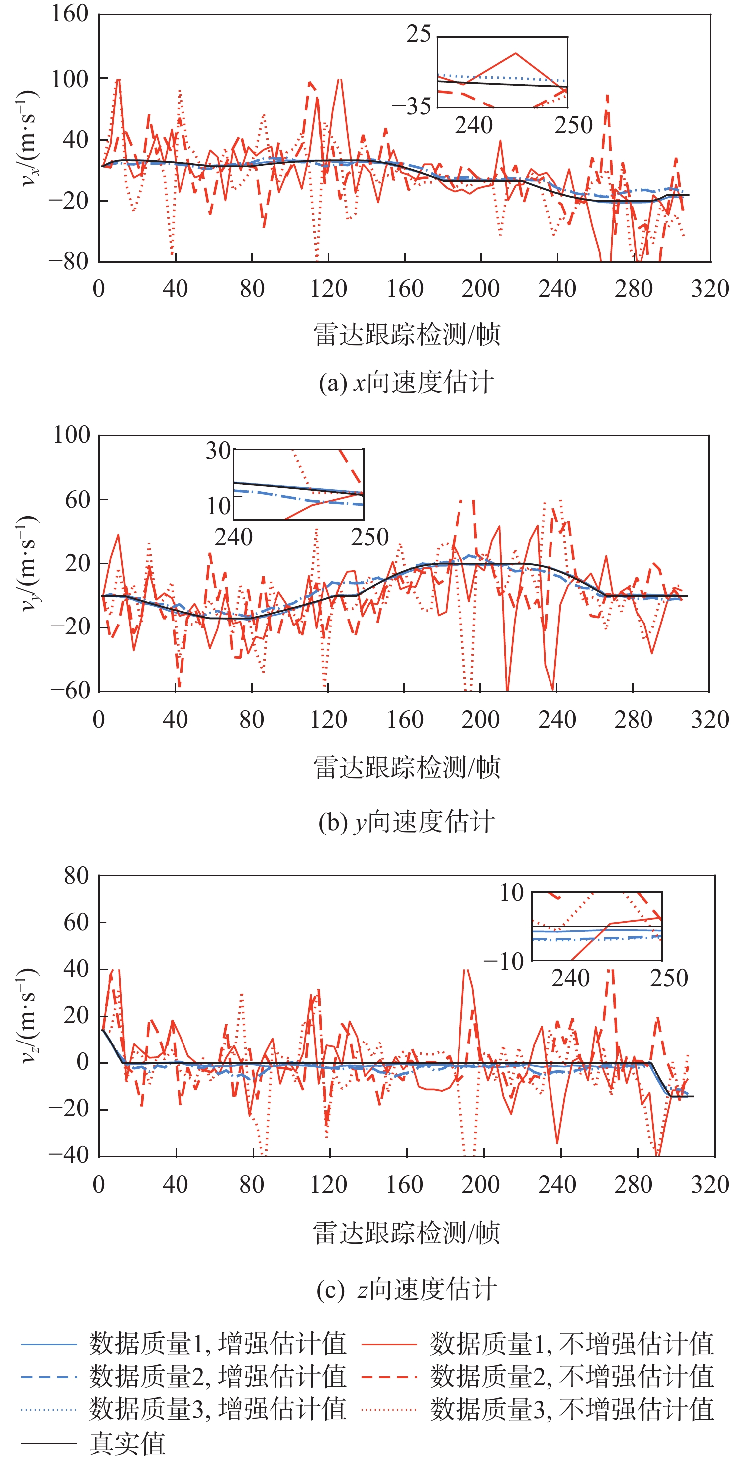
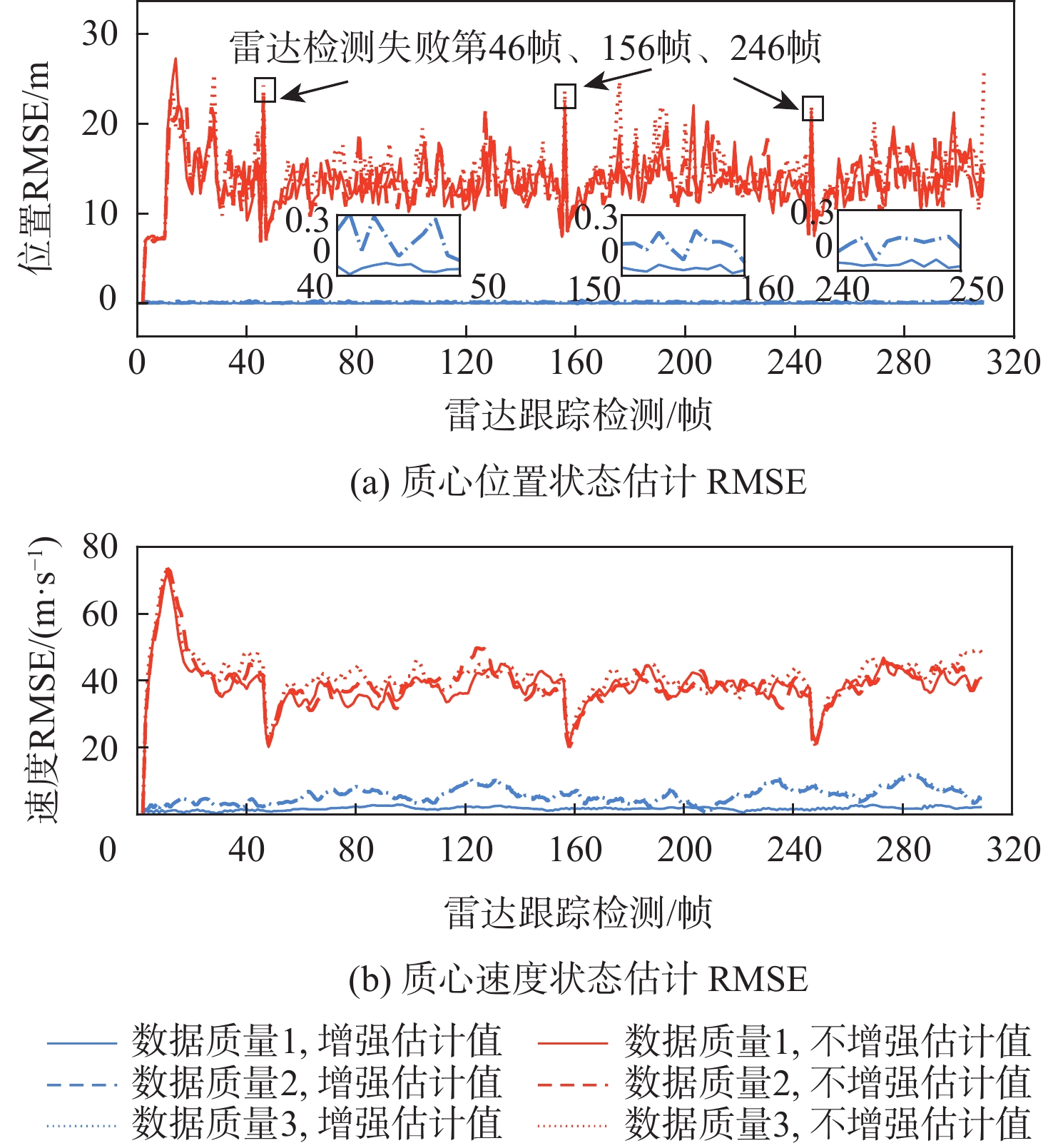
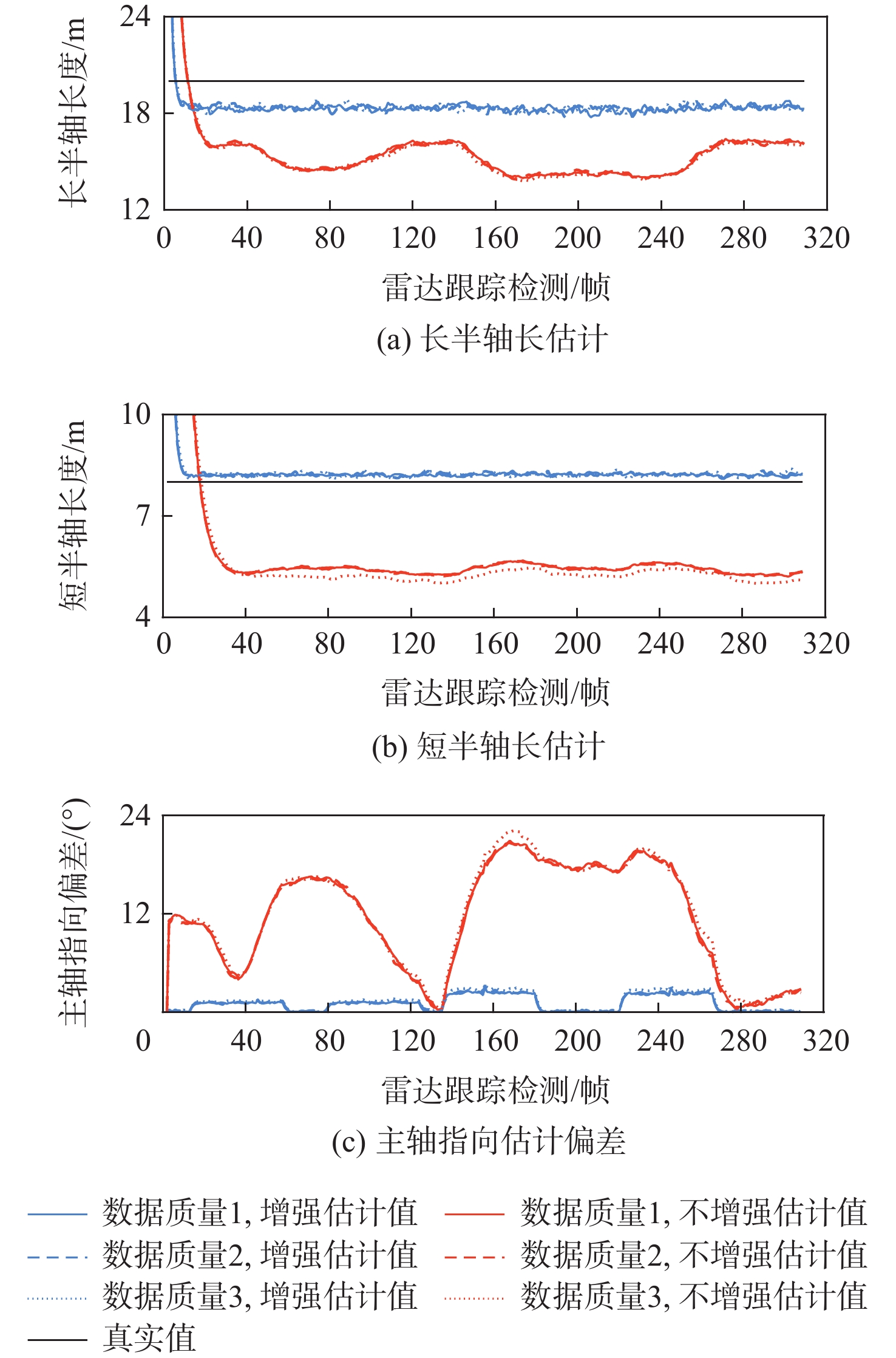
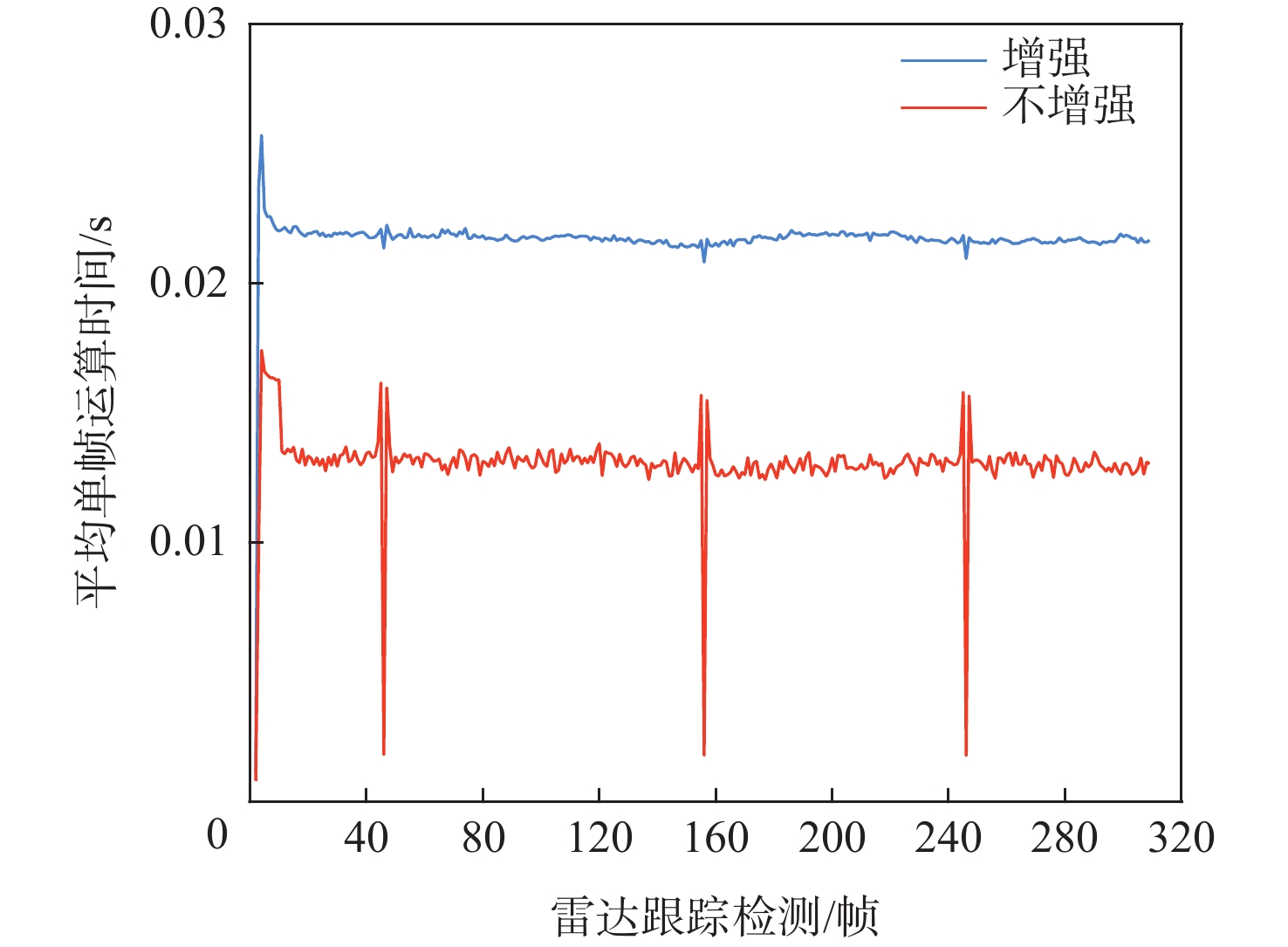
In the flight test of cooperative aircraft floating at low altitudes, a single-station high-resolution radar can get sparse (even missing) and spatially incomplete measurements, while the radar observes a partial surface of the aircraft. This will lead to poor tracking accuracy for the tested aircraft. To solve this problem, this paper proposes a tracking method using augmented radar measurements by fusing aircraft navigation information. First, a symmetric positive definite random matrix is used to approximate the aircraft’s three-dimensional extension shape, which is roughly ellipsoidal, based on the structurally extended characteristic of the aircraft identified by the high-resolution radar. Subsequently, the partially observed aircraft model and the radar measurement model are both established. Further, multiple strategies are designed to augment sparse radar measurements using assisted aircraft navigation information, such that the radar measurement data is improved in both amount and spatial completeness. Finally, an implementation of aircraft state estimation under partial observation is given within the Bayesian filtering framework. The outcomes of the simulation experiment show that the proposed method improves the tested aircraft’s tracking accuracy and, consequently, awareness accuracy for its flight condition. Moreover, the proposed method has the advantages of high fusion usage of multi-source measurement information and a low computational cost.

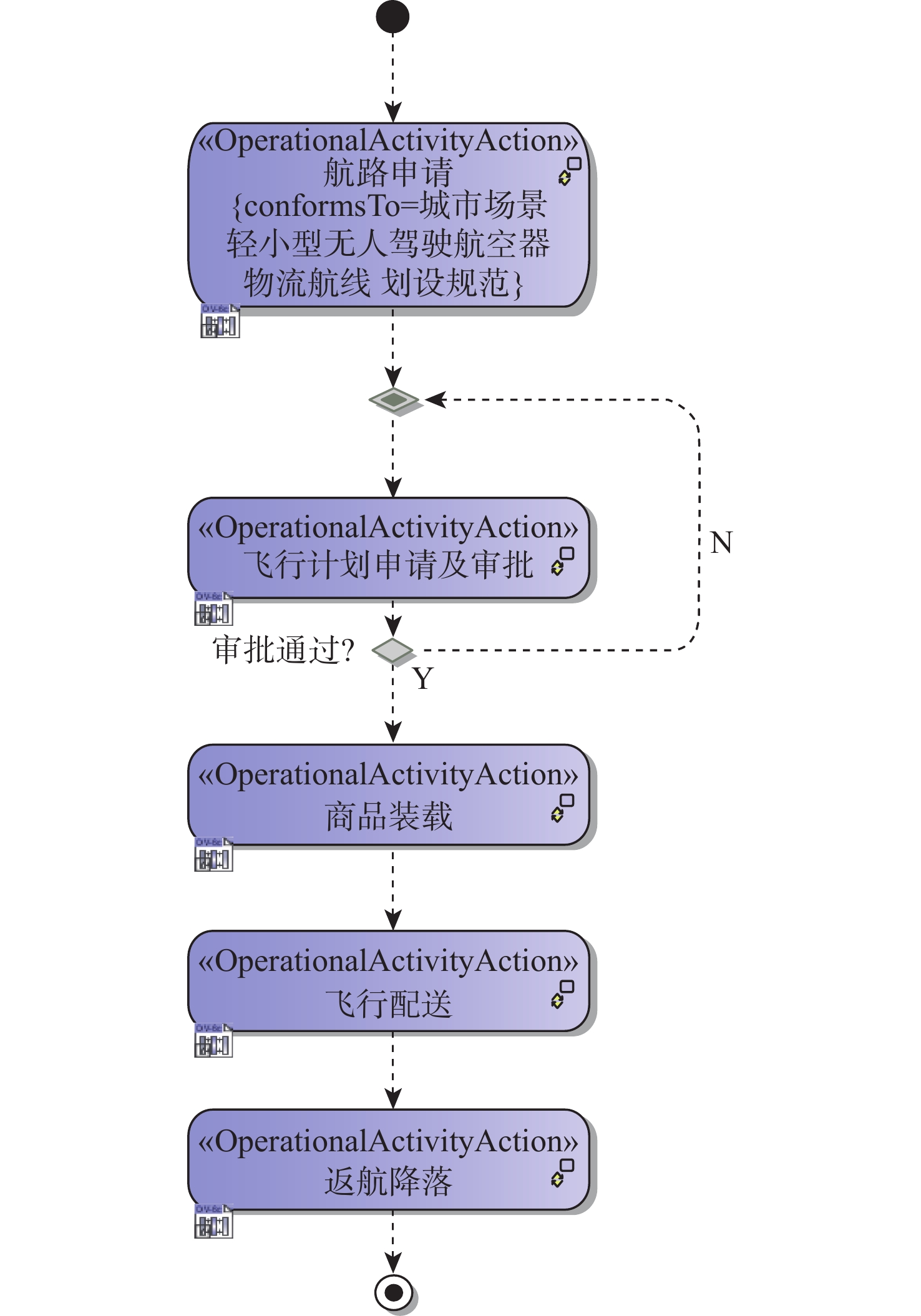
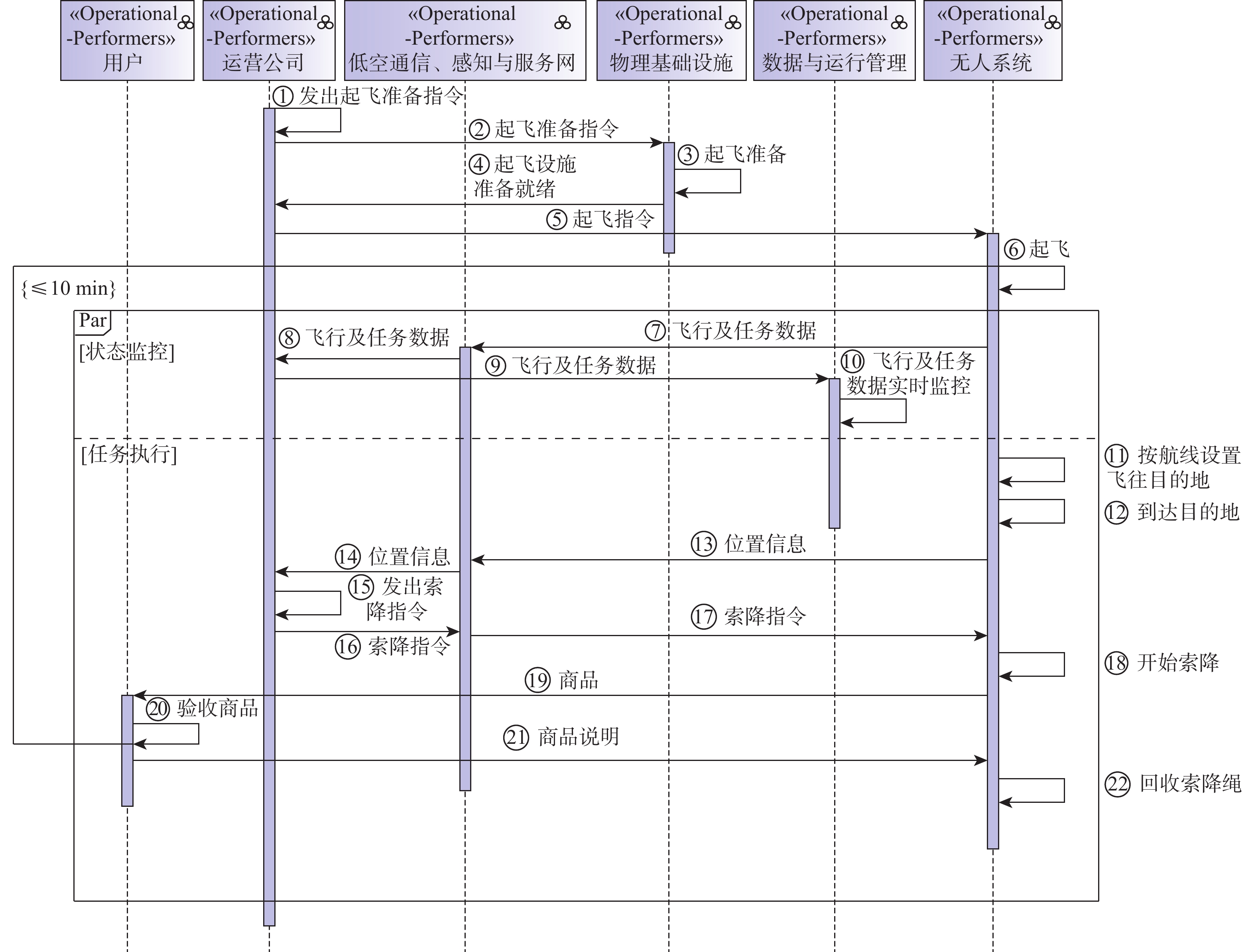
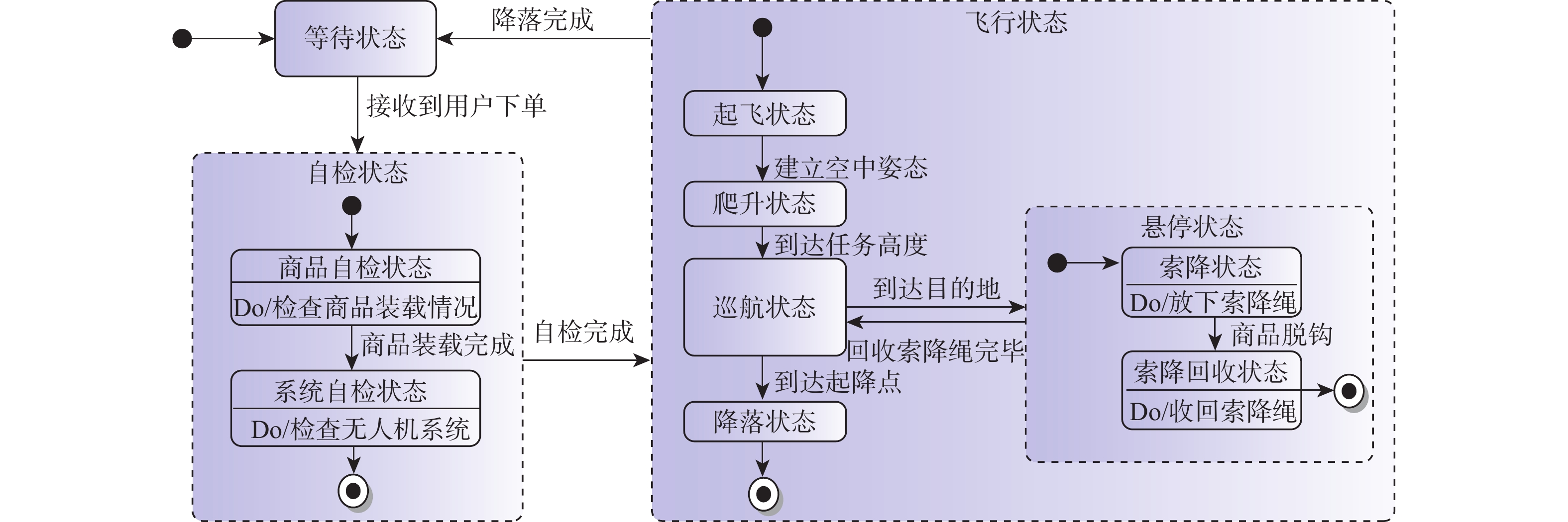
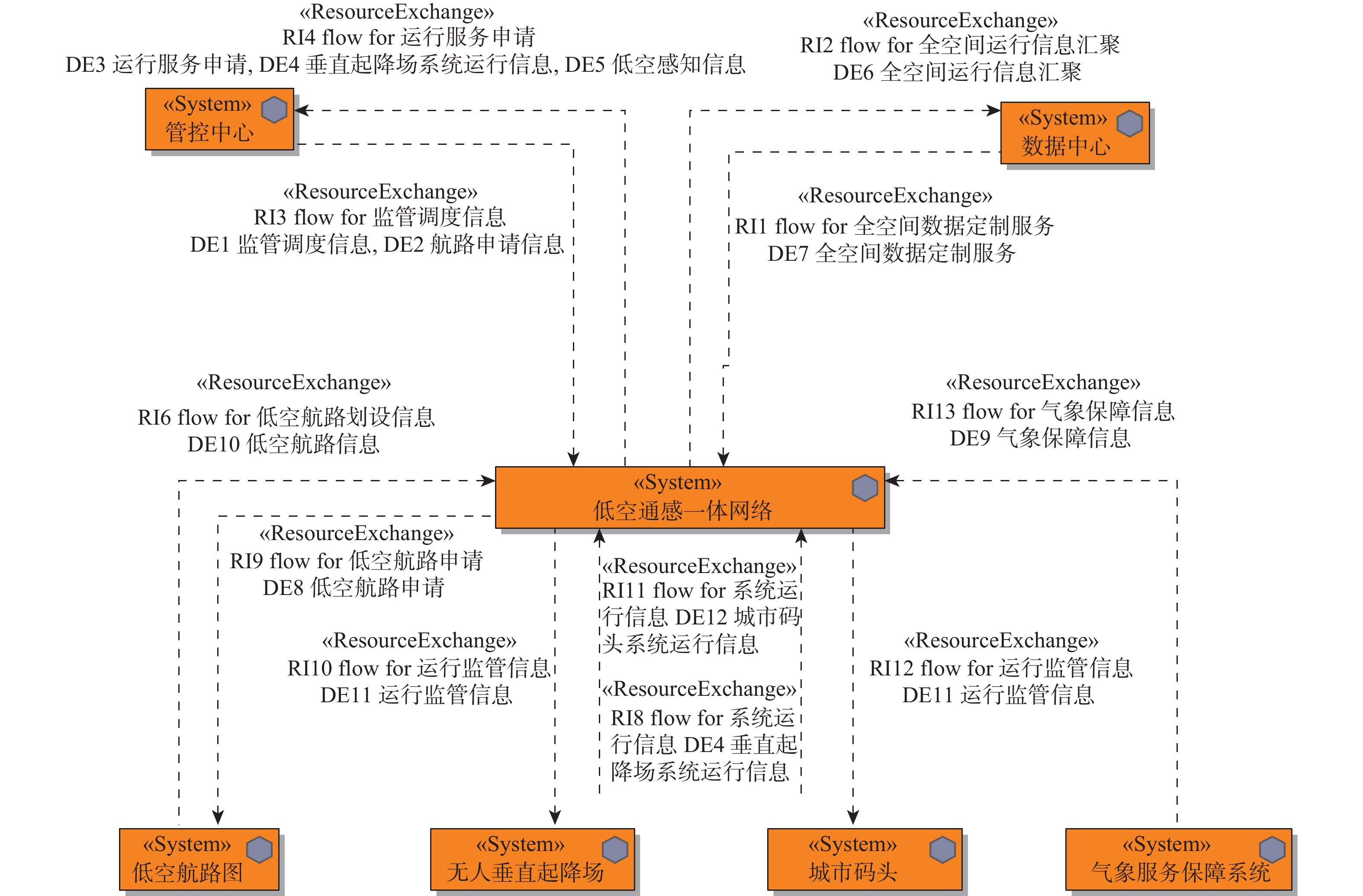
Architecture design and modeling technology for civil unmanned system operation scenarios
GUO Tai, AN Yiping, SHU Zhenjie, JIANG Jueyi, JIANG Yuhang
2026, 52(9): 3052-3065. doi: 10.13700/j.bh.1001-5965.2025.0361
Abstract:

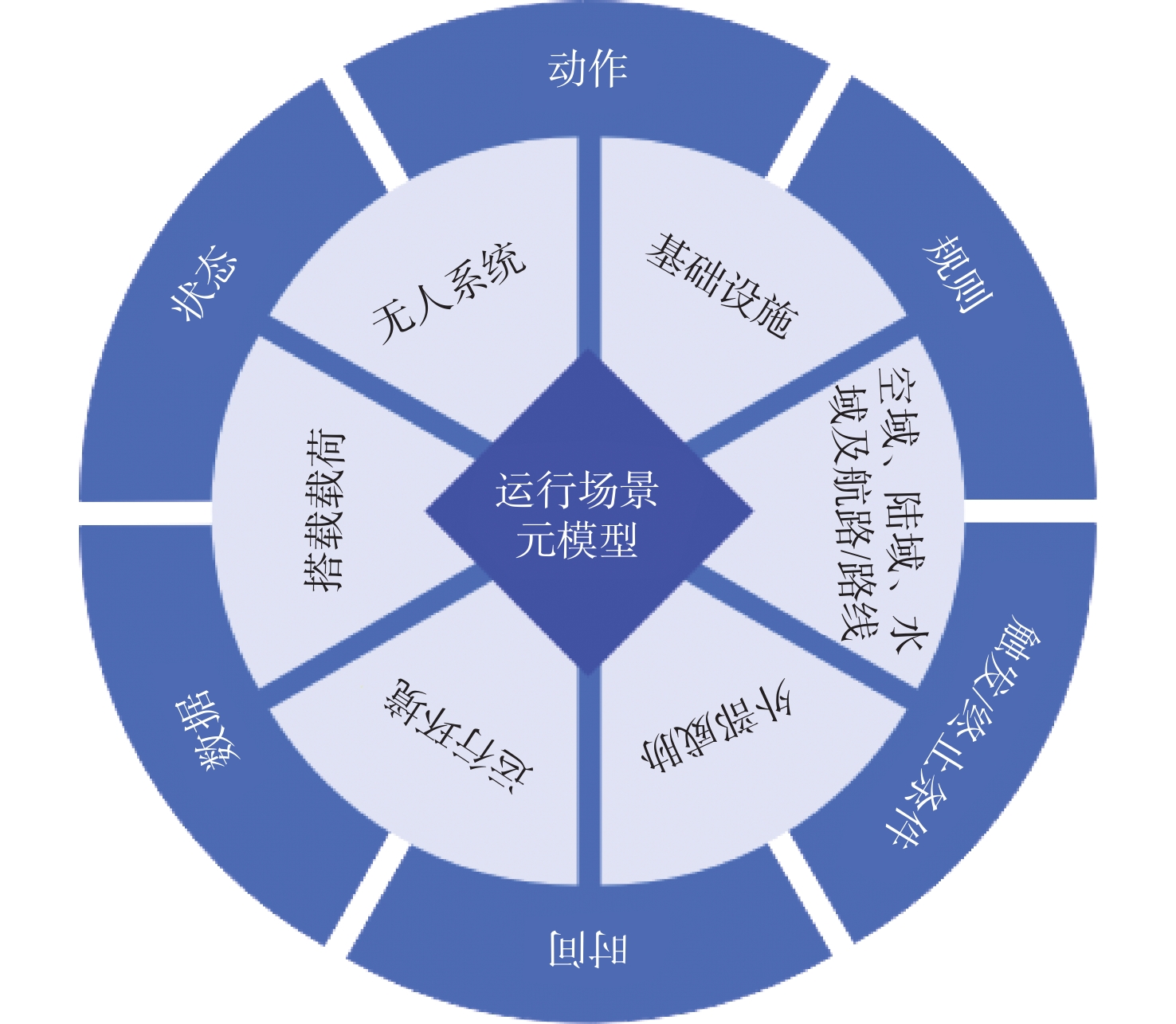
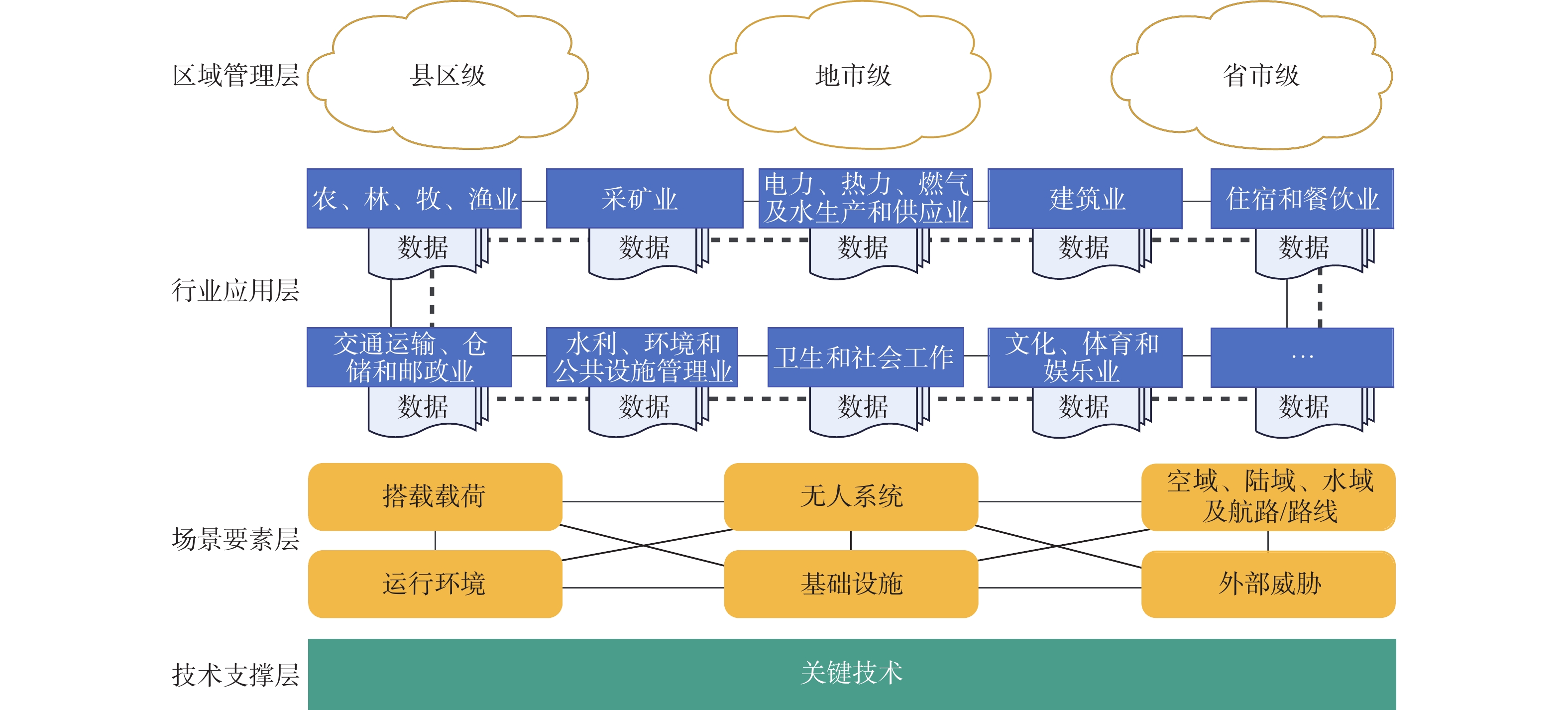
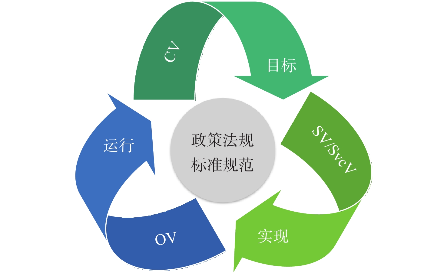
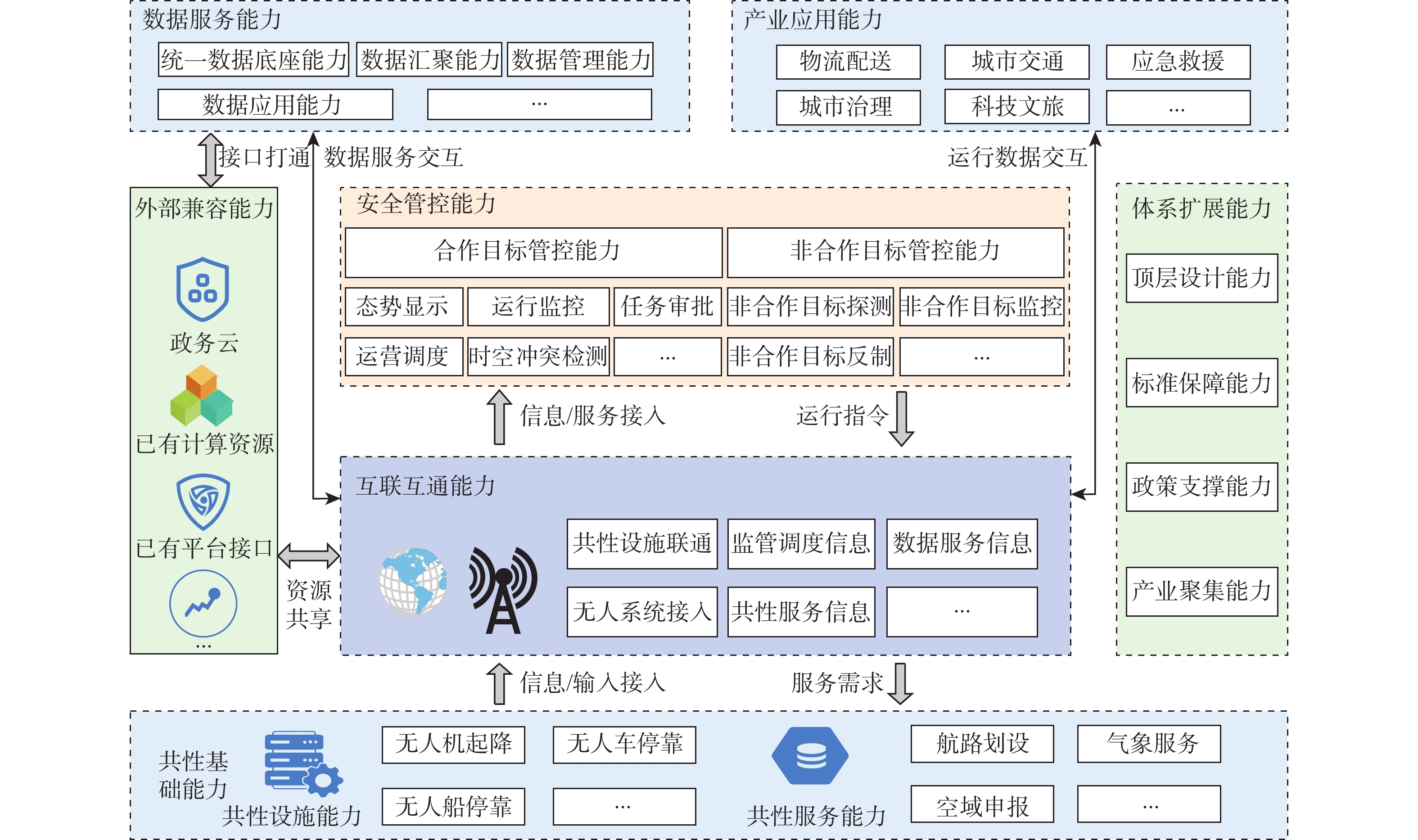
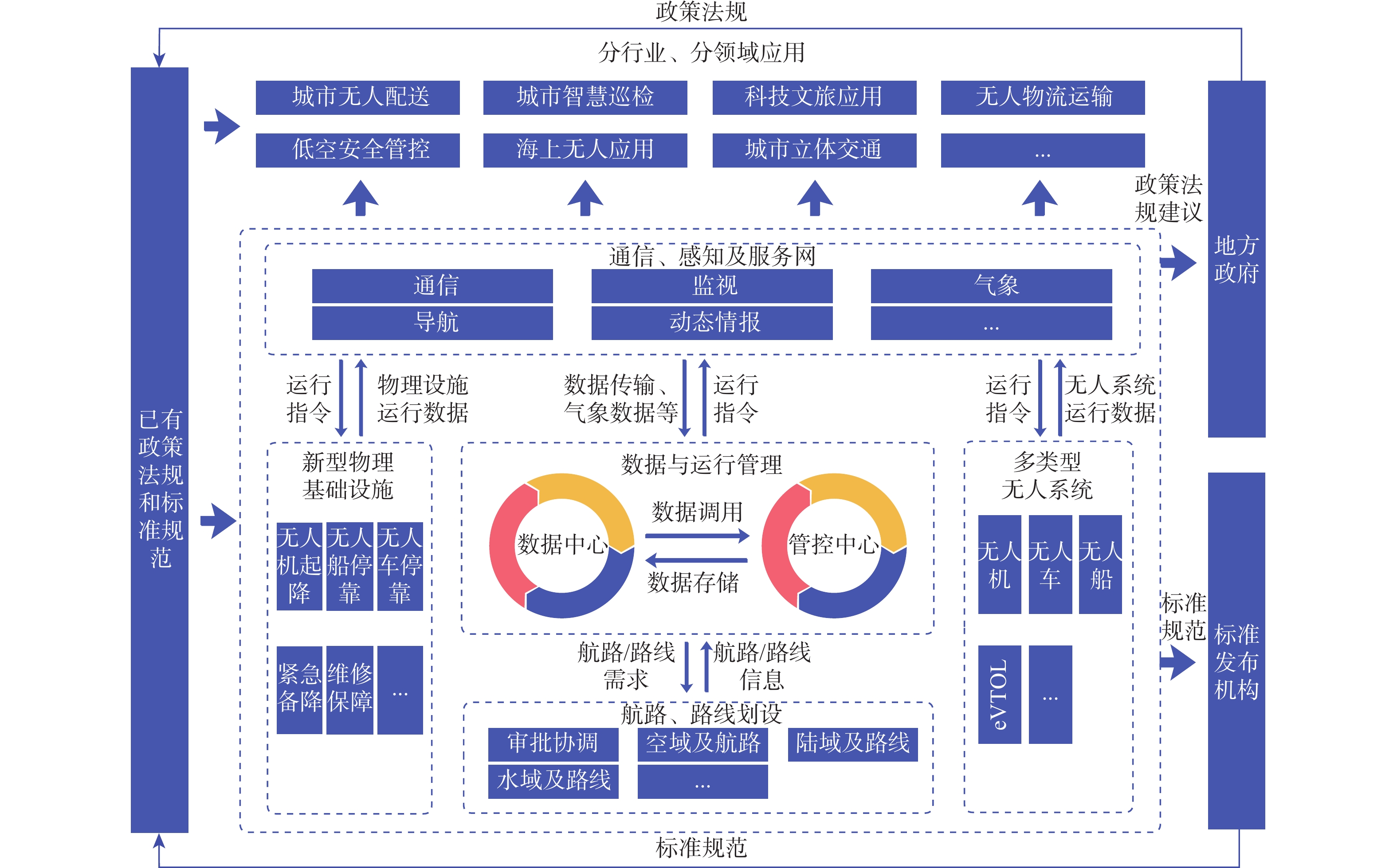
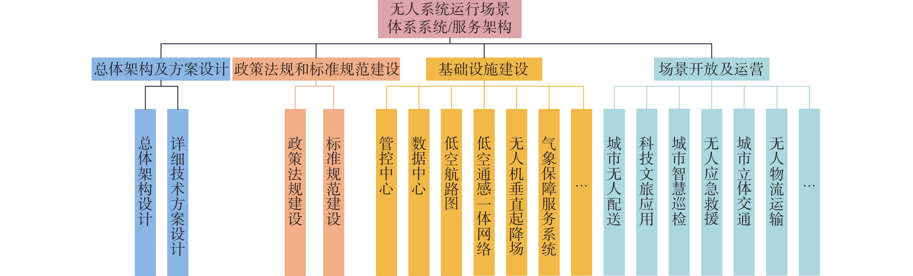
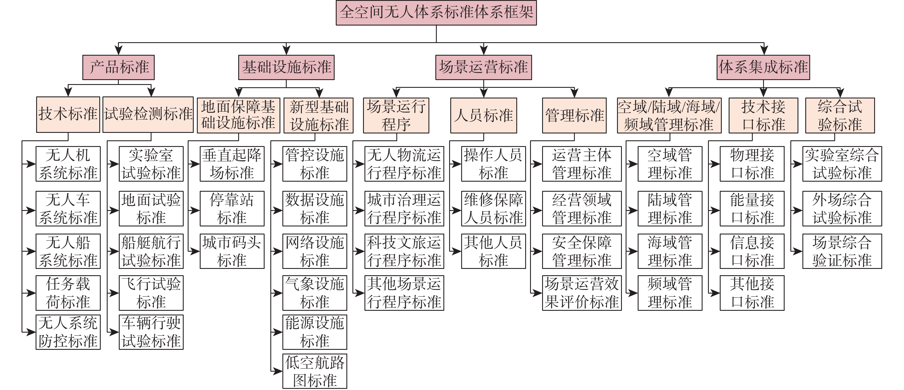
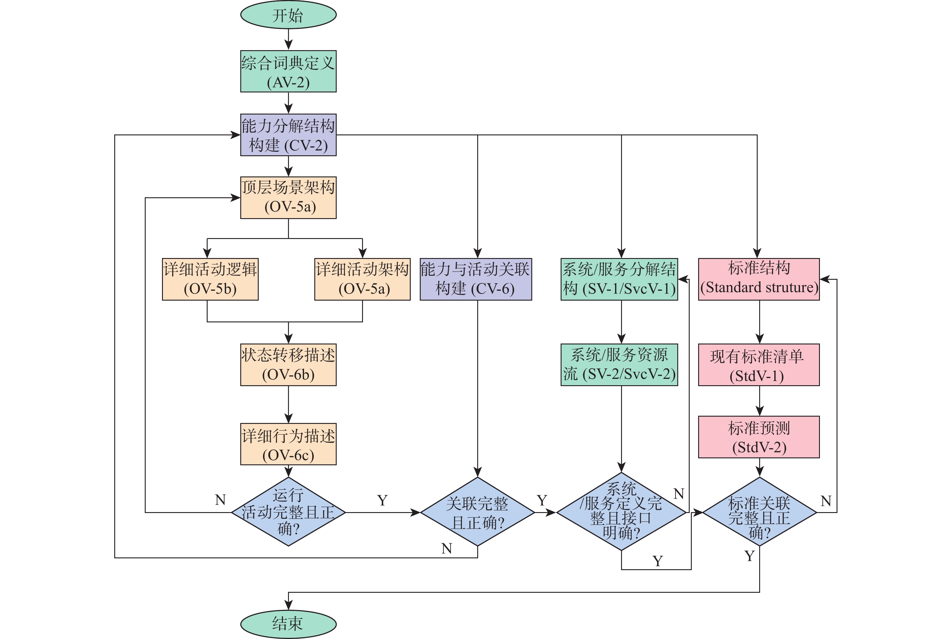
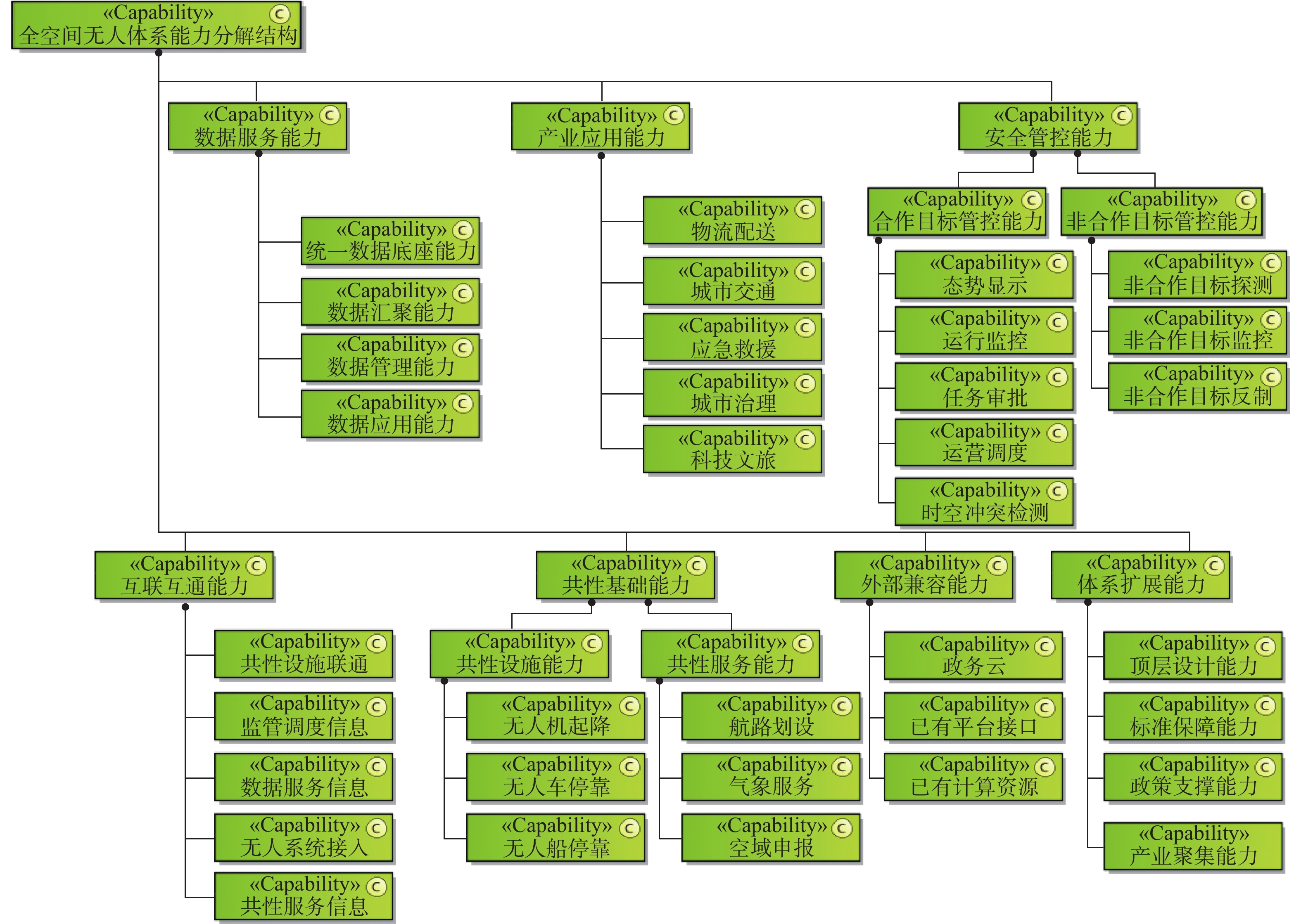
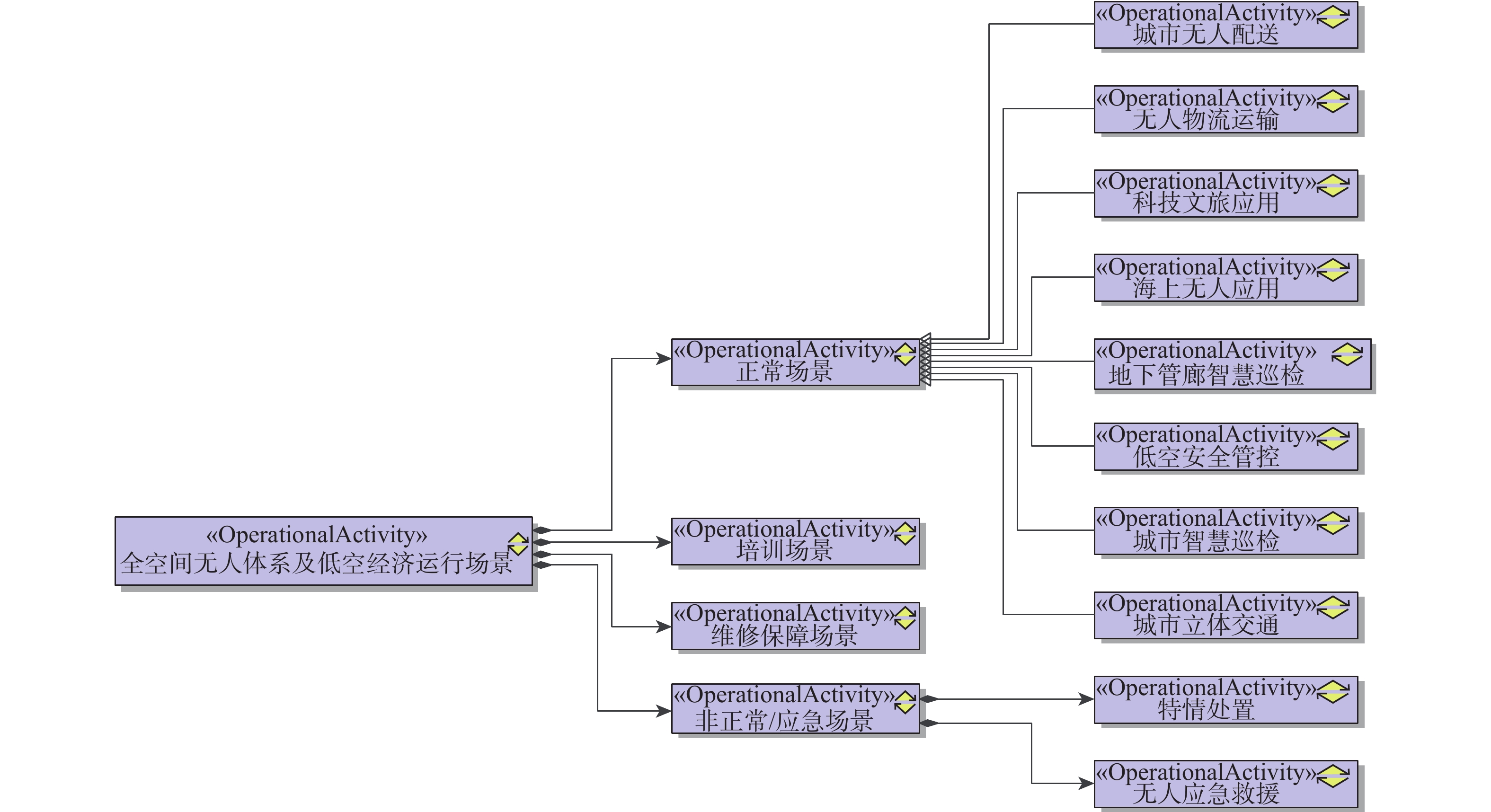
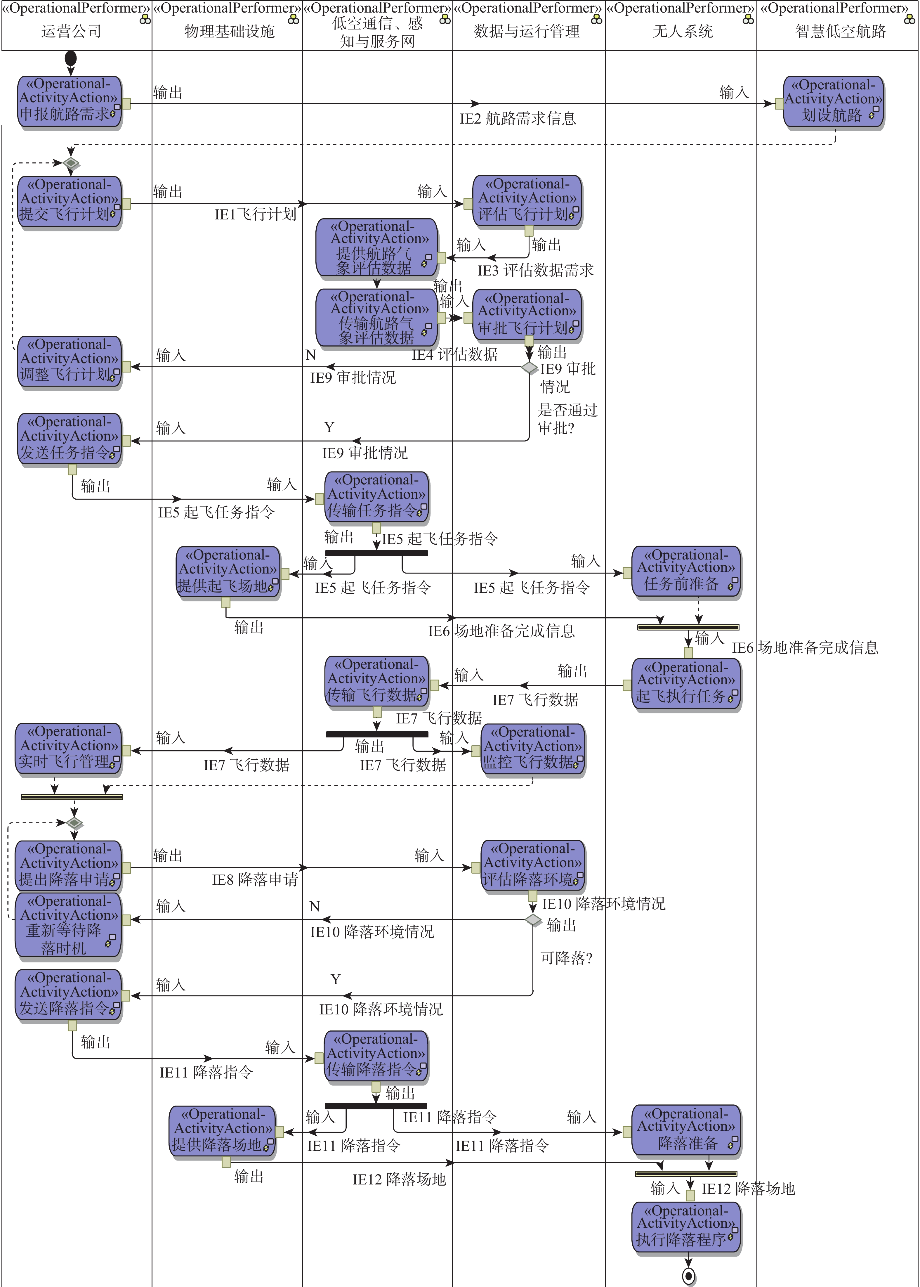
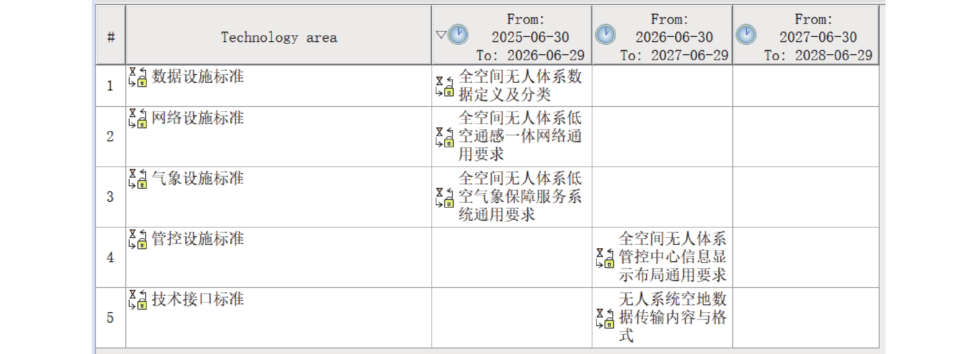
Operational scenarios for civil unmanned systems act as hubs of the industrial value of all-space unmanned system and low-altitude economy, playing a crucial role in scaling up new industries. This typical complex system features dynamic boundaries, multi-level emergence, balanced stakeholder interests, and continuous evolution. Modern systems engineering principles must be used in the design of such systems' architecture to guarantee their safe and effective operation. Our research into the architecture design and modeling of civil unmanned system scenarios produced a "6+6" meta-model, capturing static and dynamic elements. In addition to developing a thorough process that covers everything from element identification to architecture design and modeling, we created a multi-perspective architecture design and modeling including capability, operational, system, and standard architectures. This approach not only provides guidance for the construction of new infrastructure, the research, development, and selection of unmanned systems, and the formulation of policy and standard creation, but also concurrently offers technical support for the establishment of unmanned system operation scenarios and the systematic development of the related industry.

A post-training quantization method for CNN-Transformer hybrid models on UAV platforms
ZHAO Chenggong, HU Jiyuan, YANG Xingyu, CHEN Lei, JIANG Hongxu
2026, 52(9): 3066-3074. doi: 10.13700/j.bh.1001-5965.2025.0411
Abstract:

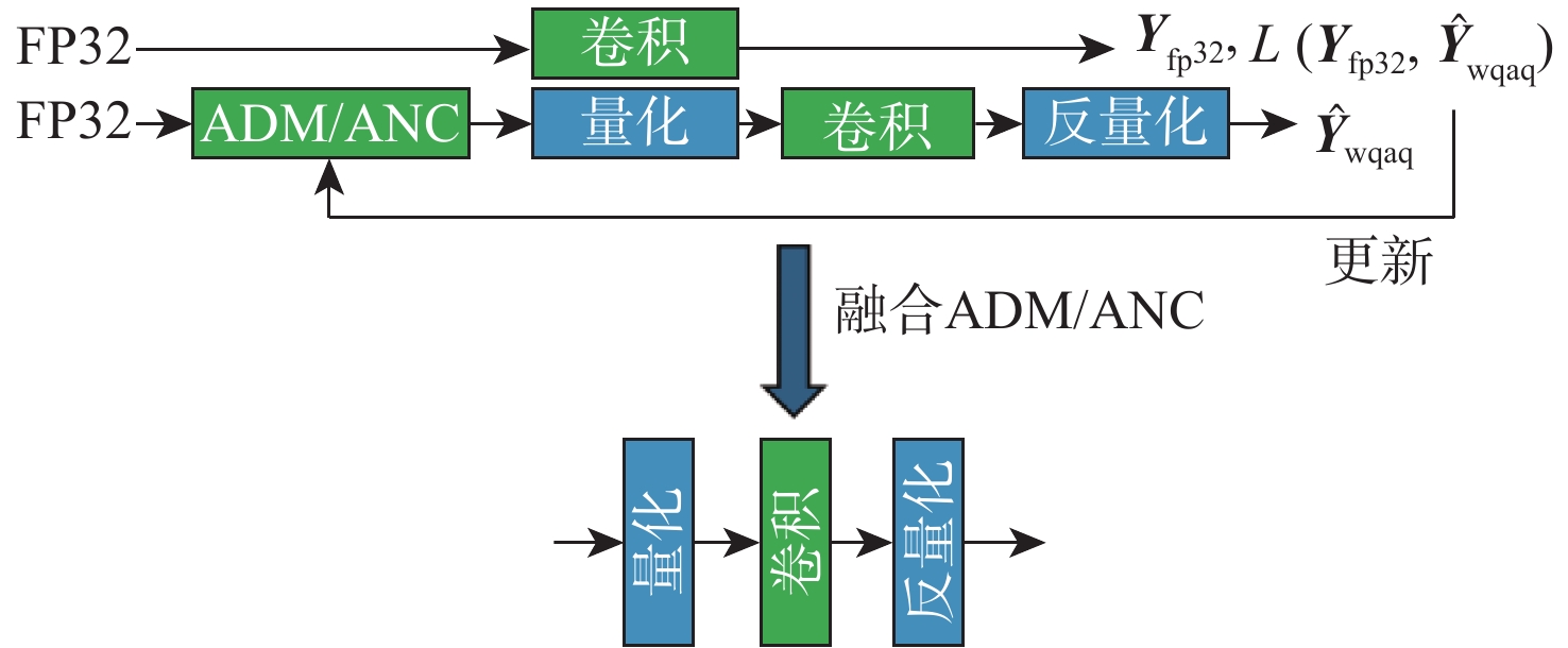
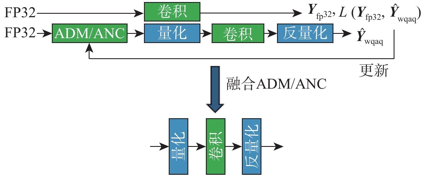
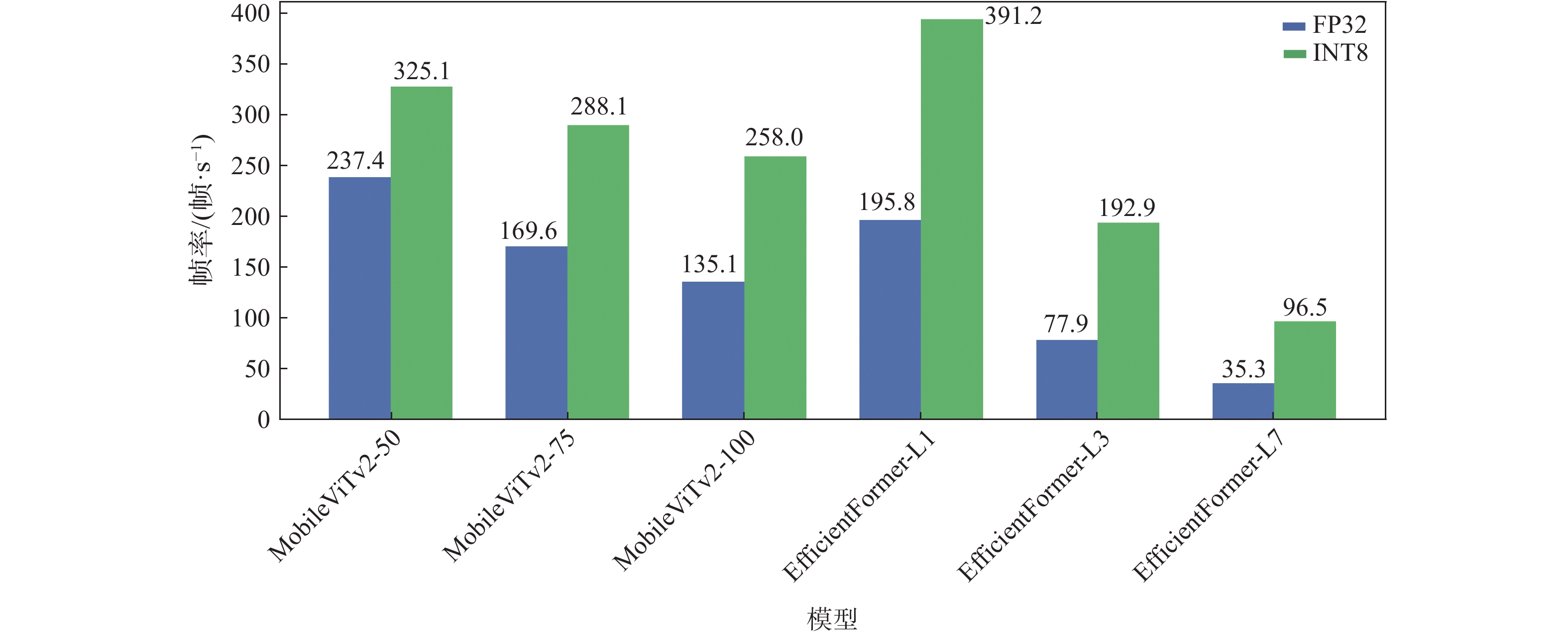
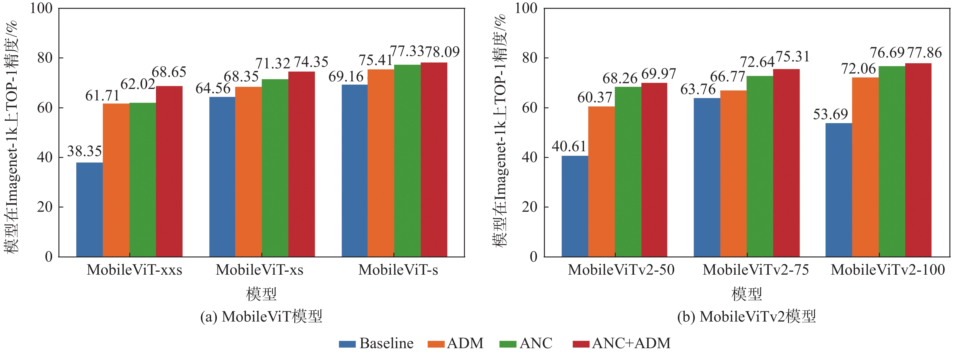
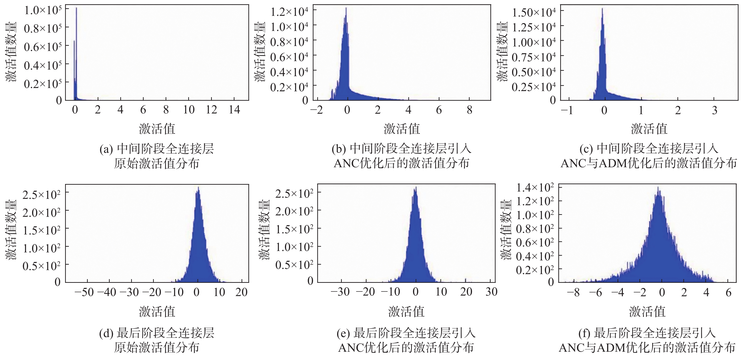
In recent years, drones have played increasingly important roles in various low-altitude production and service scenarios. Due to the limited storage and computing resources of edge computing platforms, the deployment performance of vision models becomes a bottleneck for various algorithm applications. The long-tail distribution of activation values in convolutional neural network (CNN)-Transformer hybrid models causes substantial quantization accuracy deterioration, an efficient post-training quantization method is proposed, which this study addresses by suggesting an effective post-training quantization technique. This method uses activation noise compensation (ANC) and adaptive difficulty migration to suppress the impact of outliers on quantization accuracy and improve inference efficiency. According to experimental results, the proposed method achieves less than 1% accuracy loss on typical models under 8-bit quantization, and it improves inference time after quantization by at most 200%. In summary, the proposed method significantly enhances vision model inference performance on edge devices and supports model deployment on low-altitude drone platforms.

Fine-grained semantic-enhanced cross-modal image-text retrieval method for civil aviation
LIU Shuyan, HE Liu, ZENG Jianghui
2026, 52(9): 3075-3088. doi: 10.13700/j.bh.1001-5965.2025.0549
Abstract:

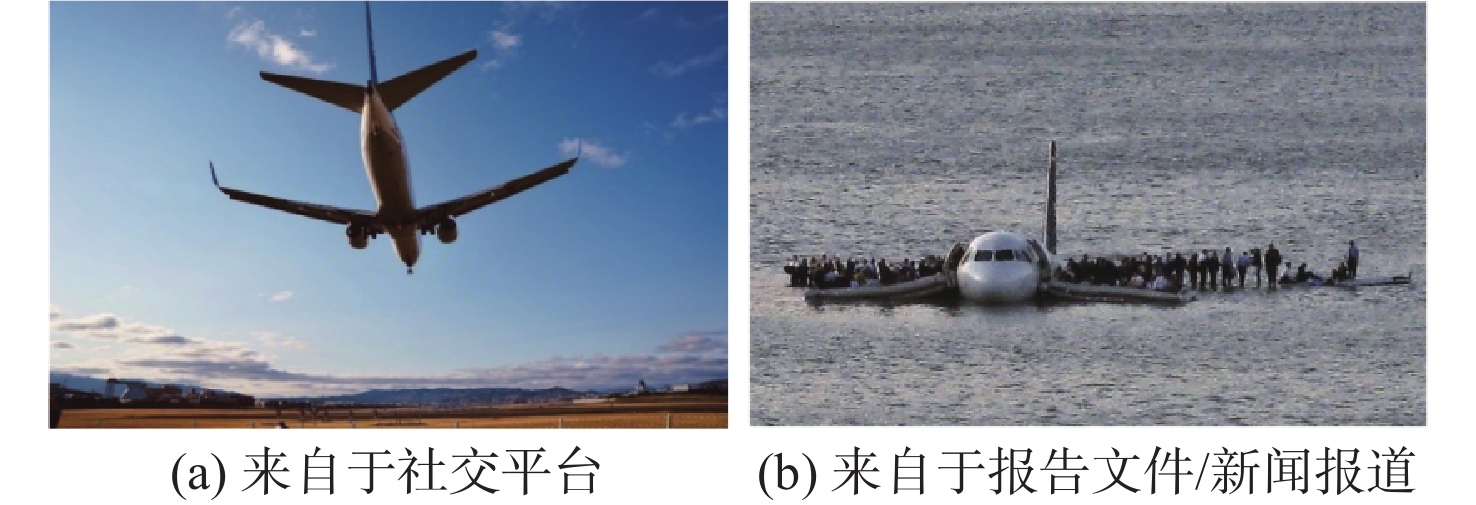
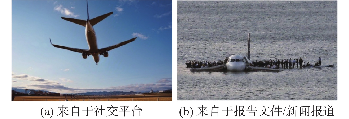
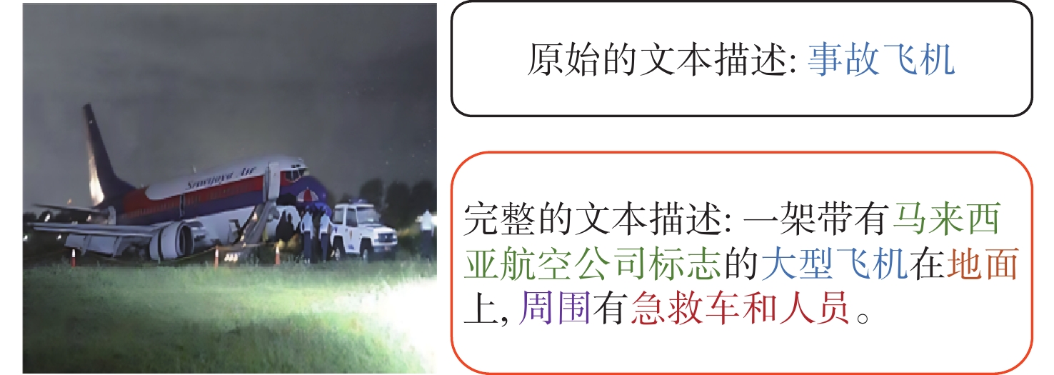
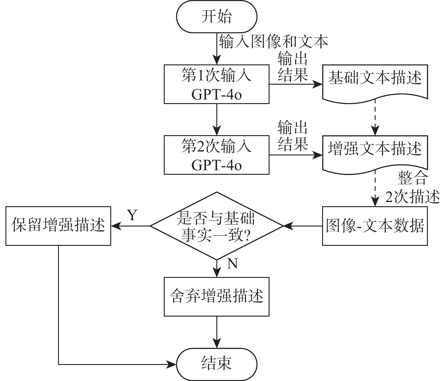
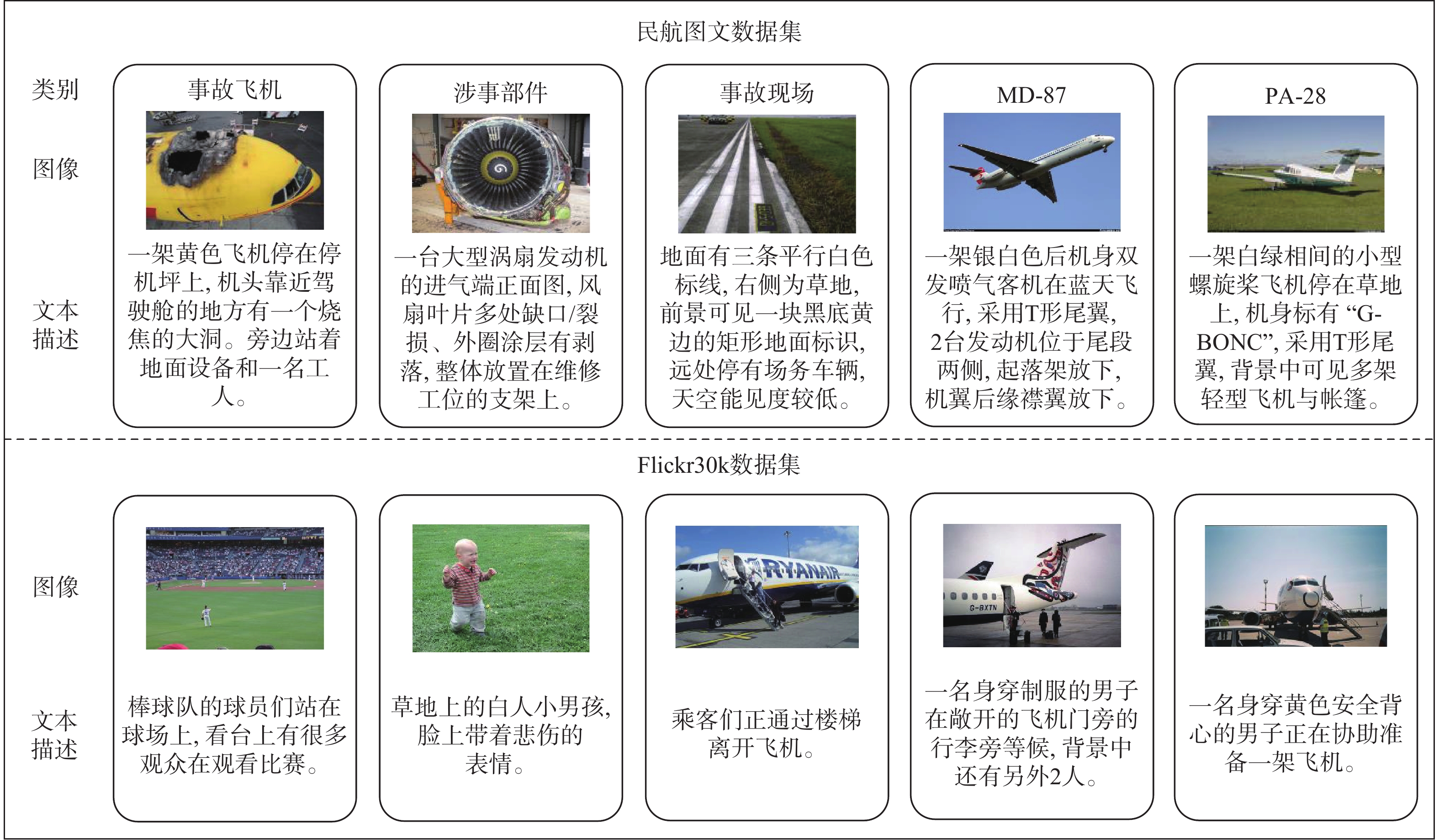
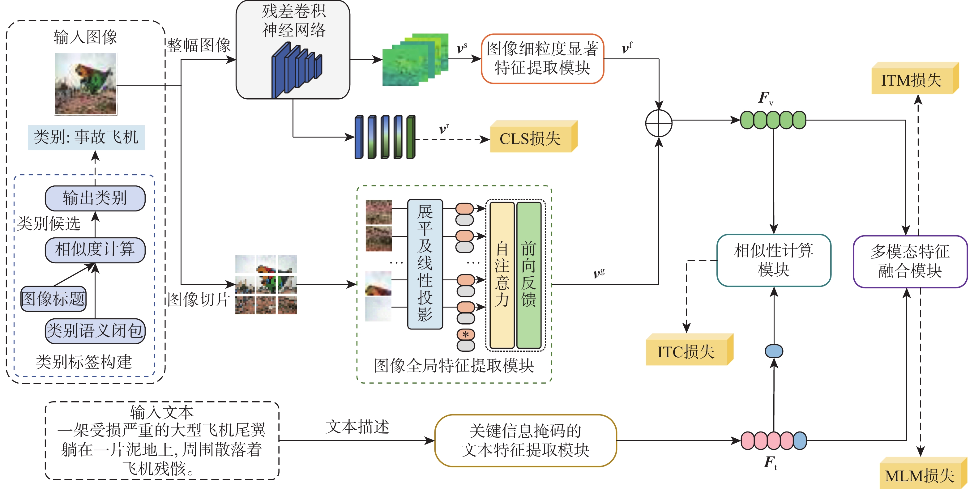
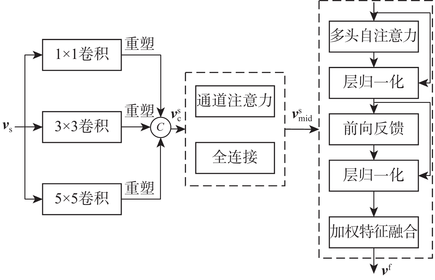
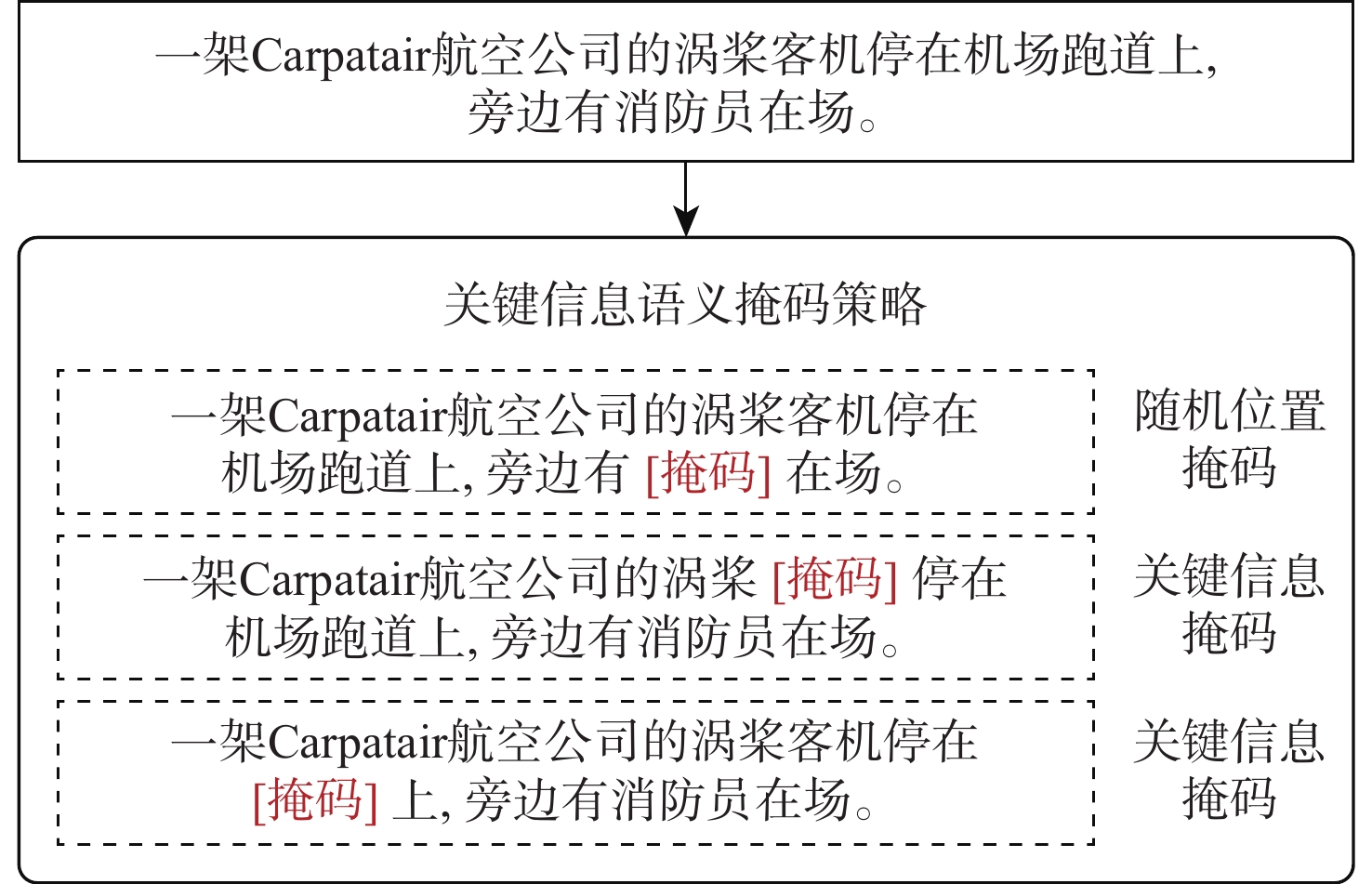
In the fields of low-altitude economy and civil aviation, security assurance tasks heavily rely on the efficient correlation of cross-modal information such as images and texts. However, while mainstream cross-modal retrieval models perform well on general datasets, they underperform in these areas, which require high levels of fine-grained semantic understanding. Based on existing civil aviation datasets, a cross-modal retrieval approach with fine-grained semantic augmentation is suggested as a solution to this problem, creating a whole pipeline that includes data processing, model development, and training. First, text descriptions are optimized and enhanced based on a large multimodal model to construct a cross-modal retrieval dataset containing rich semantic information. Second, a model is created using a popular cross-modal retrieval framework. To improve the model's ability to express fine-grained semantic features, techniques such class supervision, key semantic information masking, and a fine-grained feature extraction module are introduced. Experimental results on two datasets verify the effectiveness of the proposed method, providing a reference technical path for cross-modal retrieval in low-altitude economy scenarios.

Secure sharing scheme for low-altitude UAV operational data based on broadcast proxy re-encryption
ZHOU Zequan, JI Xiaohai, LUO Xiling, MAO Jian, WANG Junjun
2026, 52(9): 3089-3099. doi: 10.13700/j.bh.1001-5965.2025.0283
Abstract:

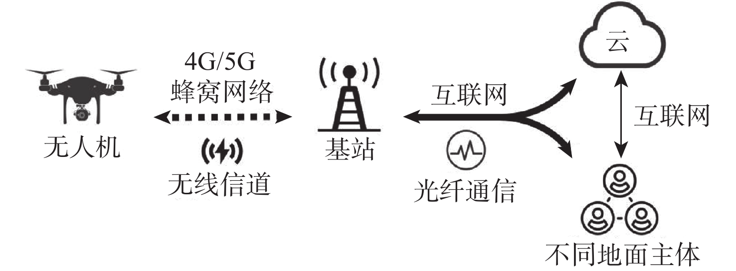
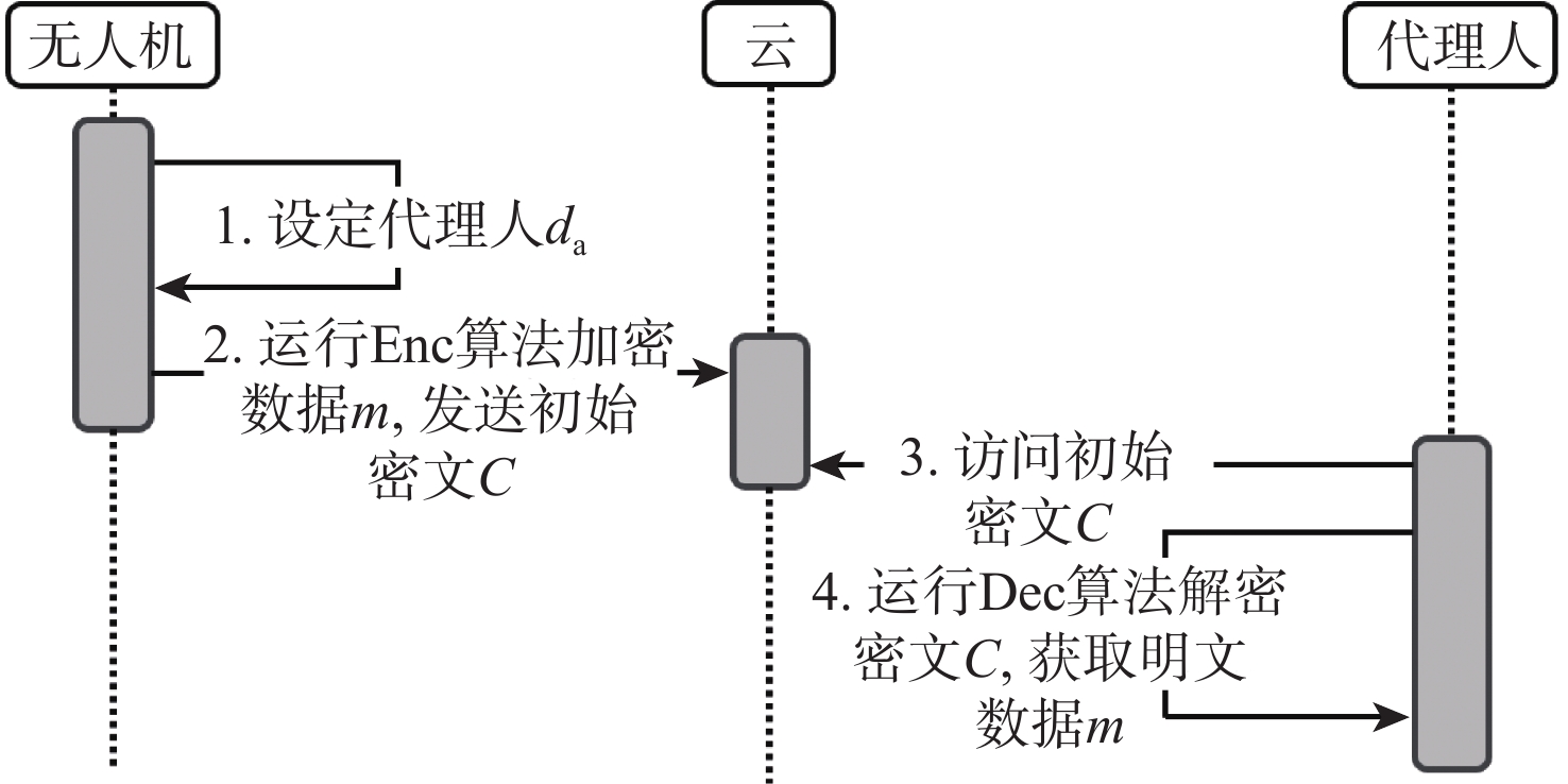
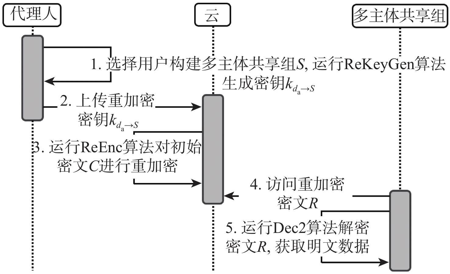
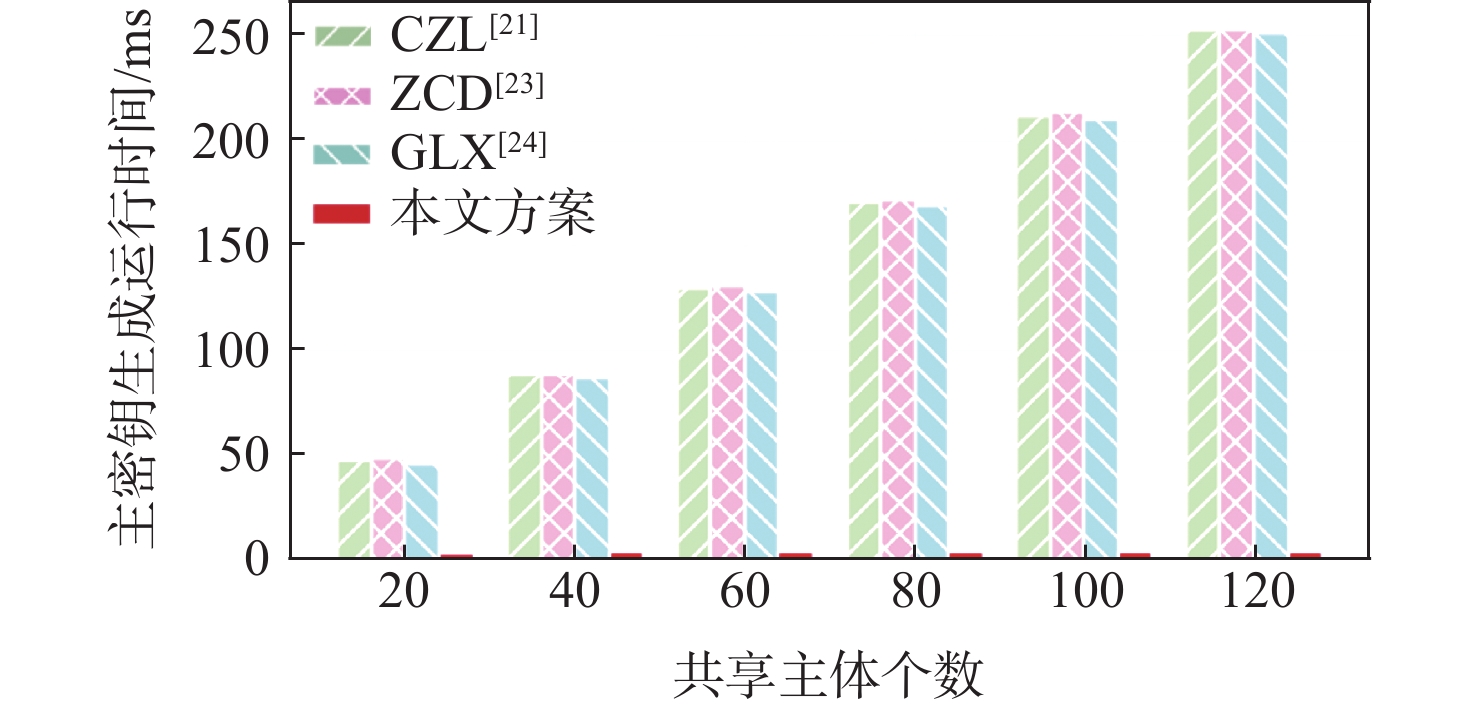
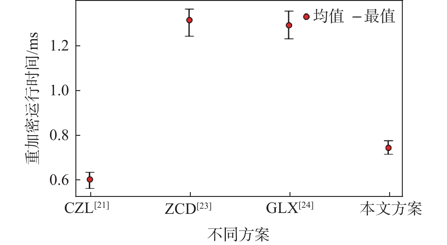
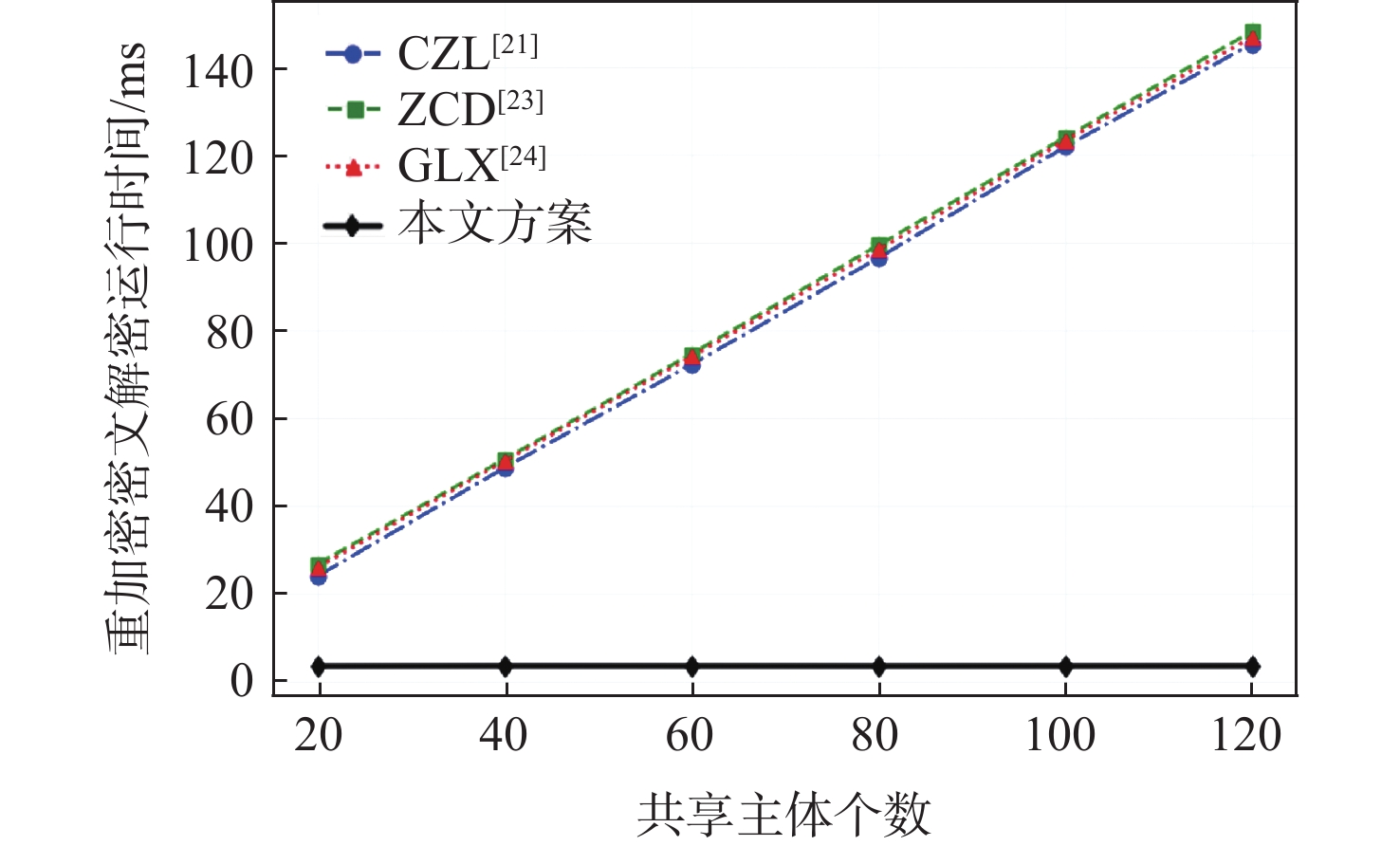
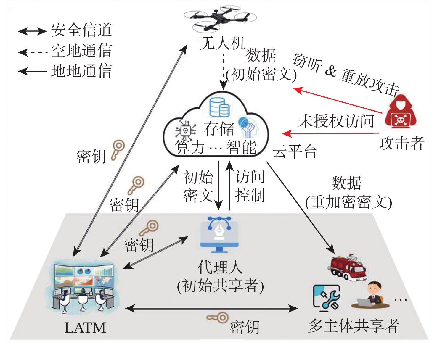
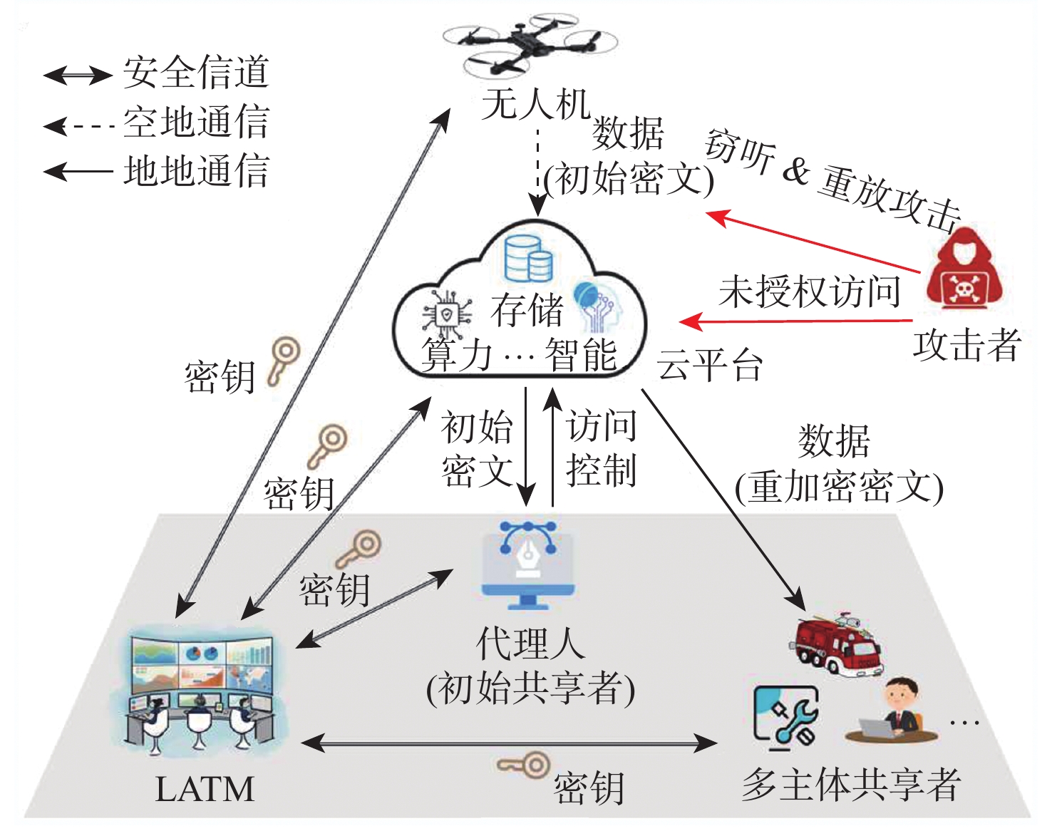
In the open and dynamic low-altitude intelligent network, unmanned aerial vehicle (UAV) operational data sharing faces security threats such as data eavesdropping, replay attacks, and unauthorized access, which may seriously jeopardize low-altitude operation security. It is crucial to guarantee the secure sharing of UAV operational data. Existing schemes utilize identity-based broadcast encryption to achieve point-to-multipoint data security sharing. Nevertheless, the sharing flexibility is sometimes restricted by these schemes' requirement to preset the sharing group capacity. Moreover, in the decryption process, the sharer needs to perform additional mathematical operations for other group members, which leads to a heavy burden of decryption computation. In this paper, we propose a secure sharing scheme for low-altitude UAV operational data based on broadcast proxy re-encryption. Through ciphertext re-encryption, the suggested technique creates a hybrid encryption mechanism that converts point-to-point sharing into point-to-multipoint sharing by utilizing identity-based broadcast encryption and symmetric encryption. In point-to-multipoint sharing, the scheme supports stateless data group sharing with fixed-length private keys and without preset group capacity, taking into account the security, flexibility, and efficiency of sharing. Experimental results show that in point-to-point sharing, the encryption and decryption computation overhead is fixed; in point-to-multipoint sharing, compared with the suboptimal scheme, the re-encryption key generation overhead is reduced by more than 40%, and the re-encryption ciphertext decryption algorithm costs about 3.6 milliseconds.

Nonconvex radar DOA estimation method for dense UAV targets
HE Guidong, LEI Peng, WANG Jun
2026, 52(9): 3100-3107. doi: 10.13700/j.bh.1001-5965.2025.0387
Abstract:

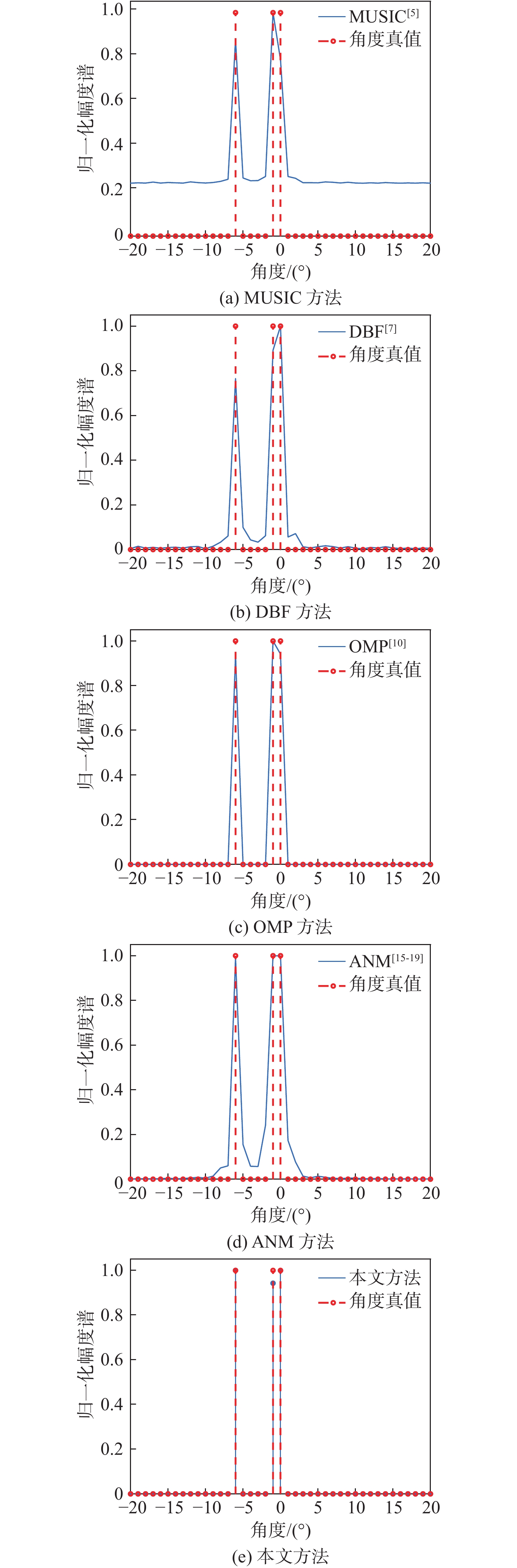
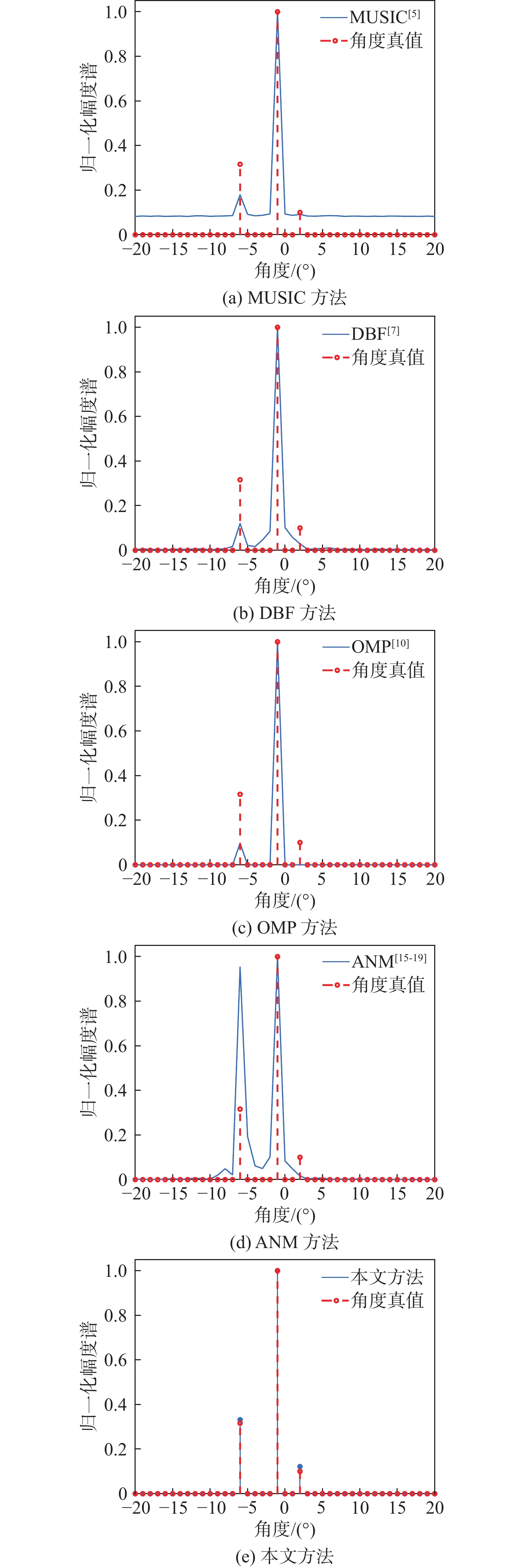
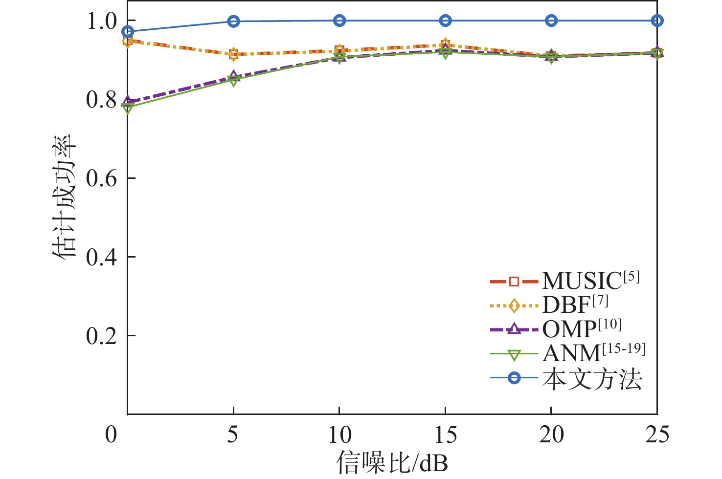
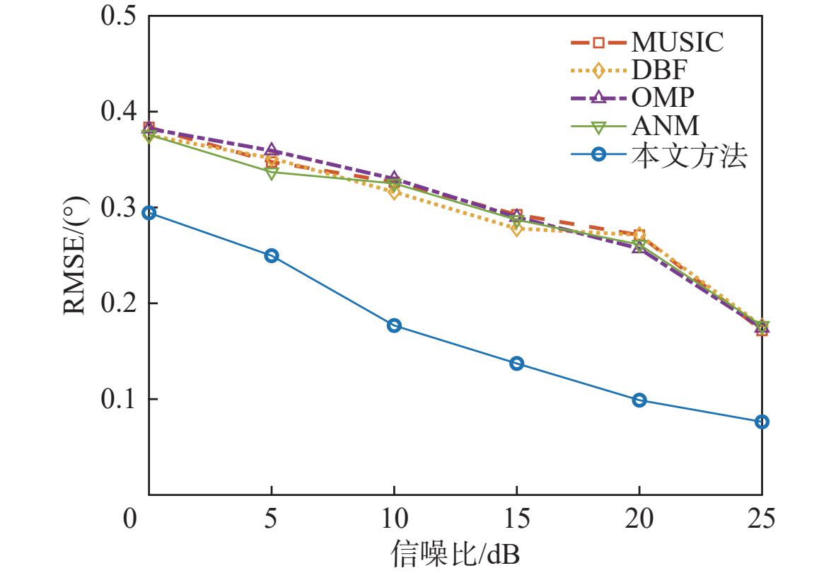
With the rapid development of the low-altitude economy, unmanned aerial vehicles (UAV) have been widely deployed in fields such as logistics, inspection, and surveillance. Their large-scale deployment imposes increasing demands on target detection and identification capabilities. However, in real-world situations, UAV swarms frequently result in widely separated arrival angles and notable variations in echo energy, which provide major difficulties for conventional direction of arrival (DOA) estimate techniques. To address this, this paper proposes a DOA estimation algorithm based on non-convex optimization. First, the number of closely spaced targets is adaptively estimated via eigenvalue analysis of the covariance matrix, thereby avoiding dependence on prior information. Then, a non-convex sparse constraint model incorporating a Laplacian prior is constructed, which preserves angle discretization while mitigating the off-grid effect, and achieves super-resolution angle estimation through iterative optimization. In the presence of coexisting strong and weak targets, the suggested non-convex regularization term can improve robustness to echo power imbalance by suppressing main-lobe interference and increasing weak target detection. Simulation results validate the effectiveness and robustness of the proposed method in complex UAV detection scenarios, demonstrating higher estimation accuracy and success rate.

Large model attribute parsing-based aerial-ground pedestrian retrieval method
TAN Quange, WANG Rong, LIAO Mancheng, LI Xin
2026, 52(9): 3108-3116. doi: 10.13700/j.bh.1001-5965.2025.0834
Abstract:

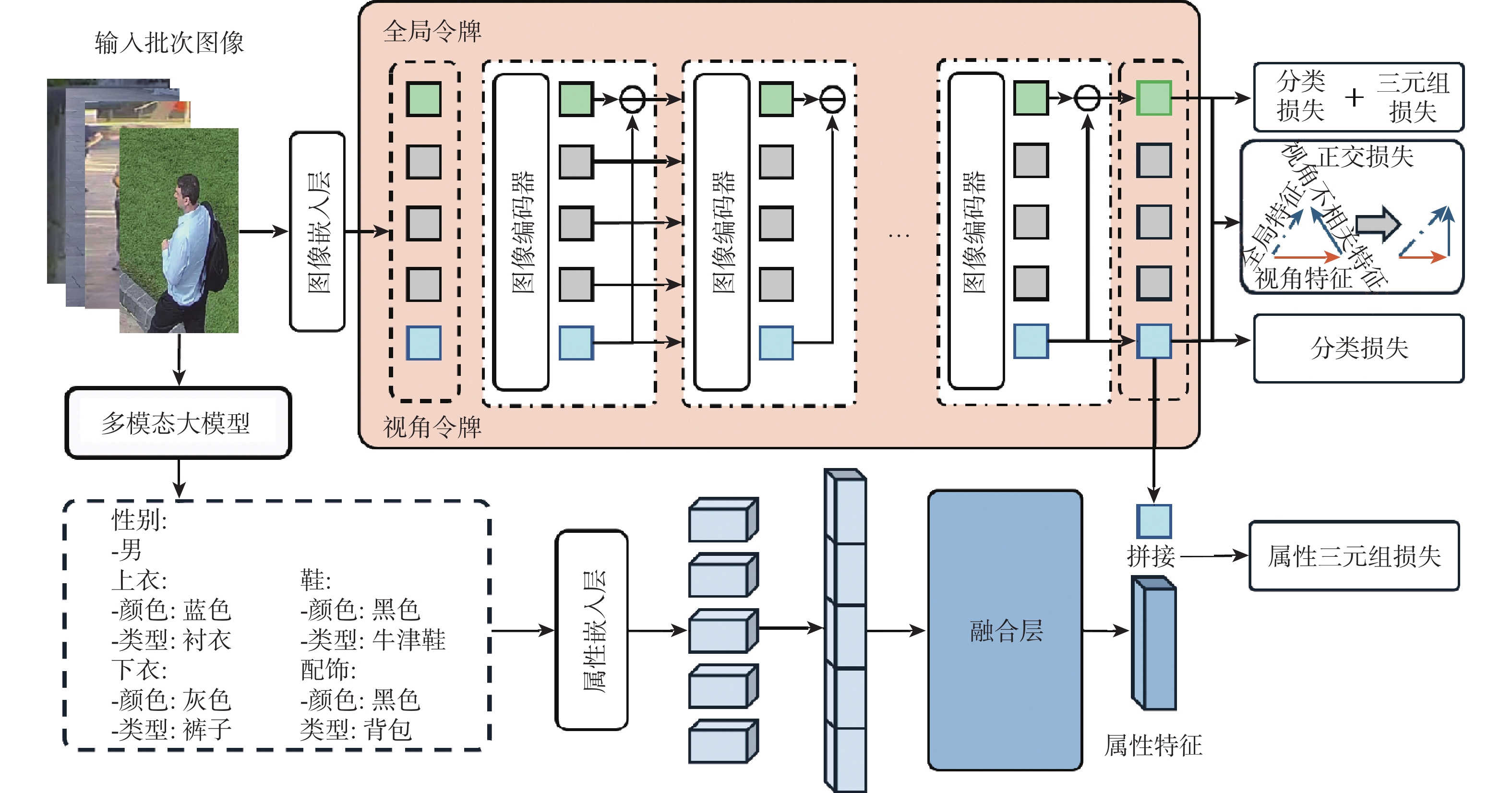
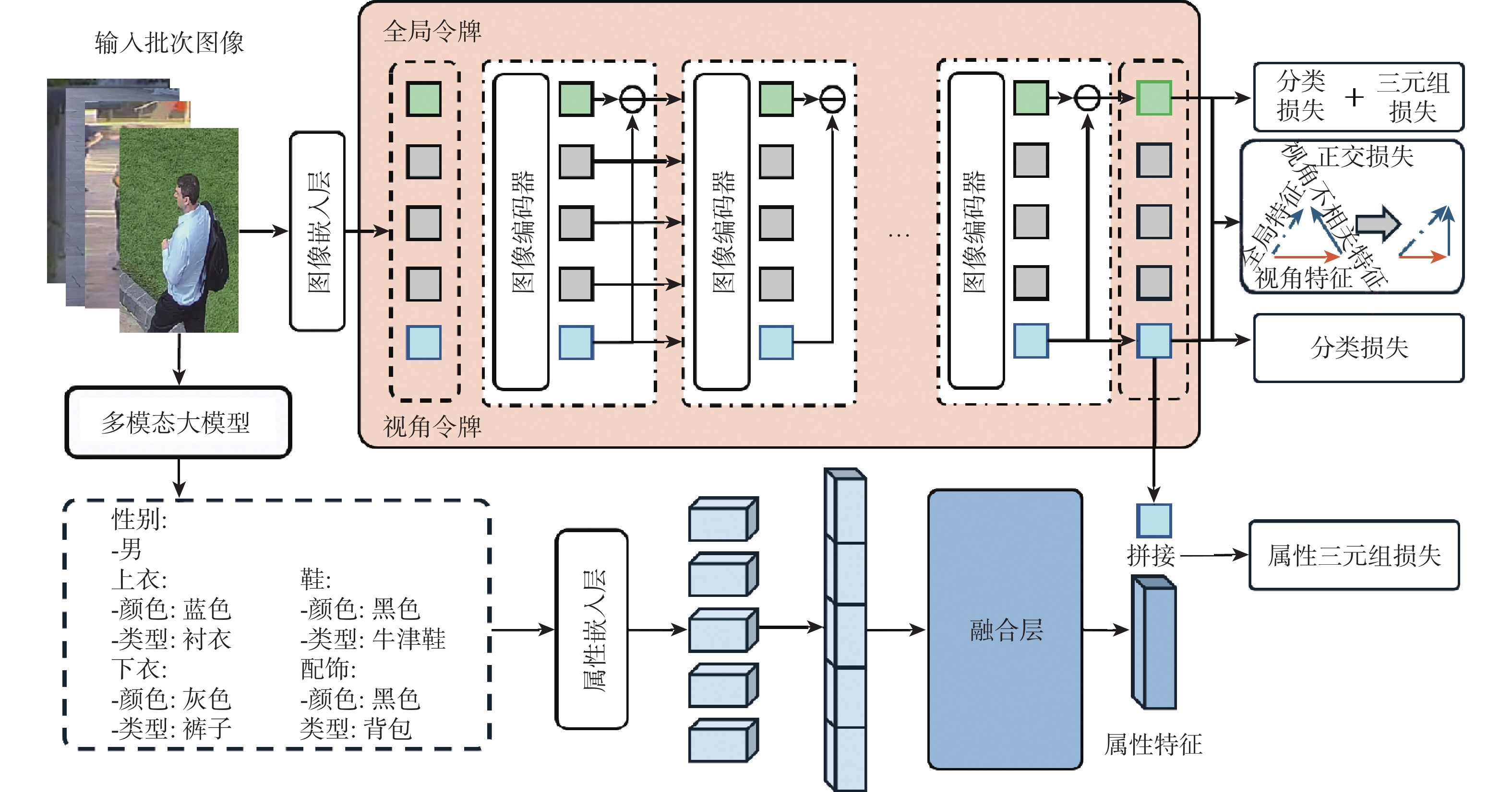
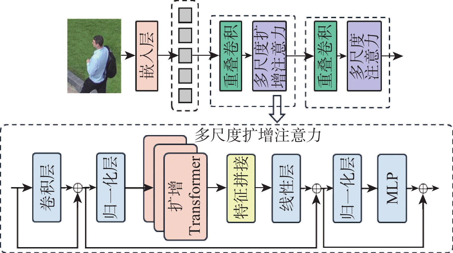
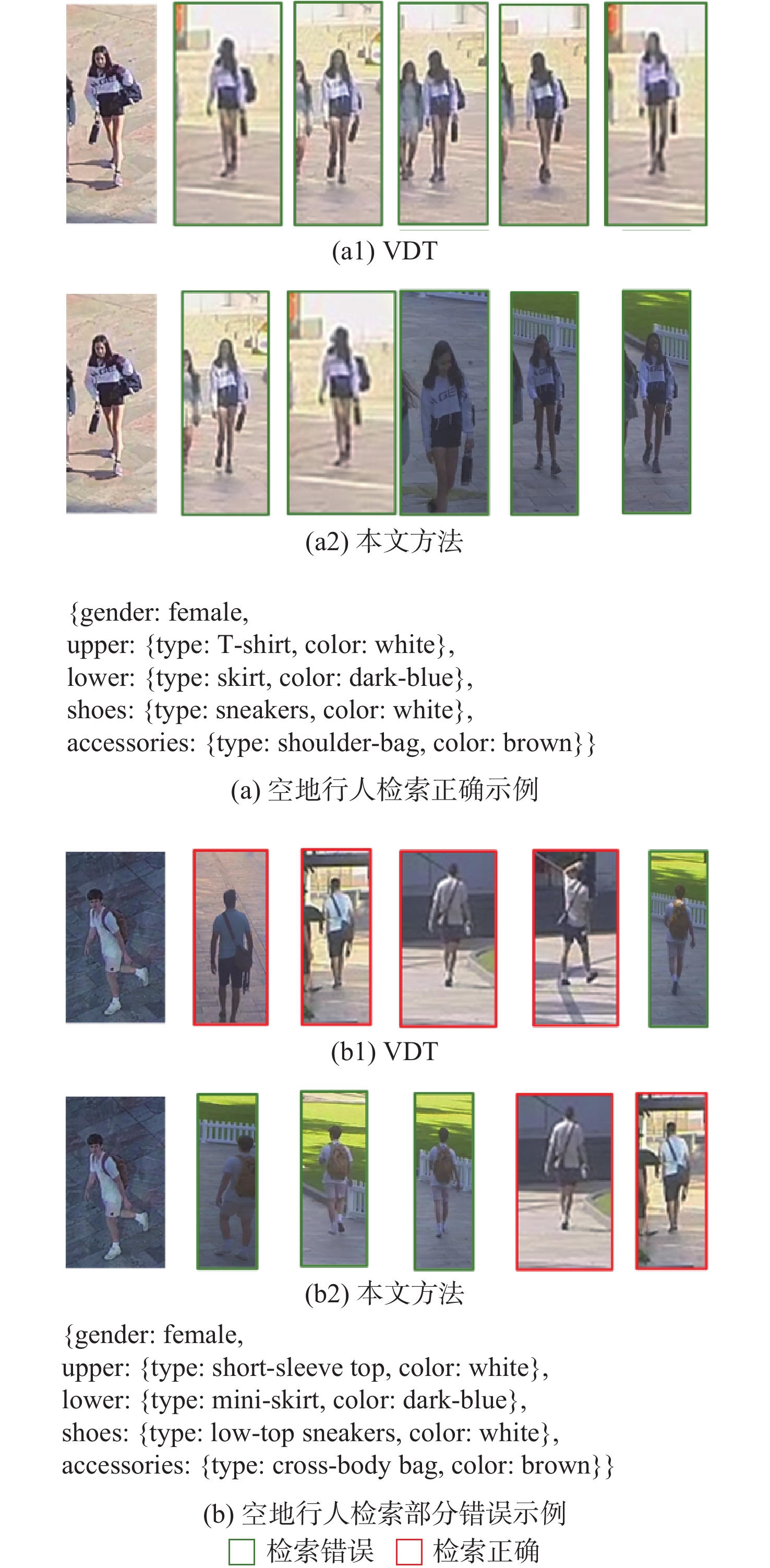
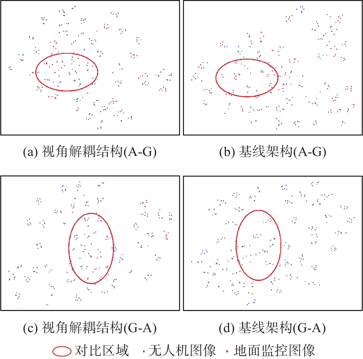
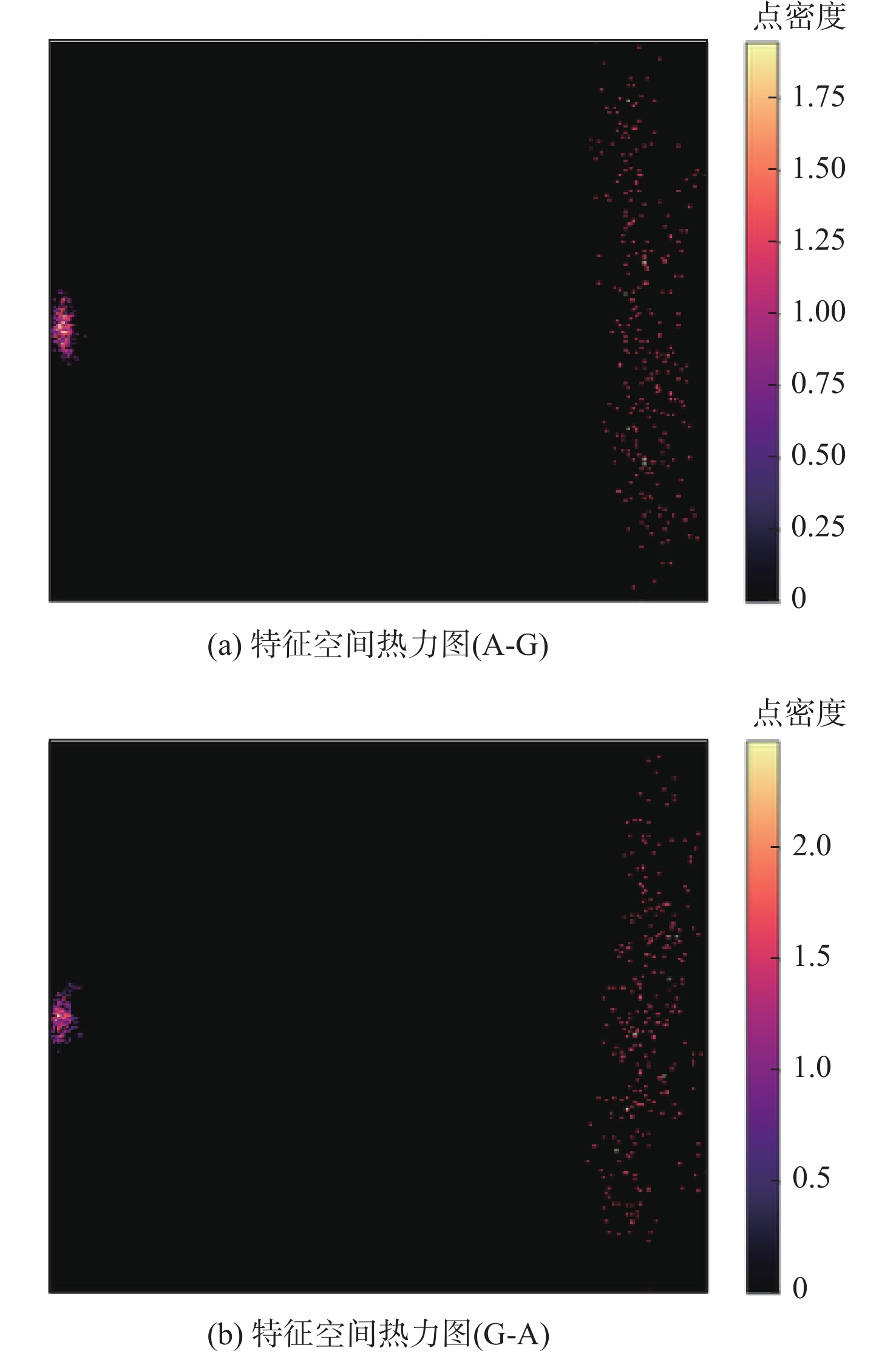
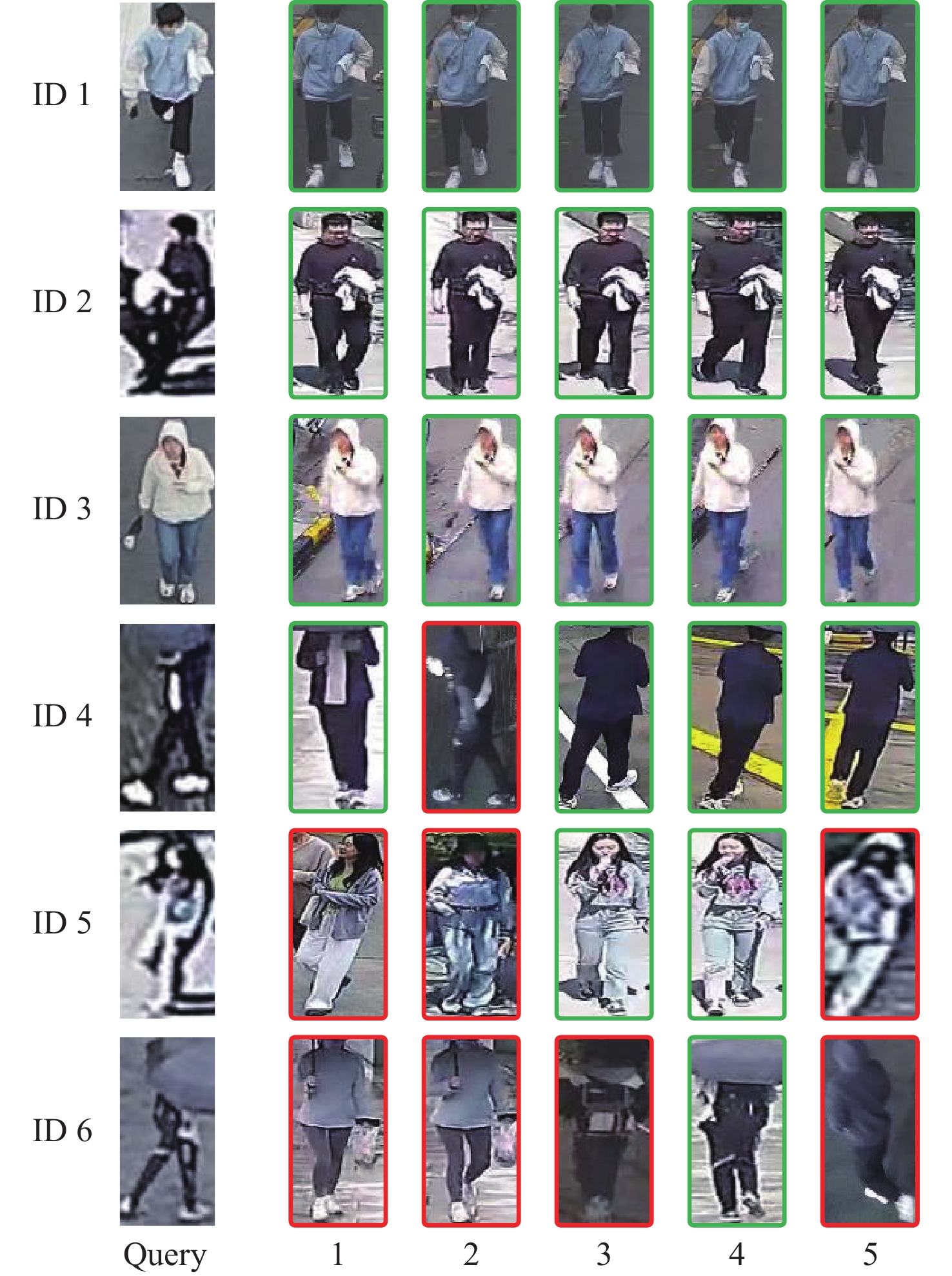
Synergistic analysis of drone-captured imagery and fixed surveillance video enables continuous tracking of targets in inspection tasks, achieving cross-view person re-identification in areas where surveillance probes are sparsely distributed. The transferability of image retrieval algorithms created for conventional surveillance situations to aerial-ground cross-view environments is limited by the notable discrepancy between the horizontal view of ground surveillance and the bird’s-eye view of drones. Existing aerial-ground pedestrian retrieval methods primarily focus on mitigating the appearance discrepancies caused by cross-view variations, while the mining and analysis of person attribute characteristics remain insufficiently explored. To address these issues, this paper proposes a aerial-ground pedestrian retrieval method based on large model attribute parsing. A person parsing module is constructed based on a multi-modal large model to generate fine-grained semantic attributes, and an attribute triplet loss is designed to achieve cross-view semantic alignment. A view decoupling architecture is introduced to separate view-specific features through hierarchical subtraction, with an orthogonal loss applied to constrain feature independence. A multi-scale dilated Transformer is incorporated, combining multi-scale dilated attention with global self-attention to optimize the balance between computational complexity and receptive field, thereby reducing model parameters. The effectiveness of the methodology is confirmed by experiments on the AG-ReID.v1, AG-ReID.v2, and CARGO datasets, which show that the suggested strategy successfully increases performance on Rank-1, mAP, and mINP metrics in aerial-ground pedestrian retrieval tasks.

Aerial-ground person re-identification method via position-aware and local pre-interaction
BI Yihan, LI Chong, WANG Rong
2026, 52(9): 3117-3124. doi: 10.13700/j.bh.1001-5965.2025.0833
Abstract:

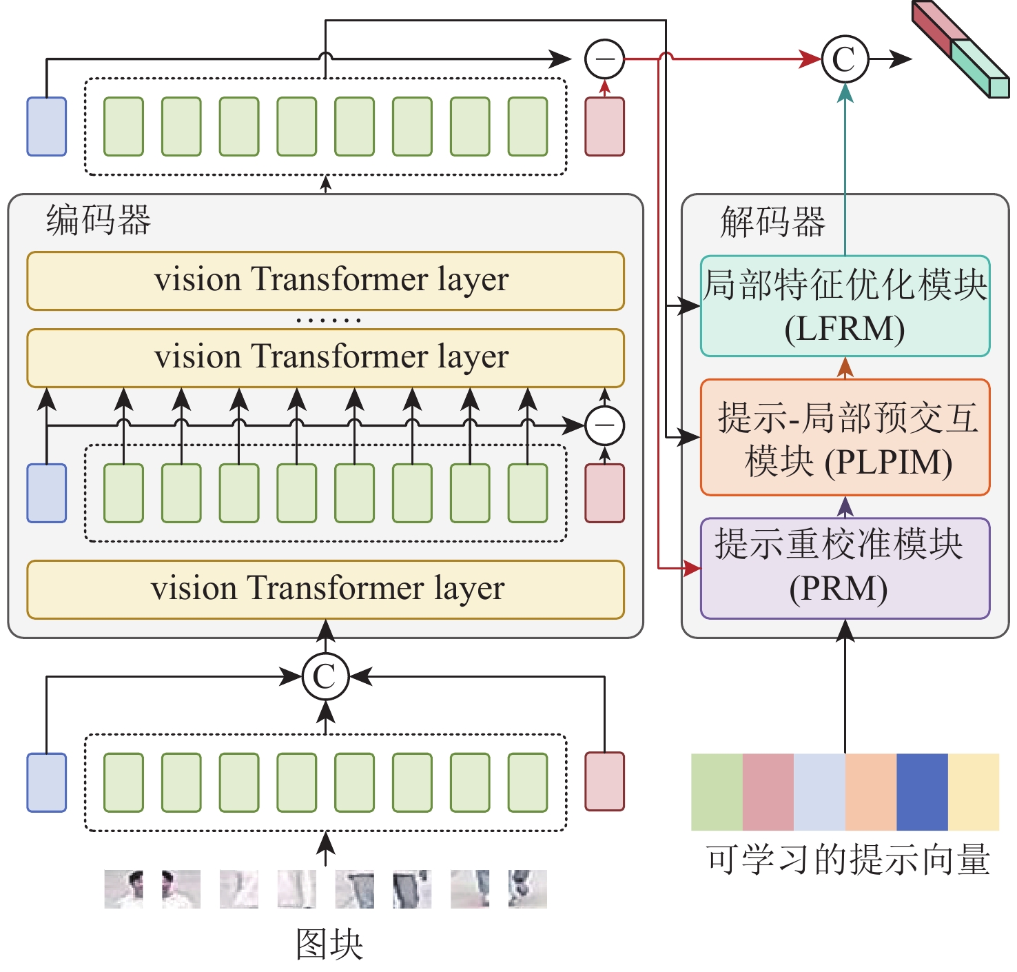
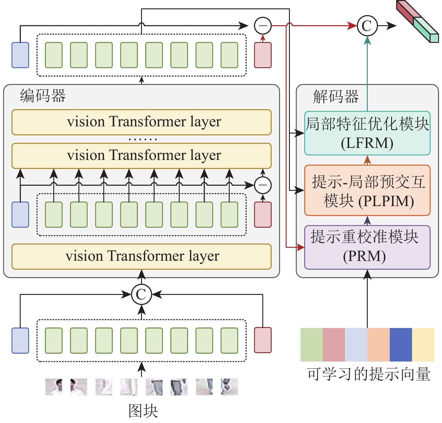
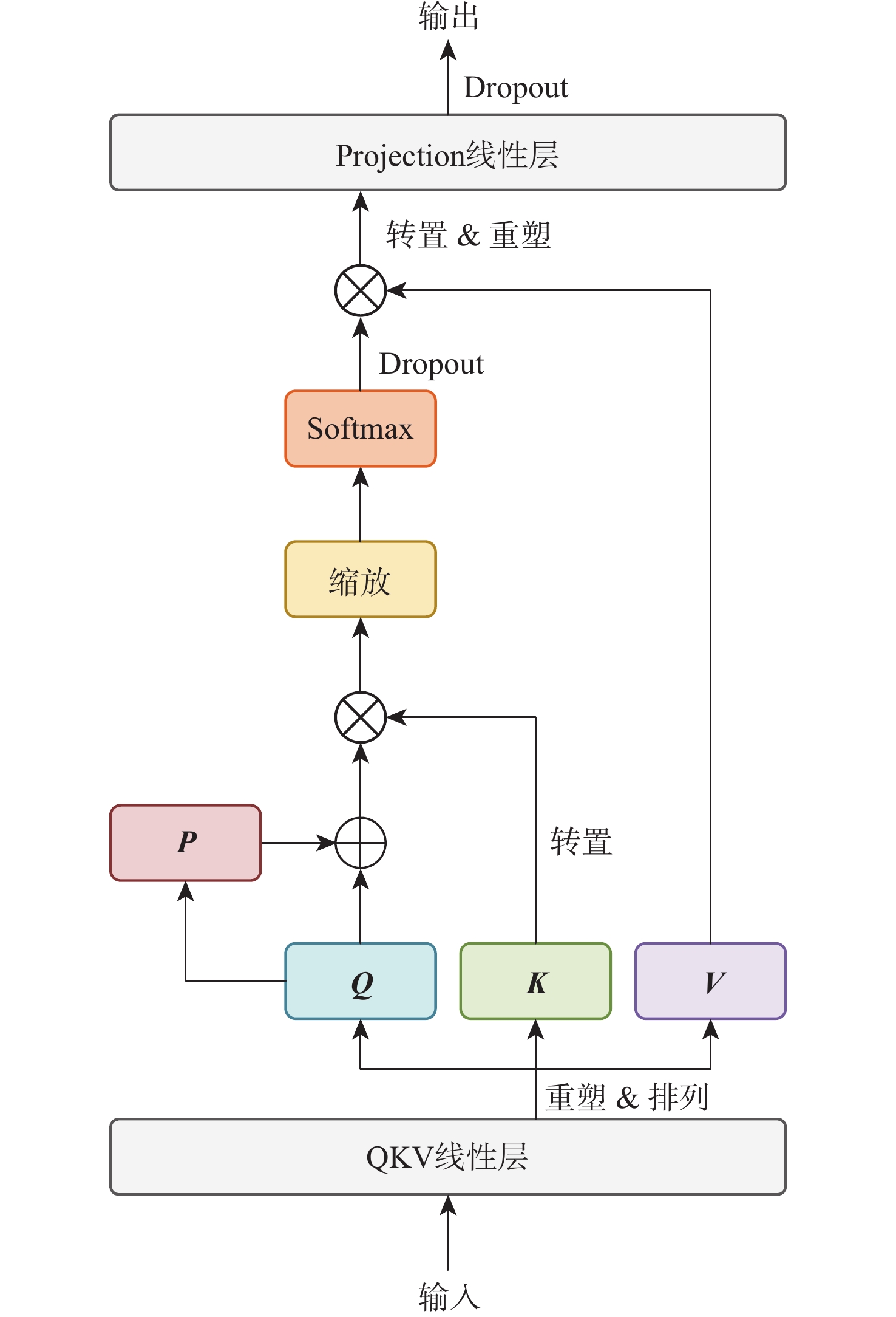
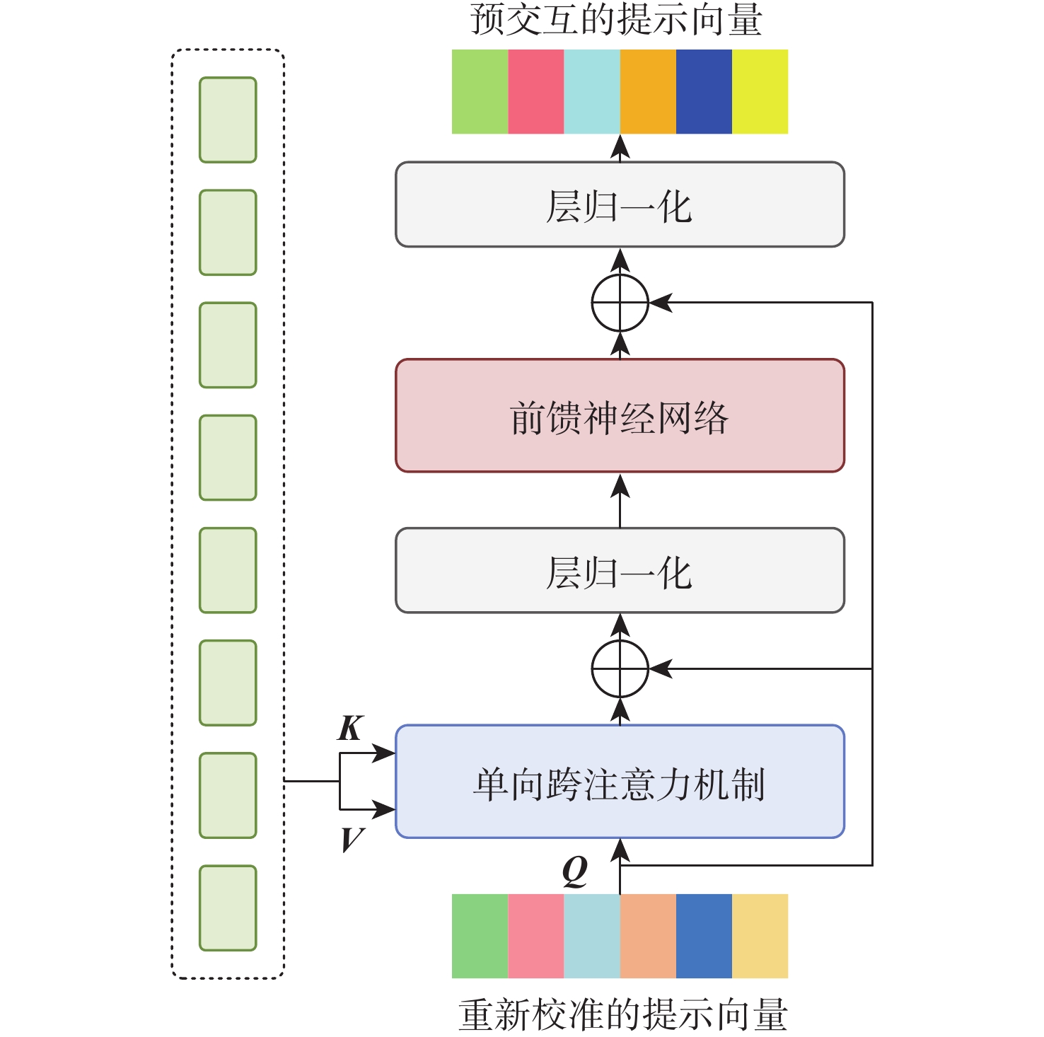
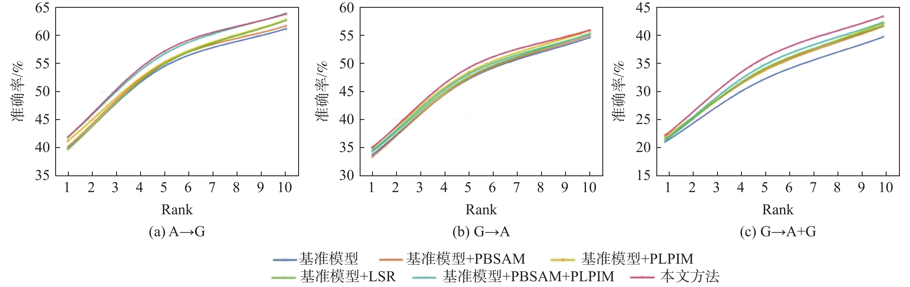
In response to the issues of poor discriminative power in pedestrian features and insufficient model generalization in existing aerial-ground person re-identification methods, this paper proposes an aerial-ground person re-identification method via position-aware and local pre-interaction. A positionally biased self-attention mechanism is proposed, which incorporates positional information into attention scores to guide the model in focusing on tokens at key positions within the input sequence. This enhances the model's perception of spatial relationships between image patches and improves the discriminability and robustness of pedestrian features. A prompt-local pre-interaction module is created that uses a single, inexpensive pre-interaction to create fine-grained linkages between prompt semantics and local attributes. This strengthens the prompt vector's ability to perceive specific local details in the current view and enhances the model's capability for fine-grained detail reconstruction. The label smoothing regularization training strategy is introduced, converting original one-hot encoded hard labels into soft labels. This encourages the model to learn smoother and more generalizable feature representations, mitigates overfitting, and improves overall model performance and generalization. The validity of the proposed strategy is confirmed by extensive trials on the public aerial-ground person re-identification dataset LAGPeR, which show that it effectively enhances Re-Identification performance.

Remaining useful life prediction of lithium-ion batteries in low-altitude vehicles based on MTL-sLSTM
ZHANG Huishan, SHEN Jiying, LIU Dongsheng, ZHOU Zhikai, HU Yifan, XU Yangbo
2026, 52(9): 3125-3135. doi: 10.13700/j.bh.1001-5965.2025.0180
Abstract:

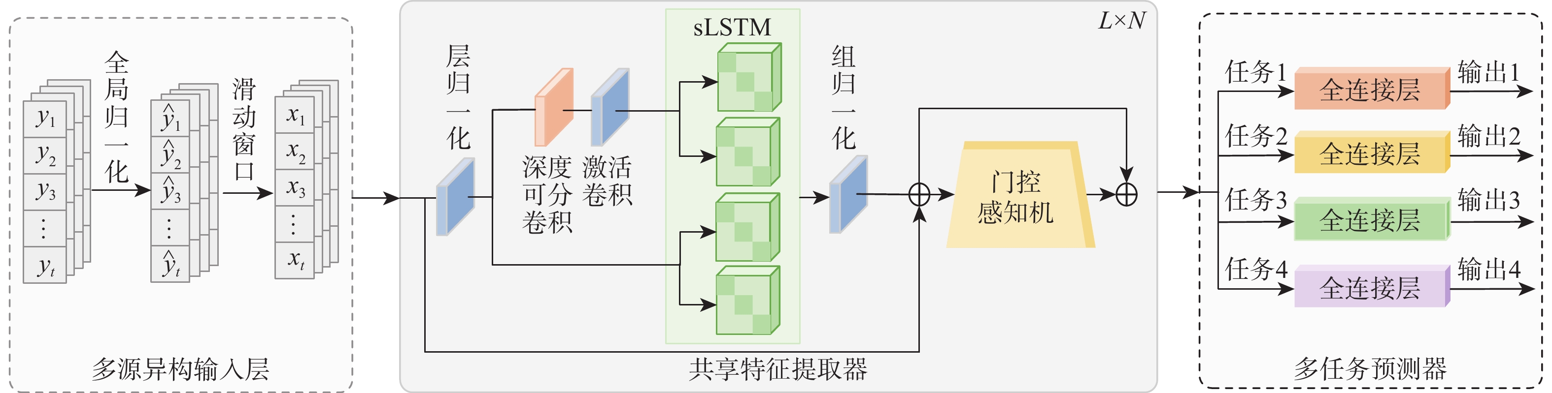
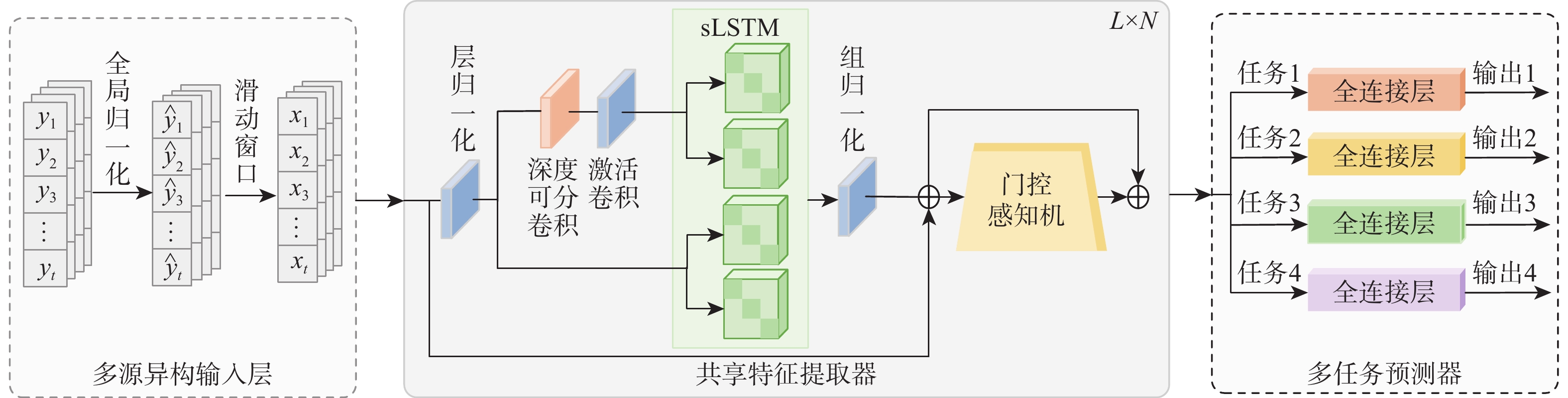
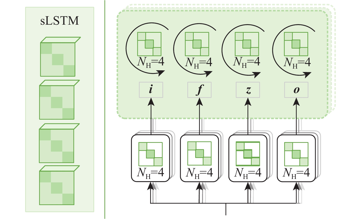
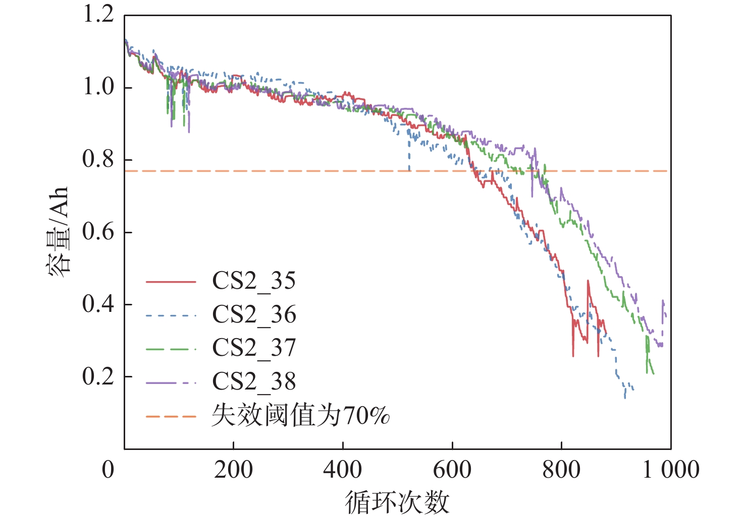
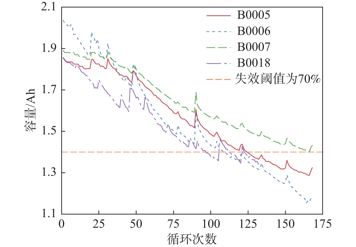
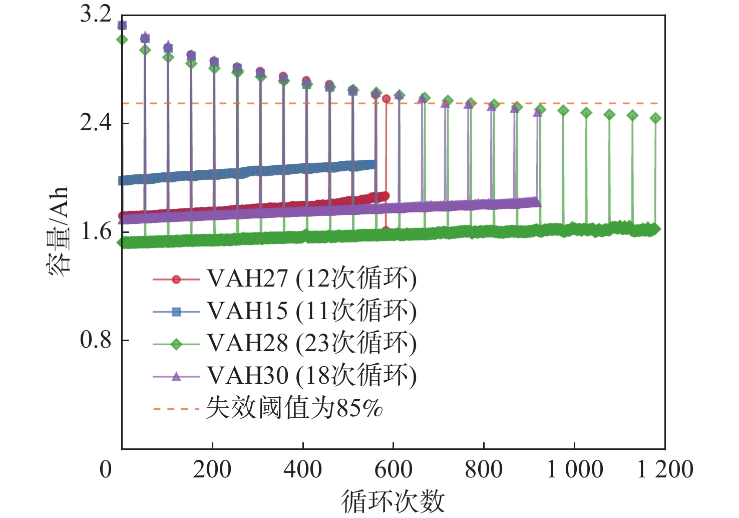
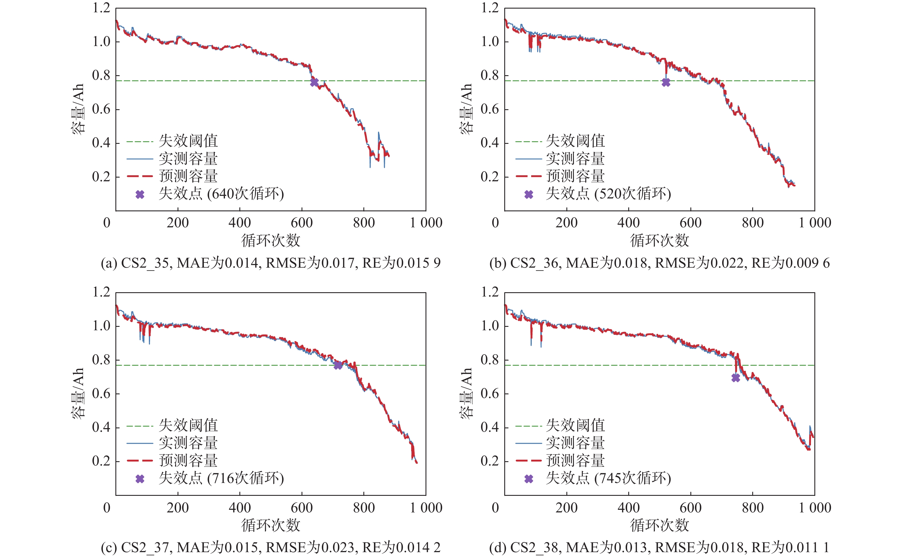
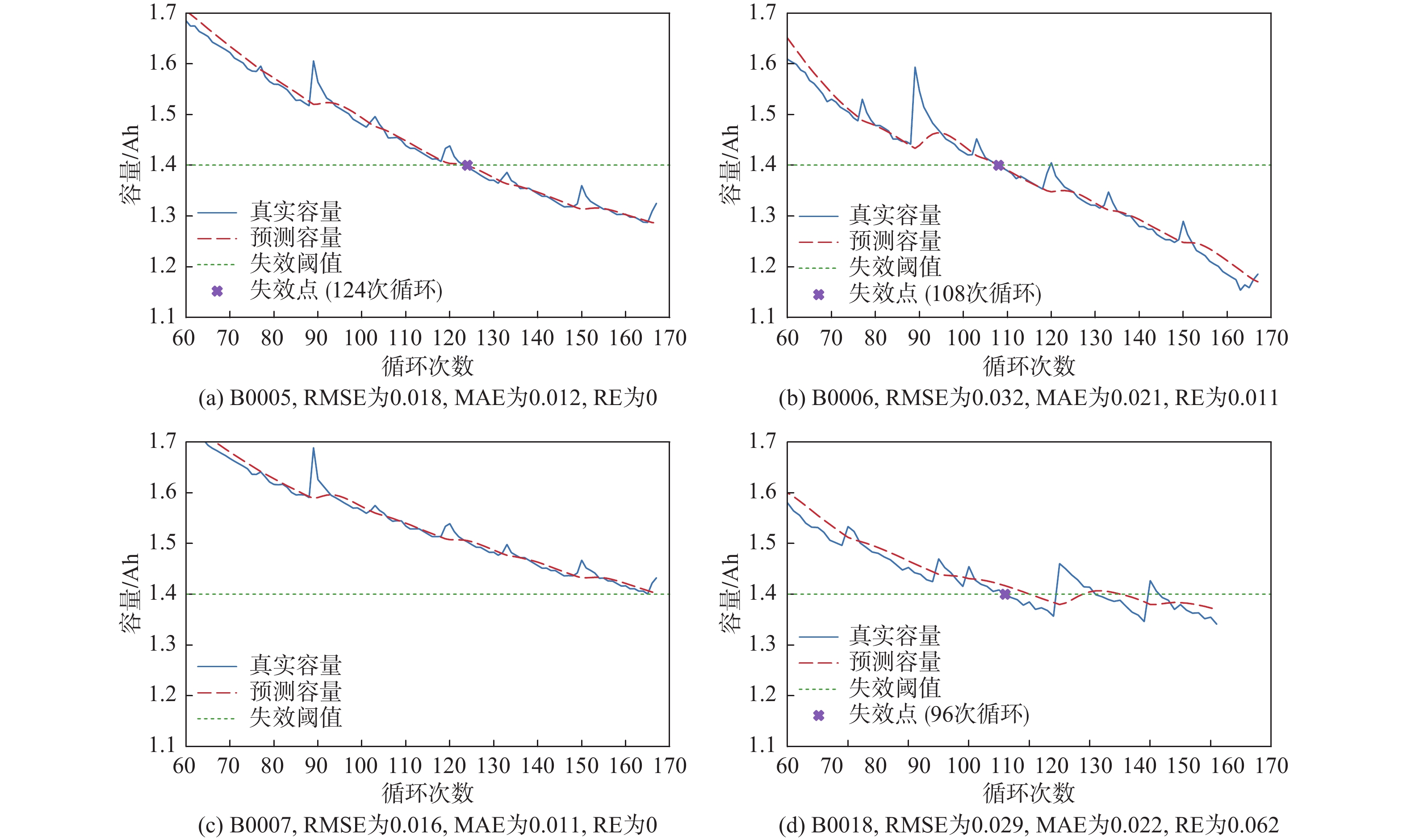
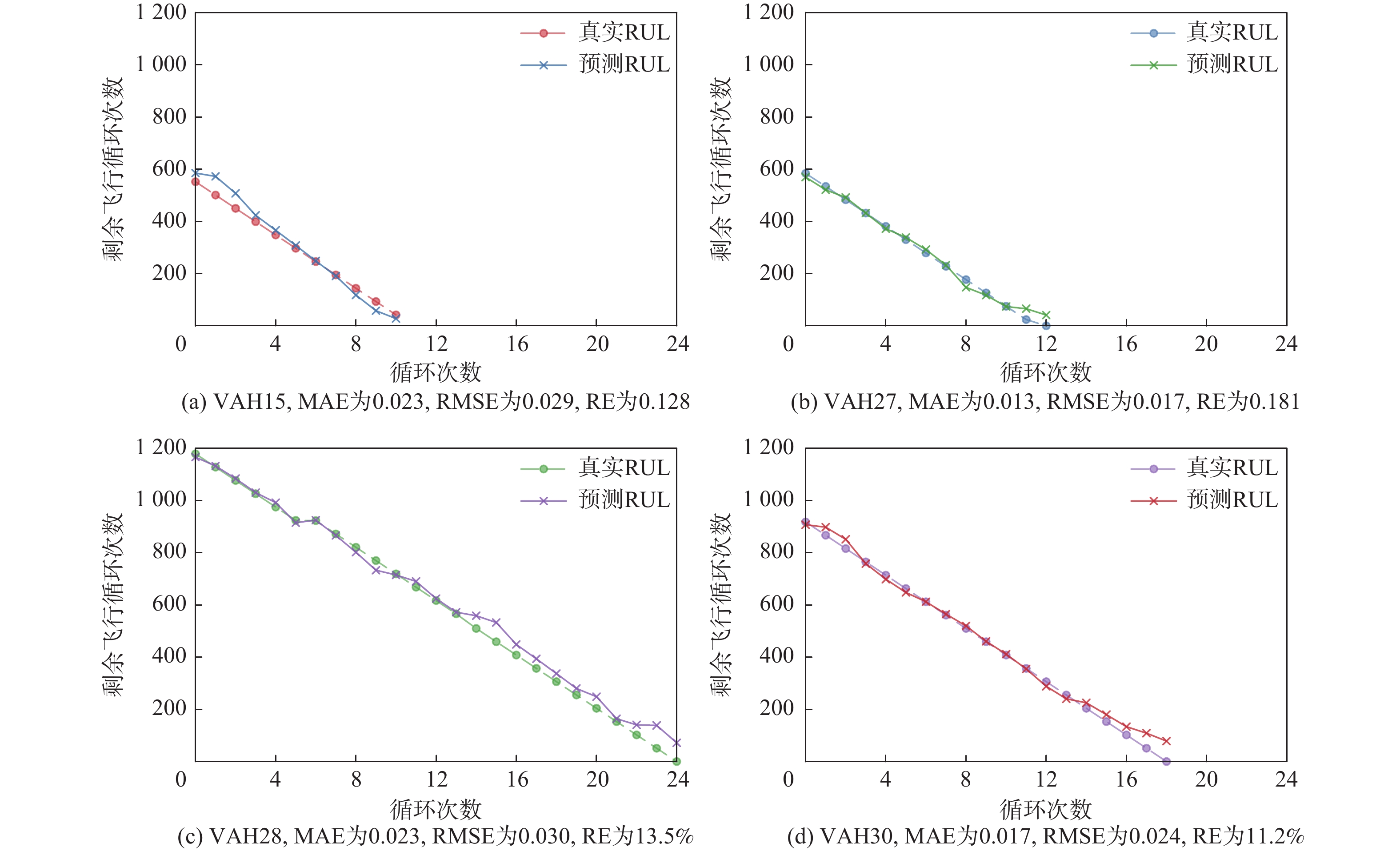
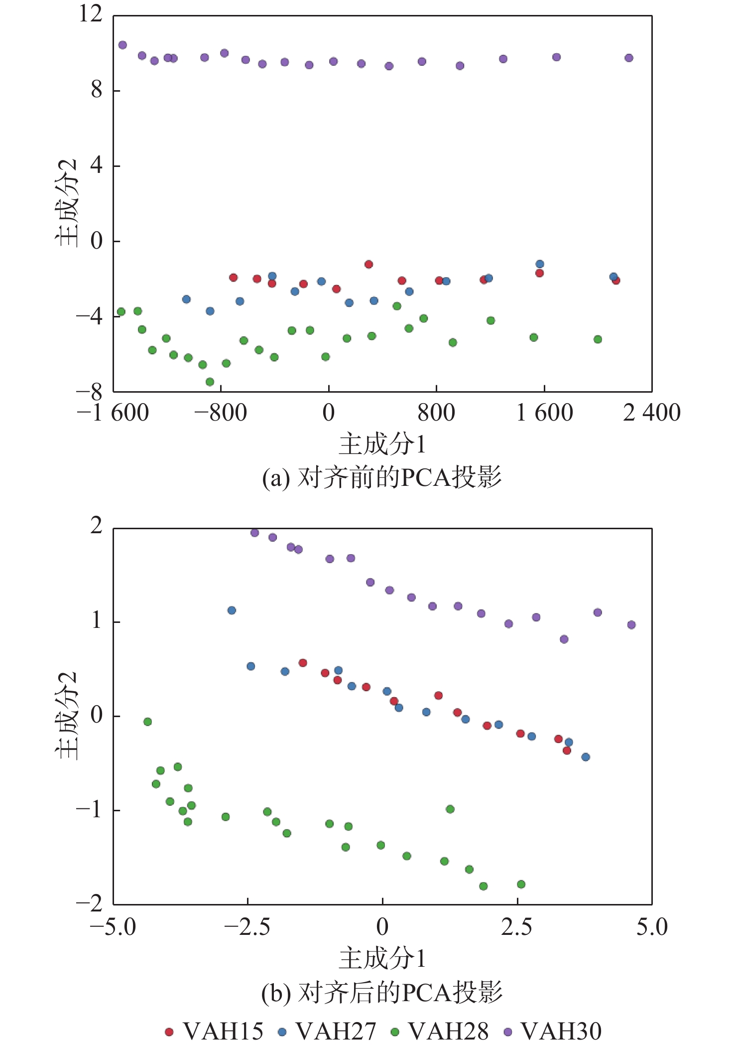
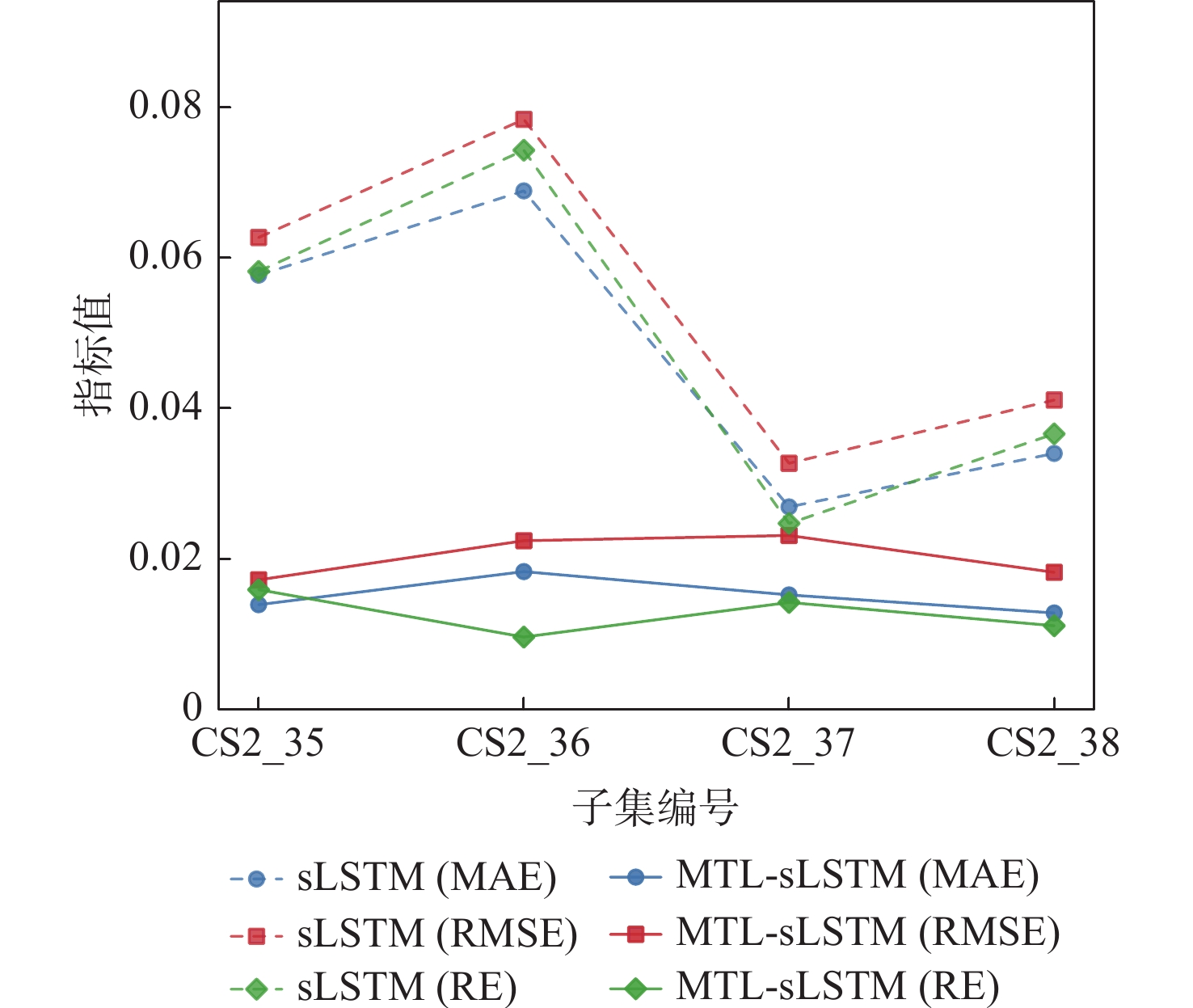
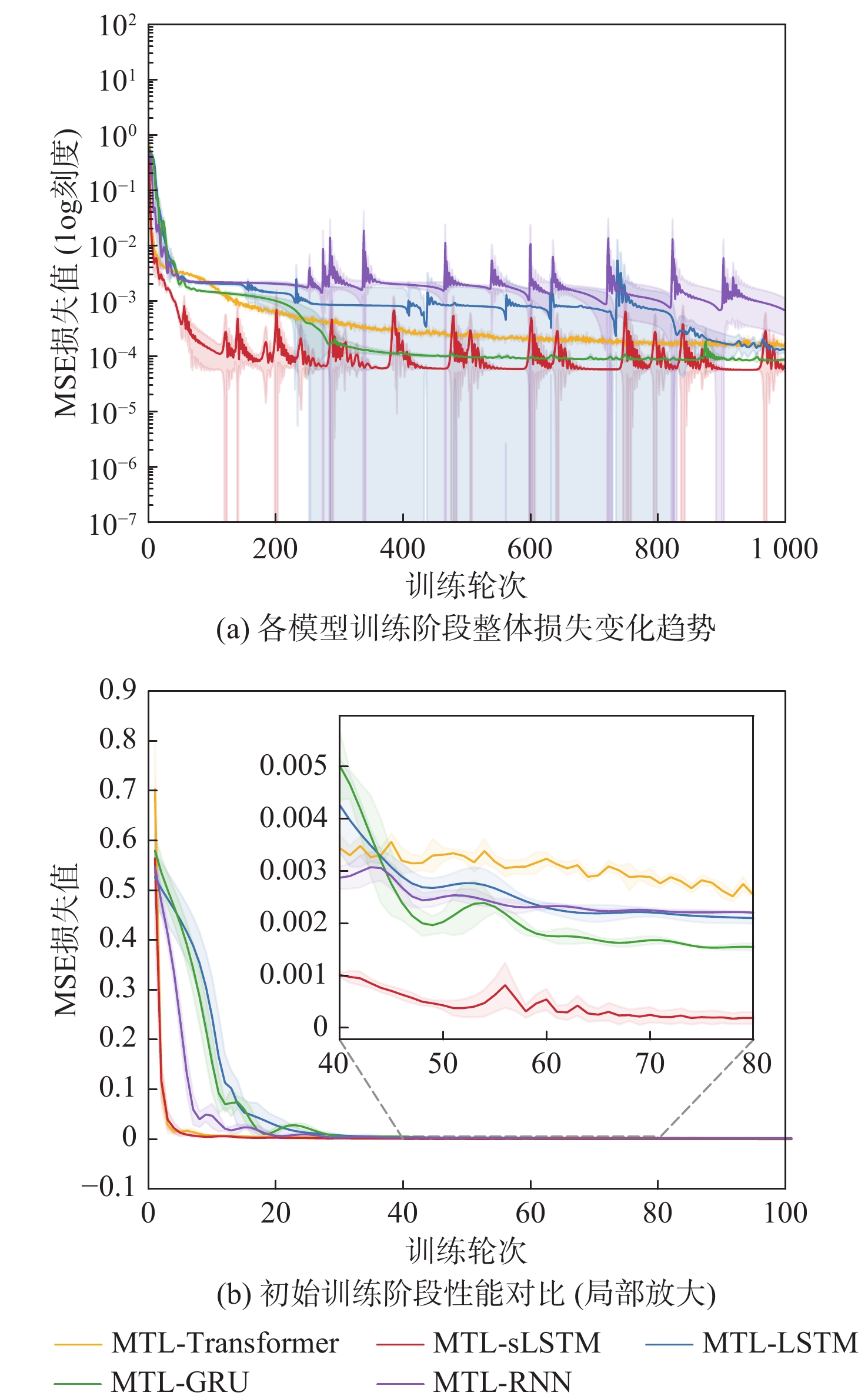
A prediction technique based on multi-task learning with scalar long short-term memory (MTL-sLSTM) was presented to solve the problem of remaining useful life (RUL) prediction for lithium-ion batteries in low-altitude economy vehicles under multi-condition coupling. Firstly, a heterogeneous input layer integrates multi-dimensional time-series data from diverse flight conditions. Then, a hierarchical stacked sLSTM structure serves as a shared feature extractor, enabling deep cross-scale feature integration and the capture of common nonlinear degradation patterns. Finally, by hard-coding task IDs to dynamically modulate network weights, the multi-task learning mechanism adaptively identifies each operating condition’s unique aging behavior while simultaneously promoting knowledge transfer across domains for independent RUL estimation. According to experimental results, MTL-sLSTM achieves a 60.7%–92.3% reduction in root mean square error (RMSE) on the eVTOL dataset, outperforming six temporal approaches, including the attention mixture of experts (AttMoE) and dual-channel LSTM (Dual-LSTM). This validates the effectiveness of the multi-task learning mechanism in enhancing the generalization capability of degradation features and improving prediction accuracy under complex operating conditions.

Low-altitude perception models pruning algorithm with irregular structures
YANG Zi, ZHUANG Liansheng
2026, 52(9): 3136-3145. doi: 10.13700/j.bh.1001-5965.2025.0313
Abstract:

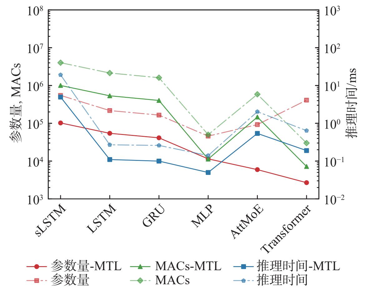
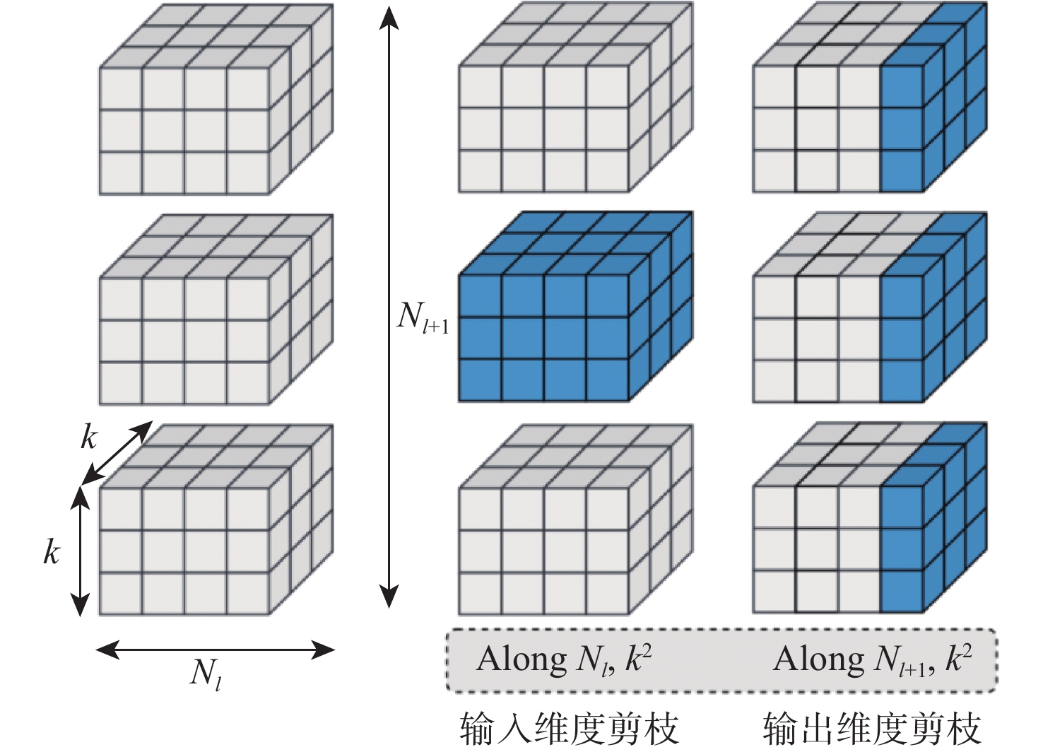
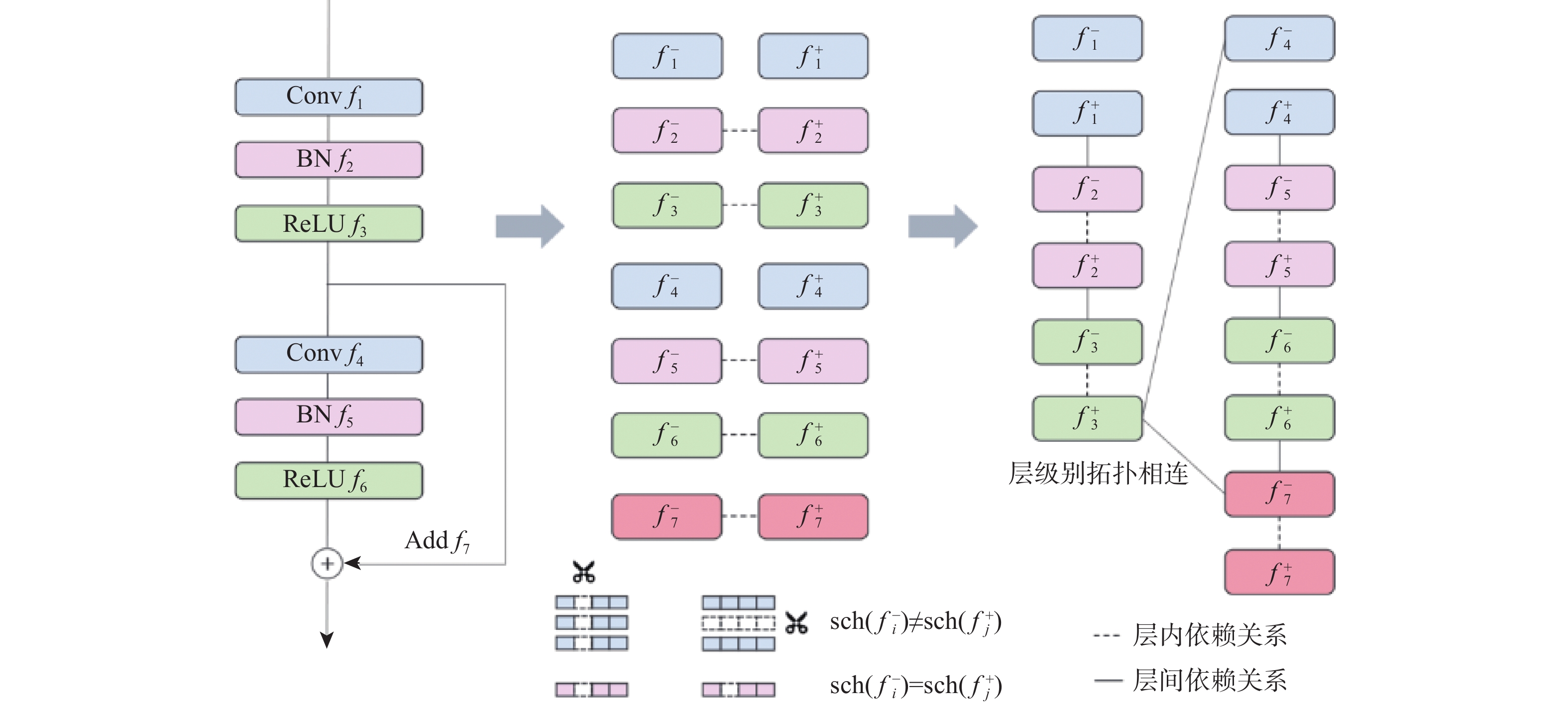
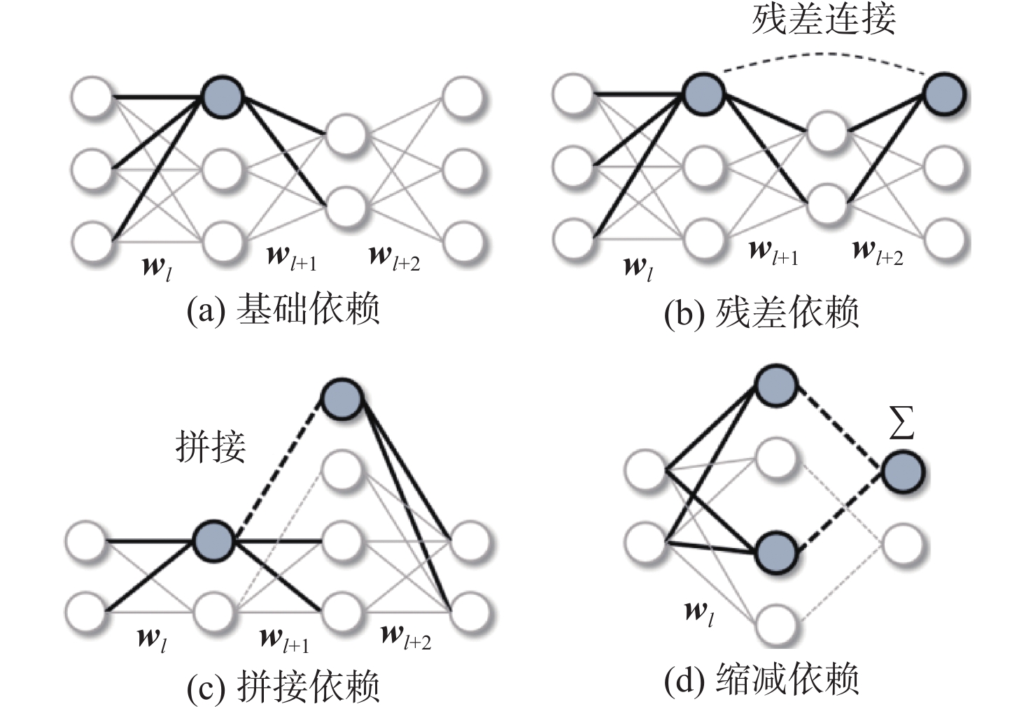
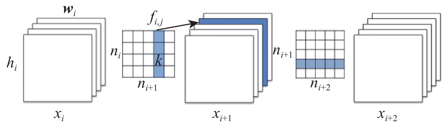
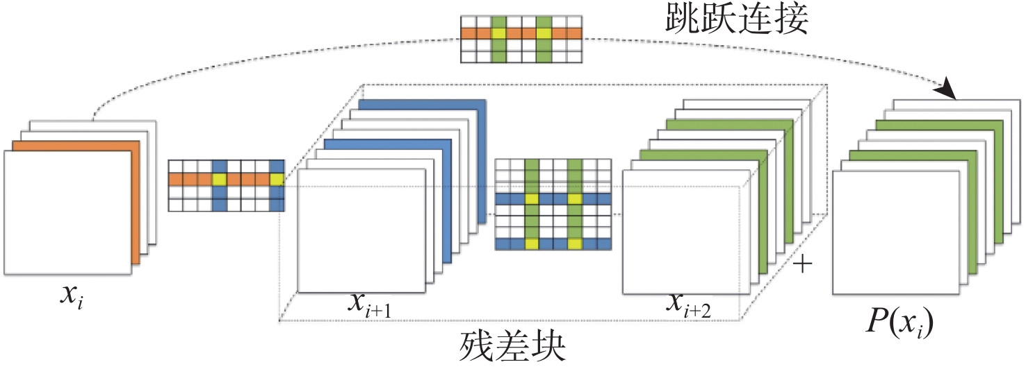
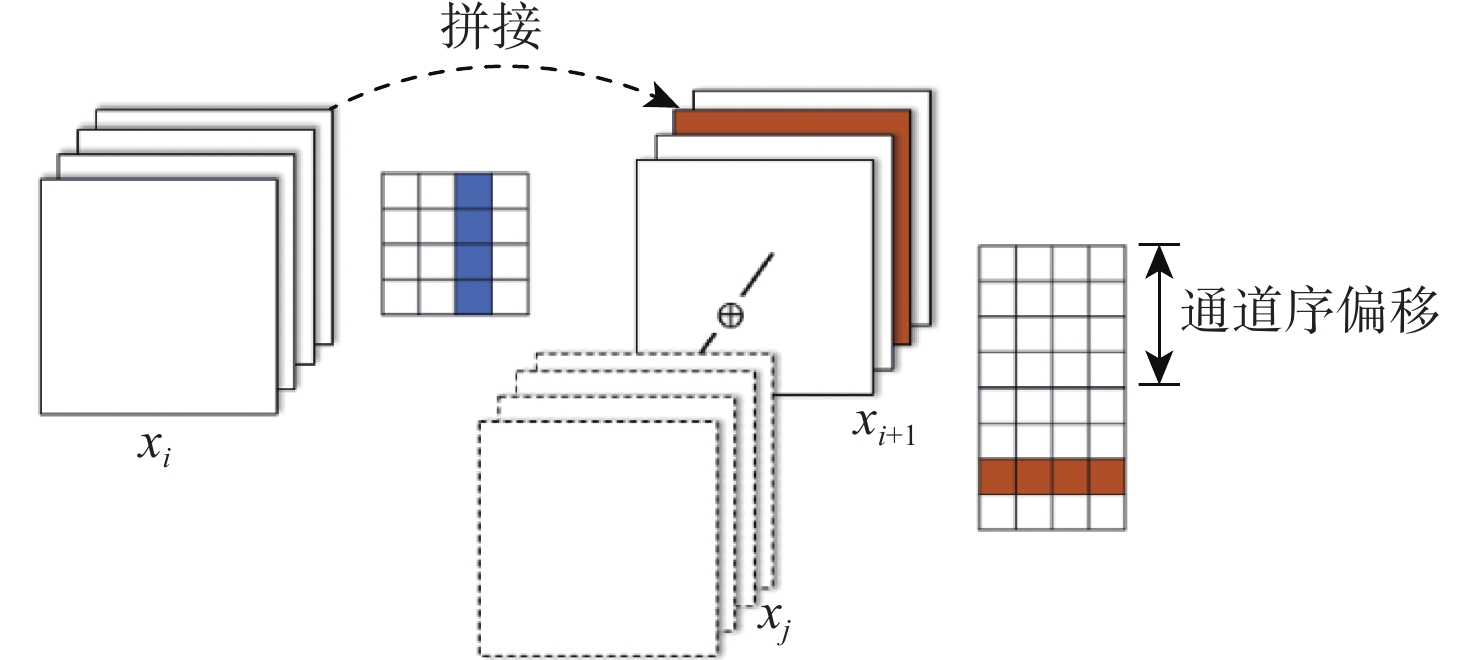
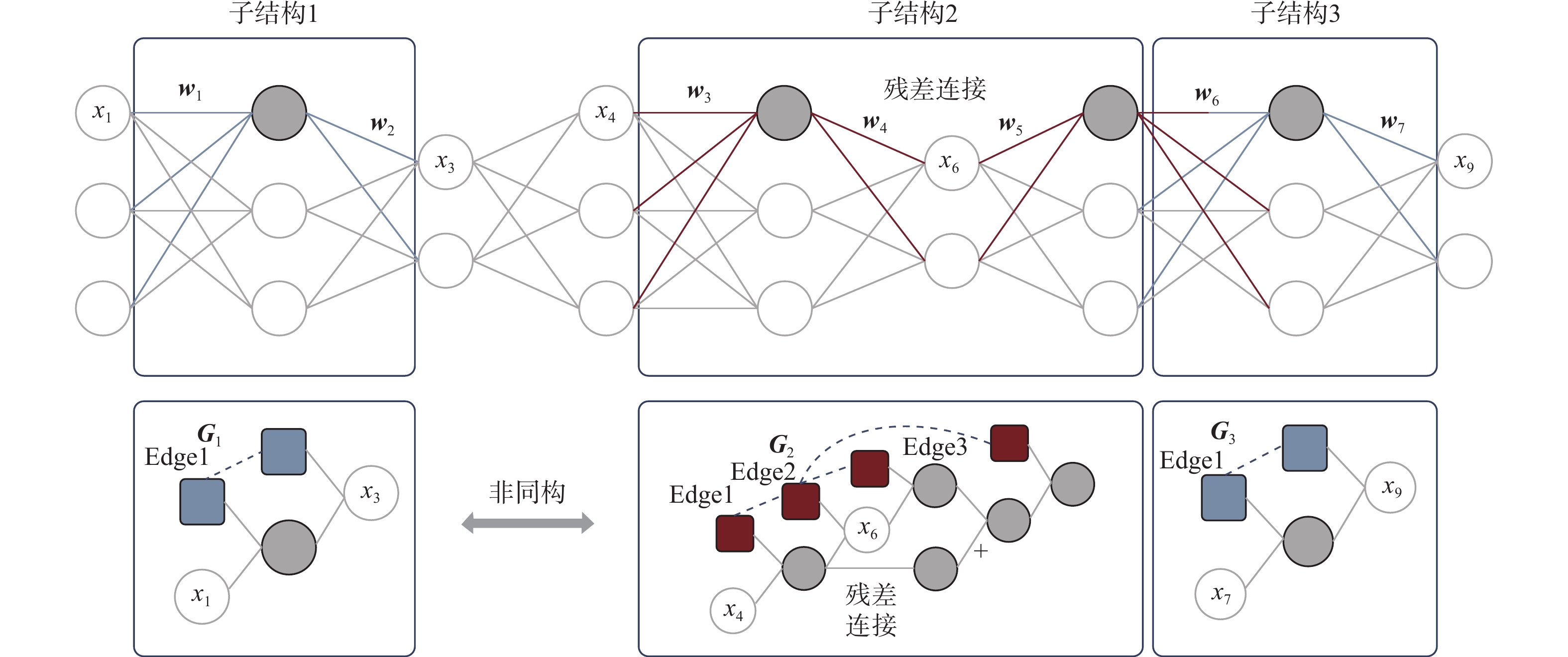
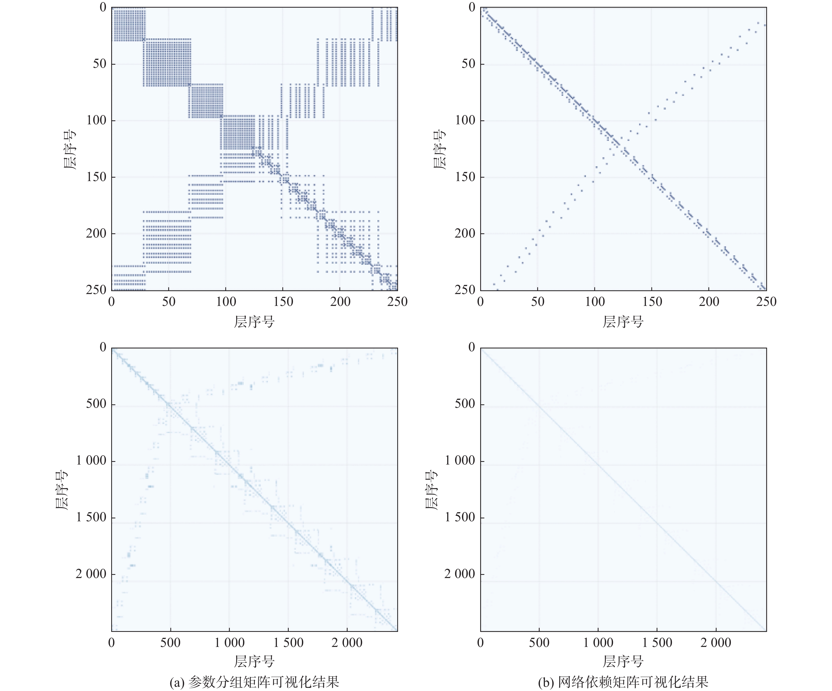
Large neural networks are challenging to implement on terminal devices due to restricted processing resources, notwithstanding deep learning’s superior performance in low-altitude intelligent sensing. Pruning techniques reduce model complexity by eliminating redundant parameters, thereby improving real-time performance. However, existing methods primarily target regularly structured models and struggle to handle irregular structures generated by neural architecture search (NAS). To address this, a dependency graph-based pruning scheme for irregular structures is proposed to optimize model efficiency. The method first employs structural parsing techniques of computational graphs to automatically identify unique multi-level connection patterns in low-altitude perception models. Subsequently, it constructs an efficient parameter grouping module to precisely locate minimum functional units that can be completely removed. Finally, a cross-layer comparison global optimization strategy is adopted to implement unified evaluation and pruning of isomorphic substructures. This solution overcomes the technical constraints of structural adaptability when compared to current approaches, allowing global precision compression for irregular network architectures. This feature makes it especially appropriate for low-altitude perception scenarios that call for intricate spatial relationship processing. Experimental results demonstrate that the proposed irregular structure pruning method can effectively identify and perform group pruning on complex structures, including multi-branch connections, residual connections, and concatenations, in both NAS-Bench101 models and ResNet series networks. When implementing 50% compression rate network lightweighting on the CIFAR-10 dataset, the recognition accuracy drop does not exceed 1%.

LCU-level video bit allocation algorithm based on two-layer game in low-altitude communication environment
ZHANG Yafei, LIU Lulu, YU Jinchi, ZHU Difeng, GONG Xuan, GAO Yi
2026, 52(9): 3146-3152. doi: 10.13700/j.bh.1001-5965.2025.0357
Abstract:

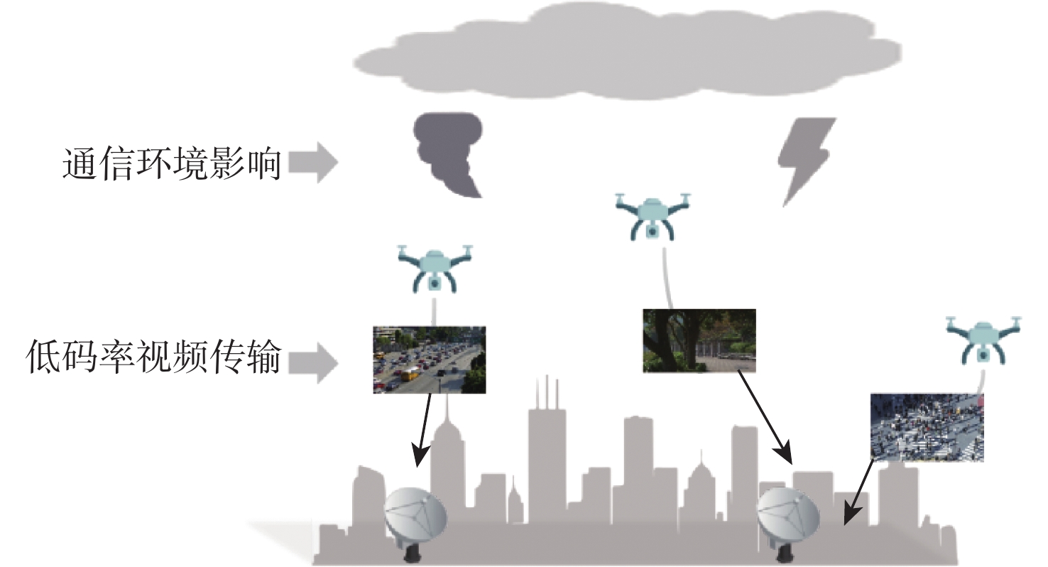
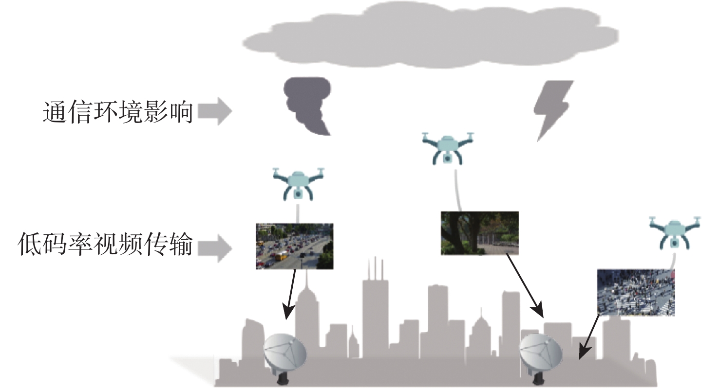
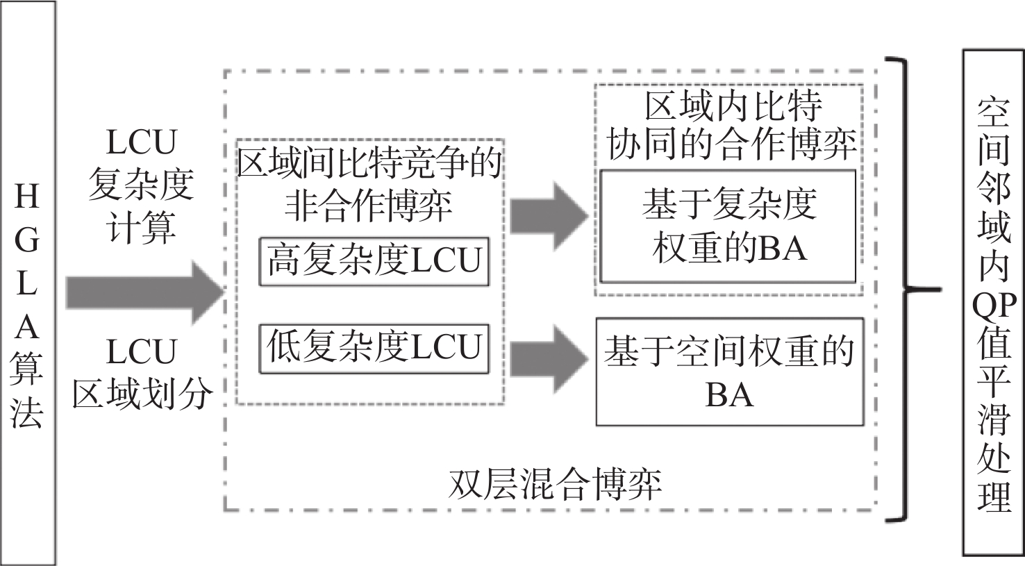
This paper addresses the issues of low video coding efficiency and insufficient bit rate utilization in low-altitude communication scenarios by proposing an largest coding unit (LCU)-level bit allocation (BA) optimization based on two-layer hybrid game model (HGLA) algorithm. Using the LCU as the basic unit, the algorithm performs region partitioning according to texture complexity, motion intensity, and edge information, and establishes a differentiated BA mechanism for high- and low-complexity regions. In particular, a combination of cooperative and non-cooperative game models is used for high-complexity regions to achieve coordinated BA; for low-complexity regions, a global quantization parameter (QP) smoothing strategy and a spatial weighting mechanism are introduced to improve bit rate utilization efficiency and visual continuity. Finally, experimental validation under four low-bit rate scenarios demonstrates that the proposed method achieves significant improvements in peak signal-to-noise ratio (PSNR), structural similarity index measure (SSIM), and subjective quality. Specifically, at the target bit rate of 16 Kbit/s, compared with four baseline methods including the high efficiency video coding (HEVC) rate control (RC) algorithm HM-RC and the frame-level multilayer perceptron (MLP)-based BA algorithm, the intra-frame rate control algorithm based on a simplified cubic rate-distortion model, and the variable-resolution rate control algorithm based on versatile video coding (VVC), the proposed method achieves average performance gains of 3.34%, 2.16%, and 9.8% in PSNR, SSIM, and mean opinion score (MOS), respectively, demonstrating its excellent practicality and adaptability in improving bit rate utilization efficiency and preserving image quality.

FOD detection and recognition for low-altitude takeoff and landing sites
ZHENG Haowen, HU Haimiao, XU Zhuang, HE Zhuang, HU Haoxin
2026, 52(9): 3153-3162. doi: 10.13700/j.bh.1001-5965.2025.0420
Abstract:

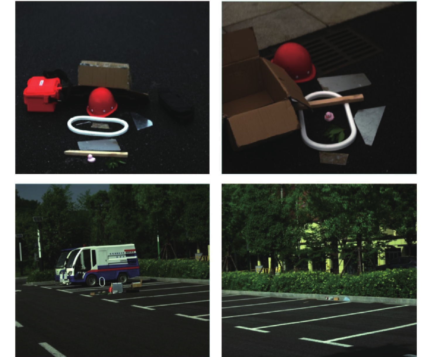
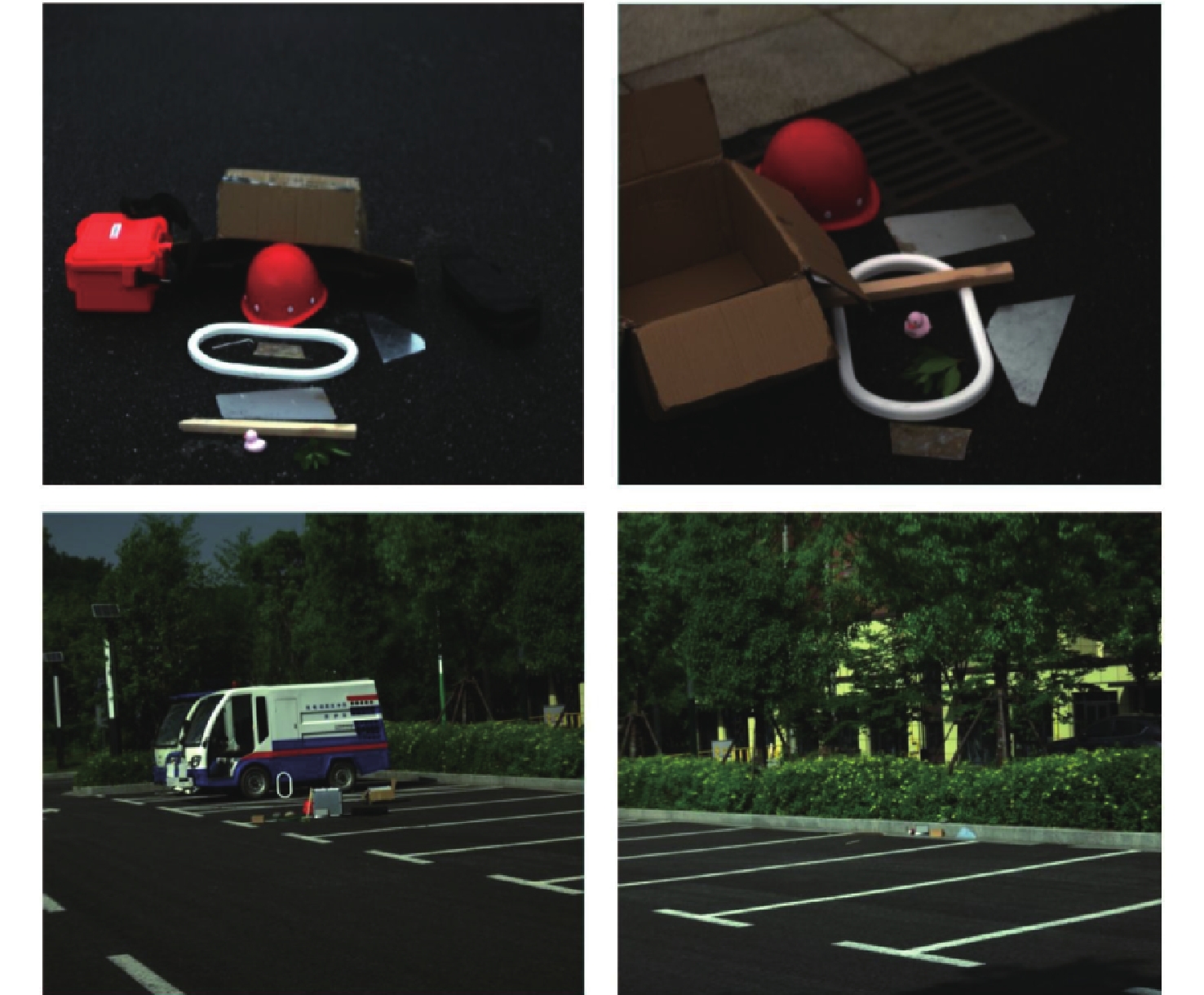
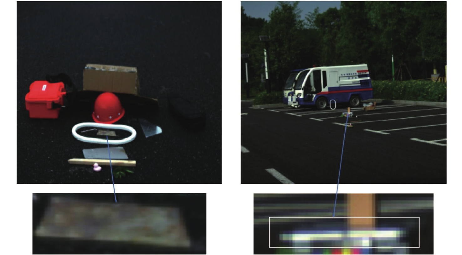
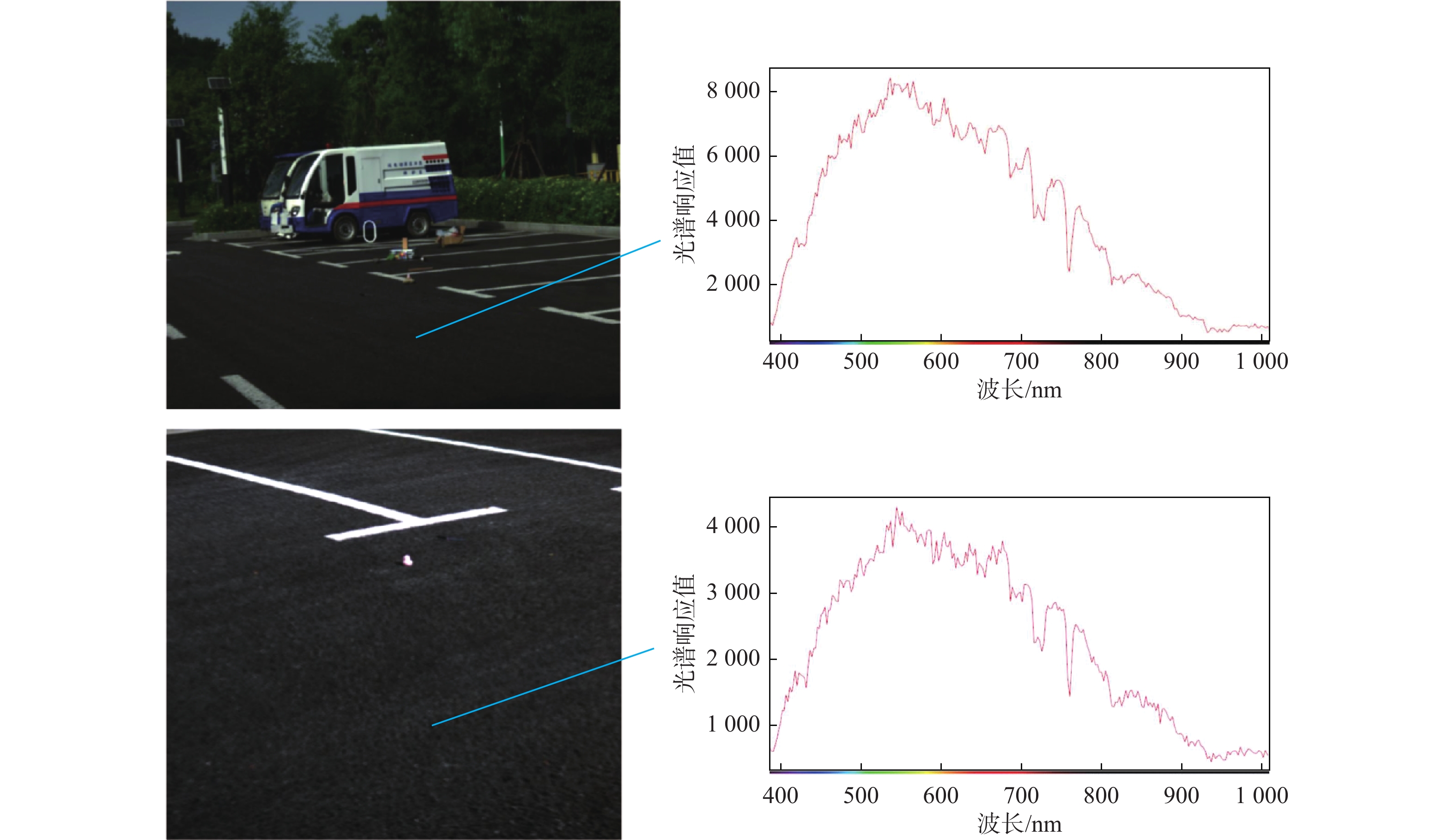
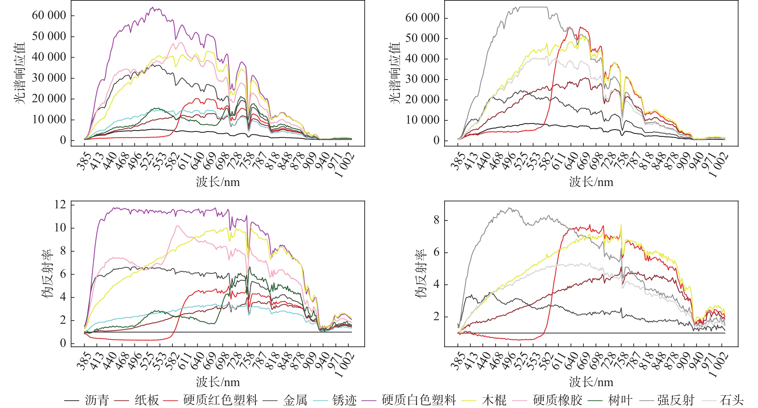
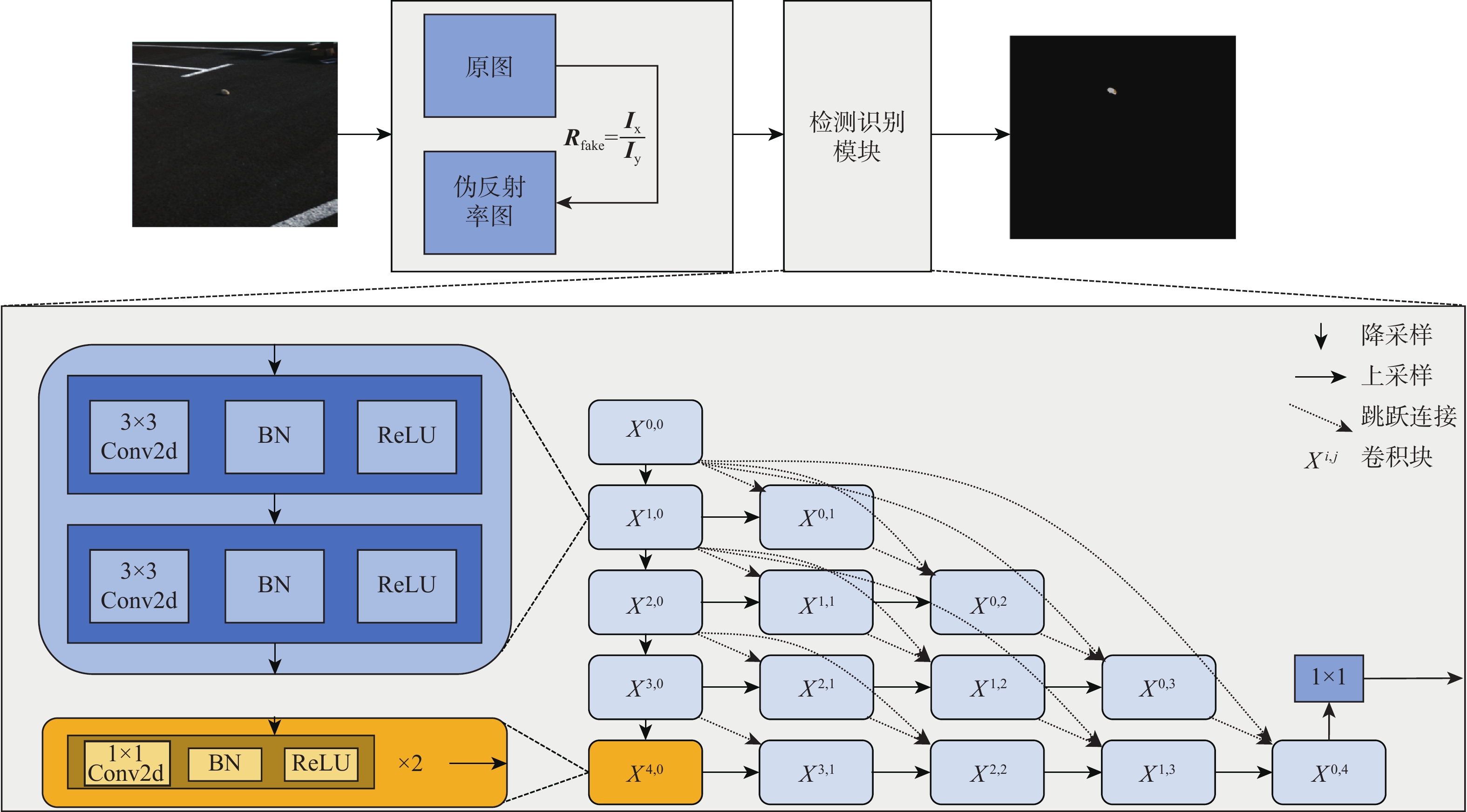
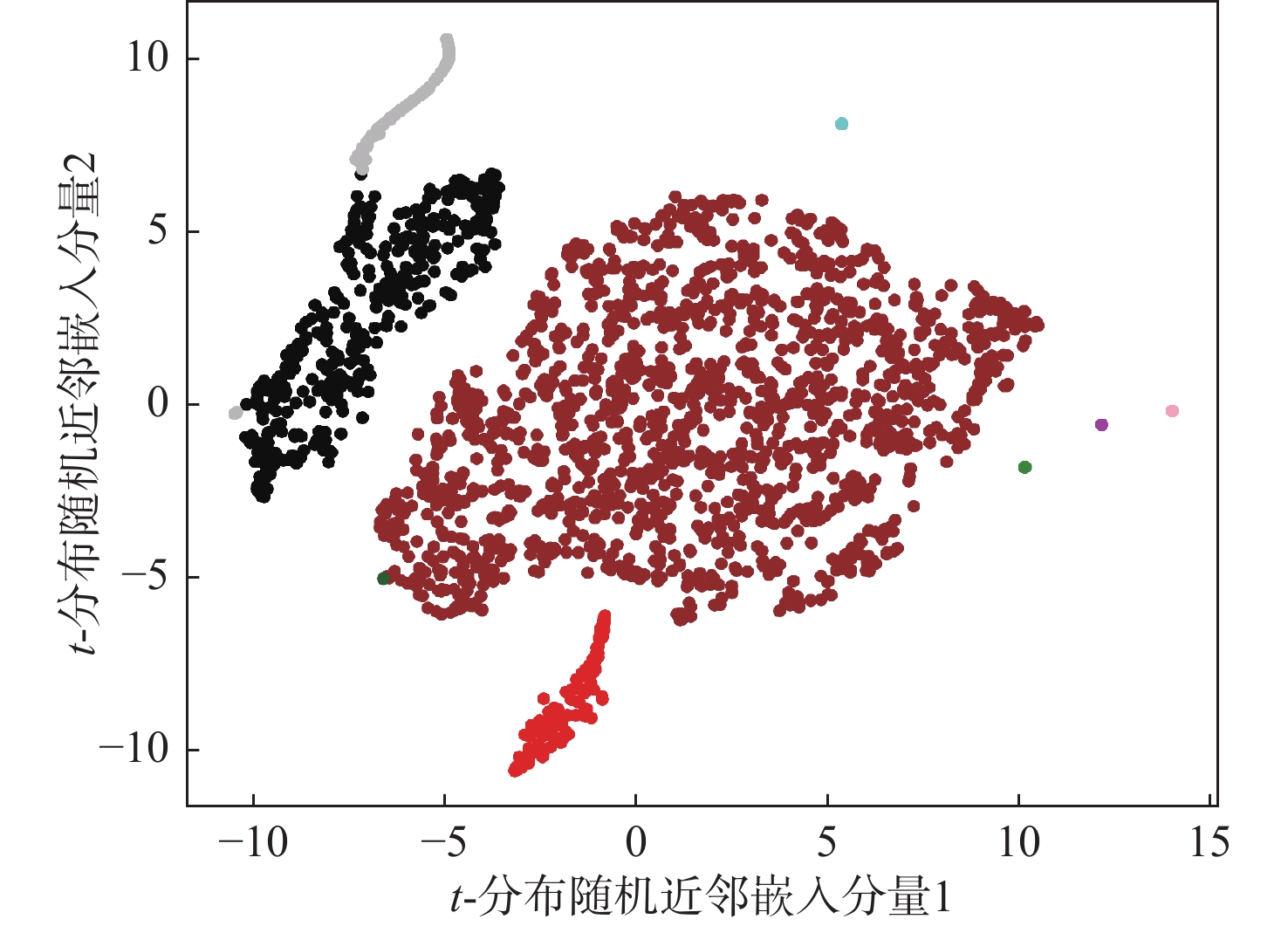
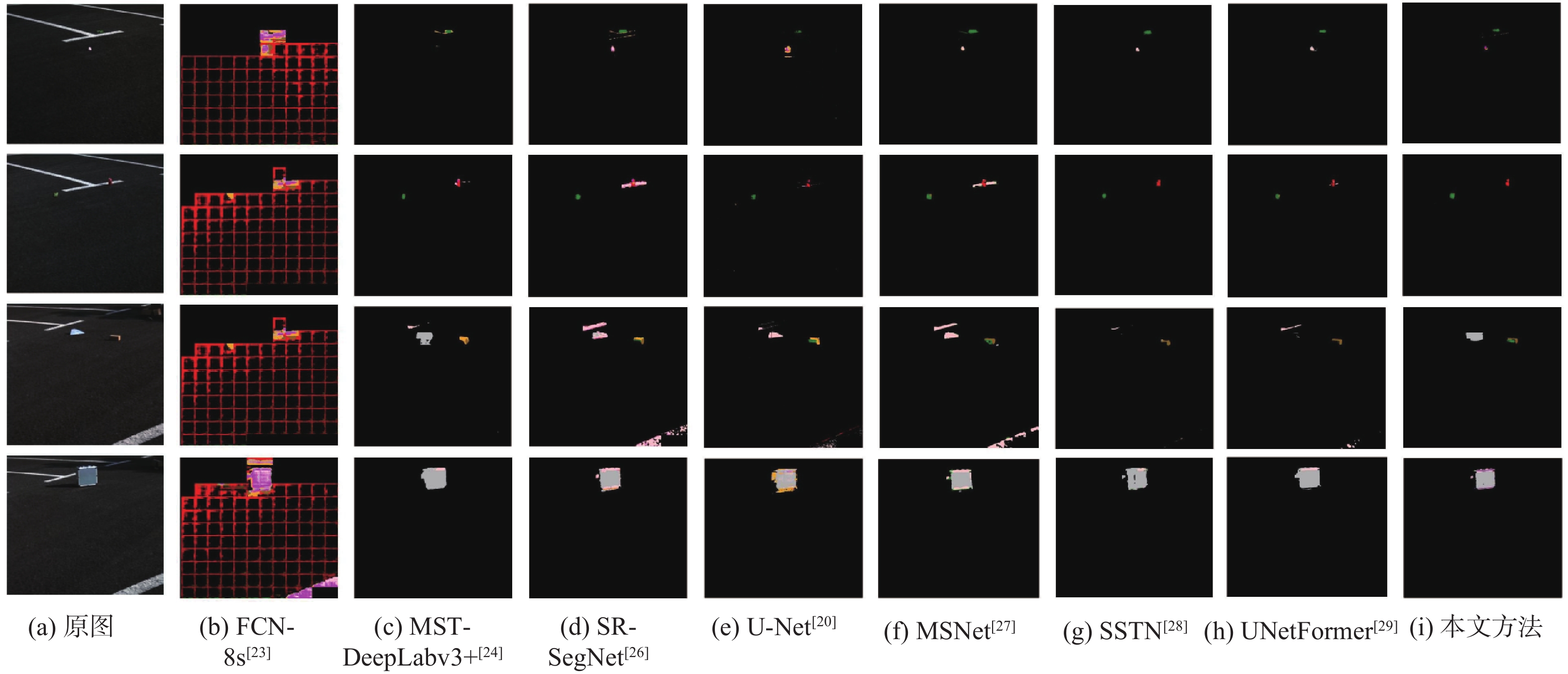
The detection and recognition of foreign object debris (FOD) on low-altitude takeoff and landing runways are of critical importance to aircraft performance and airport operational safety. A FOD dataset was created and a physics-based FOD detection and identification approach was suggested in order to address the issues caused by the small size, lack of distinctive visual traits, and restricted availability of public data for FOD. Initially, multispectral images of common FOD materials were collected to establish a multispectral FOD dataset. Based on this dataset, attribute analysis was conducted on common FOD types, including metal rust and strong reflection phenomena. Utilizing the reflectivity of asphalt backgrounds, a pseudo-reflectivity metric relative to asphalt was derived for different materials. Through various statistical measures, the separability of different materials was preliminarily validated. Subsequently, a neural network with an encoder-decoder architecture featuring densely nested connections was proposed, using pseudo-reflectivity as input for material identification. The suggested approach outperformed existing material identification and segmentation models with similar parameter ranges on the test set of this dataset, achieving an accuracy of 0.9993 and a Macro-F1 score of 0.7749.
High-accuracy real-time 3D multi-target detection for low-altitude security scenarios
WENG Jia’nan, XU Zhuang, LI Yanghui, YE Demao
2026, 52(9): 3163-3171. doi: 10.13700/j.bh.1001-5965.2025.0430
Abstract:

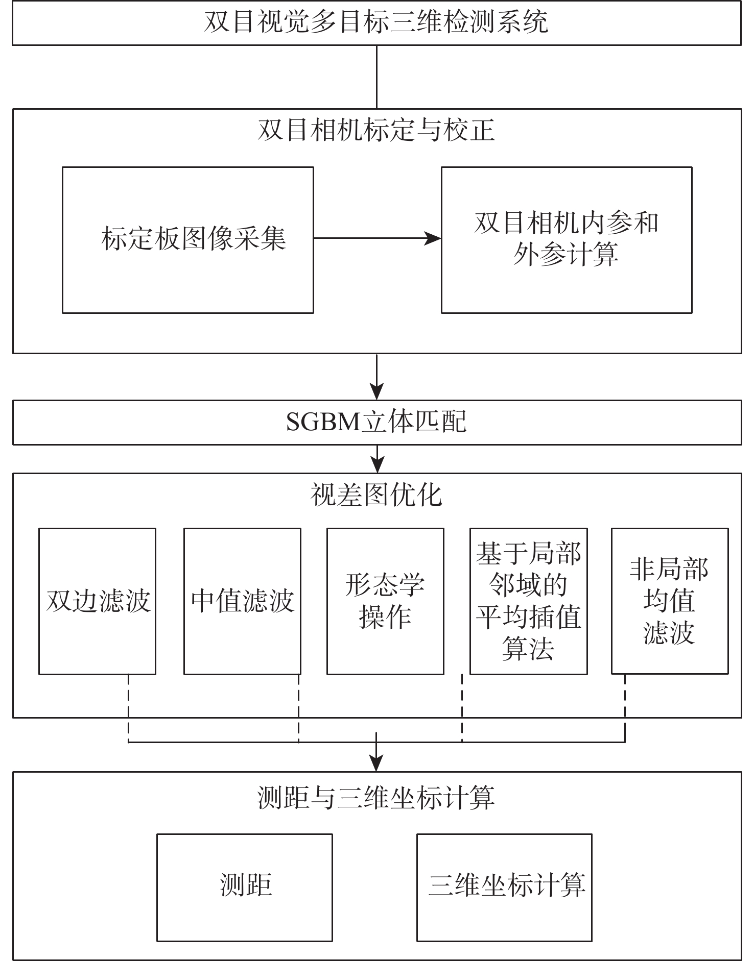
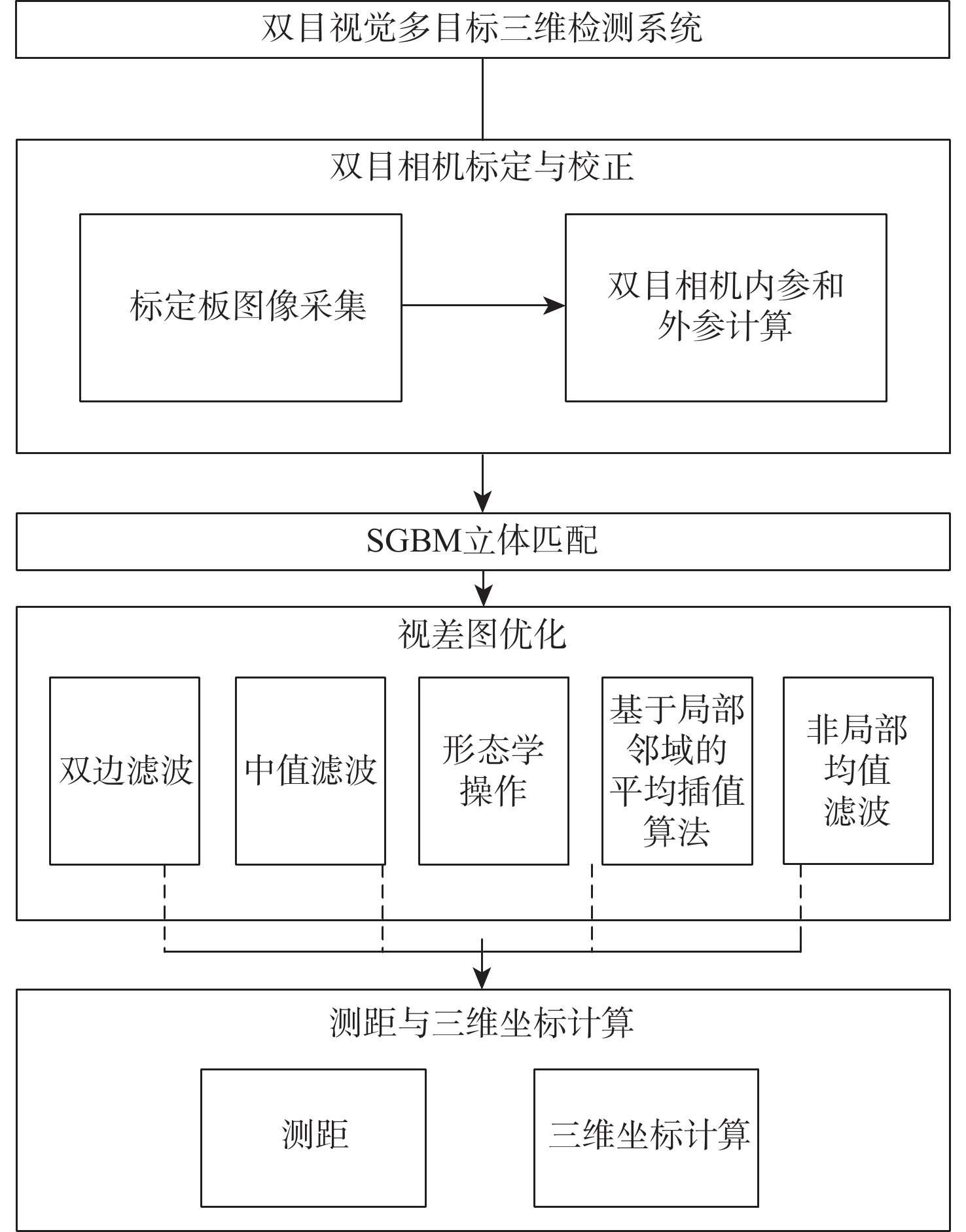
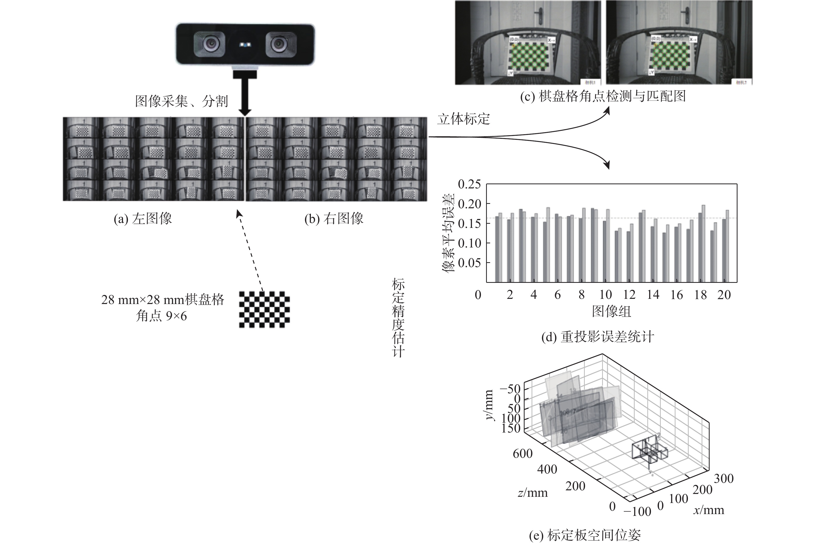
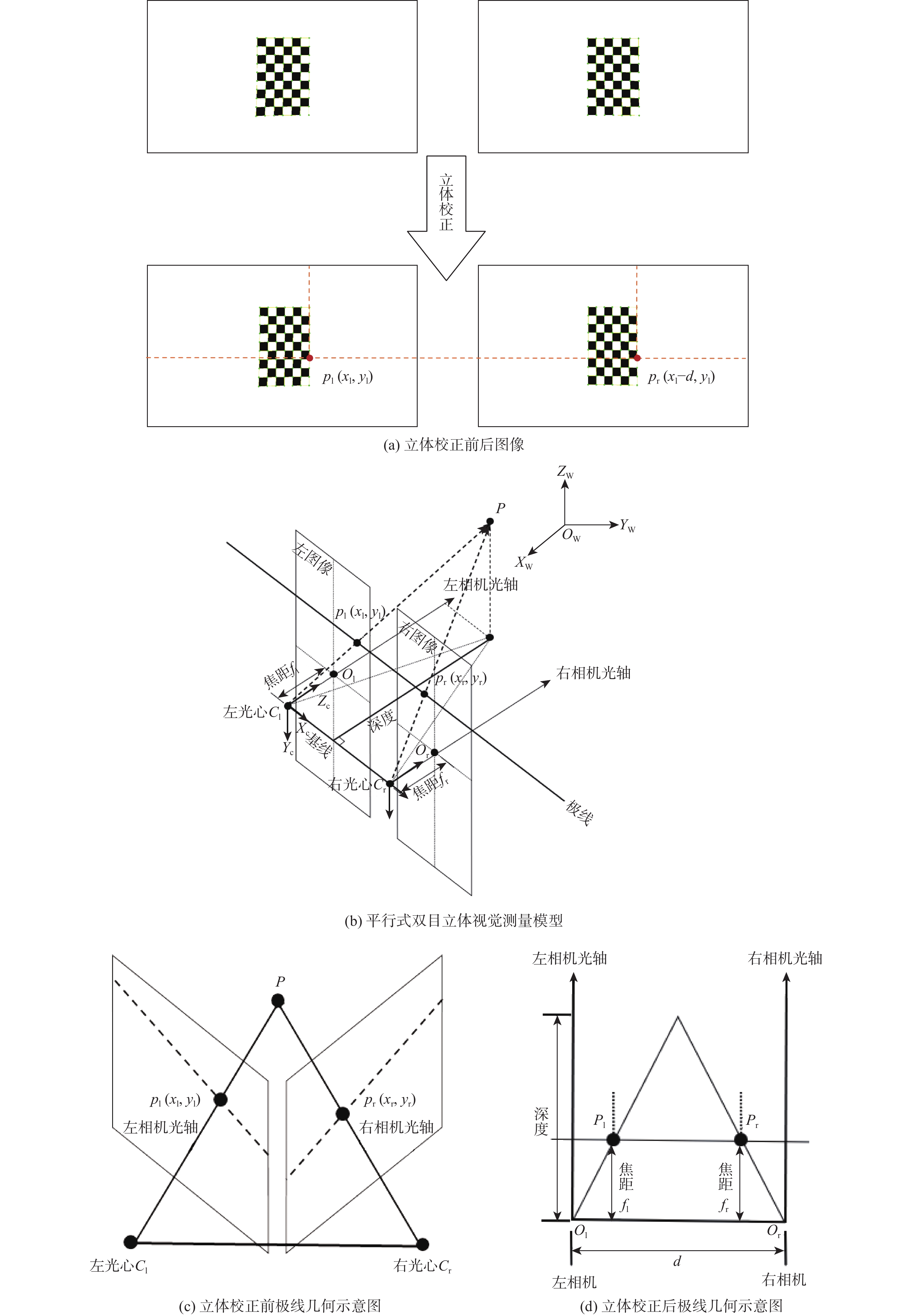
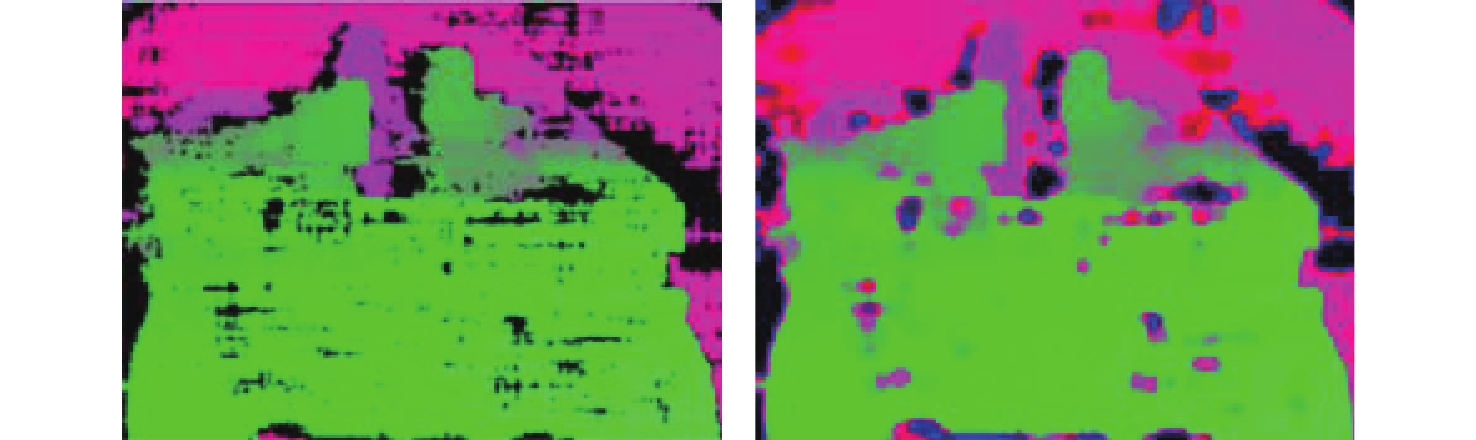
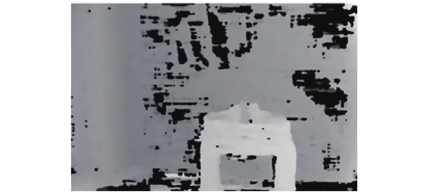
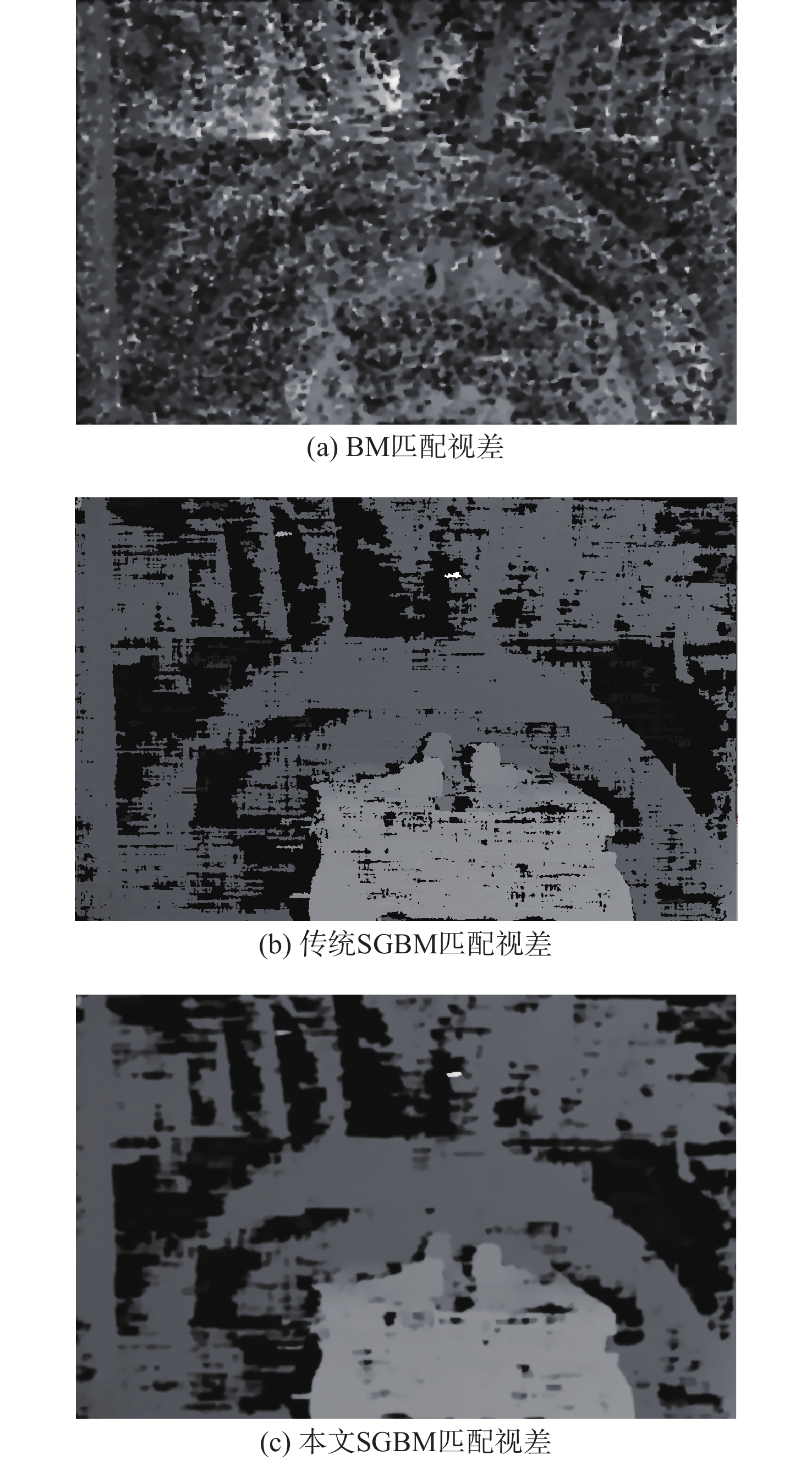
A real-time 3D detection method based on binocular vision is proposed to meet the high-accuracy ranging requirements of dynamic targets in low-altitude security scenarios. The method, which is based on the semi-global block matching (SGBM) algorithm, combines morphological processing, bilateral filtering, and interpolation-based hole-filling to enhance the completeness of depth information and disparity quality in weak-texture areas. With calibrated camera parameters and the triangulation principle, target 3D coordinates are computed in real time. Experiments show that within the distance range of 0.5-2.0 m, the disparity hole rate is reduced from 40.7004% to 1.2781%, with an average relative ranging error of 2.55% and centimeter-level positioning accuracy. The method’s scalability to 2000 meters is further confirmed by scale model study. Overall, the proposed system provides an efficient and cost-effective solution for multi-target 3D perception in low-altitude surveillance.
Pseudo-label enhanced multi-feature fusion for millimeter-wave radar UAV detection
LU Yaning, ZHANG Shengjun, YU Qianmi, LI Hongming
2026, 52(9): 3172-3182. doi: 10.13700/j.bh.1001-5965.2025.0429
Abstract:

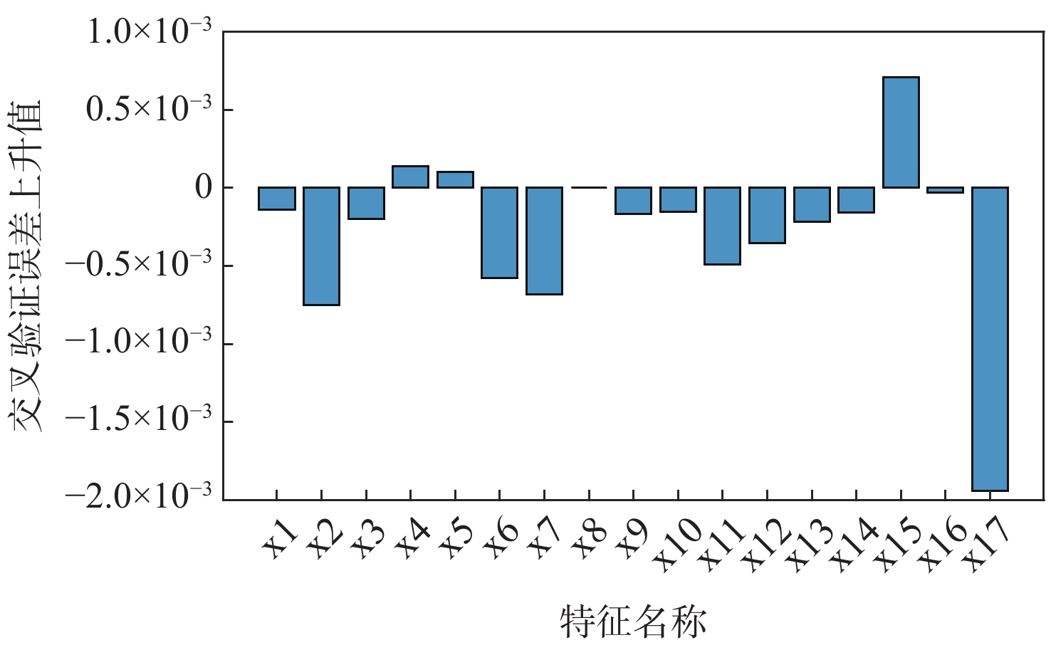
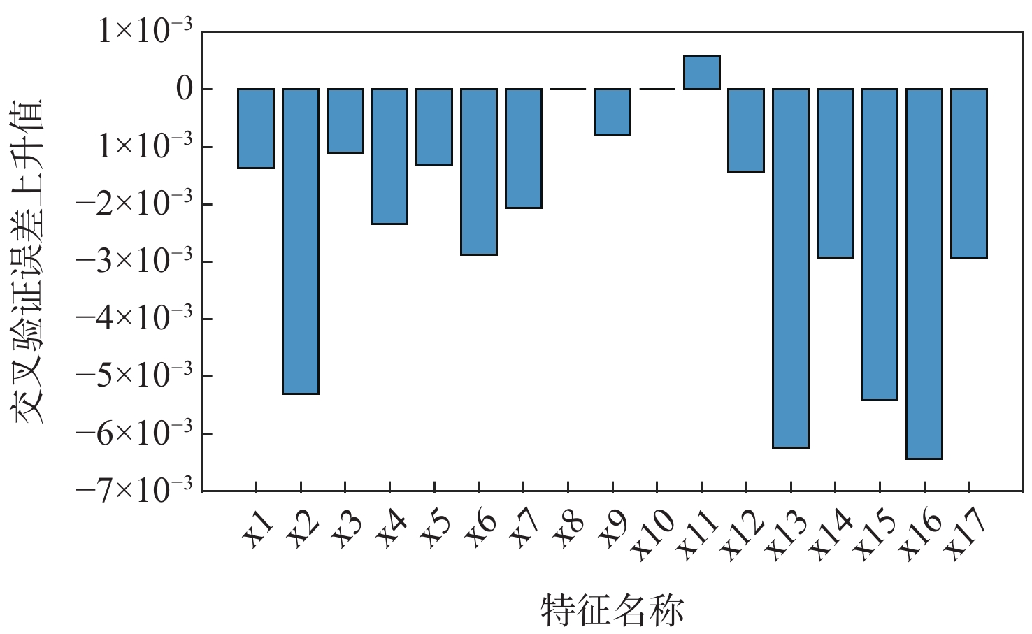
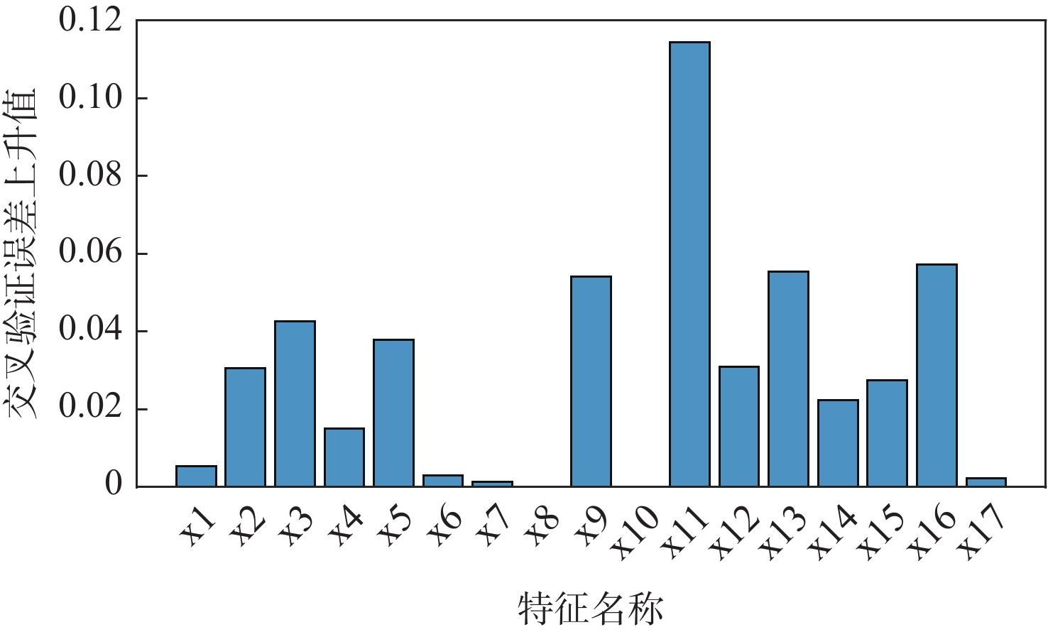
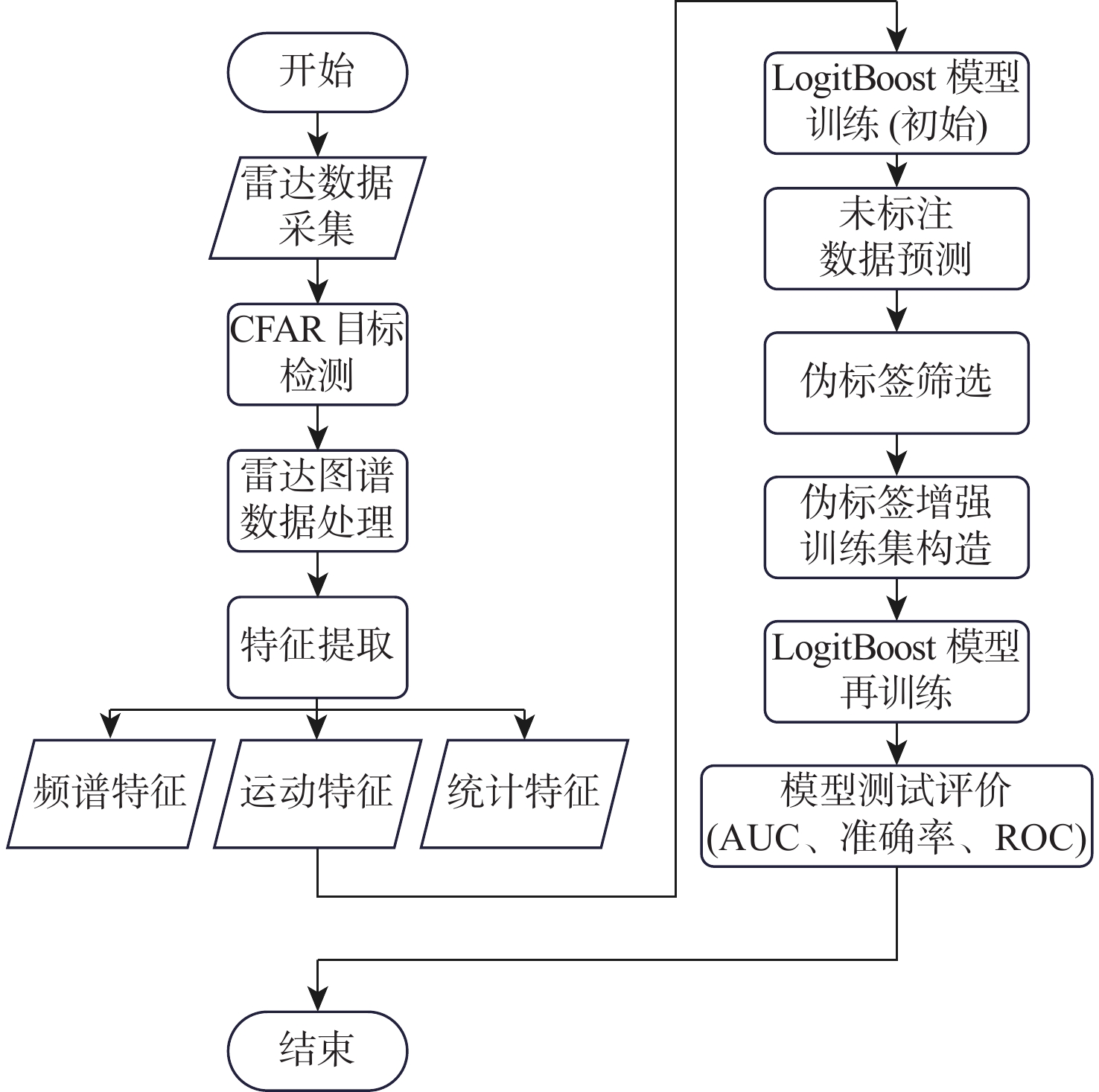
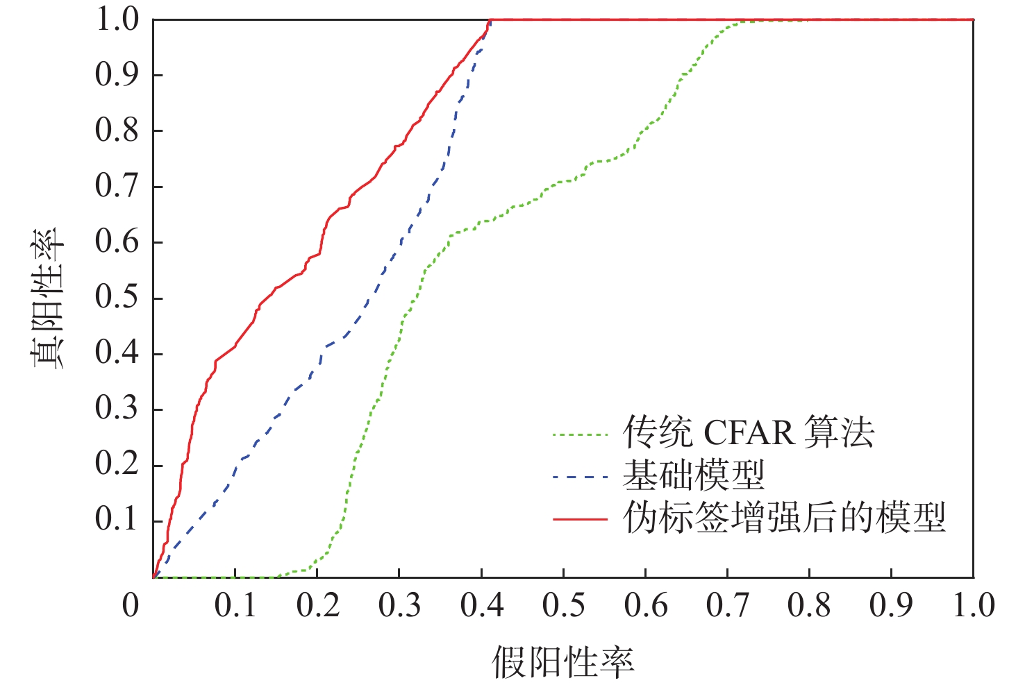
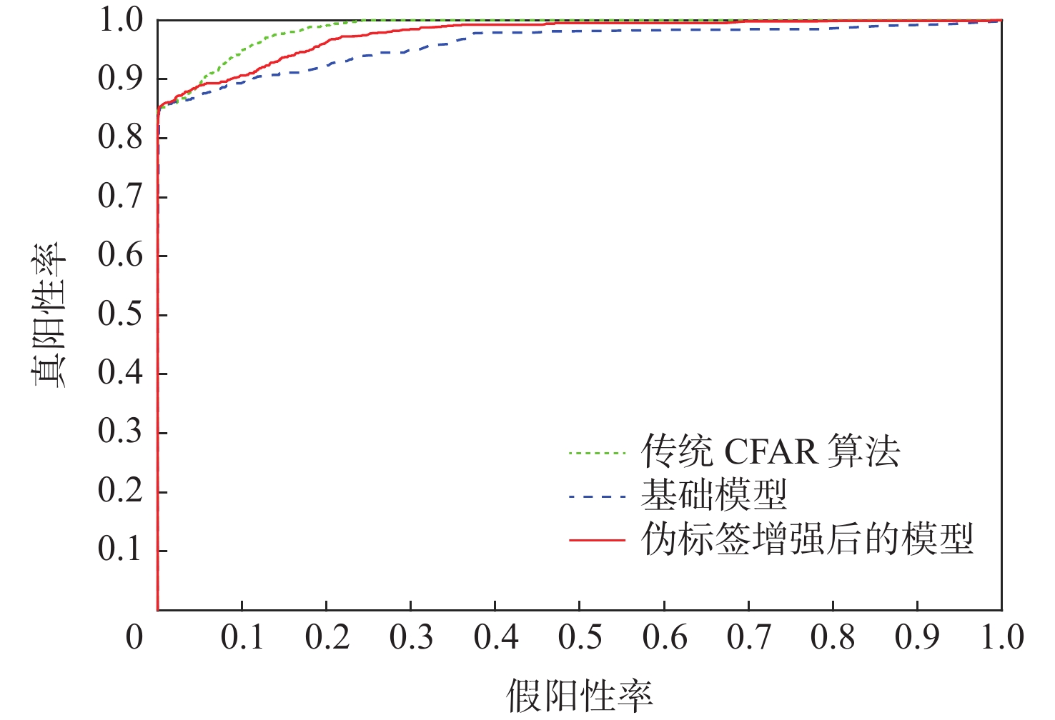
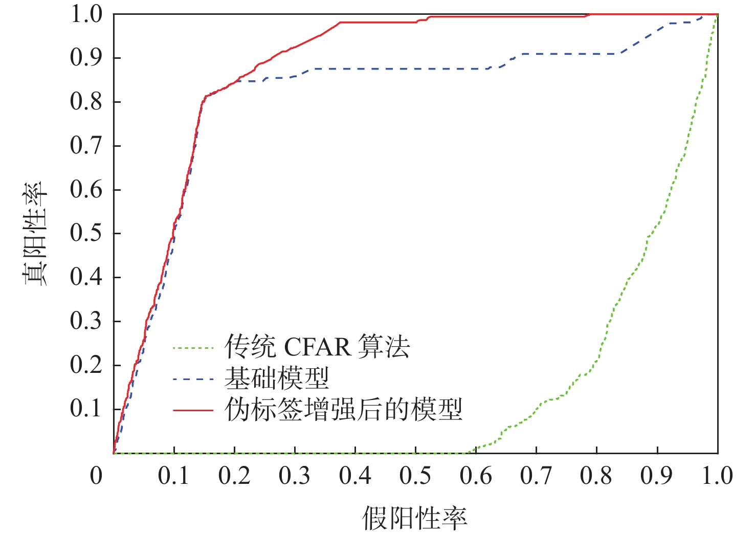
A weakly supervised learning method was investigated for unmanned aerial vehicle (UAV) detection based on millimeter-wave radar. To enhance feature representation, multiple categories of information were fused, including spectral energy distribution, motion trajectory variation, and statistical descriptors. Target pre-detection was conducted using a constant false alarm rate (CFAR) algorithm, which adaptively filtered the radar echo data and provided coarse localization. Doppler-related indexes were employed to reflect target motion parameters, and time-frequency domain information was used to derive energy characteristics for feature extraction. To further characterize the echo distribution, statistical measures like skewness, kurtosis, and energy ratio across close and far range bins were calculated. A LogitBoost ensemble classifier was employed to train the detection model by combining multiple weighted weak learners through iterative optimization. To address the scarcity of labeled samples, a pseudo-labeling strategy was introduced. The self-training mechanism automatically generated pseudo-labels from high-confidence predictions on unlabeled data and incorporated them into subsequent training cycles. Experimental validation was performed using a dataset comprising multiple real-world radar recordings with UAVs and empty field scenarios. The proposed method demonstrated robust performance under weak supervised conditions in three different scenarios. Compared with the baseline model, the final model achieved an improvement of approximately 7.2%/1.6%/6.6% in the area under the receiver operating characteristic curve (AUC) and a reduction of approximately 36.9%/0%/10.6% in the false alarm rate. Moreover, the model exhibited consistent detection accuracy in challenging environments with noise and background clutter. This study demonstrates that millimeter-wave radar detection performance for low-altitude, small-size UAVs can be significantly enhanced by combining multi-domain features and implementing pseudo-label augmentation techniques. The method provides practical value for real-time surveillance and airspace security applications.
Lightweight insulator defect detection algorithm based on UAV perspective
HU Xiaojie, NI Cui, WU Chunpo, LIU Zhu, WANG Peng
2026, 52(9): 3183-3188. doi: 10.13700/j.bh.1001-5965.2025.0495
Abstract:

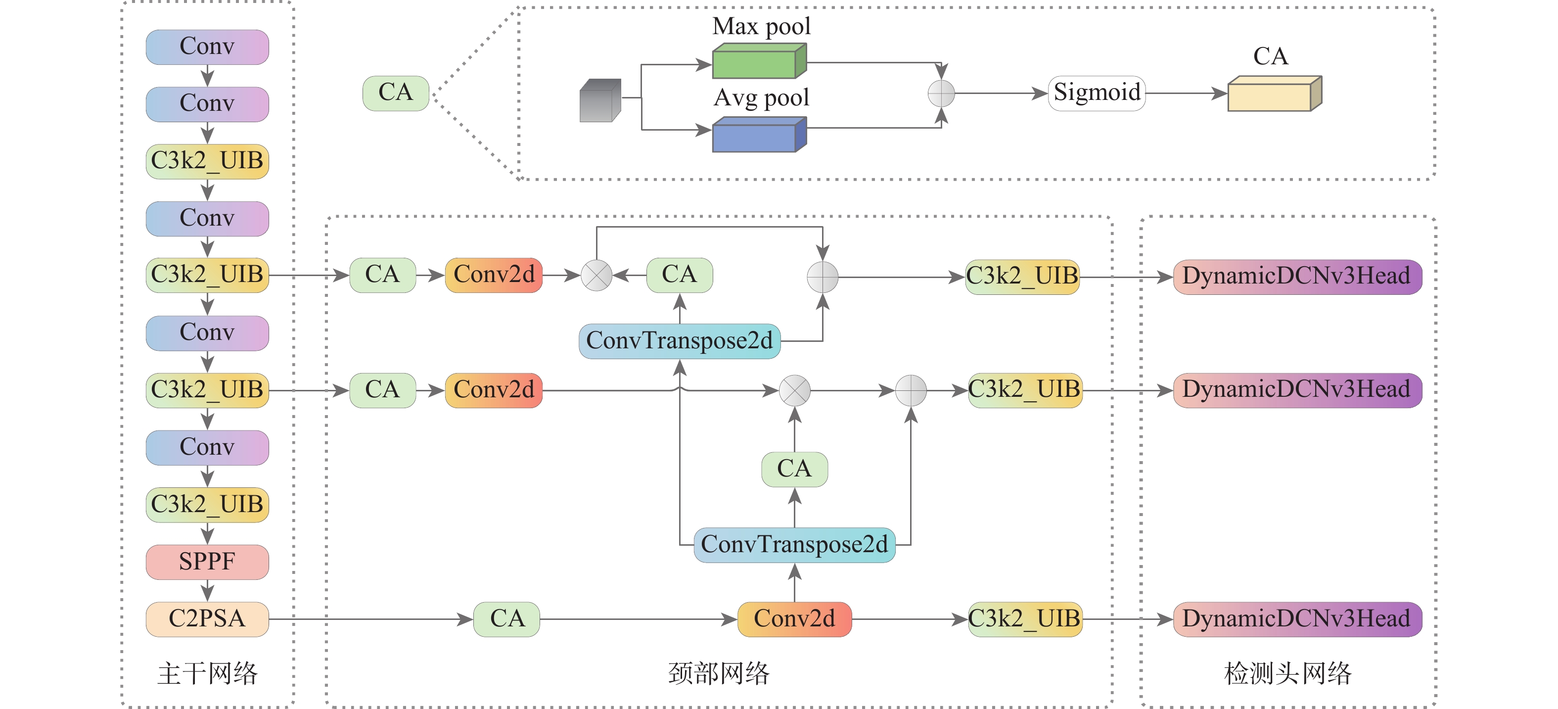
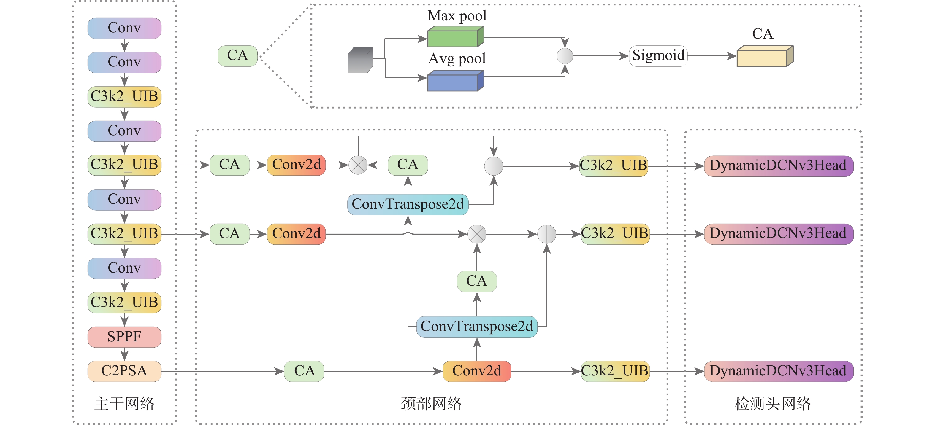
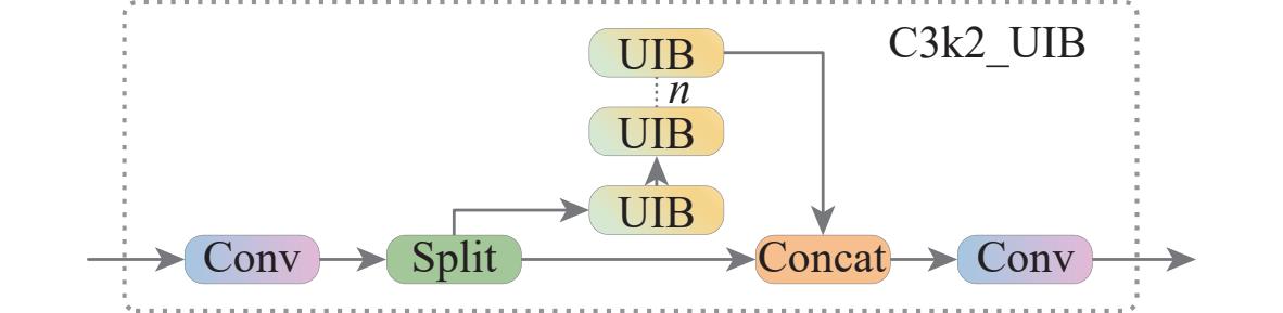
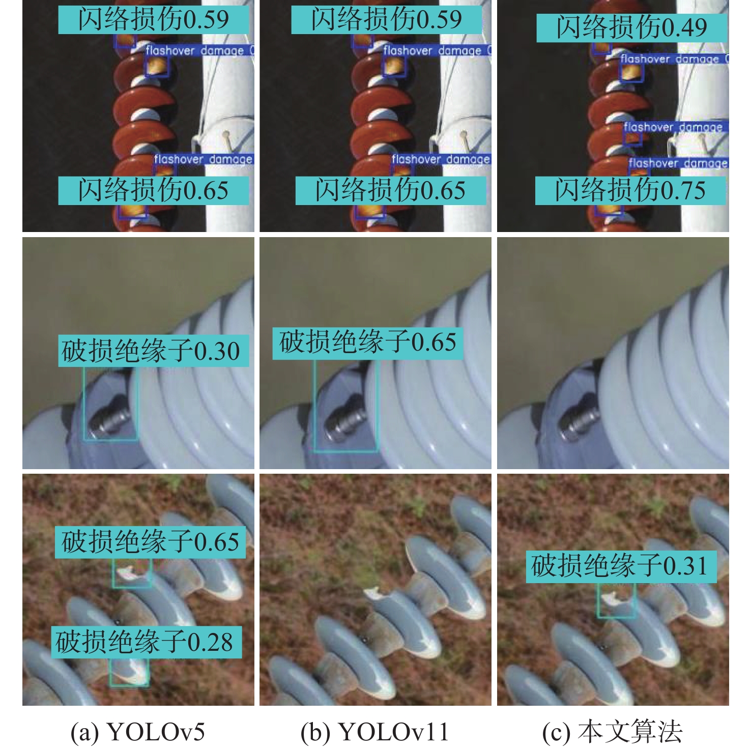
As the primary method of low-altitude power monitoring, unmanned aerial vehicle (UAV) inspection presents the dual requirements of lightweight and high precision for the detection model. The timely detection of defects is crucial to the reliability of the power grid since it is the fundamental component of the safe operation of the power system. Based on YOLOv11, a lightweight insulator defect detection algorithm based on the UAV perspective is proposed. Firstly, in the YOLOv11 backbone network, the improved feature extraction unit of MobileNetV4, with a general inverted bottleneck structure, is integrated to enhance the perception of subtle defects of insulators. Secondly, the YOLOv11 neck network was integrated with a hierarchical spatial screening feature pyramid network, and the interaction path of cross-layer features was optimized to minimize model parameter redundancy. Finally, at the detection output, the dynamic deformable convolution detection head is used to replace the traditional detection module to improve the adaptability to the geometric deformation of defects. Experimental results show that compared with the YOLO series model, the proposed lightweight model can reduce the number of parameters by more than 12.35% on the basis of ensuring detection accuracy, which is more suitable for edge equipment such as UAVs and inspection robots, and provides an efficient solution for the real-time detection of transmission line insulator defects.

Light field gaussian splatting representation and joint spatial-angular super-resolution for low-altitude scenarios
MENG Jiahan, YANG Chi, LI Chuanjun, LIN Lili, ZHOU Wenhui
2026, 52(9): 3189-3201. doi: 10.13700/j.bh.1001-5965.2025.0797
Abstract:

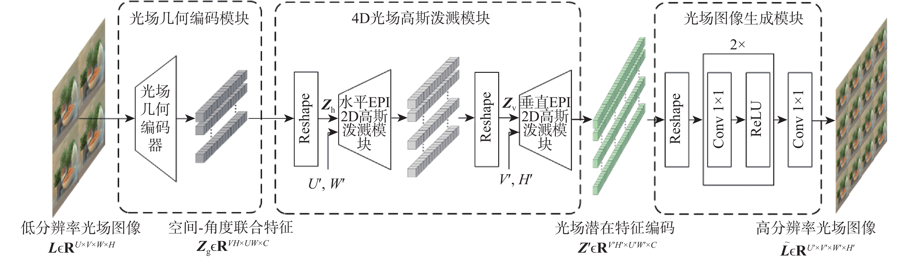
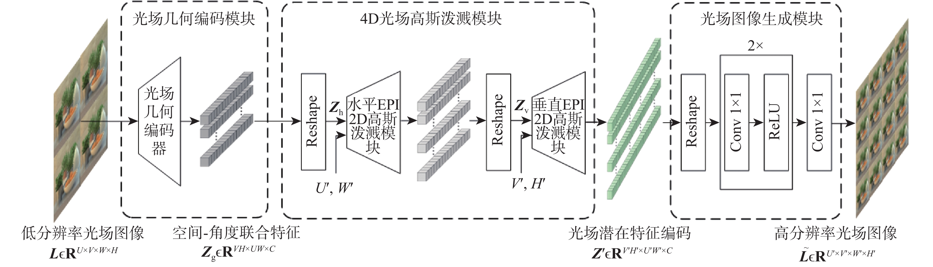
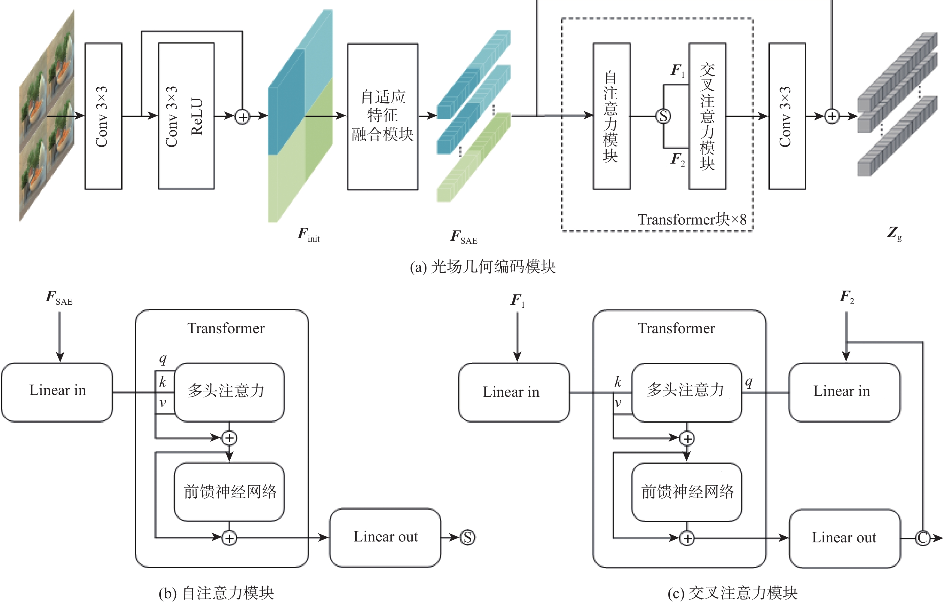
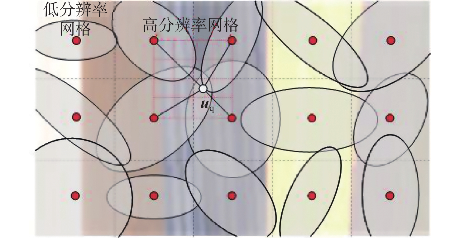
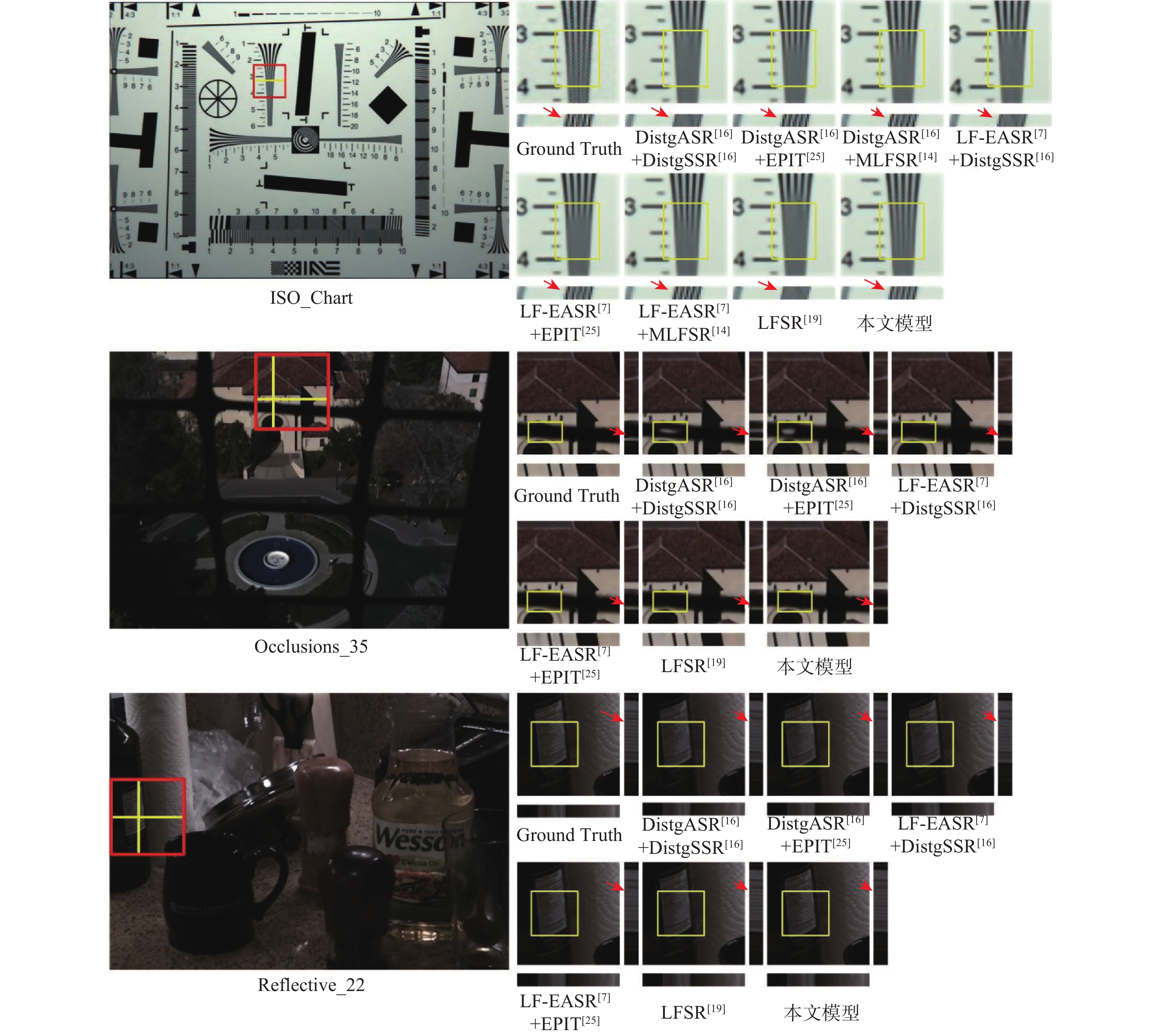
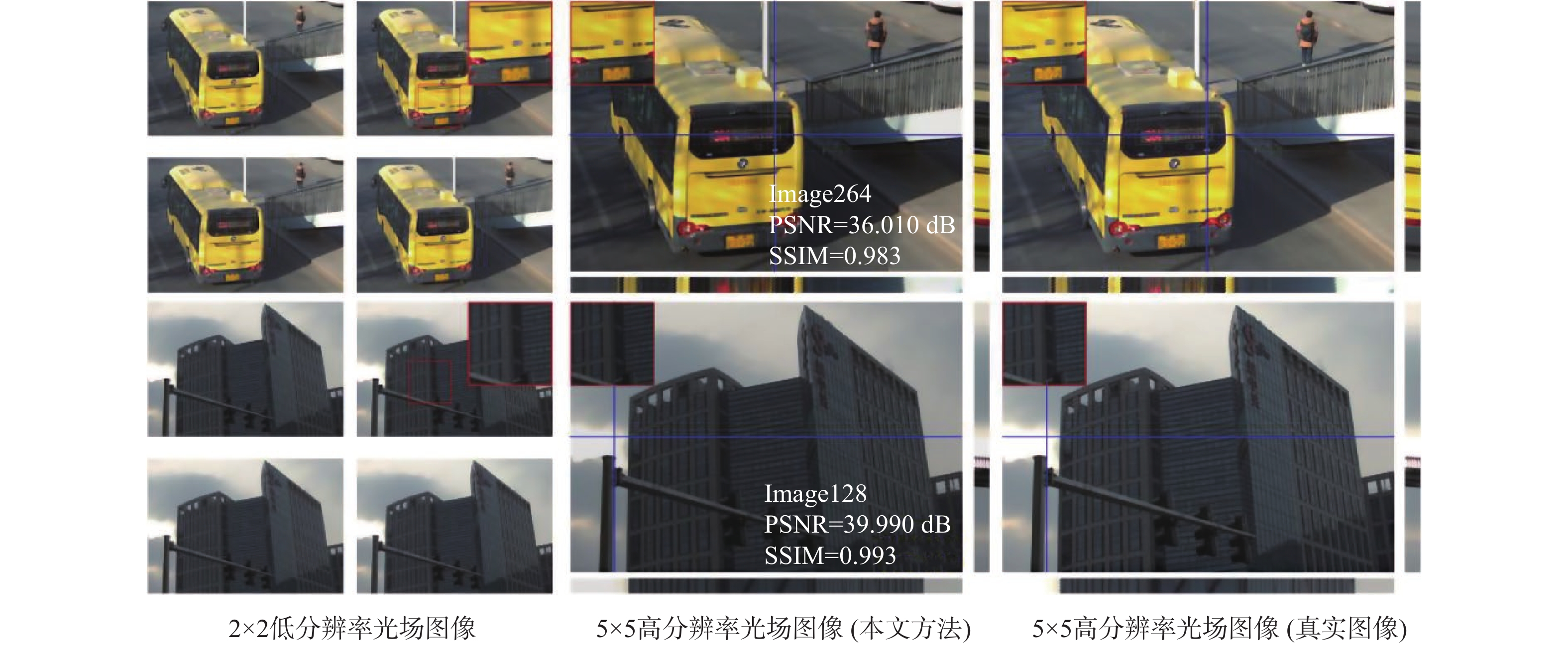
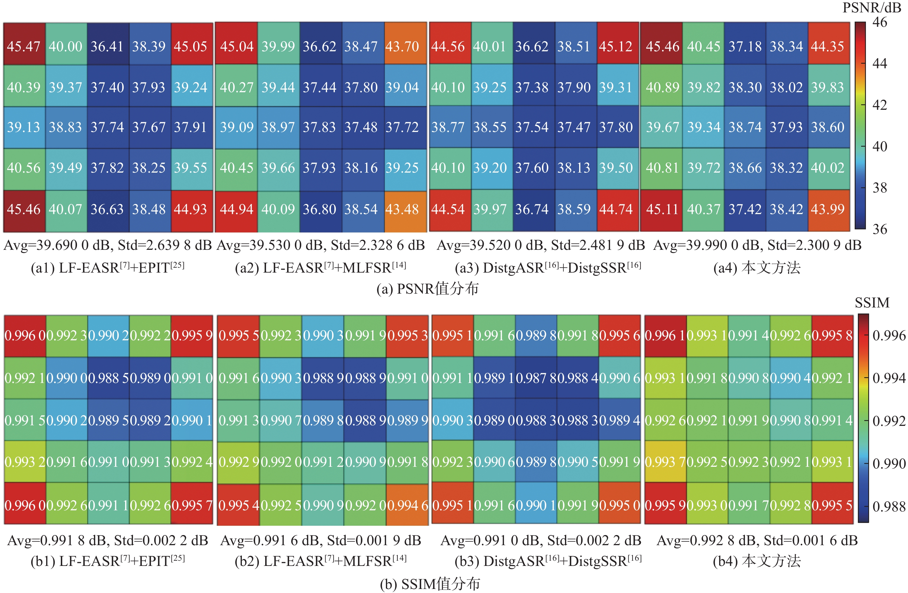
Unmanned aerial vehicle (UAV) perception and environmental monitoring are two low-altitude commercial applications where light field imaging technology shows significant promise by simultaneously capturing the spatial and angular information of light rays. However, existing light field cameras and super-resolution methods struggle to jointly optimize spatial and angular resolutions, limiting their effectiveness in tasks requiring precise perception and high-fidelity reconstruction. To address this challenge, this paper proposes a light field Gaussian splatting representation and a light field angular spatial super-resolution (LFASSR) method tailored for low-altitude scenarios. Specifically, we extend the conventional 3D Gaussian splatting framework into the 4D light field domain and propose a 4D light field Gaussian splatting representation. Leveraging the geometric structure of light field epipolar plane images (EPIs), we decompose the 4D representation into cascaded 2D Gaussian splatting models along horizontal and vertical directions, enabling more efficient modeling of light field geometry. Based on this representation, we develop a unified light field super-resolution framework. The framework first extracts and fuses features from the spatial, angular, and EPI domains, then constructs directional geometric feature spaces for horizontal and vertical views, where 2D Gaussian splatting is applied separately. Finally, high-quality dense-view light field images with enhanced spatial resolution are rendered via EPI-based synthesis. The suggested methodology greatly outperforms state-of-the-art methods in joint spatial-angular super-resolution, as shown by extensive experimentation on public light field benchmarks and a recently gathered low-altitude light field dataset. It achieves the best performance in terms of peak signal-to-noise ratio (PSNR) and structural similarity index (SSIM), while also producing visually superior results with sharp detail recovery and smooth, natural disparity transitions. Moreover, the method exhibits strong generalization capability and competitive performance in standalone light field spatial super-resolution (LFSSR) and light field angular super-resolution (LFASR) tasks.

An interference magnetic field compensation method based on a model-data hybrid drive
ZHANG Dehui, ZHANG Jinsheng, LI Ting, MA Xiaoyu, LIAO Shouyi, NI Jing, WEI Hao
2026, 52(9): 3202-3210. doi: 10.13700/j.bh.1001-5965.2025.0141
Abstract:

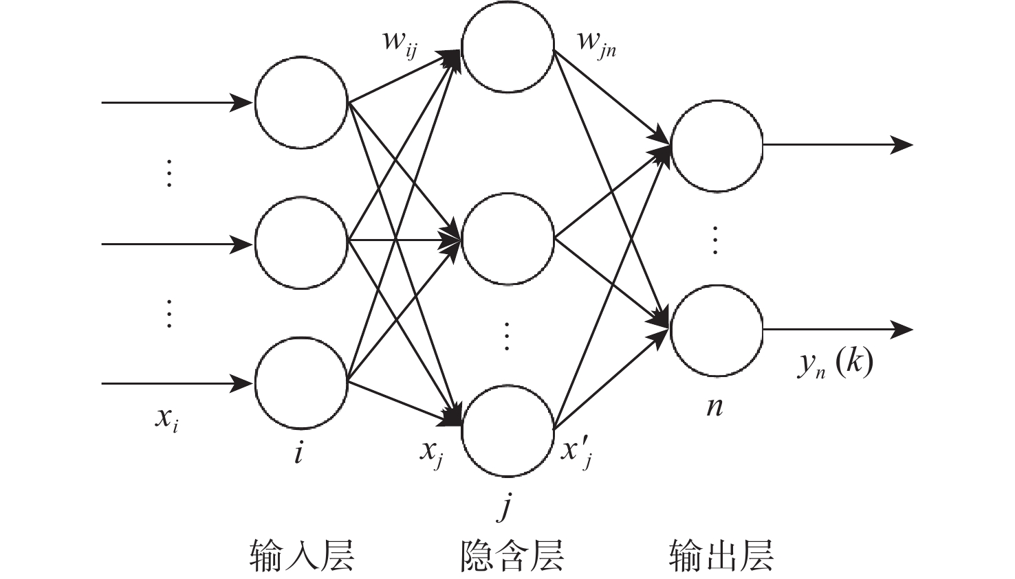
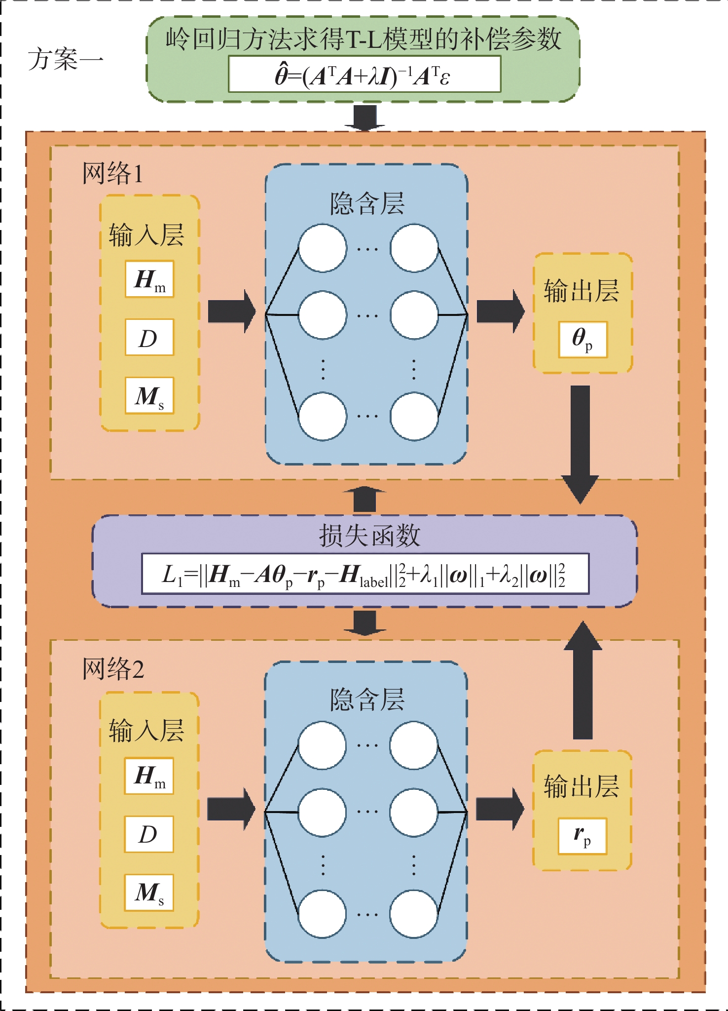
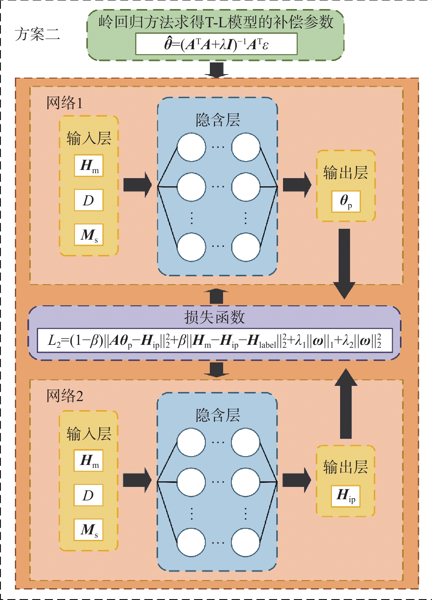
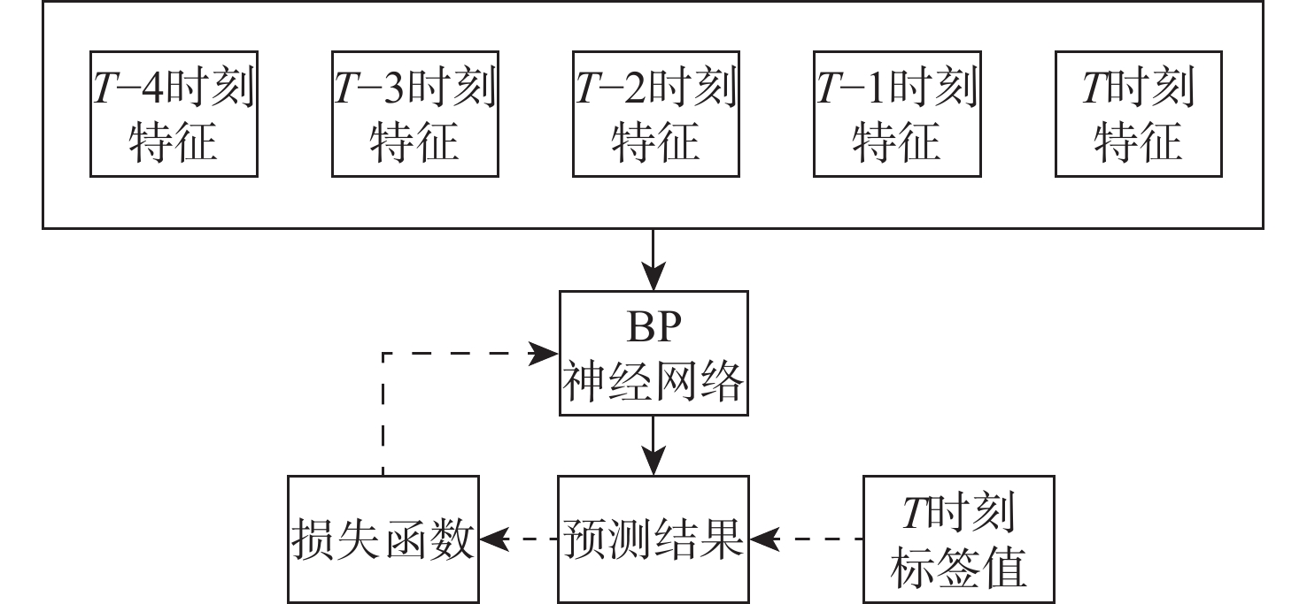
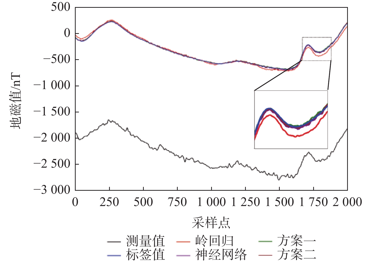
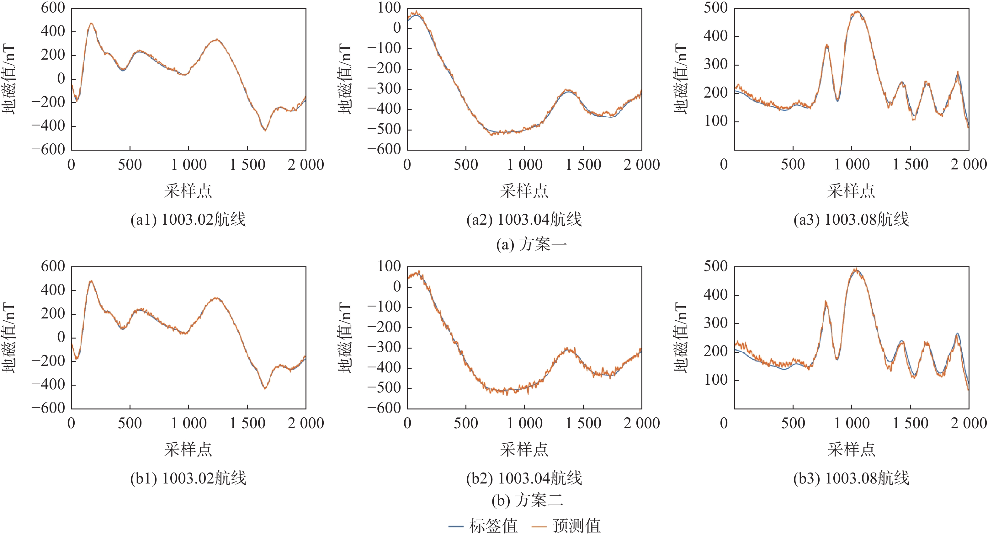
The precise compensation of the carrier’s self-interference magnetic field is a key challenge in improving the accuracy of geomagnetic navigation. Two model-data hybrid-driven magnetic interference collaborative compensation strategies are presented in response to the drawbacks of conventional compensation techniques, including the linear assumption and the challenge of responding to complex settings. In the preprocessing stage, principal component analysis is used to reduce the dimensionality of the data, and the compensation parameters obtained from the physical model are used to initialize the neural network. In scheme one, the shortcomings of the conventional compensation model are analyzed, the compensation parameters are solved using a neural network, the traditional model-solving paradigm is broken and potential multicollinearity issues are avoided, and a random factor term is introduced in the interference magnetic field to simulate the random interference magnetic field with strong nonlinearity. Scheme two constructs a loss function to link data-driven and model-driven, deeply coupling the efficient extraction of magnetic field features with the physical constraints of the interference field. Experimental results show that the proposed methods have the advantages of high compensation accuracy and strong generalization ability compared with pure model and pure data compensation methods. The highest compensation accuracy in generalization ability tests at different heights and different regions has increased by 69.64% and 69.39%, respectively, verifying the effectiveness of the proposed methods.
Intelligent routing strategy for high-speed UAVs via deep reinforcement learning
SHOU Yifan, LIU Dongsheng, CHEN Yahui
2026, 52(9): 3211-3222. doi: 10.13700/j.bh.1001-5965.2025.0282
Abstract:

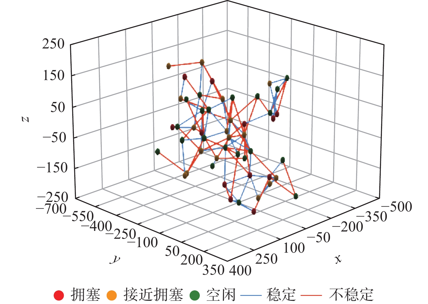
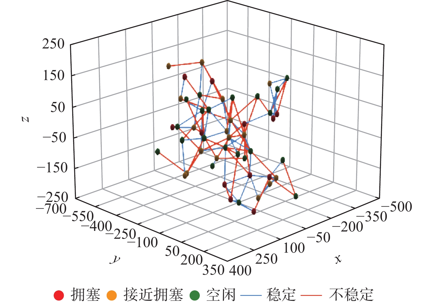
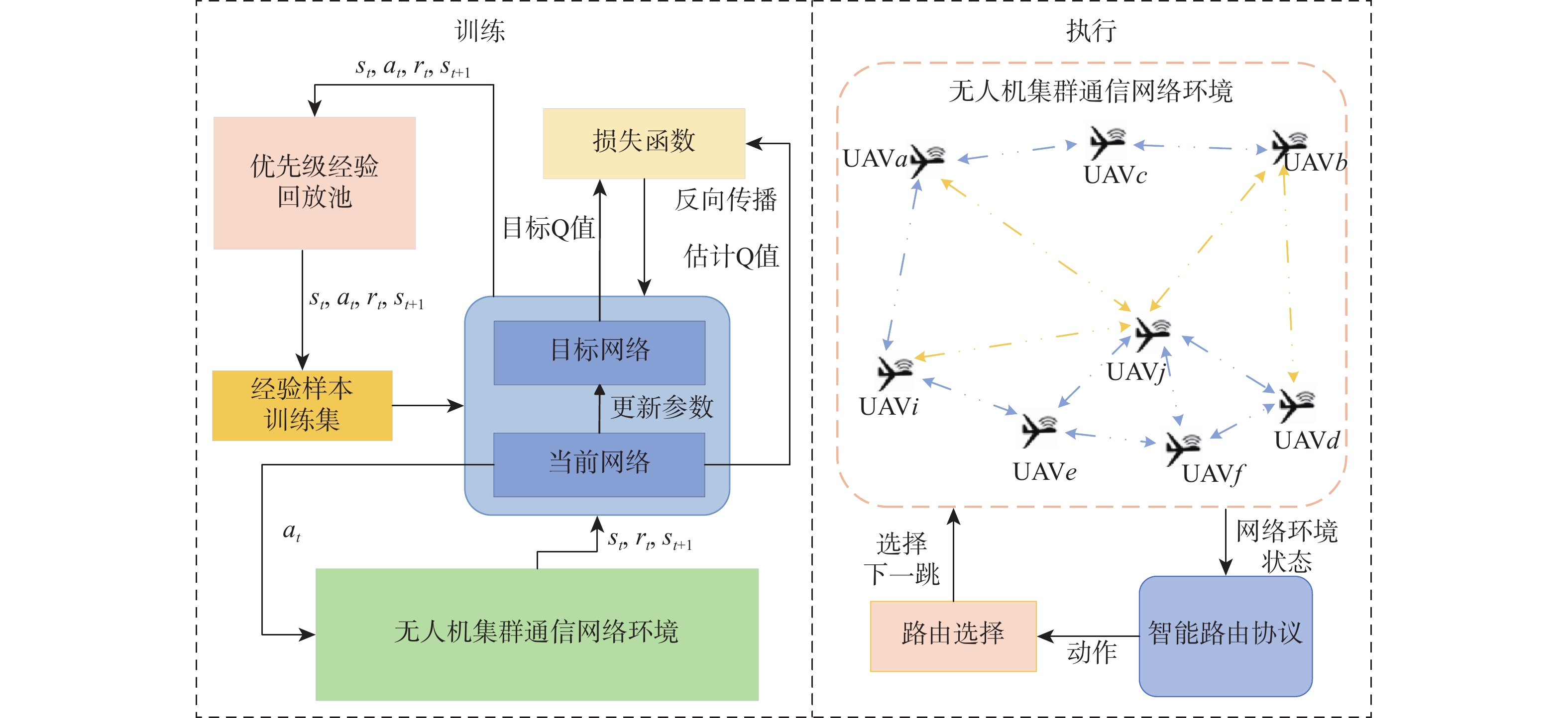
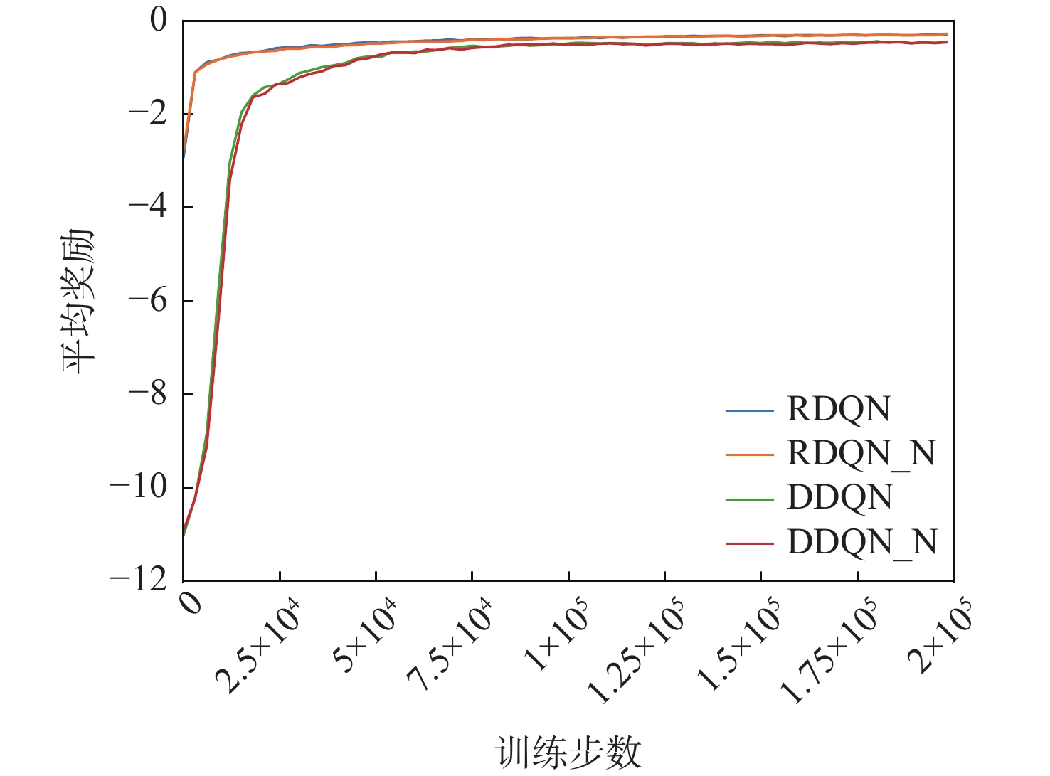
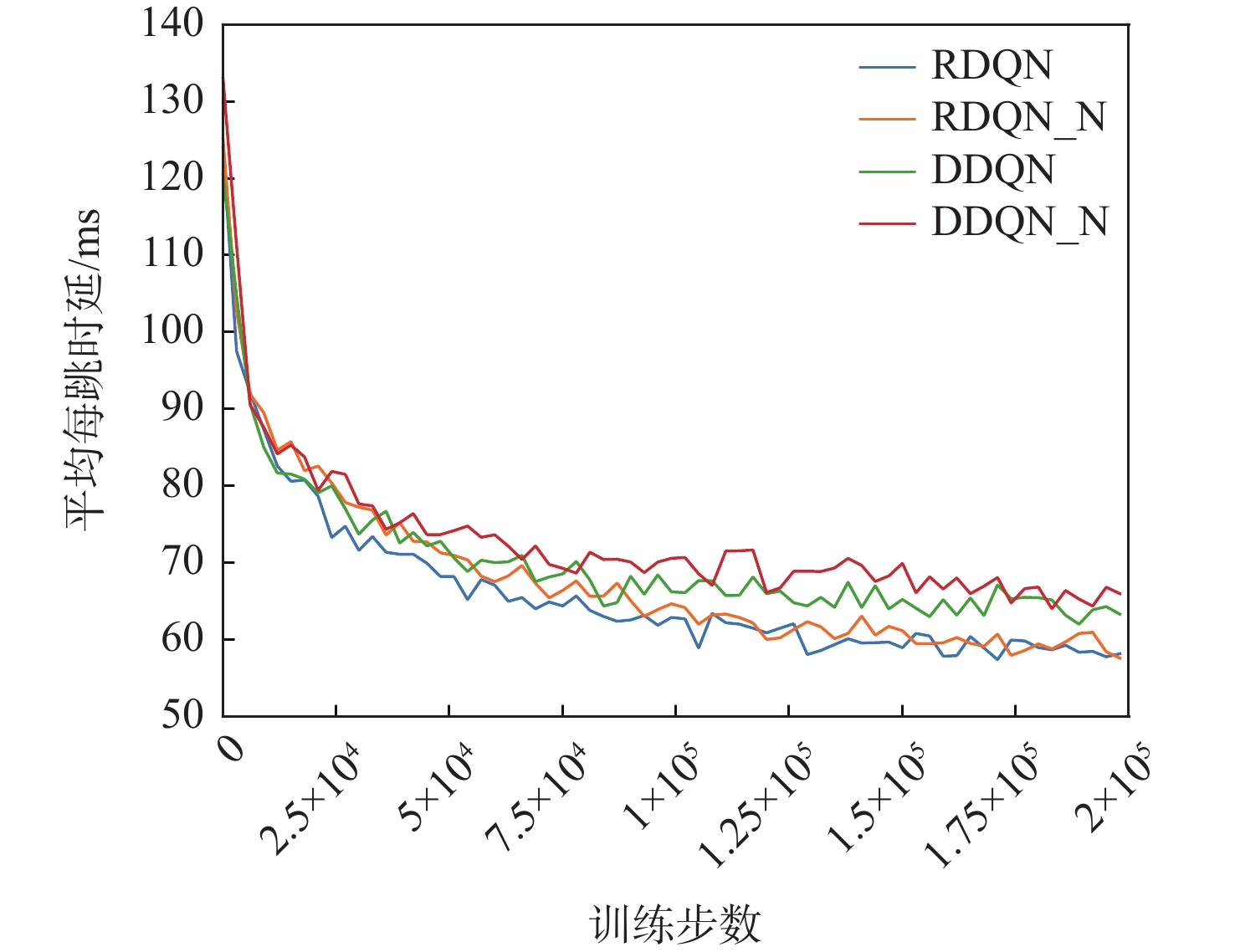
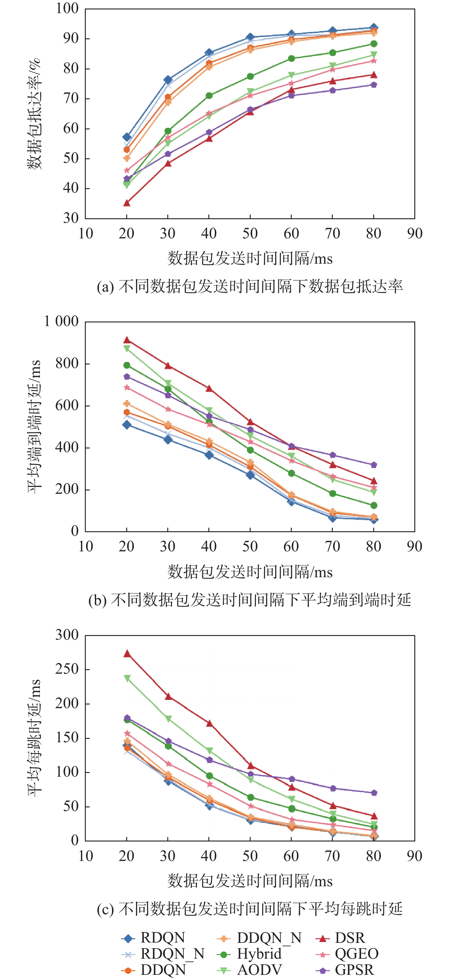
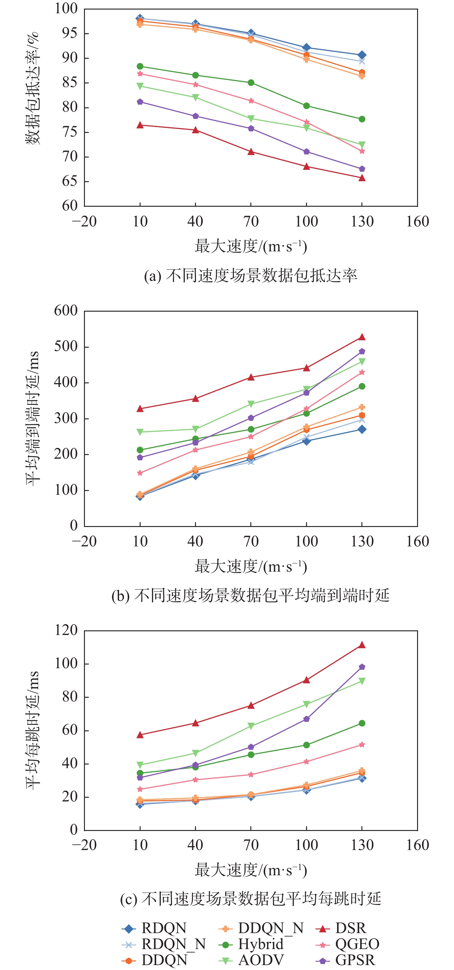
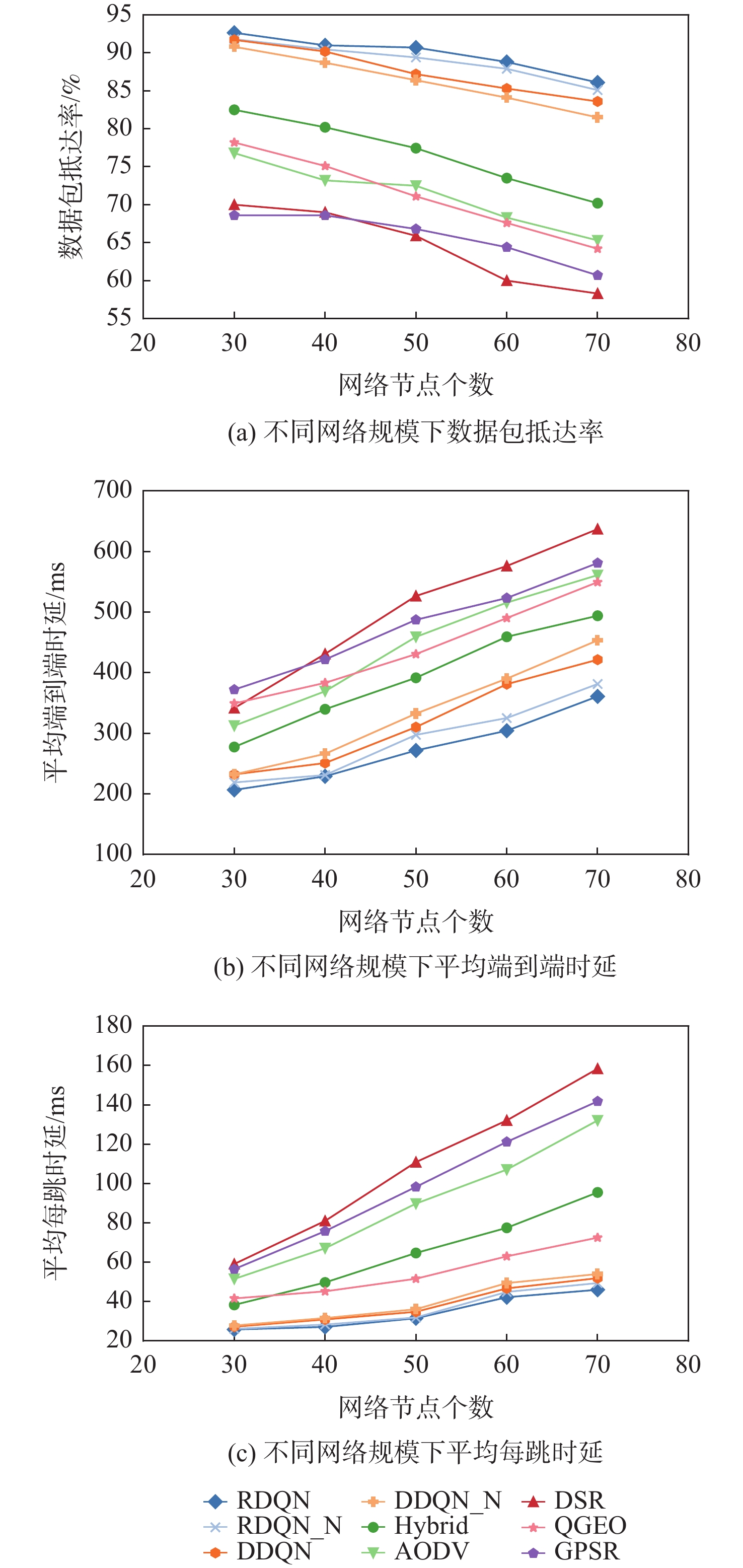
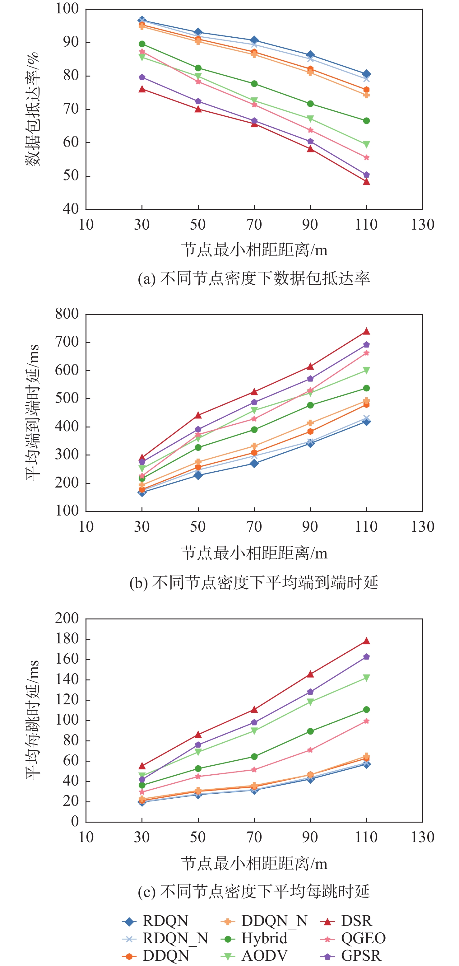
With the rapid advancement of unmanned aerial vehicle (UAV) technology, high-speed UAV swarms are increasingly applied in low-altitude complex environments. However, this also poses challenges, as traditional routing protocols struggle to cope with highly dynamic network conditions. Based on the Rainbow deep Q-network (DQN) deep reinforcement learning model, this paper suggests an intelligent routing strategy for high-speed UAVs with an emphasis on communication assurance in high-speed and highly dynamic scenarios and enhancing the capacity of UAV nodes to make autonomous, decentralized decisions. Stable factor is also designed to evaluate the future stability of communication links, enabling UAVs to autonomously make adaptive decisions based on the latest network state. According to experimental results, the high speed intelligent routing scheme suggested in this study reduces the average end-to-end delay and the per-hop delay by more than 23% when compared to traditional routing protocols, while maintaining a packet delivery ratio of more than 85% under all evaluated velocity settings. In high-frequency communication scenarios, the packet delivery ratio is improved by more than 15% on average, effectively meeting the requirements of high-speed UAV networks for stability and communication efficiency.
Multi-source element modeling and risk quantitative analysis under spatio-temporal grid
LIU Longhao, RU Le, WANG Hongqiao, WANG Wenfei, ZHANG Zhenghao, LI Yifan
2026, 52(9): 3223-3236. doi: 10.13700/j.bh.1001-5965.2025.0265
Abstract:

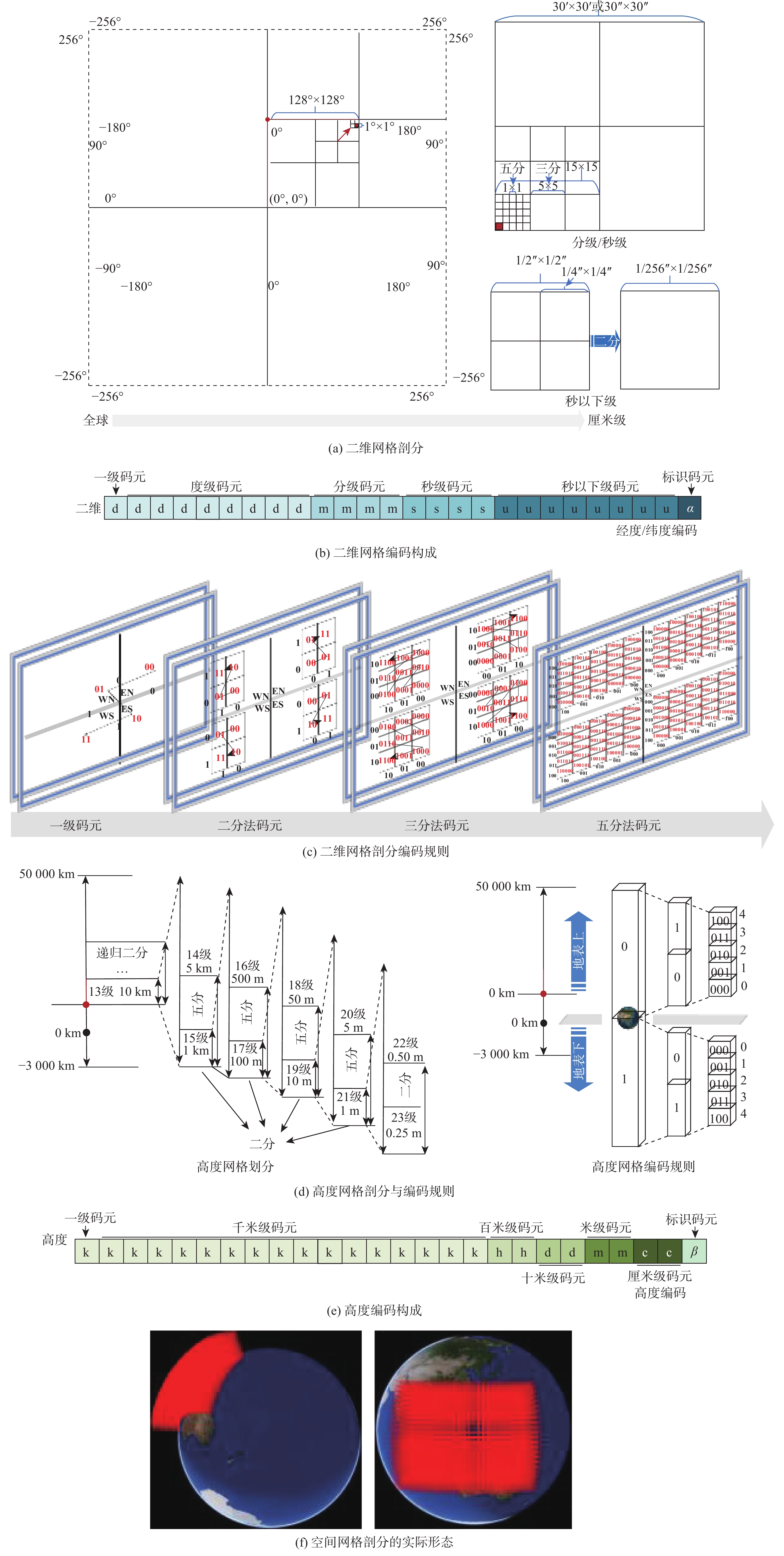
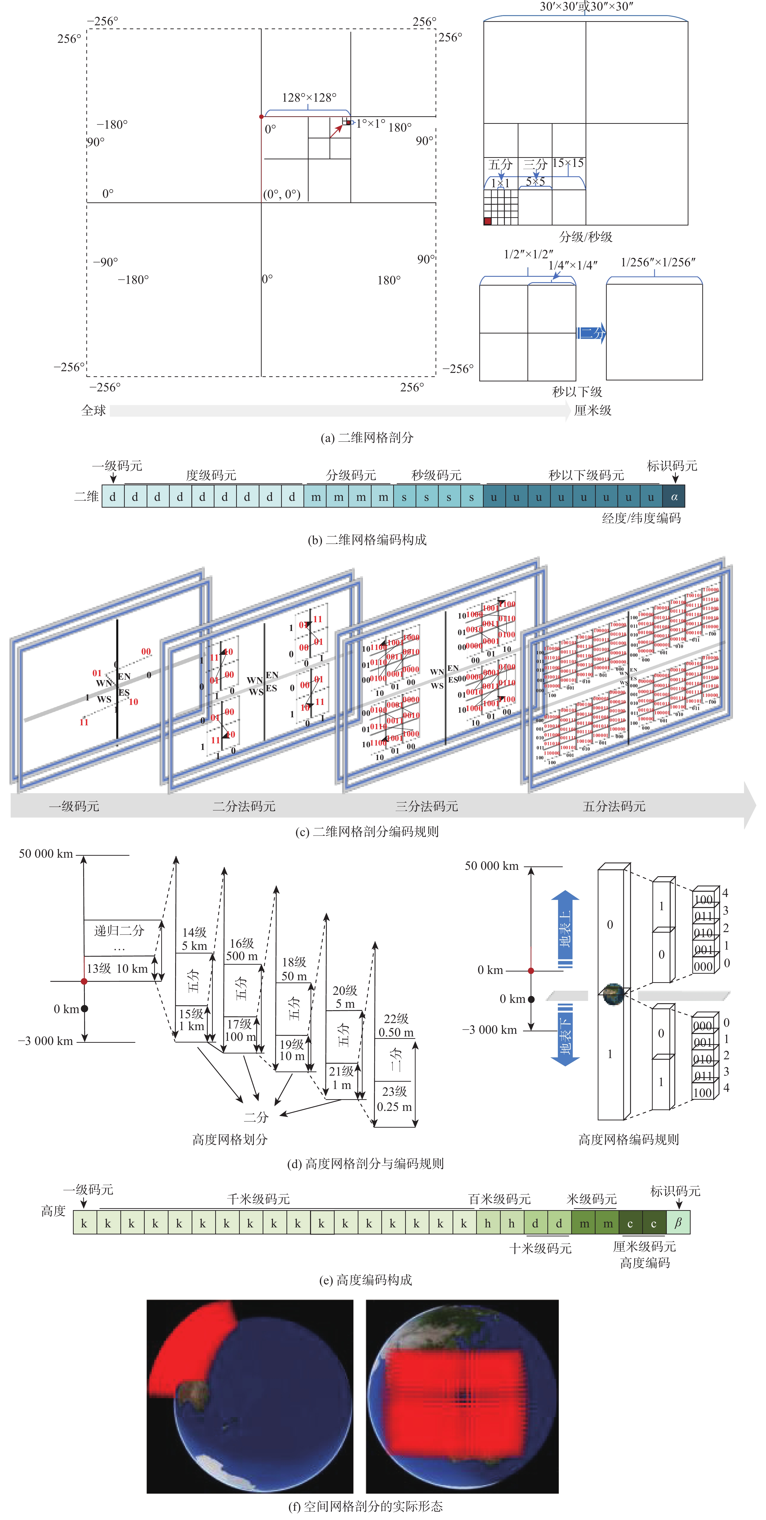
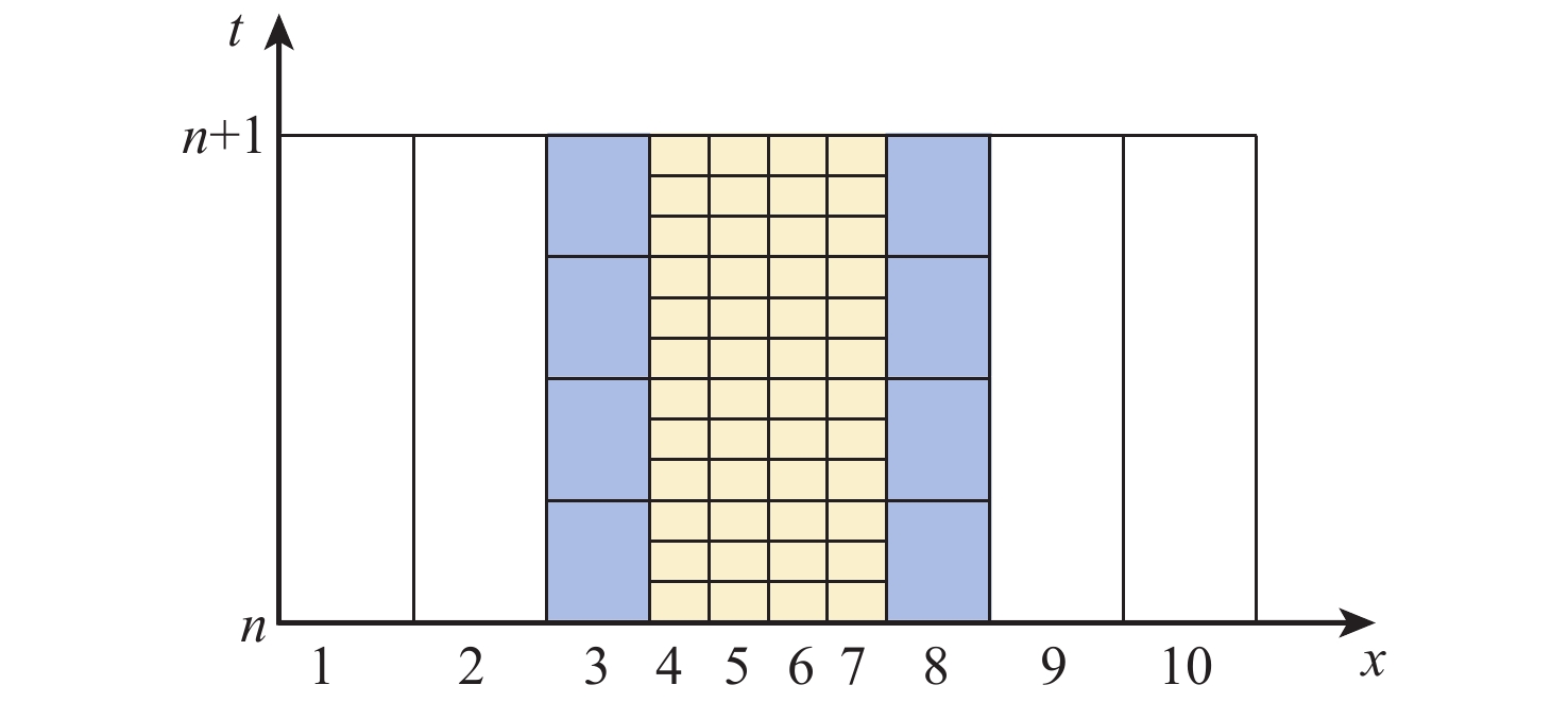
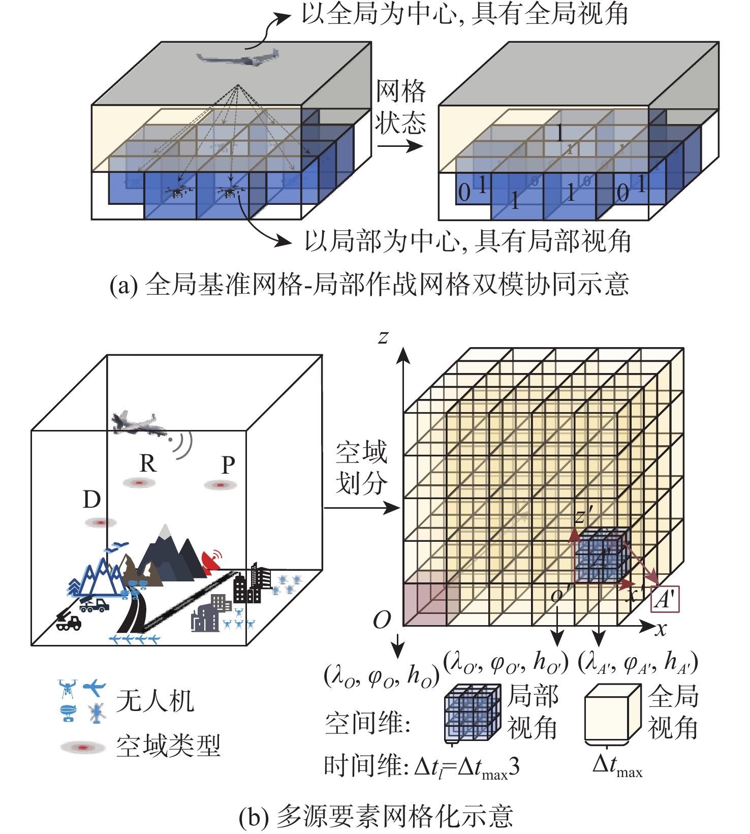
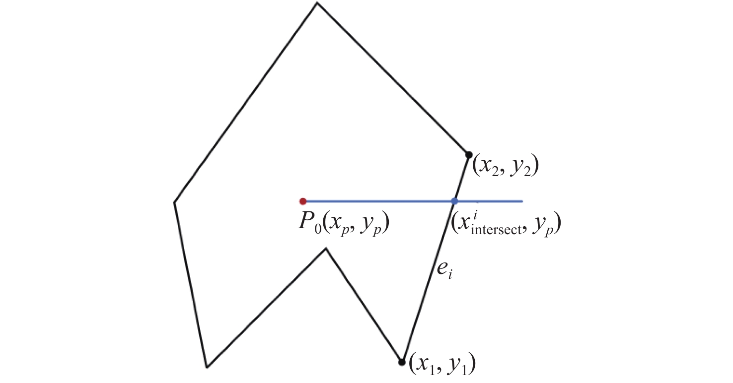
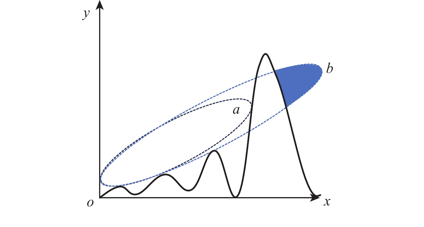
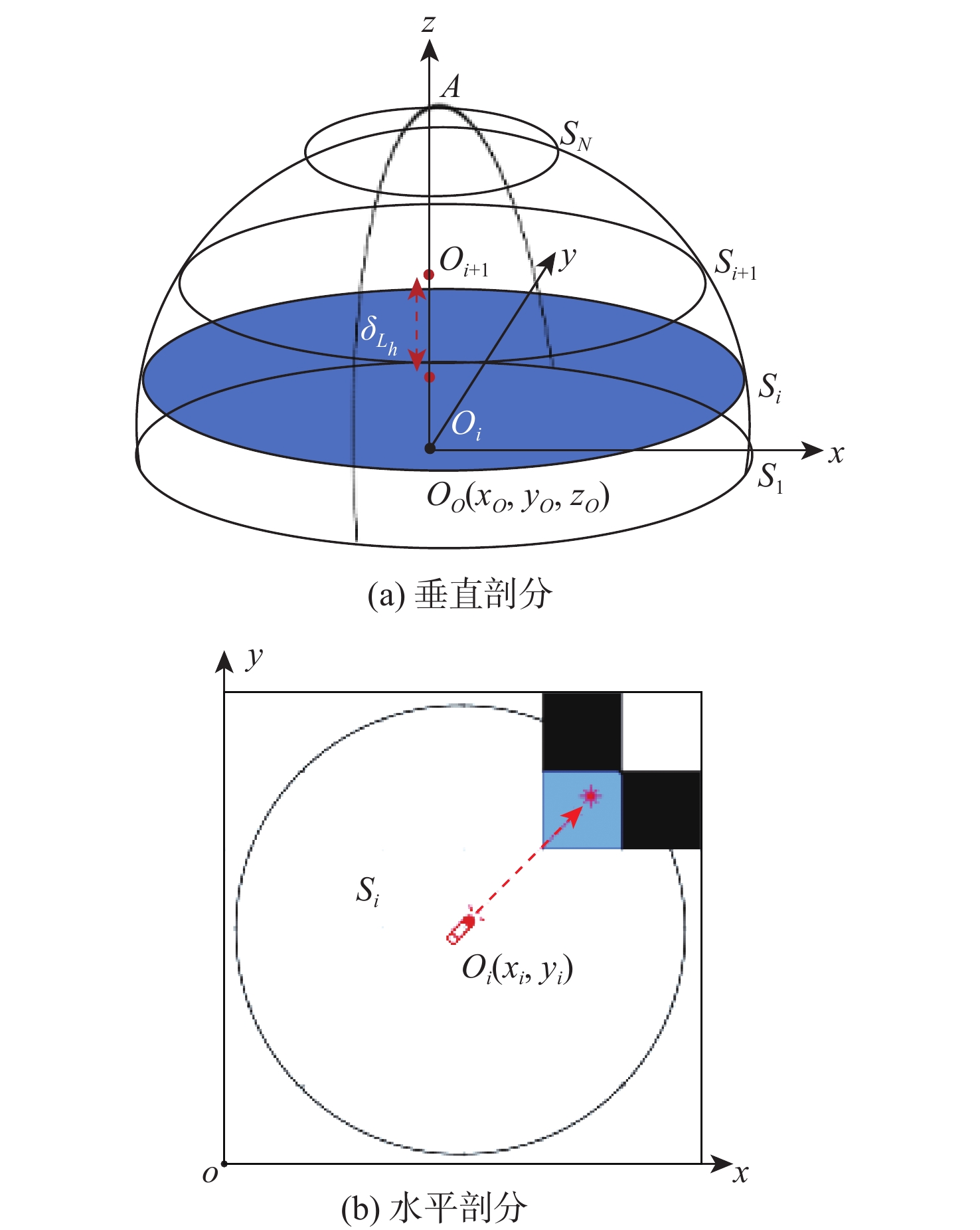
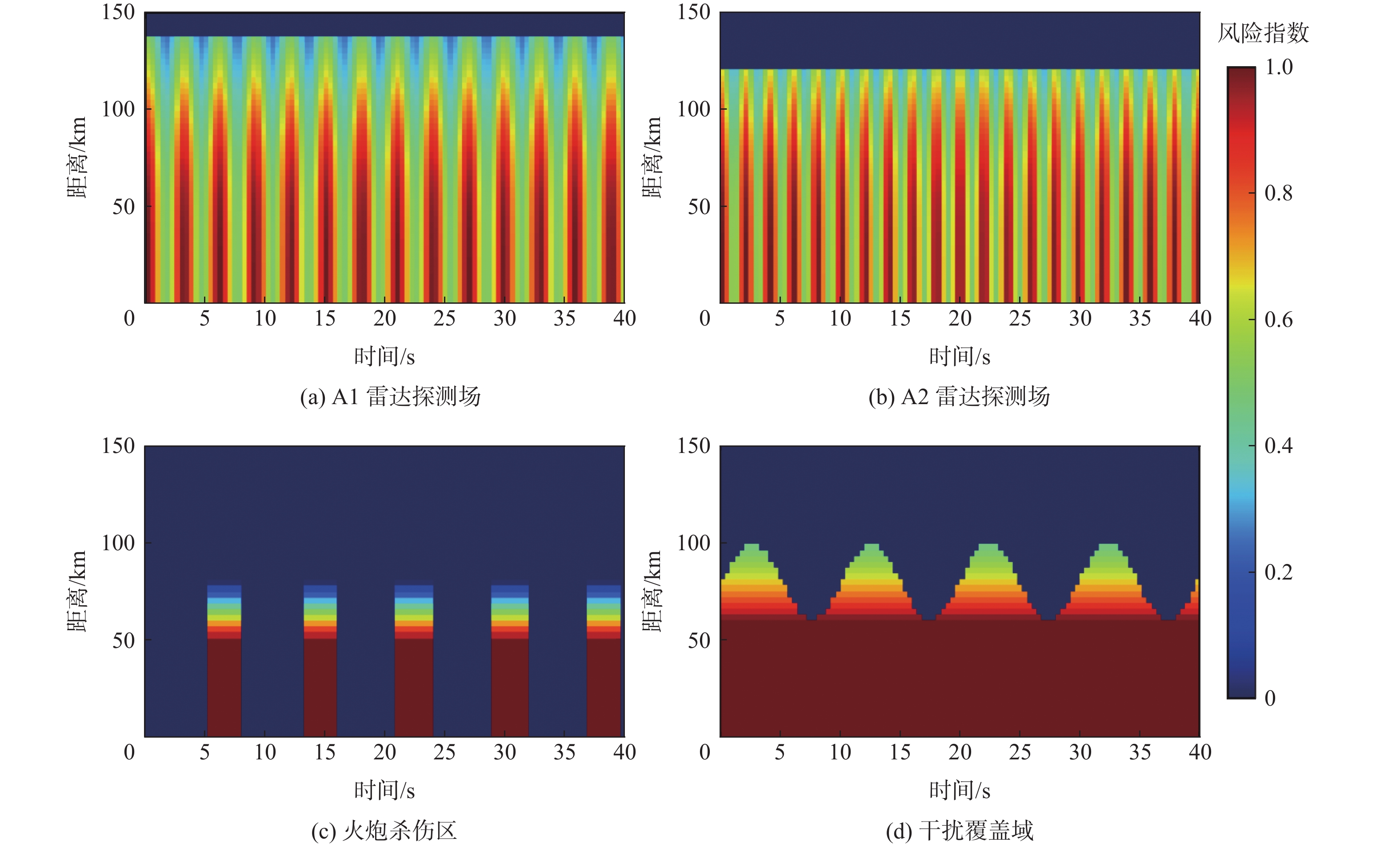
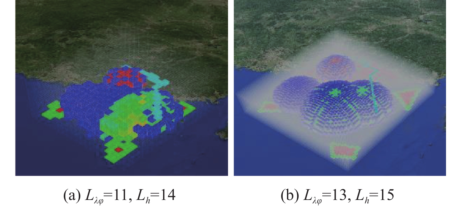
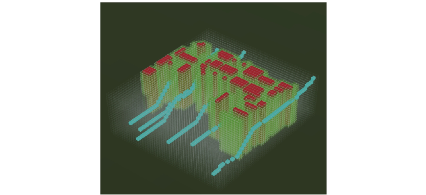
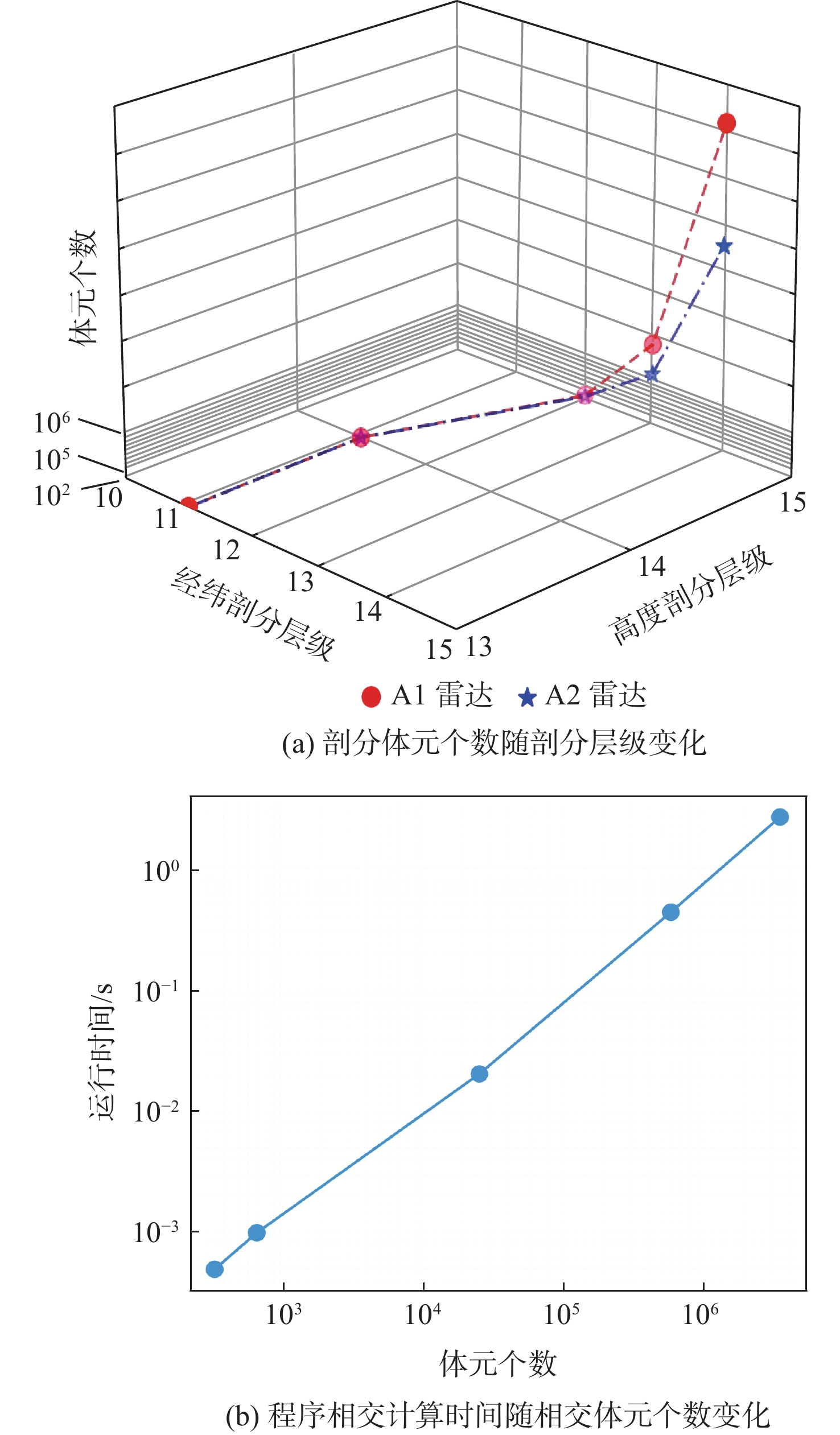
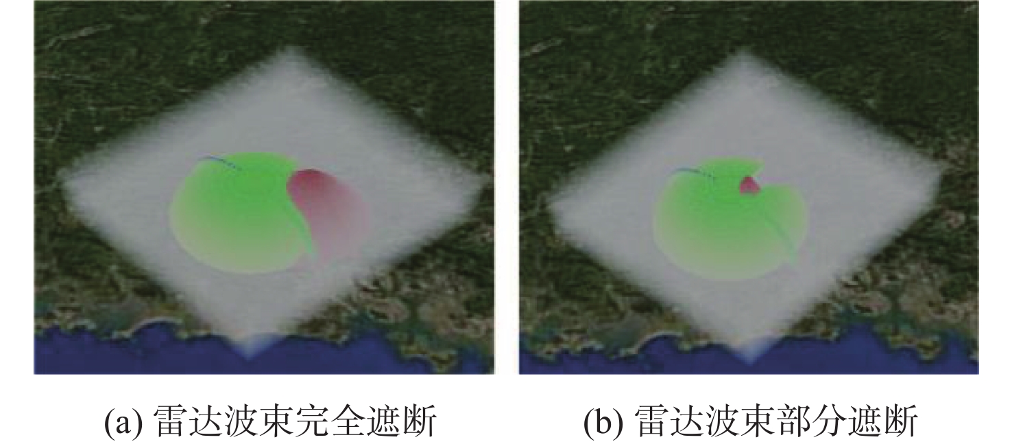
This work suggests a multi-source element modeling and risk quantification approach based on spatio-temporal grid subdivision to tackle the problem of spatio-temporal coupling modeling for multi-source elements in complex battlefield scenarios. Firstly, in the spatial dimension: A novel grid subdivision architecture compatible with the BeiDou grid location code (BDGC) is designed to significantly improve spatial data storage and computational efficiency in order to address the storage redundancy resulting from the triple virtual extension in current global subdivision models such as geographic coordinate subdividing grid with one dimension integral cording on 2n-tree(GeoSOT) and the efficiency gap issue associated with the “letter + decimal digit” encoding scheme of the BDGC. In the temporal dimension: To address the limitations caused by the quintuple temporal base extensions in the BeiDou subdivision time code (BDTC), an innovative dual-baseline temporal encoding system with “absolute-relative” layers is proposed. This successfully overcomes the spatio-temporal fusion bottleneck for heterogeneous elements by achieving a four-dimensional joint representation that integrates geographical position and time. Secondly, a two-level nested spatio-temporal reference framework comprising a “global reference grid - local combat grid” is constructed. This architecture balances local adaptability with global consistency by supporting the dynamic change of grid granularity based on equipment systems or the battlefield environment across several operational domains. Finally, to resolve the contour distortion problem inherent in traditional minimum bounding rectangle (MBR) methods when characterizing the geometric features of complex terrain and airspace elements, a three-dimensional realistic scene topological feature modeling method based on the ray-intersection judgment algorithm is proposed. Leveraging the spatio-temporal grid subdivision architecture, a unified quantitative model for enemy operational units is constructed. Combined with risk levels, the battlefield space is partitioned into free space, contested space, and denied space. Simulation experiments demonstrate that: The proposed method enables rapid multi-scale reconstruction of battlefield multi-source elements; At an approximate grid resolution of 1000 meters, the average relative error for spatial representation is only 1.414%; Compared to traditional methods, the average relative error is reduced by 49.37% and time efficiency is improved by 99.65%; It can meet the real-time response requirements for UAV swarm trajectory planning. This work provides a validated new paradigm for intelligent environmental modeling in UAV swarm operations.